Category:Archaeological sites in England
Vai alla navigazione
Vai alla ricerca
Deutsch: Archäologische Fundplätze in England
· English: Archaeological sites in England
· categoria di un progetto Wikimedia | |||||
| Carica un file multimediale | |||||
| Istanza di | |||||
|---|---|---|---|---|---|
| Argomenti della categoria | |||||
 | |||||
Sottocategorie
Questa categoria contiene le 15 sottocategorie indicate di seguito, su un totale di 15.
A
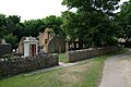
- Adscombe Chapel (3 F)
B
C
E
H
I
L
- Long Stone, Minchinhampton (3 F)
M
P
R
S
W
- Winter's Gibbet (8 F)
File nella categoria "Archaeological sites in England"
Questa categoria contiene 200 file, indicati di seguito, su un totale di 282.
(pagina precedente) (pagina successiva)-
 "The Dongas" hollow ways, Twyford Down - geograph.org.uk - 25612.jpg 640 × 313; 184 KB
-

-

-
 Abbey Hill - geograph.org.uk - 95309.jpg 640 × 427; 83 KB
-
 An Archaeological Excation on an Active Motorway Junction Construcion Site.JPG 3 072 × 2 304; 1,02 MB
-
 Anchorite Cell - geograph.org.uk - 101903.jpg 640 × 480; 225 KB
-

-

-
 Ancient Burial Cairn near Dropnose Point - geograph.org.uk - 821798.jpg 640 × 427; 224 KB
-
 Ancient Chapel Site in Sherwood Forest - geograph.org.uk - 34089.jpg 640 × 480; 99 KB
-
 Ancient Fishing Weir - geograph.org.uk - 637068.jpg 480 × 640; 116 KB
-
 Ancient Settlement on Gussage Hill - geograph.org.uk - 284222.jpg 640 × 480; 89 KB
-
 Approaching Canons Ashby - geograph.org.uk - 493921.jpg 640 × 477; 91 KB
-
 Archaeological Dig at Kibboth Crew - geograph.org.uk - 421749.jpg 640 × 480; 155 KB
-
 AstleyGreenCollieryPithead.jpg 480 × 640; 94 KB
-
 Barrows and boundaries on Bronkham Hill - geograph.org.uk - 298177.jpg 640 × 480; 114 KB
-
 Blore Heath Plaque - geograph.org.uk - 8184.jpg 640 × 480; 152 KB
-

-
 Cambridgeshire Dykes.svg 411 × 295; 48 KB
-
 Camp Hill 2.jpg 3 000 × 4 000; 4,29 MB
-
 Car Dyke - geograph.org.uk - 110431.jpg 480 × 640; 551 KB
-
 Car Dyke - geograph.org.uk - 110433.jpg 480 × 640; 421 KB
-
 Car Dyke - geograph.org.uk - 110438.jpg 480 × 640; 517 KB
-
 Castle Street and the Old Road - geograph.org.uk - 257411.jpg 640 × 480; 57 KB
-
 Catstones Ring - geograph.org.uk - 38275.jpg 640 × 480; 134 KB
-
 Coventry- Spon Street - geograph.org.uk - 631504.jpg 640 × 480; 72 KB
-
 Cross Dyke close-up - geograph.org.uk - 401339.jpg 640 × 480; 102 KB
-
 Cultivation Terraces - geograph.org.uk - 1419283.jpg 640 × 480; 88 KB
-
 Devil's Dyke - geograph.org.uk - 638549.jpg 1 005 × 754; 224 KB
-
 Devil's Dyke Cambs.jpg 575 × 668; 127 KB
-
 Donington Eaudike - geograph.org.uk - 358798.jpg 640 × 480; 90 KB
-
-
 Dragon Hill, Oxfordshire - geograph.org.uk - 10181.jpg 640 × 410; 80 KB
-

-
 Earthworks on Bow Hill - geograph.org.uk - 9288.jpg 640 × 426; 94 KB
-

-
 Entrance, Trencrom Iron Age hill fort - geograph.org.uk - 676174.jpg 640 × 480; 67 KB
-
 Epping Forest, Loughton Camp - geograph.org.uk - 548902.jpg 640 × 480; 127 KB
-
 LoughtonCamp.jpg 700 × 465; 86 KB
-
 Excavation of the Rose Theatre, Bankside, London.jpg 1 600 × 1 200; 396 KB
-
 Field fenced off area - geograph.org.uk - 105545.jpg 640 × 303; 53 KB
-
 Field System Ulpha - geograph.org.uk - 244898.jpg 640 × 480; 64 KB
-
 Fish ponds - geograph.org.uk - 728161.jpg 480 × 640; 105 KB
-
 Geograph-391716-Loveden-Hill-by-Ken-Brockway.jpg 640 × 480; 138 KB
-

-
 GrettonVillageGreen.jpg 3 072 × 2 304; 1,75 MB
-
 Grim's Ditch Hailey.JPG 1 600 × 1 200; 488 KB
-
 Grimsbury Castle - geograph.org.uk - 888.jpg 640 × 480; 91 KB
-
 Grimsbury Castle Iron Age Hill Fort - geograph.org.uk - 890.jpg 480 × 578; 208 KB
-
 Grimsbury Castle, Iron Age Hill Fort - geograph.org.uk - 886.jpg 640 × 480; 91 KB
-
 Grobstones Stone Circle, Burley Moor - geograph.org.uk - 44791.jpg 640 × 480; 159 KB
-
 Harold's Bridge in Waltham Abbey - geograph.org.uk - 346714.jpg 640 × 427; 101 KB
-
 Harolds Bridge.JPG 640 × 427; 96 KB
-
 Hobs Moat Ancient Monument - geograph.org.uk - 85091.jpg 640 × 480; 204 KB
-
 Hospital of the Holy Trinity (site of).jpg 2 857 × 1 742; 2,52 MB
-
 Ingleborough Hill Fort - geograph.org.uk - 180366.jpg 640 × 480; 127 KB
-
 Iron Fort from Summer Down - geograph.org.uk - 377170.jpg 640 × 479; 118 KB
-
 Karte SA Sachsenküstenkastelle Britannien.png 554 × 782; 79 KB
-
 Karte SK-Kastelle.xls.jpg 1 552 × 2 137; 222 KB
-
 Little Trees Hill!.JPG 2 272 × 1 704; 598 KB
-
 Lmhphot4.jpg 1 752 × 1 192; 415 KB
-
 Lmhphot6.jpg 1 752 × 1 192; 626 KB
-
 Long Cairn - geograph.org.uk - 280440.jpg 640 × 480; 138 KB
-
 Manorial Earthworks Battenhall - geograph.org.uk - 649423.jpg 640 × 375; 56 KB
-
 Mediaeval Cobblestone Road Birmingham.jpg 750 × 993; 289 KB
-
 Medieval Brackenborough (1) - geograph.org.uk - 457717.jpg 640 × 480; 99 KB
-
 Medieval Brackenborough (2) - geograph.org.uk - 457725.jpg 640 × 480; 119 KB
-
 Medieval Brackenborough (3) - geograph.org.uk - 457727.jpg 640 × 480; 92 KB
-
 Medieval Brackenborough - geograph.org.uk - 457570.jpg 640 × 480; 89 KB
-
 Medieval settlement near Tytherington - geograph.org.uk - 494872.jpg 640 × 480; 84 KB
-
 Medieval Village (site of) - geograph.org.uk - 95634.jpg 640 × 480; 173 KB
-
 Mill mound near Coles Green - geograph.org.uk - 444402.jpg 640 × 480; 147 KB
-
 Minphot1.jpg 1 784 × 1 196; 678 KB
-
 Minphot2.jpg 1 760 × 1 200; 595 KB
-
 Moated site at Thorpe St.Peter - geograph.org.uk - 266453.jpg 640 × 427; 65 KB
-
 Motte, Corby Glen - geograph.org.uk - 102878.jpg 640 × 480; 95 KB
-
 Mounds, Stonehenge - geograph.org.uk - 34455.jpg 640 × 480; 406 KB
-
 Muscott Manor Medieval Gatehouse.jpg 640 × 480; 78 KB
-
 Muscott Northants 9th Feb 2008 (4).jpg 2 560 × 1 920; 1,15 MB
-
 Norbury - geograph.org.uk - 453780.jpg 640 × 480; 92 KB
-
 Nutball Stone, Cannimore Road, Warminster - geograph.org.uk - 298150.jpg 640 × 480; 368 KB
-
 Oakley Wood Camp 1875.png 619 × 674; 429 KB
-
 Panpudding Hill from the SVR Station - geograph.org.uk - 698716.jpg 640 × 480; 54 KB
-
 Pikestones - geograph.org.uk - 1892027.jpg 1 600 × 1 200; 1,05 MB
-
 Pilgrims way westwell.jpg 640 × 480; 158 KB
-
 Q-pit on Lodge Hill.jpg 709 × 531; 368 KB
-
 Remains of a cottage in Clicket village - geograph.org.uk - 688243.jpg 640 × 426; 129 KB
-
 Rievaulx Abbey - geograph.org.uk - 5400.jpg 640 × 427; 68 KB
-
 Roman Road Pit at Chalkdell Farm - geograph.org.uk - 128297.jpg 640 × 480; 149 KB
-
 Romano-British Settlement on Beanley Moor - geograph.org.uk - 96802.jpg 640 × 480; 123 KB
-
 Sarsen Stones - approaching from the west - geograph.org.uk - 6951.jpg 640 × 480; 108 KB
-
 Shippea Hill railway station in 2006.jpg 640 × 480; 72 KB
-

-
 Site of Braunston Cleves (3).JPG 2 560 × 1 920; 1,14 MB
-
 Site of Noseley Village - geograph.org.uk - 147931.jpg 640 × 480; 77 KB
-

-
 The Calder Stones, Calderstones Park - geograph.org.uk - 40880.jpg 640 × 480; 91 KB
-
 The Calderstones, Calderstone Park - geograph.org.uk - 401915.jpg 640 × 480; 103 KB
-
 The End of Aves Ditch - geograph.org.uk - 442488.jpg 640 × 480; 143 KB
-

-
 The Manor House Ruislip - geograph.org.uk - 380098.jpg 640 × 480; 119 KB
-
 The Priory at Lindisfarne - geograph.org.uk - 362025.jpg 640 × 480; 82 KB
-
 The ruins of Penhallam Moated Manor House - geograph.org.uk - 23988.jpg 640 × 480; 177 KB
-
 The Stables - geograph.org.uk - 380104.jpg 640 × 480; 95 KB
-

-
 The Wroth Stone - geograph.org.uk - 303303.jpg 640 × 480; 107 KB
-
 Three of the Seven Barrows - geograph.org.uk - 10384.jpg 640 × 426; 57 KB
-
 Thundersbarrow Hill - geograph.org.uk - 54113.jpg 640 × 479; 161 KB
-

-
 Tumuli at Sutton Hoo - geograph.org.uk - 8232.jpg 640 × 480; 82 KB
-
 Tyneham houses.jpg 3 872 × 2 592; 5,69 MB
-
 Ulnaby 009.jpg 3 648 × 1 708; 1,43 MB
-
 Ulnaby 010.jpg 3 640 × 1 636; 1,22 MB
-
 Ulnaby 011.jpg 3 644 × 904; 760 KB
-
 Ulnaby 012.jpg 3 648 × 1 024; 789 KB
-
 Ulnaby 013.jpg 3 628 × 1 024; 797 KB
-
 Ulnaby 014.jpg 3 648 × 1 304; 1,03 MB
-
 Ulnaby 015.jpg 3 640 × 916; 699 KB
-
 Ulnaby 016.jpg 3 640 × 1 028; 919 KB
-
 Ulnaby 017.jpg 3 644 × 1 420; 1,21 MB
-
 Ulnaby 018.jpg 3 492 × 1 524; 1,15 MB
-
 Ulnaby 019.jpg 3 444 × 2 056; 1,57 MB
-
 Ulnaby 020.jpg 1 832 × 1 040; 453 KB
-
 View from obadiahs barrow.jpg 640 × 285; 96 KB
-
 West Wycombe - geograph.org.uk - 4908.jpg 640 × 427; 274 KB
-
 Whiteleaf Cross from Icknield Way - geograph.org.uk - 98645.jpg 480 × 640; 96 KB
-
 Williamson Tunnels - Excavation Work.jpg 4 172 × 2 782; 1,2 MB
-
 Site of Wythmail.jpg 640 × 480; 83 KB
-
 Yew Tree in Rotherfield Churchyard - geograph.org.uk - 171050.jpg 640 × 480; 272 KB
-
 Ad Gefrin, Yeavering - geograph.org.uk - 411317.jpg 640 × 480; 113 KB
-

-
 Ancient enclosure near Streathill Farm - geograph.org.uk - 42888.jpg 640 × 479; 121 KB
-
 Ancient field system - geograph.org.uk - 316165.jpg 640 × 480; 94 KB
-

-
 Ancient Field System, Eastdean Down - geograph.org.uk - 147244.jpg 640 × 479; 123 KB
-
 Ancient field system, Low Sleets - geograph.org.uk - 194047.jpg 640 × 465; 117 KB
-
 Ancient Fish Ponds at Stonton Wyville - geograph.org.uk - 232765.jpg 640 × 480; 79 KB
-

-
 Ancient settlement at Nanjulian - geograph.org.uk - 1079794.jpg 640 × 427; 62 KB
-

-
 Approaching Creswell Crags - geograph.org.uk - 632956.jpg 640 × 480; 70 KB
-

-
 Barnmoor Wood - geograph.org.uk - 21514.jpg 640 × 480; 91 KB
-
 Belsar's Hill, Willingham, Cambs - geograph.org.uk - 176422.jpg 640 × 480; 291 KB
-
 Beneath the Shadow of the Stones - geograph.org.uk - 67053.jpg 640 × 480; 417 KB
-
 Bilbury Rings - geograph.org.uk - 445835.jpg 640 × 430; 225 KB
-
 Blackheath Clump - geograph.org.uk - 272517.jpg 640 × 480; 196 KB
-
 Blore Heath Battleground - geograph.org.uk - 8182.jpg 480 × 640; 99 KB
-
 Bockerly Ditch from Blagdon Hill - geograph.org.uk - 368742.jpg 640 × 411; 61 KB
-
 Bokerley Ditch from Blagdon Gap - geograph.org.uk - 440321.jpg 640 × 480; 71 KB
-
 Bolebec Castle, Moat and Spring - geograph.org.uk - 261788.jpg 640 × 480; 50 KB
-
 Bradup Stone Circle - geograph.org.uk - 48242.jpg 640 × 480; 235 KB
-
 Burial mound, Whitehill Head - geograph.org.uk - 700985.jpg 640 × 480; 75 KB
-
 Bury Hill Fort - geograph.org.uk - 6131.jpg 640 × 480; 190 KB
-
 Cairn north of The Dod - geograph.org.uk - 384640.jpg 640 × 480; 88 KB
-
 Camp Hill, Woolton - geograph.org.uk - 48241.jpg 640 × 480; 58 KB
-
 Car Dyke - geograph.org.uk - 110524.jpg 480 × 640; 484 KB
-
 Car Dyke - geograph.org.uk - 110526.jpg 640 × 480; 443 KB
-
 Car Dyke - geograph.org.uk - 110530.jpg 640 × 480; 456 KB
-
 Car Dyke Again - geograph.org.uk - 524798.jpg 640 × 480; 69 KB
-
-
 Chapel Farm, Meppershall - geograph.org.uk - 158292.jpg 640 × 291; 44 KB
-
 Chiselbury ancient site Whiltshire - geograph.org.uk - 357378.jpg 640 × 480; 165 KB
-
 Circular Ditch at Avebury - geograph.org.uk - 67065.jpg 640 × 480; 367 KB
-
 Cissbury Ring - geograph.org.uk - 3214.jpg 640 × 480; 124 KB
-
 Coberley Long Barrow - geograph.org.uk - 3955.jpg 640 × 480; 71 KB
-

-

-
 Devil's Ditch - geograph.org.uk - 31500.jpg 640 × 480; 70 KB
-
 Devil's Ditch looking S - geograph.org.uk - 2514.jpg 640 × 480; 44 KB
-
 Dorset Cursus - geograph.org.uk - 75903.jpg 640 × 481; 114 KB
-
 Double Dykes at Hengistbury Head - geograph.org.uk - 318679.jpg 640 × 286; 42 KB
-
 Double Dykes, Hengistbury Head - geograph.org.uk - 10327.jpg 640 × 481; 154 KB
-
 Duck's Nest long barrow, Rockbourne - geograph.org.uk - 25430.jpg 640 × 480; 395 KB
-
 Duggleby Howe - geograph.org.uk - 1100.jpg 640 × 436; 58 KB
-
 Earthworks of ancient settlement - geograph.org.uk - 117850.jpg 640 × 480; 193 KB
-
 Eccleston Hall - geograph.org.uk - 444767.jpg 640 × 479; 73 KB
-

-
 Finchingfield Moat - geograph.org.uk - 368228.jpg 640 × 480; 127 KB
-
 Firestone at Avebury - geograph.org.uk - 67064.jpg 450 × 600; 377 KB
-
 Fish ponds at Steeple Gidding - geograph.org.uk - 728180.jpg 640 × 480; 49 KB
-
 Footpath Through the Ramparts - geograph.org.uk - 495485.jpg 640 × 479; 141 KB
-
 Forest Boundary Stone - geograph.org.uk - 353582.jpg 640 × 480; 120 KB
-
 Gorse on the foothills of Lanton Hill - geograph.org.uk - 411144.jpg 640 × 480; 148 KB
-
 Green Castle - geograph.org.uk - 1420593.jpg 640 × 480; 161 KB
-
 Grims ditch ancient earthwork. - geograph.org.uk - 119603.jpg 640 × 480; 164 KB
-
 Hadrian's Wall above Peel Crags - geograph.org.uk - 31209.jpg 640 × 480; 91 KB
-
 Hadrian's wall at Peel Crags - geograph.org.uk - 229162.jpg 640 × 482; 109 KB
-
 Hascombe Hill Fort - geograph.org.uk - 84717.jpg 640 × 428; 80 KB
-
 Historical Evidence - geograph.org.uk - 590502.jpg 640 × 480; 116 KB
-
 Hoar stone - Long Barrow - geograph.org.uk - 330315.jpg 640 × 371; 208 KB
-
 Homestead, Kinniside Common - geograph.org.uk - 92137.jpg 640 × 427; 110 KB
-
 Ingleborough ramparts - geograph.org.uk - 180810.jpg 640 × 480; 102 KB
-

-
 Kit's Coty monument - geograph.org.uk - 26578.jpg 640 × 432; 28 KB
-

-

-
 Layton deserted medieval village. - geograph.org.uk - 404923.jpg 640 × 480; 126 KB
-

-
 Long barrow south of Buxbury Hill - geograph.org.uk - 437803.jpg 640 × 480; 84 KB

.jpg)
.jpg)


_-_geograph.org.uk_-_19581.jpg)


.jpg)


_-_geograph.org.uk_-_457717.jpg)
_-_geograph.org.uk_-_457725.jpg)
_-_geograph.org.uk_-_457727.jpg)


_-_geograph.org.uk_-_95634.jpg)


.jpg)


.JPG)


