Category:Arkendale
Aller à la navigation
Aller à la recherche
localité britannique du comté anglais de North Yorkshire  | |||||
| Téléverser des médias | |||||
| Nature de l’élément | |||||
|---|---|---|---|---|---|
| Lieu | Harrogate, Yorkshire du Nord, Yorkshire-et-Humber, Angleterre | ||||
| Population |
| ||||
 | |||||
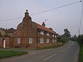
English: Arkendale is a village and civil parish in the Harrogate district of North Yorkshire, England. It is seven miles north-east of Harrogate town, and a had a population of 278 according to the 2001 census. It consists of a Pub, a Village Hall, a Church and is close to Staveley village.
Sous-catégories
Cette catégorie comprend seulement la sous-catégorie ci-dessous.
S
Média dans la catégorie « Arkendale »
Cette catégorie comprend 137 fichiers, dont les 137 ci-dessous.
-
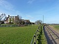
 A bridleway to Poplars Farm - geograph.org.uk - 2548437.jpg 800 × 600 ; 353 kio
-
 A disused farm building near The Hollies - geograph.org.uk - 2284493.jpg 1 152 × 864 ; 414 kio
-
 A1(M) - Marton Lane bridge - geograph.org.uk - 2647850.jpg 640 × 428 ; 83 kio
-
 A1(M) heading north - geograph.org.uk - 3801044.jpg 640 × 480 ; 57 kio
-
 A1(M) near Arkendale - geograph.org.uk - 214036.jpg 640 × 480 ; 54 kio
-
 A1(M) near to Arkendale - geograph.org.uk - 6399756.jpg 800 × 533 ; 523 kio
-
 A1(M) northbound - geograph.org.uk - 2647851.jpg 640 × 428 ; 74 kio
-
 A1(M) southbound near Grafton Grange - geograph.org.uk - 5395464.jpg 640 × 481 ; 45 kio
-
 A1(M) southbound near Thornbar Farm - geograph.org.uk - 5395471.jpg 640 × 481 ; 37 kio
-
 A1(M), Marton Lane Bridge - geograph.org.uk - 6399778.jpg 800 × 533 ; 237 kio
-
 A1(M), northbound - geograph.org.uk - 3040676.jpg 640 × 426 ; 32 kio
-
 Access Lane to Brooms House - geograph.org.uk - 3282403.jpg 4 320 × 3 240 ; 3,92 Mio
-
 Access Track leading to Shortsill Lane - geograph.org.uk - 4299266.jpg 5 184 × 3 456 ; 7,14 Mio
-
 An old barn, Arkendale, North Yorkshire - geograph.org.uk - 2548429.jpg 800 × 600 ; 318 kio
-
 Approaching Brooms House - geograph.org.uk - 3282389.jpg 4 320 × 3 240 ; 2,74 Mio
-
 Approaching Castle Farm - geograph.org.uk - 5852250.jpg 1 600 × 1 200 ; 484 kio
-
 Arkendale , A1(M) - geograph.org.uk - 6635113.jpg 6 000 × 4 000 ; 7,4 Mio
-
 Arkendale , A1(M) - geograph.org.uk - 6635114.jpg 6 000 × 4 000 ; 7,09 Mio
-
 Arkendale , Ploughed Field - geograph.org.uk - 6635111.jpg 6 000 × 4 000 ; 7,21 Mio
-
 Arkendale , Ploughed Field - geograph.org.uk - 6635112.jpg 6 000 × 4 000 ; 6,57 Mio
-
 Arkendale - geograph.org.uk - 253468.jpg 640 × 480 ; 82 kio
-
 Arkendale Lane - geograph.org.uk - 3282446.jpg 4 320 × 3 240 ; 3,78 Mio
-
 Barn conversion, Arkendale - geograph.org.uk - 2251499.jpg 2 176 × 1 632 ; 977 kio
-
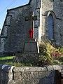
 Benchmark on St Bartholomew's Church - geograph.org.uk - 3175894.jpg 2 048 × 1 536 ; 596 kio
-
 Blue Bell at Arkendale - geograph.org.uk - 6318609.jpg 3 648 × 1 744 ; 2,09 Mio
-
 Bluebell Inn, Arkendale - geograph.org.uk - 3282432.jpg 4 308 × 3 020 ; 2,91 Mio
-
 Bridleway north of Castle Farm - geograph.org.uk - 2284427.jpg 1 152 × 864 ; 316 kio
-
 Bridleway south of The Hollies - geograph.org.uk - 2284415.jpg 1 152 × 864 ; 423 kio
-
 Bridleway towards Coneythorpe south of The Hollies - geograph.org.uk - 3921502.jpg 1 600 × 1 200 ; 433 kio
-
 Brooms House Farm - geograph.org.uk - 3175403.jpg 2 048 × 1 536 ; 568 kio
-
 Brown Moor - geograph.org.uk - 2931274.jpg 640 × 437 ; 65 kio
-
 Castle Farm - geograph.org.uk - 2284435.jpg 1 024 × 768 ; 319 kio
-
 Castle Farm - geograph.org.uk - 4299270.jpg 5 184 × 3 456 ; 7,56 Mio
-
 Castle Farm to Shortshill Lane - geograph.org.uk - 2497323.jpg 1 024 × 768 ; 277 kio
-
 Church Barn, Arkendale - geograph.org.uk - 6616820.jpg 1 600 × 1 065 ; 545 kio
-
 Church Barn, Arkendale.jpg 1 600 × 1 200 ; 546 kio
-
 Church in Arkendale - geograph.org.uk - 4605124.jpg 640 × 428 ; 115 kio
-
 Clareton Moor Farm - geograph.org.uk - 253470.jpg 640 × 480 ; 78 kio
-
 Community Hall, Arkendale - geograph.org.uk - 6616832.jpg 1 600 × 1 065 ; 579 kio
-
 Cottage at Castle Farm - geograph.org.uk - 2284431.jpg 1 152 × 864 ; 324 kio
-
 Crop field off the A6055 - geograph.org.uk - 3800897.jpg 640 × 480 ; 113 kio
-
 Dale Farm, Arkendale - geograph.org.uk - 3801053.jpg 640 × 480 ; 86 kio
-
 Dale House Barn, Arkendale.jpg 1 600 × 1 065 ; 567 kio
-
 Entering Arkendale - geograph.org.uk - 4605120.jpg 640 × 428 ; 81 kio
-
 Entering Arkendale, North Yorkshire - geograph.org.uk - 2548387.jpg 800 × 600 ; 308 kio
-
 Entrance to Arkendale - geograph.org.uk - 4751160.jpg 640 × 480 ; 105 kio
-
 Farm Outbuilding near The Hollies - geograph.org.uk - 4300077.jpg 5 179 × 3 451 ; 7,3 Mio
-
 Farmland and woodland - geograph.org.uk - 3801047.jpg 640 × 480 ; 102 kio
-
 Farmland east of Moor Lane - geograph.org.uk - 3801057.jpg 640 × 480 ; 95 kio
-
 Farmland off Marton Lane - geograph.org.uk - 3801045.jpg 640 × 480 ; 61 kio
-
 Farmland off Marton Lane - geograph.org.uk - 4605134.jpg 640 × 428 ; 110 kio
-
 Field by Hay-a-Park Lane - geograph.org.uk - 2931241.jpg 640 × 432 ; 78 kio
-
 Field by Hay-a-Park Lane - geograph.org.uk - 2931257.jpg 640 × 412 ; 87 kio
-
 Field near Castle Farm - geograph.org.uk - 5788867.jpg 1 024 × 683 ; 462 kio
-
 Footbridge on Brown Moor - geograph.org.uk - 2931497.jpg 640 × 480 ; 116 kio
-
 Former chapel in Arkendale - geograph.org.uk - 2251507.jpg 2 277 × 2 177 ; 1,03 Mio
-
 Forms House - geograph.org.uk - 3175421.jpg 2 048 × 1 536 ; 446 kio
-
 Goals at Castle Farm - geograph.org.uk - 5788870.jpg 1 024 × 683 ; 500 kio
-
 Hay bales on the track to Poplar and Hollies Farms - geograph.org.uk - 2282842.jpg 1 152 × 864 ; 245 kio
-
 Hill Bank - geograph.org.uk - 3801049.jpg 640 × 480 ; 76 kio
-
 Holgate Fields - geograph.org.uk - 214025.jpg 640 × 480 ; 75 kio
-
 House with unusual gable ends - geograph.org.uk - 3175436.jpg 2 048 × 1 536 ; 551 kio
-
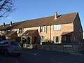 Houses on Manor Park, Arkendale - geograph.org.uk - 3801052.jpg 640 × 480 ; 71 kio
-
 Houses on Reins (road) Arkendale - geograph.org.uk - 6616836.jpg 1 600 × 1 102 ; 646 kio
-
 Isolated tree by the A1(M) - geograph.org.uk - 3040678.jpg 640 × 430 ; 54 kio
-
 Lakes NE of Knaresborough, aerial 2016 - geograph.org.uk - 5090863.jpg 640 × 427 ; 67 kio
-
 Livestock drink in a culvert on The Rampart - geograph.org.uk - 2284421.jpg 1 024 × 768 ; 405 kio
-
 Looking North on the A1(M) - geograph.org.uk - 4605136.jpg 640 × 428 ; 79 kio
-
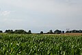 Maize growing - geograph.org.uk - 4605109.jpg 640 × 428 ; 88 kio
-
 Marton Lane - geograph.org.uk - 1709209.jpg 1 280 × 959 ; 354 kio
-
 Marton Lane - geograph.org.uk - 2251449.jpg 3 264 × 2 448 ; 1,86 Mio
-
 Marton Lane - geograph.org.uk - 3801046.jpg 640 × 480 ; 63 kio
-
 Marton Lane Bridge, A1(M) - geograph.org.uk - 3040680.jpg 640 × 430 ; 35 kio
-
 Marton Lane Bridgw, A1(M) - geograph.org.uk - 2568769.jpg 640 × 396 ; 34 kio
-
 Marton Lane crossing the A1(M) to join the A168 - geograph.org.uk - 5896035.jpg 4 000 × 3 000 ; 2,79 Mio
-
 Marton Lane heading towards Arkendale - geograph.org.uk - 5896031.jpg 4 000 × 3 000 ; 2,88 Mio
-
 Moor House Farm on Moor Lane - geograph.org.uk - 2548434.jpg 800 × 600 ; 289 kio
-
 Moor Lane - geograph.org.uk - 3282787.jpg 4 320 × 3 240 ; 4,21 Mio
-
 Moor Lane - geograph.org.uk - 3801056.jpg 640 × 480 ; 66 kio
-
 Moor Lane - geograph.org.uk - 4605113.jpg 640 × 428 ; 96 kio
-
 Moor Lane in Arkendale - geograph.org.uk - 5896025.jpg 4 000 × 3 000 ; 3,12 Mio
-
 Moor Lane towards Ferrensby - geograph.org.uk - 6616849.jpg 1 600 × 1 065 ; 431 kio
-
 Moor Lane, Arkendale - geograph.org.uk - 3801054.jpg 640 × 480 ; 88 kio
-
 Moor Lane, Arkendale - geograph.org.uk - 6182979.jpg 1 024 × 683 ; 235 kio
-
 Moor Lane, Arkendale - geograph.org.uk - 6319256.jpg 3 648 × 1 744 ; 2,6 Mio
-
 Muddy bridleway near The Hollies - geograph.org.uk - 2284412.jpg 1 152 × 864 ; 352 kio
-
 New chicken sheds at The Hollies - geograph.org.uk - 2284409.jpg 1 152 × 864 ; 291 kio
-
 NHS Priority Postbox, Moor Lane, Arkendale - geograph.org.uk - 6616792.jpg 1 065 × 1 600 ; 514 kio
-
 North Kills Gutter - geograph.org.uk - 2251477.jpg 1 984 × 2 177 ; 957 kio
-
 Old and new at Nineveh - geograph.org.uk - 1709201.jpg 1 280 × 959 ; 315 kio
-
 Old brick barn south of The Hollies farm - geograph.org.uk - 6274527.jpg 1 024 × 768 ; 316 kio
-
 On Moor Lane, Lower Arkendale - geograph.org.uk - 3282772.jpg 4 320 × 3 240 ; 2,78 Mio
-
 Ordnance Survey Cut Mark - geograph.org.uk - 5897051.jpg 3 854 × 2 891 ; 3,1 Mio
-
 Phone kiosk and postbox, Arkendale - geograph.org.uk - 2251494.jpg 2 747 × 1 632 ; 1,27 Mio
-
 Poplar Cottage, east of Ferrensby - geograph.org.uk - 3921482.jpg 1 600 × 1 200 ; 472 kio
-
 Poplars Farm - geograph.org.uk - 3921493.jpg 1 600 × 1 200 ; 400 kio
-
 Riffa Lane - geograph.org.uk - 3282411.jpg 4 320 × 3 240 ; 3,83 Mio
-
 Road to Coneythorpe - geograph.org.uk - 3800722.jpg 2 448 × 2 176 ; 1,19 Mio
-
 Rougham Farm - geograph.org.uk - 1709210.jpg 1 280 × 959 ; 352 kio
-
 Sloping fields of cattle - geograph.org.uk - 4605128.jpg 640 × 428 ; 73 kio
-
 St Bartholomew's Church, Arkendale - geograph.org.uk - 6616796.jpg 1 065 × 1 600 ; 480 kio
-
 St Bartholomew's Church, Arkendale - geograph.org.uk - 6616817.jpg 1 600 × 1 065 ; 566 kio
-
 St Bartholomew's parish Church, Arkendale - geograph.org.uk - 6319249.jpg 3 648 × 1 744 ; 1,94 Mio
-
 Swift POWELL - geograph.org.uk - 5010953.jpg 2 433 × 3 753 ; 1,83 Mio
-
 Telephone kiosk and postbox on Moor lane, Arkendale - geograph.org.uk - 6616790.jpg 1 600 × 1 065 ; 768 kio
-
 The A1M from Marton Lane - geograph.org.uk - 2548365.jpg 800 × 600 ; 197 kio
-
 The Blue Bell - geograph.org.uk - 4751164.jpg 640 × 480 ; 51 kio
-
 The Blue Bell inn - geograph.org.uk - 6197619.jpg 1 024 × 757 ; 182 kio
-
 The Blue Bell public house, Arkendale - geograph.org.uk - 6616828.jpg 1 600 × 1 065 ; 462 kio
-
 The Bluebell public house, Arkendale - geograph.org.uk - 2548422.jpg 800 × 600 ; 235 kio
-
 The Bluebell public house, Arkendale - geograph.org.uk - 2548424.jpg 800 × 600 ; 231 kio
-
 The Hollies - geograph.org.uk - 3921497.jpg 1 600 × 1 200 ; 319 kio
-
 The Hollies - geograph.org.uk - 4300070.jpg 5 179 × 3 451 ; 5,52 Mio
-
 The lane to Holly Bank Farm - geograph.org.uk - 1709204.jpg 1 280 × 959 ; 314 kio
-
 The Mar at Low Arkendale - geograph.org.uk - 3175430.jpg 2 048 × 1 536 ; 566 kio
-
 The modern Great North Road - geograph.org.uk - 1709208.jpg 1 280 × 959 ; 320 kio
-
 The old A1 at Nineveh - geograph.org.uk - 1709193.jpg 1 280 × 959 ; 361 kio
-
 The Poplars Farm - geograph.org.uk - 2282847.jpg 1 152 × 864 ; 288 kio
-
 The Rampart - geograph.org.uk - 2931515.jpg 480 × 640 ; 105 kio
-
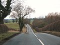
 The road to Arkendale - geograph.org.uk - 3800715.jpg 3 264 × 1 632 ; 1 023 kio
-
 The way to Arkendale Hall - geograph.org.uk - 2548381.jpg 800 × 600 ; 325 kio
-
 The way to Hollins Farm - geograph.org.uk - 2548375.jpg 800 × 600 ; 229 kio
-
 Towards Castle Farm - geograph.org.uk - 2931288.jpg 640 × 454 ; 54 kio
-
 Towards Ninevah along the old A1 - geograph.org.uk - 3802549.jpg 2 448 × 2 293 ; 1,41 Mio
-
 Track alongside the motorway - geograph.org.uk - 1709213.jpg 1 280 × 959 ; 478 kio
-
 Track and Bridleway to Arkendale at Hill Wood - geograph.org.uk - 5896016.jpg 4 000 × 3 000 ; 3,92 Mio
-
 Track leading to Forms House - geograph.org.uk - 6617155.jpg 1 600 × 1 109 ; 497 kio
-
 Track off Marton Lane - geograph.org.uk - 4605131.jpg 640 × 428 ; 92 kio
-
 Track off Moor Lane - geograph.org.uk - 4605117.jpg 640 × 428 ; 102 kio
-
 Underpass giving Access to Brooms House - geograph.org.uk - 3282396.jpg 4 320 × 3 240 ; 3,4 Mio
-

-
 Village pump, Arkendale - geograph.org.uk - 2251484.jpg 2 448 × 3 264 ; 2,87 Mio
-
 Vintage Croft - geograph.org.uk - 3282799.jpg 4 320 × 3 240 ; 3,24 Mio
-
 War Memorial, Arkendale - geograph.org.uk - 3801051.jpg 480 × 640 ; 109 kio
-
 War memorial, Arkendale - geograph.org.uk - 6616799.jpg 1 065 × 1 600 ; 510 kio
-
 Westfield Lane - geograph.org.uk - 6658885.jpg 3 807 × 4 650 ; 3,22 Mio
-
 Westfield Lane in Arkendale - geograph.org.uk - 5896022.jpg 4 000 × 3 000 ; 3,38 Mio


_-_Marton_Lane_bridge_-_geograph.org.uk_-_2647850.jpg)
_heading_north_-_geograph.org.uk_-_3801044.jpg)
_near_Arkendale_-_geograph.org.uk_-_214036.jpg)
_near_to_Arkendale_-_geograph.org.uk_-_6399756.jpg)
_northbound_-_geograph.org.uk_-_2647851.jpg)
_southbound_near_Grafton_Grange_-_geograph.org.uk_-_5395464.jpg)
_southbound_near_Thornbar_Farm_-_geograph.org.uk_-_5395471.jpg)
,_Marton_Lane_Bridge_-_geograph.org.uk_-_6399778.jpg)
,_northbound_-_geograph.org.uk_-_3040676.jpg)


_-_geograph.org.uk_-_6635113.jpg)
_-_geograph.org.uk_-_6635114.jpg)


_Arkendale_-_geograph.org.uk_-_6616836.jpg)
_-_geograph.org.uk_-_3040678.jpg)


_-_geograph.org.uk_-_4605136.jpg)


_-_geograph.org.uk_-_3040680.jpg)
_-_geograph.org.uk_-_2568769.jpg)
_to_join_the_A168_-_geograph.org.uk_-_5896035.jpg)


_near_to_Grafton,_North_Yorkshire_-_geograph.org.uk_-_6399780.jpg)


