Category:Arncott
Vai alla navigazione
Vai alla ricerca
village and civil parish in Cherwell district, Oxfordshire, England  | |||||
| Carica un file multimediale | |||||
| Istanza di | |||||
|---|---|---|---|---|---|
| Luogo | Cherwell, Oxfordshire, Sud Est dell'Inghilterra, Inghilterra | ||||
| Popolazione |
| ||||
| Superficie |
| ||||
| sito web ufficiale | |||||
 | |||||
English: Arncott is a village and civil parish about southeast of Bicester in Oxfordshire, England. It includes two settlements: Lower Arncott and Upper Arncott.
Sottocategorie
Questa categoria contiene le 3 sottocategorie indicate di seguito, su un totale di 3.
File nella categoria "Arncott"
Questa categoria contiene 36 file, indicati di seguito, su un totale di 36.
-
 Arncott Fire Tower - geograph.org.uk - 256268.jpg 640 × 480; 125 KB
-
 Arncott Signal Box - geograph.org.uk - 4365674.jpg 1 500 × 999; 178 KB
-
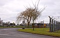
 Bicester Garrison - geograph.org.uk - 464267.jpg 640 × 480; 161 KB
-
 Bridleway to Murcott - geograph.org.uk - 4365670.jpg 1 500 × 999; 135 KB
-
 Cornfield Arncott Wood Road - geograph.org.uk - 204302.jpg 640 × 427; 138 KB
-
 Depot Buildings off Arncott Wood Road - geograph.org.uk - 204307.jpg 640 × 427; 110 KB
-
 Derelict Military Railway - geograph.org.uk - 6272071.jpg 5 345 × 3 433; 3,46 MB
-
 Emergency Vehicle Access - geograph.org.uk - 6272567.jpg 4 443 × 3 382; 2,44 MB
-
 Footpath to Arncott - geograph.org.uk - 2181230.jpg 640 × 480; 71 KB
-
 Gate to the MOD railway sidings at Arncott - geograph.org.uk - 1747188.jpg 1 500 × 965; 187 KB
-
 House on Ploughley Road, Lower Arncott - geograph.org.uk - 4873224.jpg 2 048 × 1 536; 647 KB
-
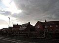
 Level crossing on the B4011 - geograph.org.uk - 6274484.jpg 800 × 600; 117 KB
-
 Looking across the River Ray - geograph.org.uk - 2492820.jpg 1 500 × 984; 330 KB
-

-
 Military railway system - geograph.org.uk - 464271.jpg 640 × 480; 145 KB
-
 Military Storage Building - geograph.org.uk - 6272102.jpg 5 079 × 3 342; 2,18 MB
-
 New houses in Arncott - geograph.org.uk - 4872911.jpg 2 008 × 1 480; 565 KB
-
 Norris Road, Upper Arncott - geograph.org.uk - 4873907.jpg 2 048 × 1 536; 689 KB
-
 Old Military Buildings at Arncott - geograph.org.uk - 6272148.jpg 5 325 × 3 276; 2,3 MB
-
 Plane outside RAF Arncott depot - geograph.org.uk - 4872896.jpg 2 038 × 1 522; 1,07 MB
-
 Playing Field Arncott - geograph.org.uk - 204268.jpg 640 × 427; 115 KB
-
 Ploughley Road - geograph.org.uk - 5215631.jpg 640 × 428; 181 KB
-
 Ploughley Road crosses Arncott Bridge - geograph.org.uk - 4365675.jpg 1 500 × 999; 244 KB
-
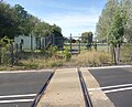
 Rail Crossing near Arncott - geograph.org.uk - 204291.jpg 640 × 427; 140 KB
-
 Remains of a Level Crossing - geograph.org.uk - 6272080.jpg 4 388 × 3 553; 2,92 MB
-
 Roundabout on Ploughley Road, Lower Arncott - geograph.org.uk - 4872888.jpg 1 984 × 1 446; 628 KB
-
 Signs off Mill Lane Arncott - geograph.org.uk - 204276.jpg 640 × 427; 181 KB
-
 The Plough at Arncott - geograph.org.uk - 1744273.jpg 1 500 × 995; 145 KB
-
 The Plough Bus Stop - geograph.org.uk - 6272588.jpg 4 902 × 3 409; 2,62 MB
-
 The Plough, Lower Arncott - geograph.org.uk - 4873226.jpg 2 048 × 1 536; 1,49 MB
-
 The Plough, Lower Arncott - geograph.org.uk - 5215624.jpg 640 × 428; 115 KB
-
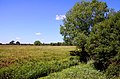
 The River Ray at Blackthorn - geograph.org.uk - 2492822.jpg 1 000 × 1 500; 343 KB
-
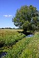
 Trees by the River Ray - geograph.org.uk - 2449102.jpg 1 500 × 1 000; 160 KB
-
 Trees by the River Ray in Peter's Paddock - geograph.org.uk - 2449111.jpg 1 500 × 1 000; 160 KB
-
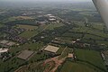 Upper Arncott, aerial 2017 - geograph.org.uk - 5436973.jpg 640 × 427; 57 KB
-
 Water lilies in the River Ray - geograph.org.uk - 2492824.jpg 1 500 × 1 000; 295 KB


