Category:Arnesby
Aller à la navigation
Aller à la recherche
Cebuano: Arnesby maoy parokya sa Hiniusang Gingharian. Ang Arnesby nahimutang sa kondado sa Leicestershire ug apil sa nasod sa Inglatera, sa habagatang bahin sa nasod, km sa amihanan-kasadpan sa ulohang dakbayan London. (→Arnesby)
English: Arnesby is a village and civil parish in the Harborough district of Leicestershire, England. According to the 2001 census the parish had a population of 343, increasing to 357 at the 2011 census. The village is south of Leicester, on the Welford Road, between Kilby and Shearsby. (→Arnesby)
Italiano: Arnesby è un paese di 343 abitanti della contea del Leicestershire, in Inghilterra. (→Arnesby)
Polski: Arnesby – wieś w Anglii, w hrabstwie Leicestershire, w dystrykcie Harborough. Leży 14 km na południe od miasta Leicester i 130 km na północny zachód od Londynu. (→Arnesby)
Svenska: Arnesby är en parish i Storbritannien. Den ligger i grevskapet Leicestershire och riksdelen England, i den södra delen av landet, km nordväst om huvudstaden London. (→Arnesby)

localité britannique du comté anglais de Leicestershire | |||||
| Téléverser des médias | |||||
| Nature de l’élément | |||||
|---|---|---|---|---|---|
| Lieu | Harborough, Leicestershire, Midlands de l'Est, Angleterre | ||||
| Population |
| ||||
| Superficie |
| ||||
 | |||||
Sous-catégories
Cette catégorie comprend seulement la sous-catégorie ci-dessous.
P
- St Peter's Church, Arnesby (2 F)
Média dans la catégorie « Arnesby »
Cette catégorie comprend 91 fichiers, dont les 91 ci-dessous.
-
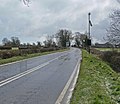
 A5199 Welford Road at Arnesby - geograph.org.uk - 4667645.jpg 800 × 570 ; 109 kio
-
 A5199, Welford Road - geograph.org.uk - 209285.jpg 640 × 427 ; 134 kio
-
 Arnesby church - geograph.org.uk - 3701321.jpg 1 600 × 1 200 ; 472 kio
-
 Arnesby Footpath - geograph.org.uk - 2919509.jpg 640 × 480 ; 100 kio
-
 Arnesby Lane leading to Peatling Magna - geograph.org.uk - 2568057.jpg 4 000 × 3 000 ; 2,84 Mio
-
 Arnesby Lodge and Arnesby Lodge Cottages - geograph.org.uk - 734152.jpg 640 × 463 ; 76 kio
-
 Arnesby Mill - geograph.org.uk - 2919766.jpg 640 × 480 ; 66 kio
-
 Arnesby Mill - geograph.org.uk - 3292687.jpg 640 × 480 ; 50 kio
-
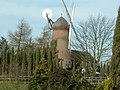
 Arnesby Windmill - geograph.org.uk - 5695708.jpg 800 × 413 ; 65 kio
-
 Arnesby windmill.jpg 640 × 480 ; 107 kio
-
 Autumn berries and a field of maize - geograph.org.uk - 3674935.jpg 1 600 × 1 200 ; 734 kio
-
 Barns - geograph.org.uk - 5935632.jpg 640 × 396 ; 52 kio
-
 Blossom on Lutterworth Road in Arnesby - geograph.org.uk - 5356652.jpg 800 × 559 ; 178 kio
-
 Bridleway along the edge of a field of maize - geograph.org.uk - 3674793.jpg 1 600 × 1 200 ; 599 kio
-
 Communications mast along Fleckney Road - geograph.org.uk - 4667661.jpg 800 × 654 ; 215 kio
-
 Daffodils along Lutterworth Road in Arnesby - geograph.org.uk - 5315015.jpg 800 × 531 ; 148 kio
-
 Farm track eastwards - geograph.org.uk - 5935633.jpg 640 × 458 ; 80 kio
-
 Farm track westwards - geograph.org.uk - 5935634.jpg 640 × 480 ; 79 kio
-
 Farmland north of Fleckney Road - geograph.org.uk - 4667664.jpg 800 × 600 ; 184 kio
-
 Field to east of sewage works - geograph.org.uk - 5935604.jpg 640 × 462 ; 64 kio
-
 Fleckney Road - geograph.org.uk - 3735632.jpg 1 600 × 1 200 ; 651 kio
-
 Fleckney Road joining the A5199 - geograph.org.uk - 2568055.jpg 4 000 × 3 000 ; 2,9 Mio
-
 Footpath and overgrown hedge - geograph.org.uk - 5935608.jpg 640 × 551 ; 142 kio
-
 Footpath from Kilby to Arnesby - geograph.org.uk - 5909778.jpg 4 000 × 3 000 ; 3,62 Mio
-
 Footpath sign - geograph.org.uk - 5935605.jpg 640 × 447 ; 67 kio
-
 Footpath sign to Arnesby - geograph.org.uk - 5935606.jpg 640 × 511 ; 44 kio
-
 Footpath to Arnesby - geograph.org.uk - 5935607.jpg 640 × 436 ; 90 kio
-
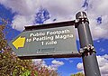
 Footpath to Peatling Magna - geograph.org.uk - 5935609.jpg 640 × 494 ; 100 kio
-
 Former R.A.F. Bruntingthorpe, aerial 2018 - geograph.org.uk - 5951883.jpg 800 × 533 ; 138 kio
-
 Gate along the bridleway - geograph.org.uk - 3674915.jpg 1 600 × 1 289 ; 732 kio
-
 Gate to fields to south of farm track - geograph.org.uk - 5935635.jpg 640 × 456 ; 102 kio
-
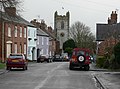
 Little India at Arnesby - geograph.org.uk - 6423451.jpg 800 × 523 ; 149 kio
-
 Lutterworth Road crosses a tributary of the River Sence - geograph.org.uk - 3699877.jpg 1 600 × 1 200 ; 542 kio
-
 Lutterworth Road in Arnesby - geograph.org.uk - 5285084.jpg 800 × 539 ; 114 kio
-
 Lutterworth Road in Arnesby - geograph.org.uk - 5331142.jpg 800 × 539 ; 156 kio
-
 Lutterworth Road in Arnesby - geograph.org.uk - 5627300.jpg 800 × 479 ; 106 kio
-
 Lutterworth Road in Arnesby - geograph.org.uk - 734169.jpg 640 × 420 ; 71 kio
-

-
 Lutterworth Road passing Brookside Farm - geograph.org.uk - 5935611.jpg 640 × 473 ; 85 kio
-

-

-
 Mill at Arnesby - geograph.org.uk - 53058.jpg 640 × 480 ; 52 kio
-
 Mill Hill Road in Arnesby - geograph.org.uk - 5695717.jpg 800 × 467 ; 91 kio
-
 North along the A5199 Welford Road - geograph.org.uk - 4667627.jpg 800 × 571 ; 199 kio
-
 Public bridleway leading to Fleckney - geograph.org.uk - 4250317.jpg 1 600 × 1 254 ; 454 kio
-
 Public bridleway marker - geograph.org.uk - 3674768.jpg 1 600 × 1 200 ; 832 kio
-
 Public footpath to Shearsby - geograph.org.uk - 5935636.jpg 640 × 445 ; 62 kio
-
 Public footpath towards Peatling Magna - geograph.org.uk - 5935637.jpg 640 × 449 ; 69 kio
-
 Remains of a tree - geograph.org.uk - 5935638.jpg 640 × 446 ; 107 kio
-
 St. Peter's Church, Arnesby - geograph.org.uk - 734175.jpg 640 × 473 ; 78 kio
-
 Shearsby Sewage Works entrance - geograph.org.uk - 5935614.jpg 640 × 415 ; 66 kio
-
 Shearsby Sewage Works entrance road - geograph.org.uk - 5935615.jpg 640 × 394 ; 59 kio
-
 Sign at Fleckney Road-Arnesby Road junction - geograph.org.uk - 735216.jpg 640 × 533 ; 120 kio
-
 Signs at Shearsby Sewage Works entrance 0001 - geograph.org.uk - 5935616.jpg 640 × 513 ; 94 kio
-
 Signs at Shearsby Sewage Works entrance 0002 - geograph.org.uk - 5935617.jpg 640 × 343 ; 84 kio
-
 Signs at Shearsby Sewage Works entrance 0003 - geograph.org.uk - 5935618.jpg 640 × 404 ; 54 kio
-
 Signs at Shearsby Sewage Works entrance 0004 - geograph.org.uk - 5935619.jpg 640 × 487 ; 99 kio
-
 Signs at Shearsby Sewage Works entrance 0005 - geograph.org.uk - 5935620.jpg 640 × 479 ; 98 kio
-
 Signs at Shearsby Sewage Works entrance 0006 - geograph.org.uk - 5935621.jpg 640 × 515 ; 73 kio
-
 Signs on footpath marker - geograph.org.uk - 5935622.jpg 640 × 543 ; 103 kio
-
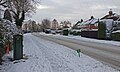
 Snow storm in Arnesby - geograph.org.uk - 735165.jpg 640 × 480 ; 87 kio
-
 St Peter's Church in Arnesby - geograph.org.uk - 5305507.jpg 619 × 800 ; 128 kio
-
 St Peter's Church in Arnesby - geograph.org.uk - 6423439.jpg 498 × 800 ; 123 kio
-
 Stile and plank bridge for footpath to Arnesby - geograph.org.uk - 5935623.jpg 640 × 502 ; 105 kio
-
 Sustrans National Cycle Network Sign - geograph.org.uk - 735078.jpg 362 × 640 ; 91 kio
-
 Telephone box along Lutterworth Road - geograph.org.uk - 4250301.jpg 1 600 × 1 136 ; 310 kio
-
 Track and public footpath towards Shearsby - geograph.org.uk - 5935624.jpg 640 × 479 ; 93 kio
-
 Track eastwards from sewage works - geograph.org.uk - 5935625.jpg 640 × 467 ; 76 kio
-
 Track passing sewage works - geograph.org.uk - 5935626.jpg 640 × 464 ; 91 kio
-
 Track passing sewage works entrance - geograph.org.uk - 5935627.jpg 640 × 454 ; 88 kio
-
 View across Leicestershire - geograph.org.uk - 735099.jpg 640 × 432 ; 55 kio
-
 View north towards the city of Leicester - geograph.org.uk - 4667667.jpg 800 × 640 ; 163 kio
-
 View towards Arnesby Windmill - geograph.org.uk - 645968.jpg 640 × 418 ; 59 kio
-
 Welford Road at Arnesby in Leicestershire - geograph.org.uk - 734068.jpg 640 × 556 ; 83 kio
-
 Welford Road, Arnesby - geograph.org.uk - 738318.jpg 640 × 452 ; 72 kio
-
 Arnesby Lane - geograph.org.uk - 274176.jpg 640 × 427 ; 83 kio
-
 Arnesby Lane-Lutterworth Road junction - geograph.org.uk - 735092.jpg 640 × 428 ; 74 kio
-
 Arnesby Lodge - geograph.org.uk - 734141.jpg 640 × 434 ; 55 kio
-
 Derelict building near Welford Road - geograph.org.uk - 734073.jpg 640 × 516 ; 98 kio
-
 Farmland north of Arnesby Lane - geograph.org.uk - 734181.jpg 640 × 480 ; 73 kio
-
 Farmland off Lutterworth Road - geograph.org.uk - 274178.jpg 640 × 427 ; 66 kio
-
 Fleckney Road - geograph.org.uk - 220236.jpg 640 × 421 ; 105 kio
-
 Fleckney Road towards Arnesby - geograph.org.uk - 734023.jpg 640 × 491 ; 61 kio
-
 Gallop's Farm near Arnesby, Leicestershire - geograph.org.uk - 209292.jpg 640 × 427 ; 83 kio
-
 Gallops Farm - geograph.org.uk - 734077.jpg 609 × 640 ; 63 kio
-
 Gate and trees - geograph.org.uk - 224713.jpg 640 × 468 ; 129 kio
-
 Hail storm along Fleckney Road - geograph.org.uk - 734036.jpg 640 × 436 ; 46 kio
-
 Hail storm along Fleckney Road - geograph.org.uk - 734043.jpg 640 × 490 ; 44 kio
-
 Hail storm on Lutterworth Road - geograph.org.uk - 735162.jpg 640 × 489 ; 101 kio
-
 Little India, Arnesby - geograph.org.uk - 734166.jpg 640 × 430 ; 51 kio
-
 The Mill entrance Arnesby - geograph.org.uk - 361614.jpg 640 × 480 ; 87 kio


