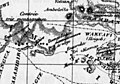
Category:Arusha Region
Zur Navigation springen
Zur Suche springen
Verwaltungsregion Tansanias   | |||||
| Medium hochladen | |||||
| Ist ein(e) | |||||
|---|---|---|---|---|---|
| Benannt nach | |||||
| Ort | Tansania | ||||
| Hauptstadt | |||||
| Einwohnerzahl |
| ||||
| Fläche |
| ||||
| offizielle Website | |||||
 | |||||
Unterkategorien
Es werden 16 von insgesamt 16 Unterkategorien in dieser Kategorie angezeigt:
In Klammern die Anzahl der enthaltenen Kategorien (K), Seiten (S), Dateien (D)
A
C
- C-Block Mine (2 D)
L
- Lake Manyara (25 D)
M
- Maps of Arusha Region (21 D)
- Minerals of Merelani Hills (159 D)
- Minerals of Nani (298 D)
- Mount Longido (3 D)
N
O
P
S
T
Medien in der Kategorie „Arusha Region“
Folgende 200 Dateien sind in dieser Kategorie, von 867 insgesamt.
(vorherige Seite) (nächste Seite)-
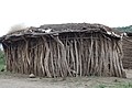 A house in Datoga tribe Arusha region Tanzania.jpg 720 × 480; 220 KB
-
 Acacia in Naiyobi, Ngorongoro District.jpg 2.422 × 2.163; 2,81 MB
-
 Agriculture 10A.jpg 6.000 × 4.000; 2,27 MB
-
 Agriculture 10D.jpg 6.000 × 4.000; 2,68 MB
-
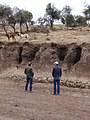
 Ancient game in Ngorongoro District.jpg 3.024 × 4.032; 7,11 MB
-
 Argya aylmeri 250295281.jpg 2.048 × 1.825; 1 MB
-
 Arumeru, Tanzania - panoramio.jpg 1.000 × 563; 261 KB
-
 Arusha (2) (13962410509).jpg 3.264 × 2.448; 3,41 MB
-
 Arusha (4) (13962388337).jpg 3.264 × 2.448; 3,3 MB
-
 Arusha (5) (14125887166).jpg 3.264 × 2.448; 3,21 MB
-
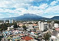 Arusha City view.jpg 4.031 × 2.805; 4,14 MB
-
 Arusha Declaration Monument, Kati Ward.jpg 240 × 320; 26 KB
-
 Arusha Monument View, Arusha City Council.jpg 1.105 × 1.473; 632 KB
-
 Arusha Post Office, Goliondoi, Sekei Ward, Arusha City.jpg 960 × 1.280; 271 KB
-
 Arusha Region, Tanzania-1.jpg 4.320 × 3.240; 3,13 MB
-
 Arusha Region, Tanzania-2.jpg 4.320 × 3.240; 3,15 MB
-
 Arusha Region, Tanzania-3.jpg 4.320 × 3.240; 3,04 MB
-
 Arusha Torch tower.jpg 4.032 × 3.024; 2,01 MB
-
 Balozi wa WLF.jpg 5.184 × 3.456; 6,43 MB
-
 Banana Market - panoramio.jpg 1.000 × 563; 259 KB
-
 Bettle on Loolmalasin, Ngorongoro District.jpg 3.024 × 4.032; 6,1 MB
-
 Birds eye view of Longido Town.jpg 4.032 × 3.024; 5,66 MB
-
 Blik op Selela in Rift Valley.jpg 710 × 325; 179 KB
-
 Boat on Ngarareso, Usa River, Meru District.jpg 3.024 × 3.024; 2,8 MB
-
 Boma Road, Arusha City.jpg 4.032 × 3.024; 5,9 MB
-
 Boma Street 2, Sekei ward.jpg 4.032 × 3.024; 6,41 MB
-
 Boma Street 4, Sekei Ward.jpg 3.024 × 4.032; 4,51 MB
-
 Boma Street, Sekei Ward.jpg 3.848 × 2.886; 5,06 MB
-
 Bridge at Ngaresero,Usa River, Meru District.jpg 3.024 × 4.032; 4,65 MB
-
 Bulati Village from Loolmalasin, Ngorongoro District.jpg 4.032 × 3.024; 6,1 MB
-
 Bulati, Nainokanoka, Ngorongoro District.jpg 4.032 × 3.024; 3,21 MB
-

-
 Butter and Scotch 2, Olasiti, Arusha CC.jpg 2.575 × 3.587; 1,77 MB
-
 Butter and Scotch interior, Olasiti, Arusha CC.jpg 4.032 × 3.024; 2,25 MB
-
 Central Bus Terminal Arusha City.jpg 4.032 × 3.024; 11,61 MB
-
 Central Oltoroto Ward.jpg 4.032 × 3.024; 9,02 MB
-
 Chance & Sada.jpg 3.000 × 4.000; 3,9 MB
-
 Cityscape, Sekei Ward, Arusha Urban District.jpg 4.032 × 3.024; 4,25 MB
-
 Clean Rivers.jpg 6.000 × 4.000; 3,82 MB
-
 Cleaning doing.jpg 6.000 × 3.376; 7,53 MB
-
 Clear waters in Ngaresero, Usa River, Meru District.jpg 3.024 × 4.032; 3,66 MB
-
 Climate change and human.jpg 6.000 × 4.000; 4,18 MB
-
 Clouds on Mount Longido, Arusha Region.jpg 5.712 × 4.284; 8,52 MB
-
 Corn Milling.jpg 4.000 × 3.000; 4,58 MB
-
 Country road, Mateves.jpg 2.598 × 2.755; 5,74 MB
-
 Daisies on Lolmalasin.jpg 4.032 × 3.024; 3,32 MB
-
 Daisy on Loolmalasin 2.jpg 3.024 × 4.032; 2,42 MB
-
 Daisy on Loolmalasin 3.jpg 4.032 × 3.024; 3,91 MB
-
 Daisy on Loolmalasin.jpg 1.380 × 1.840; 1,43 MB
-
 Datooga Skirt, Baray, Karatu.jpg 994 × 993; 406 KB
-
 Empakaai at sunset, Ngorongoro District.jpg 3.779 × 2.834; 3,94 MB
-
 Empakaai beach, Ngorongoro District.jpg 2.984 × 2.238; 3,4 MB
-
 Empakaai from Loolmalasin, Ngorongoro District.jpg 4.032 × 3.024; 6,48 MB
-
 Empakaai postcard, Ngorongoro District.jpg 3.068 × 2.306; 2,58 MB
-
 Empakaai view point, Ngorongoro District.jpg 4.032 × 3.024; 3,92 MB
-
 Empakaai, Ngorongoro District.jpg 3.868 × 2.901; 6,99 MB
-
 Empakaii Crater 2, Ngorongoro District.jpg 4.032 × 3.024; 2,49 MB
-
 Empakaii Crater, Ngorongoro District.jpg 4.032 × 3.024; 5,86 MB
-
 Empakaii view, Ngorongoro District.jpg 4.032 × 3.024; 7,49 MB
-
 Engaresero River, Ngorongoro District.jpg 2.671 × 3.249; 3,76 MB
-
 Engaruka map.jpg 1.024 × 716; 85 KB
-
 Enivronmental Pollution 00X.jpg 6.000 × 4.000; 3,19 MB
-
 Enviroment Kisongo.jpg 6.000 × 4.000; 2,34 MB
-
 Enviromental issues.jpg 6.000 × 4.000; 2,75 MB
-
 Environment Cleanliness T001.jpg 6.000 × 3.376; 6,91 MB
-
 Environment Cleanness T002.jpg 6.000 × 3.376; 8,44 MB
-
 Environment Cleanness T003.jpg 6.000 × 3.376; 8 MB
-
 Environment Cleanness T004.jpg 6.000 × 3.376; 4,66 MB
-
 Environment Cleanness T005.jpg 6.000 × 3.376; 4,59 MB
-
 Environment Cleanness T006.jpg 6.000 × 3.376; 9,28 MB
-
 Environment Cleanness T007.jpg 6.000 × 3.376; 9,75 MB
-
 Environment Cleanness T008.jpg 6.000 × 3.376; 9,19 MB
-
 Environment Cleanness T009.jpg 6.000 × 3.376; 8,19 MB
-
 Environment Cleanness T010.jpg 6.000 × 3.376; 7,63 MB
-
 Environment Cleanness T011.jpg 6.000 × 3.376; 8,75 MB
-
 Environment Cleanness T012.jpg 6.000 × 3.376; 6,41 MB
-
 Environment volunteering.jpg 6.000 × 3.376; 7,16 MB
-
 Environmental Cleanliness z01.jpg 6.000 × 3.376; 8,59 MB
-
 Environmental Cleanliness z010.jpg 6.000 × 3.376; 5 MB
-
 Environmental Cleanliness z012.jpg 6.000 × 3.376; 10,38 MB
-
 Environmental Cleanliness z02.jpg 6.000 × 3.376; 9,22 MB
-
 Environmental Cleanliness z03.jpg 6.000 × 3.376; 9,78 MB
-
 Environmental Cleanliness z04.jpg 6.000 × 3.376; 9,22 MB
-
 Environmental Cleanliness z05.jpg 6.000 × 3.376; 9,81 MB
-
 Environmental Cleanliness z06.jpg 6.000 × 3.376; 9,91 MB
-
 Environmental Cleanliness z07.jpg 6.000 × 3.376; 7,16 MB
-
 Environmental Cleanliness z08.jpg 6.000 × 3.376; 5,94 MB
-
 Environmental Cleanliness z09.jpg 6.000 × 3.376; 5,31 MB
-
 Environmental Cleanliness z11.jpg 6.000 × 3.376; 8,16 MB
-
 Environmental cleanness 01.jpg 6.000 × 3.376; 5,63 MB
-
 Environmental cleanness 02.jpg 6.000 × 3.376; 5,34 MB
-
 Environmental cleanness 03.jpg 6.000 × 3.376; 6,22 MB
-
 Environmental cleanness 04.jpg 6.000 × 3.376; 5,91 MB
-
 Environmental cleanness 05.jpg 6.000 × 3.376; 7,16 MB
-
 Environmental cleanness 06.jpg 6.000 × 3.376; 4,97 MB
-
 Environmental Pollution 002X.jpg 6.000 × 4.000; 3,29 MB
-
 Environmental Pollution 003X.jpg 6.000 × 4.000; 2,64 MB
-
 Firewood for food.jpg 4.000 × 3.000; 4,53 MB
-
 Flag for the Arusha Region.png 900 × 600; 71 KB
-
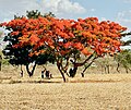 Flame trees, Mateves.jpg 2.904 × 2.450; 5,57 MB
-
 Flood erosion close to Arusha.JPG 1.536 × 2.048; 1,05 MB
-
 Flora on Lolmalasin, Ngorongoro District.jpg 3.024 × 4.032; 6,21 MB
-
 Flower 2 on Mount Longido, Arusha Region.jpg 3.717 × 4.146; 1,34 MB
-
 Flower on Empakaai, Ngorongoro District.jpg 3.024 × 4.032; 2,45 MB
-
 Flower on Loolmalasin 2.jpg 3.024 × 4.032; 6,16 MB
-
 Flower on Loolmalasin 3.jpg 3.024 × 4.032; 5,04 MB
-
 Flower on Loolmalasin.5.jpg 2.814 × 3.752; 3,49 MB
-
 Flower on Loolmalasin.6.jpg 3.024 × 4.032; 2,7 MB
-
 Flower on Loolmalasin.7.jpg 3.024 × 4.032; 2,63 MB
-
 Flower on Loolmalasin.8.jpg 3.024 × 4.032; 2,46 MB
-
 Flower on Loolmalasin.9.jpg 1.918 × 2.558; 1,6 MB
-
 Flower on Loolmalasin4.jpg 3.024 × 4.032; 4,4 MB
-
 Flowers on Mount Longido, Arusha Region.jpg 4.284 × 4.552; 1,77 MB
-
 Forest on Mount Longido, Arusha Region.jpg 4.284 × 5.712; 9,3 MB
-
 Garbage collection point at Murieti Arusha.jpg 6.000 × 4.000; 2,74 MB
-
 Gedi St in Ngarenaro Ward.jpg 3.024 × 3.024; 1,91 MB
-
 Gelai from Natron, Longido District.jpg 3.978 × 2.431; 2,29 MB
-
 Gelai from Natron, Ngorongoro District, Arusha.jpg 2.048 × 1.536; 610 KB
-
 Gelai Meirugoi road, Longido District.jpg 3.931 × 2.790; 3,79 MB
-
 Gelai panorama, Longido District.jpg 3.909 × 1.777; 1,4 MB
-

-
 Goat grazing on a degraded land.jpg 6.000 × 4.000; 5,07 MB
-
 Goats eating in the river valley.jpg 6.000 × 4.000; 5,08 MB
-
 Gorge 00.jpg 4.000 × 6.000; 2,54 MB
-
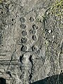
 Granat, spessartyn (mono) - Nani, Loliondo, Arusha Region, Tanzania..jpg 4.472 × 2.981; 1,97 MB
-
 Heading to Ngorongoro.jpg 3.264 × 2.448; 1,68 MB
-
 Hiil, Moita Ward, Monduli District, Arusha Region.jpg 4.032 × 3.024; 5,17 MB
-
 Hill in Mwandeti ward.jpg 3.787 × 2.840; 4,16 MB
-
 Hill in Sokon II.jpg 4.032 × 3.024; 9,53 MB
-
 Hindu Temple, kati ward, Arusha CC.jpg 3.024 × 4.032; 1,72 MB
-
 ICreate10.jpg 6.000 × 4.000; 1,59 MB
-
 ICreate11.jpg 6.000 × 4.000; 1,64 MB
-
 ICreate12.jpg 6.000 × 4.000; 1,72 MB
-
 ICreate13.jpg 6.000 × 4.000; 1,1 MB
-
 ICreate14.jpg 6.000 × 4.000; 1,45 MB
-
 ICreate15.jpg 6.000 × 4.000; 2,01 MB
-
 ICreate16.jpg 6.000 × 4.000; 1,38 MB
-
 ICreate3.jpg 6.000 × 4.000; 1,71 MB
-
 ICreate4.jpg 6.000 × 4.000; 1,55 MB
-
 ICreate5.jpg 6.000 × 4.000; 1,14 MB
-
 ICreate6.jpg 6.000 × 4.000; 1,43 MB
-
 ICreate7.jpg 6.000 × 4.000; 1,04 MB
-
 ICreate8.jpg 6.000 × 4.000; 1,63 MB
-
 ICreate9.jpg 6.000 × 4.000; 1,87 MB
-
 Idara ya Kazi, Kati ward, Arusha City Council.jpg 1.996 × 2.661; 2,25 MB
-
 IMGA10.jpg 4.000 × 6.000; 2,07 MB
-
 IMGA11.jpg 6.000 × 4.000; 2,41 MB
-
 IMGA12.jpg 6.000 × 4.000; 2,5 MB
-
 IMGA13.jpg 4.000 × 6.000; 3,26 MB
-
 IMGA14.jpg 4.000 × 6.000; 3,32 MB
-
 IMGA15.jpg 4.000 × 6.000; 3,05 MB
-
 IMGA16.jpg 4.000 × 6.000; 2,88 MB
-
 IMGA17.jpg 6.000 × 4.000; 2,84 MB
-
 IMGA18.jpg 4.000 × 6.000; 2,6 MB
-
 IMGA19.jpg 4.000 × 6.000; 2,44 MB
-
 IMGA20.jpg 4.000 × 6.000; 2,49 MB
-
 IMGA21.jpg 4.000 × 6.000; 2,54 MB
-
 IMGA22.jpg 6.000 × 4.000; 2 MB
-
 IMGA23.jpg 6.000 × 4.000; 2 MB
-
 IMGA24.jpg 6.000 × 4.000; 2,76 MB
-
 IMGA27.jpg 6.000 × 4.000; 1,66 MB
-
 IMGA28.jpg 6.000 × 4.000; 1,66 MB
-
 IMGA29.jpg 6.000 × 4.000; 2,5 MB
-
 IMGA30.jpg 6.000 × 4.000; 2,5 MB
-
 IMGA32.jpg 6.000 × 4.000; 1,89 MB
-
 IMGA33.jpg 6.000 × 4.000; 1,38 MB
-
 IMGA34.jpg 6.000 × 4.000; 1,38 MB
-
 IMGA41.jpg 6.000 × 4.000; 1.004 KB
-
 IMGA42.jpg 6.000 × 4.000; 905 KB
-
 IMGA43.jpg 6.000 × 4.000; 990 KB
-
 IMGA44.jpg 6.000 × 4.000; 1.009 KB
-
 IMGA45.jpg 6.000 × 4.000; 1,17 MB
-
 IMGA46.jpg 6.000 × 4.000; 1,15 MB
-
 IMGA47.jpg 6.000 × 4.000; 1,32 MB
-
 IMGA48.jpg 6.000 × 4.000; 1,99 MB
-
 IMGA49.jpg 6.000 × 4.000; 1,56 MB
-
 IMGA50.jpg 6.000 × 4.000; 1,37 MB
-
 IMGA51.jpg 6.000 × 4.000; 1,7 MB
-
 IMGA52.jpg 6.000 × 4.000; 1,41 MB
-
 IMGA53.jpg 4.000 × 6.000; 1,22 MB
-
 IMGA54.jpg 6.000 × 4.000; 1,36 MB
-
 IMGA55.jpg 6.000 × 4.000; 1,12 MB
-
 IMGA56.jpg 6.000 × 4.000; 1,5 MB
-
 IMGA57.jpg 6.000 × 4.000; 1,5 MB
-
 IMGA58.jpg 6.000 × 4.000; 1,35 MB
-
 IMGA59.jpg 6.000 × 4.000; 1,34 MB
-
 IMGA60.jpg 6.000 × 4.000; 1,6 MB
-
 Inside Ngorongoro Crater, Ngorongoro District.jpg 3.024 × 3.023; 4,08 MB
-
 Karatu, Tanzania (51489131541).jpg 4.075 × 2.454; 7,43 MB
-
 Karatu, Tanzania (51489839524).jpg 3.872 × 2.581; 7,08 MB
-
 Karatu, Tanzania (51489845319).jpg 3.420 × 2.336; 5,3 MB
-
 Karatu, Tanzania (51490061250).jpg 3.872 × 2.581; 7,91 MB
-
 Karatu, Tanzania (51492456335).jpg 3.872 × 2.581; 11,67 MB
-
 Kerimasi, Monduli District.jpg 4.032 × 3.024; 3,02 MB
-
 Kilima Moto Crater, Olturmet Ward.jpg 4.032 × 3.024; 6,02 MB
-
 Kilimanjaro Mountain - panoramio.jpg 1.000 × 562; 270 KB
-
 Kimandolu Arusha 2012 Tamino.jpg 900 × 600; 314 KB
-
 Kitumbeine covered in clouds, Monduli District.jpg 4.032 × 3.024; 3,21 MB
-
 Kori Bustard (28114935985).jpg 4.316 × 2.879; 11,62 MB
-
 Korongo 0.jpg 6.000 × 4.000; 5,05 MB


_(13962410509).jpg)
_(13962388337).jpg)
_(14125887166).jpg)


_-_Nani,_Loliondo,_Arusha_Region,_Tanzania..jpg)


.jpg)
.jpg)
.jpg)
.jpg)
.jpg)


.jpg)
