Category:Ascott-under-Wychwood
Aller à la navigation
Aller à la recherche
localité britannique du comté anglais d'Oxfordshire  | |||||
| Téléverser des médias | |||||
| Nature de l’élément | |||||
|---|---|---|---|---|---|
| Lieu | West Oxfordshire, Oxfordshire, Angleterre du Sud-Est, Angleterre | ||||
| Baigné par | |||||
| site officiel | |||||
 | |||||
English: Ascott-under-Wychwood is a village and civil parish in the Evenlode valley about south of Chipping Norton.
Sous-catégories
Cette catégorie comprend 2 sous-catégories, dont les 2 ci-dessous.
Média dans la catégorie « Ascott-under-Wychwood »
Cette catégorie comprend 76 fichiers, dont les 76 ci-dessous.
-
 A bit of new fencing - geograph.org.uk - 6103131.jpg 5 116 × 3 538 ; 3,39 Mio
-
 Ascott Barrow in its new home - geograph.org.uk - 4498289.jpg 1 226 × 1 600 ; 594 kio
-
 Ascott under Wychwood - geograph.org.uk - 232793.jpg 640 × 480 ; 46 kio
-
 B4437 Burford to Charlbury road - geograph.org.uk - 4401518.jpg 800 × 450 ; 180 kio
-
 B4437 heading away from Charlbury - geograph.org.uk - 1096636.jpg 640 × 427 ; 36 kio
-
 B4437 near Ascott-under-Wychwood - geograph.org.uk - 43800.jpg 640 × 427 ; 72 kio
-
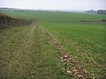
 Beside the Oxfordshire Way - geograph.org.uk - 4498224.jpg 1 600 × 1 131 ; 519 kio
-
 Bridleway to Ascott d'Oyley - geograph.org.uk - 1563029.jpg 640 × 480 ; 84 kio
-
 By the River Evenlode at Ascott-under-Wychwood - geograph.org.uk - 3301134.jpg 2 048 × 1 536 ; 541 kio
-
 Childrens Playground - geograph.org.uk - 1563042.jpg 640 × 480 ; 122 kio
-
 Church View, Ascott under Wychwood - geograph.org.uk - 356335.jpg 640 × 480 ; 102 kio
-

-

-
 Five Shilling Corner - geograph.org.uk - 2736221.jpg 4 320 × 3 240 ; 4,71 Mio
-
 Footpath to Ascott-under-Wychwood - geograph.org.uk - 4401511.jpg 800 × 450 ; 185 kio
-
 Footpath to Ascott-under-Wychwood - geograph.org.uk - 4401560.jpg 800 × 450 ; 170 kio
-
 Going towards Ascott - geograph.org.uk - 4503854.jpg 1 600 × 1 066 ; 316 kio
-
 Harvested field near Ascott d'Oyley - geograph.org.uk - 989692.jpg 426 × 640 ; 126 kio
-
 Harvested field, near Ascott d'Oyley - geograph.org.uk - 989696.jpg 640 × 426 ; 108 kio
-
 Houses in Ascott-under-Wychwood - geograph.org.uk - 990994.jpg 640 × 426 ; 64 kio
-
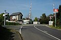
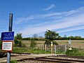 Hyatts user-worked crossing, Cotswold Line, Ascott-under-Wychwood, Oxfordshire.jpg 2 587 × 1 940 ; 1,4 Mio
-
 In Evenlode valley at Ascott-under-Wychwood, 1992 - geograph.org.uk - 4144438.jpg 2 393 × 1 567 ; 3,92 Mio
-
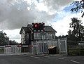
 Level crossing and signal box, Ascott-under-Wychwood - geograph.org.uk - 3642458.jpg 4 320 × 3 240 ; 3,78 Mio
-
 Level crossing at Ascott-under-Wychwood - geograph.org.uk - 3062621.jpg 1 527 × 1 164 ; 394 kio
-
 Level crossing, Ascott-under-Wychwood - geograph.org.uk - 990810.jpg 640 × 426 ; 62 kio
-
 Level crossing, Ascott-under-Wychwood - geograph.org.uk - 990811.jpg 426 × 640 ; 58 kio
-
-

-
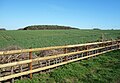
 Not the Castle - geograph.org.uk - 4503807.jpg 4 000 × 2 664 ; 2,72 Mio
-
 Optare Solo WP52 YSJ AscottUnderWychwood.jpg 1 280 × 959 ; 585 kio
-
 Oxfordshire Way - geograph.org.uk - 4787323.jpg 640 × 480 ; 81 kio
-
 Oxfordshire Way at Ascott-under-Wychwood - geograph.org.uk - 3301133.jpg 2 048 × 1 536 ; 883 kio
-
 Pound, Ascott-under-Wychwood - geograph.org.uk - 990817.jpg 640 × 426 ; 98 kio
-
 Private access to Cornbury Park - geograph.org.uk - 4401496.jpg 800 × 450 ; 187 kio
-
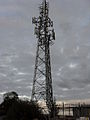 Radio transmitter beside the A361 - geograph.org.uk - 1578668.jpg 480 × 640 ; 54 kio
-
 Restricted byway to Kingstanding Farm - geograph.org.uk - 4401501.jpg 800 × 450 ; 188 kio
-
 River Evenlode at Ascott-under-Wychwood - geograph.org.uk - 3301132.jpg 2 048 × 1 536 ; 531 kio
-
 River Evenlode, Ascott-under-Wychwood - geograph.org.uk - 990997.jpg 640 × 426 ; 83 kio
-
 Road by the village green, Ascott Under Wychwood - geograph.org.uk - 1633598.jpg 640 × 480 ; 107 kio
-
 Road through Ascott Under Wychwood - geograph.org.uk - 1633591.jpg 640 × 480 ; 89 kio
-
 Road to Honeydale Farm - geograph.org.uk - 1578657.jpg 640 × 480 ; 54 kio
-
 Small bridge over the River Evenlode - geograph.org.uk - 2312960.jpg 640 × 480 ; 47 kio
-
 Stone bridge balustrade and the River Evenlode - geograph.org.uk - 3642469.jpg 4 320 × 3 240 ; 5,92 Mio
-
 Swans on the Evenlode - geograph.org.uk - 4498230.jpg 4 000 × 2 664 ; 2,55 Mio
-
 The Cotswold Line, Ascott-under-Wychwood - geograph.org.uk - 991009.jpg 640 × 426 ; 104 kio
-
 The Evenlode Valley from Crown Farm - geograph.org.uk - 6105808.jpg 4 341 × 2 755 ; 1,38 Mio
-
 The Green, Ascott-under-Wychwood - geograph.org.uk - 990276.jpg 640 × 426 ; 80 kio
-
 The Oxfordshire Way, Ascott under Wychwood - geograph.org.uk - 4498238.jpg 1 600 × 1 117 ; 380 kio
-
 The River Evenlode, Ascott-under-Wychwood - geograph.org.uk - 990283.jpg 640 × 426 ; 107 kio
-
 The single Cotswold line - geograph.org.uk - 162695.jpg 640 × 427 ; 97 kio
-
 The Swan, Ascott-under-Wychwood - geograph.org.uk - 990819.jpg 640 × 426 ; 69 kio
-
 Tree lined field edge - geograph.org.uk - 2312990.jpg 480 × 640 ; 73 kio
-
 Unnamed wood in Cornbury Park - geograph.org.uk - 4401504.jpg 800 × 450 ; 180 kio
-

-

-
 View from the Leafield Road, west of Leafield - geograph.org.uk - 1447678.jpg 640 × 480 ; 161 kio
-
 View over the Evenlode valley, 1 - geograph.org.uk - 4401483.jpg 800 × 450 ; 183 kio
-
 View over the Evenlode valley, 2 - geograph.org.uk - 4401489.jpg 800 × 450 ; 200 kio
-
 Village green, Ascott Under Wychwood - geograph.org.uk - 1633595.jpg 640 × 480 ; 113 kio
-
 Village school in Ascott-under-Wychwood - geograph.org.uk - 990279.jpg 640 × 426 ; 69 kio
-
 Wychwood Way - geograph.org.uk - 5683630.jpg 640 × 480 ; 72 kio
-
 Wychwood Way - geograph.org.uk - 5683659.jpg 640 × 480 ; 83 kio
-
 Wychwood Way near Ascott - geograph.org.uk - 6105821.jpg 5 472 × 3 648 ; 4,03 Mio
-
 Bend in the road - geograph.org.uk - 309039.jpg 640 × 480 ; 86 kio
-
 Bridleway to Sarsden - geograph.org.uk - 309045.jpg 640 × 480 ; 118 kio
-
 Coldwell Bridge - geograph.org.uk - 272554.jpg 640 × 480 ; 157 kio
-
 Fallow field - geograph.org.uk - 272578.jpg 640 × 480 ; 138 kio
-
 Folks at the fair - geograph.org.uk - 242935.jpg 640 × 480 ; 99 kio
-
 Grassy fields - geograph.org.uk - 272533.jpg 640 × 480 ; 108 kio
-
 Harvesting of field near Kingstanding Farm - geograph.org.uk - 258460.jpg 640 × 427 ; 118 kio
-
 Looking towards Fernhill Farm and Wychwood Manor - geograph.org.uk - 272539.jpg 640 × 480 ; 111 kio
-
 Path out of Knighton's Copse - geograph.org.uk - 258456.jpg 640 × 427 ; 128 kio
-
 Railway crossing near Ascott - geograph.org.uk - 595981.jpg 640 × 480 ; 217 kio
-
 Sign outside Sarsden Lodge - geograph.org.uk - 267705.jpg 640 × 480 ; 89 kio
-
 The course of Coldwell Brook - geograph.org.uk - 272548.jpg 640 × 480 ; 131 kio
-
 Tiddy Hall - geograph.org.uk - 234465.jpg 640 × 480 ; 63 kio


