Category:Ashford, Surrey
Aller à la navigation
Aller à la recherche
localité britannique  | |||||
| Téléverser des médias | |||||
| Nature de l’élément | |||||
|---|---|---|---|---|---|
| Lieu | Spelthorne, Surrey, Angleterre du Sud-Est, Angleterre | ||||
| Superficie |
| ||||
 | |||||
English: Ashford is a town almost entirely in the Surrey borough of Spelthorne in England, with a small part falling within Greater London. It is a suburban development situated 15 miles (24 km) west south-west of Charing Cross in London and forms part of the London commuter belt. It is often referred to as Ashford, Middlesex to distinguish it from the larger town of Ashford, because it fell within the historic county of Middlesex. Since 1965, when Middlesex County Council was dissolved, it has been administered by Surrey County Council and the small London section by the London Borough of Hounslow.
Norsk bokmål: Ashford er en by i Surrey. Den ligger nær grensen til Stor-London, og tilhører den delen av Middlesex som ble en del av Surrey i 1965. Byen er nevnt i Domesday Book (1086), og ble antagelig grunnlagt i angelsaksisk tid. Det meste av bebyggelsen er fra mellom 1930 og 1960.
Polski: Ashford - miasto w Wielkiej Brytanii, w Anglii, w regionie South East England, w hrabstwie Surrey. W 2001r. miasto to zamieszkiwało 25240 osób.
Svenska: Ashford är en stad i Surrey belägen nära gränsen till Storlondon i Storbritannien. År 2004 hade Ashford omkring 90 000 invånare. Ashford tillhör den delen av Middlesex som blev en del av Surrey år 1965. Staden är nämnd i Domesday Book (1086), och blev antagligen grundlagd under anglosaxisk tid. Den största delen av byggnaderna är från mellan 1930 och 1960.
Sous-catégories
Cette catégorie comprend 5 sous-catégories, dont les 5 ci-dessous.
A
- Ashford Burial Ground (10 F)
- Ashford War Memorial, Surrey (8 F)
B
P
Q
- Queen Mary Reservoir (7 F)
Média dans la catégorie « Ashford, Surrey »
Cette catégorie comprend 159 fichiers, dont les 159 ci-dessous.
-
 A puzzling right turn off eastbound A30 - geograph.org.uk - 5578821.jpg 640 × 480 ; 115 kio
-
 A30 looking west - geograph.org.uk - 5578810.jpg 640 × 480 ; 112 kio
-
 A30, London Road - geograph.org.uk - 3013468.jpg 2 048 × 1 536 ; 1,95 Mio
-
 A30, The London Road - geograph.org.uk - 4016998.jpg 2 048 × 1 536 ; 949 kio
-
 A308 Fordbridge Park - geograph.org.uk - 4482327.jpg 640 × 480 ; 295 kio
-
 A308, Fordbridge Roundabout - geograph.org.uk - 4482331.jpg 640 × 480 ; 326 kio
-
 A308, Staines Road West - geograph.org.uk - 4482837.jpg 640 × 427 ; 217 kio
-
 Approach Road - geograph.org.uk - 3341133.jpg 640 × 480 ; 102 kio
-
 Approaching the railway bridge, Church Road, Ashford - geograph.org.uk - 3808023.jpg 1 024 × 795 ; 160 kio
-
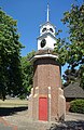
 Ashford (Surrey) town clock.jpg 3 024 × 4 032 ; 4,2 Mio
-
 Ashford - Desford Way - geograph.org.uk - 5327250.jpg 4 608 × 3 456 ; 5,59 Mio
-
 Ashford Antiques Centre - geograph.org.uk - 4160076.jpg 4 000 × 3 000 ; 4,03 Mio
-
 Ashford cemetery - geograph.org.uk - 4214223.jpg 2 048 × 1 536 ; 2,63 Mio
-
 Ashford Community Association - geograph.org.uk - 6058117.jpg 1 024 × 684 ; 220 kio
-
 Ashford Hospital on London Road - geograph.org.uk - 6295017.jpg 1 898 × 1 246 ; 1 000 kio
-
 Ashford Manor Golf Club - Ashford Middlesex (Surrey) - geograph.org.uk - 4940423.jpg 3 264 × 1 840 ; 2,03 Mio
-
 Ashford Manor Golf Club - Ashford Middlesex (Surrey) - geograph.org.uk - 4940450.jpg 3 264 × 1 840 ; 2,23 Mio
-
 Ashford Manor Golf Club - geograph.org.uk - 4940435.jpg 3 264 × 1 840 ; 2,24 Mio
-
 Ashford Manor Golf Club - geograph.org.uk - 4940443.jpg 3 264 × 1 840 ; 1,98 Mio
-
 Ashford Manor Golf Club - geograph.org.uk - 4940452.jpg 3 264 × 1 840 ; 2,72 Mio
-
 Ashford Middx StationApproach TypeK.jpg 719 × 1 280 ; 493 kio
-
 Ashford Park - geograph.org.uk - 156979.jpg 640 × 480 ; 60 kio
-
 Ashford Park - geograph.org.uk - 160079.jpg 640 × 480 ; 135 kio
-
 Ashford Park - geograph.org.uk - 3071047.jpg 2 048 × 1 536 ; 2,67 Mio
-
 Ashford Recreation Ground - geograph.org.uk - 4738332.jpg 640 × 480 ; 62 kio
-
 Ashford SalvationArmy flag.jpg 853 × 1 280 ; 421 kio
-
 Ashford Shortwood Common.jpg 1 523 × 1 086 ; 919 kio
-
 Ashford, Fordbridge Park - geograph.org.uk - 407231.jpg 640 × 480 ; 127 kio
-
 Ashford, St Matthew - geograph.org.uk - 6368044.jpg 3 456 × 4 608 ; 5,08 Mio
-
 Ashford, Staines Road West - geograph.org.uk - 4482851.jpg 640 × 427 ; 267 kio
-
 Ashford, UK - panoramio (1).jpg 4 000 × 2 248 ; 1,08 Mio
-
 Ashford, UK - panoramio (2).jpg 4 000 × 2 248 ; 1,12 Mio
-
 Ashford, UK - panoramio (3).jpg 4 000 × 2 248 ; 1,44 Mio
-
 Ashford, UK - panoramio (4).jpg 4 000 × 2 248 ; 1,13 Mio
-
 Ashford, UK - panoramio (5).jpg 4 000 × 2 248 ; 908 kio
-
 Ashford, UK - panoramio (6).jpg 4 000 × 2 248 ; 1,72 Mio
-
 Ashford, UK - panoramio (7).jpg 4 000 × 2 248 ; 1,26 Mio
-
 Ashford, UK - panoramio.jpg 2 248 × 4 000 ; 1,22 Mio
-
 Avondale Road - geograph.org.uk - 4738343.jpg 640 × 480 ; 59 kio
-
 Avondale Road, Ashford - geograph.org.uk - 4220426.jpg 2 560 × 1 920 ; 1,96 Mio
-
 Bedfont Lakes Country park from the air - geograph.org.uk - 6374084.jpg 1 024 × 768 ; 507 kio
-
 BP petrol station on Staines Road, Ashford - geograph.org.uk - 3501854.jpg 1 600 × 1 200 ; 528 kio
-
 BP service station on Staines Road West - geograph.org.uk - 4545968.jpg 2 304 × 1 728 ; 659 kio
-
 Chalmers Road East, Ashford - geograph.org.uk - 2286217.jpg 1 600 × 1 200 ; 572 kio
-
 Chapel, Ashford Cemetery - geograph.org.uk - 5576345.jpg 640 × 480 ; 180 kio
-
 Church Road (High Street), Ashford, Surrey.jpg 4 032 × 3 024 ; 5,16 Mio
-
 Church Road at the junction of Fordbridge Road - geograph.org.uk - 4230260.jpg 2 560 × 1 920 ; 1,93 Mio
-
 Church Road, Ashford - geograph.org.uk - 3621115.jpg 2 048 × 1 536 ; 1,5 Mio
-
 Church Road, Ashford - geograph.org.uk - 3621127.jpg 2 048 × 1 536 ; 1,53 Mio
-
 Church Road, Ashford, Surrey.jpg 4 032 × 3 024 ; 3,24 Mio
-
 Clock Tower in the Park - geograph.org.uk - 5468053.jpg 2 461 × 3 788 ; 2,76 Mio
-
 Clockhouse Lane Park - geograph.org.uk - 5468056.jpg 3 888 × 2 592 ; 2,46 Mio
-
 Common by Woodthorpe Road - geograph.org.uk - 4738354.jpg 640 × 480 ; 69 kio
-
 Connaught Avenue, Ashford - geograph.org.uk - 4220044.jpg 2 560 × 1 920 ; 1,89 Mio
-
 Convent Road Ashford - geograph.org.uk - 2286200.jpg 1 600 × 1 200 ; 605 kio
-
 Convent Road Ashford - geograph.org.uk - 2286629.jpg 1 200 × 1 600 ; 481 kio
-
 Cumberland Road, Ashford - geograph.org.uk - 4220417.jpg 2 560 × 1 920 ; 2,02 Mio
-
 Denman Drive - geograph.org.uk - 4738389.jpg 640 × 480 ; 89 kio
-
 Detail of a suburban landscape, Ashford - geograph.org.uk - 3808133.jpg 709 × 1 024 ; 251 kio
-
 Entrance to Bronzefield Prison.jpg 1 780 × 1 035 ; 366 kio
-
 Entrance to St James School for Senior Boys - geograph.org.uk - 4162256.jpg 4 000 × 3 000 ; 4,03 Mio
-
 Fairholme Road, Ashford - geograph.org.uk - 4214205.jpg 2 048 × 1 536 ; 2,3 Mio
-
 False acacia, Tennyson Road - geograph.org.uk - 4214217.jpg 2 048 × 1 536 ; 3,24 Mio
-
 Feltham Road Ashford - geograph.org.uk - 2286210.jpg 1 600 × 1 200 ; 547 kio
-
 Feltham Road Ashford - geograph.org.uk - 2286381.jpg 1 600 × 1 200 ; 554 kio
-
 Fingerpost on Church Road, Ashford (Surrey).jpg 4 032 × 3 024 ; 4,18 Mio
-
 Fishing - geograph.org.uk - 160082.jpg 640 × 480 ; 142 kio
-
 Fishing Lake, Ashford - geograph.org.uk - 3071114.jpg 2 048 × 1 536 ; 3,25 Mio
-
 Fishing Lakes, Ashford Park - geograph.org.uk - 3071090.jpg 1 989 × 1 491 ; 2,33 Mio
-
 Flats by Fordbridge roundabout - geograph.org.uk - 2808431.jpg 640 × 410 ; 84 kio
-
 Footbridge over London Road - geograph.org.uk - 3338430.jpg 640 × 480 ; 55 kio
-
 Footbridge over River Ash - geograph.org.uk - 6058126.jpg 1 024 × 684 ; 360 kio
-
 Footbridge over the A30 Road at Ashford - panoramio.jpg 3 648 × 2 736 ; 3,3 Mio
-
 Footpath, Ashford - geograph.org.uk - 3071036.jpg 1 993 × 1 494 ; 518 kio
-
 Former post office, Ashford - geograph.org.uk - 4376840.jpg 1 275 × 822 ; 263 kio
-
 Gilmore Crescent viewed from Ashford Manor Golf Club - geograph.org.uk - 4940438.jpg 3 264 × 1 840 ; 2,26 Mio
-
 Goffs Road - Ashford Common - geograph.org.uk - 4908949.jpg 3 264 × 1 840 ; 1,46 Mio
-
 Goffs Road - Ashford Common - geograph.org.uk - 4908951.jpg 3 264 × 1 840 ; 2,01 Mio
-
 Gravel pit banking - geograph.org.uk - 3071050.jpg 2 048 × 1 536 ; 2,93 Mio
-
 Green alongside Stanwell Road - geograph.org.uk - 4162259.jpg 4 000 × 3 000 ; 3,99 Mio
-
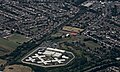 H.M. Prison Bronzefield from the air - geograph.org.uk - 4598191.jpg 640 × 384 ; 148 kio
-
 Hengrove Farm - geograph.org.uk - 3071056.jpg 2 048 × 1 536 ; 2,74 Mio
-
 Hengrove Recreation Ground - geograph.org.uk - 4159772.jpg 4 000 × 3 000 ; 3,97 Mio
-
 Houses along the A30, London Road - geograph.org.uk - 4016994.jpg 2 048 × 1 536 ; 1,14 Mio
-
 Houses in Village Way - geograph.org.uk - 6041179.jpg 640 × 480 ; 87 kio
-
 JR Car Sales of Ashford - geograph.org.uk - 4960307.jpg 2 304 × 1 728 ; 873 kio
-
 Junction of Convent Road and Feltham Road Ashford - geograph.org.uk - 2286203.jpg 1 600 × 1 200 ; 551 kio
-
 Kenilworth Road - geograph.org.uk - 3013471.jpg 2 048 × 1 536 ; 1,96 Mio
-
 Kenilworth Road - geograph.org.uk - 3013475.jpg 2 048 × 1 536 ; 2,81 Mio
-
 Kenilworth Road at the junction with Avondale Road - geograph.org.uk - 4220010.jpg 2 560 × 1 920 ; 1,67 Mio
-
 Kenilworth Road, Ashford - geograph.org.uk - 4220002.jpg 2 560 × 1 920 ; 2 Mio
-
 Landscaping on green alongside Stanwell Road - geograph.org.uk - 4162262.jpg 4 000 × 3 000 ; 4,23 Mio
-
 Lloyds Bank on the Corner - geograph.org.uk - 5389867.jpg 3 396 × 2 348 ; 1,51 Mio
-
 Lodge, Masons - geograph.org.uk - 5389916.jpg 3 325 × 2 166 ; 1,18 Mio
-
 Looking east-northeast in Village Way - geograph.org.uk - 6041180.jpg 640 × 480 ; 69 kio
-
 Looking south-southwest in Village Way - geograph.org.uk - 6041177.jpg 480 × 640 ; 115 kio
-
 Lynegrove Avenue - geograph.org.uk - 3341128.jpg 640 × 480 ; 94 kio
-
 Lynegrove Avenue - geograph.org.uk - 5495505.jpg 640 × 428 ; 107 kio
-
 Manor Road - Ashford Surrey - geograph.org.uk - 4940430.jpg 3 264 × 1 840 ; 2,24 Mio
-
 McDonald's on London Road, Ashford - geograph.org.uk - 4960291.jpg 2 304 × 1 728 ; 868 kio
-
 McDonald's on London Road, Ashford - geograph.org.uk - 4960299.jpg 2 304 × 1 728 ; 887 kio
-
 New block at Ashford Hospital - geograph.org.uk - 4220680.jpg 2 560 × 1 920 ; 1,94 Mio
-
 New block at Ashford Hospital - geograph.org.uk - 4230203.jpg 2 560 × 1 920 ; 1,9 Mio
-
 New flats, Ashford Hospital - geograph.org.uk - 4214239.jpg 2 048 × 1 536 ; 2,43 Mio
-
 Petrol station on corner of School Road and Kingston Road - geograph.org.uk - 2329358.jpg 1 600 × 1 200 ; 516 kio
-
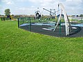
 Play equipment in Hengrove Recreation Ground - geograph.org.uk - 4159766.jpg 4 000 × 3 000 ; 4,22 Mio
-
 Polar bear at Ashford Antiques Centre - geograph.org.uk - 4159782.jpg 4 000 × 3 000 ; 4,35 Mio
-
 Queens Walk, Ashford - geograph.org.uk - 4220018.jpg 2 560 × 1 920 ; 2,03 Mio
-
 Queens Walk, Ashford - geograph.org.uk - 4220025.jpg 2 560 × 1 920 ; 2,13 Mio
-
 Railway Bridge, Ashford - geograph.org.uk - 3071102.jpg 1 968 × 1 476 ; 2,1 Mio
-
 Railway Lines - geograph.org.uk - 3071106.jpg 2 048 × 1 536 ; 2,91 Mio
-
 Reservoir bank, Queen Mary Reservoir - geograph.org.uk - 3795134.jpg 1 024 × 768 ; 175 kio
-
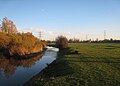
 River Ash in Ashford - geograph.org.uk - 407223.jpg 640 × 480 ; 153 kio
-
 Royal Hart pub sign in Ashford (Surrey).jpg 3 024 × 4 032 ; 2,75 Mio
-
 School Road Junction, Ashford - geograph.org.uk - 4482844.jpg 640 × 427 ; 239 kio
-
 School Road Sunbury - geograph.org.uk - 2329355.jpg 1 600 × 1 200 ; 502 kio
-
 School Road, Ashford - geograph.org.uk - 5495313.jpg 640 × 480 ; 125 kio
-
 Scott Freeman Garden Diana memorial plaque.jpg 4 032 × 3 024 ; 3,46 Mio
-
 Scott Freeman Garden sign, Ashford (Surrey).jpg 4 032 × 3 024 ; 3,78 Mio
-
 Scott Freeman Garden, Ashford (Surrey) 1.jpg 4 032 × 3 024 ; 5,58 Mio
-
 Scott Freeman Garden, Ashford (Surrey) 2.jpg 4 032 × 3 024 ; 7,12 Mio
-
 Shops on Church Road, Ashford - geograph.org.uk - 5468368.jpg 3 479 × 2 305 ; 1,59 Mio
-
 Shops, Church Road, Ashford - geograph.org.uk - 5468073.jpg 3 667 × 2 592 ; 1,63 Mio
-
 Shortwood Common at Dusk.jpg 4 032 × 3 024 ; 4,09 Mio
-
 Shortwood Common at sunset.jpg 4 032 × 3 024 ; 2,64 Mio
-
 Shortwood Common cattle in fog.jpg 4 032 × 3 024 ; 2,09 Mio
-
 Shortwood Common farmhouse in fog.jpg 4 032 × 3 024 ; 2,14 Mio
-
 Shortwood Common lake and fog.jpg 4 032 × 3 024 ; 2,52 Mio
-
 Shortwood Common SSSI and Farmhouse, Ashford, Surrey.jpg 4 032 × 3 024 ; 4,18 Mio
-
 Site of the ancient church of St Michael, Ashford - geograph.org.uk - 4162189.jpg 4 000 × 3 000 ; 4,35 Mio
-
 Site of the ancient church of St Michael, Ashford - geograph.org.uk - 4162308.jpg 4 000 × 3 000 ; 4,05 Mio
-
 Staines bypass approaching Fordbridge roundabout - geograph.org.uk - 2329347.jpg 1 600 × 1 200 ; 589 kio
-
 Staines Road from the junction of Ashford Road, Ashford - geograph.org.uk - 3501862.jpg 1 600 × 1 200 ; 500 kio
-
 Staines Road West, Ashford - geograph.org.uk - 4482856.jpg 640 × 427 ; 250 kio
-
 Stanwell Road at the junction of Station Crescent - geograph.org.uk - 4220064.jpg 2 560 × 1 920 ; 2,01 Mio
-
 Stanwell Road at the junction of the A30 - geograph.org.uk - 3620602.jpg 2 048 × 1 536 ; 1,38 Mio
-
 Stanwell Road at the junction with Gordon Road - geograph.org.uk - 4230248.jpg 2 560 × 1 920 ; 1,98 Mio
-
 Stanwell Road, Ashford - geograph.org.uk - 3621394.jpg 2 048 × 1 536 ; 1,01 Mio
-
 Stanwell Road, Ashford - geograph.org.uk - 4214207.jpg 2 048 × 1 536 ; 2,56 Mio
-
 Stanwell Road, Ashford - geograph.org.uk - 4220057.jpg 2 560 × 1 920 ; 2,03 Mio
-
 Station Crescent, Ashford - geograph.org.uk - 4220492.jpg 2 560 × 1 920 ; 2 Mio
-
 Station Crescent, Ashford - geograph.org.uk - 4220502.jpg 2 560 × 1 920 ; 1,98 Mio
-
 The A30, London Road - geograph.org.uk - 4214232.jpg 2 048 × 1 536 ; 3,07 Mio
-
 The Bulldog - geograph.org.uk - 5578808.jpg 640 × 480 ; 112 kio
-
 The Kings Head - geograph.org.uk - 5468064.jpg 3 586 × 2 206 ; 1,22 Mio
-
 The Oaks, Feltham Road - geograph.org.uk - 5495496.jpg 640 × 428 ; 100 kio
-
 The Rowland Hill Almshouses, Feltham Hill Road - geograph.org.uk - 3869393.jpg 740 × 1 024 ; 152 kio
-
 Towards Ashford Station - geograph.org.uk - 160087.jpg 640 × 480 ; 116 kio
-
 Train kept a-rollin' - geograph.org.uk - 3071118.jpg 1 879 × 1 408 ; 2,4 Mio
-
 Tudor Close, Ashford - geograph.org.uk - 4220460.jpg 2 560 × 1 920 ; 1,98 Mio
-
 V for Victory in Ashford, Surrey.png 861 × 467 ; 971 kio
-
 V for Victory recreated in Ashford, Surrey.jpg 3 024 × 1 857 ; 886 kio
-
 Village Way, Ashford - geograph.org.uk - 4162248.jpg 4 000 × 3 000 ; 4,4 Mio
-
 Welcome to Ashford, Surrey sign.jpg 4 032 × 3 024 ; 6,29 Mio
-
 White Lodge, Ashford (Surrey).jpg 4 032 × 3 024 ; 2,16 Mio
-
 Windsor Drive, Ashford - geograph.org.uk - 4220443.jpg 2 560 × 1 920 ; 2,02 Mio
-
 Woodthorpe Road - geograph.org.uk - 3071041.jpg 1 949 × 1 461 ; 508 kio
-
 Woodthorpe Road - geograph.org.uk - 4738348.jpg 640 × 480 ; 56 kio
-
 Fordbridge Roundabout - geograph.org.uk - 157020.jpg 640 × 480 ; 163 kio


_town_clock.jpg)


_-_geograph.org.uk_-_4940423.jpg)
_-_geograph.org.uk_-_4940450.jpg)


.jpg)
.jpg)
.jpg)
.jpg)
.jpg)
.jpg)
.jpg)


,_Ashford,_Surrey.jpg)


.jpg)


.jpg)


.jpg)
_1.jpg)
_2.jpg)


.jpg)


