Category:Ashley, Northamptonshire
Aller à la navigation
Aller à la recherche
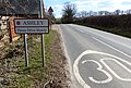
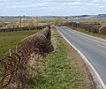
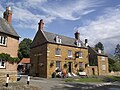
English: Ashley is a village and civil parish in the Kettering district of Northamptonshire, England, about five miles north-east of Market Harborough in Leicestershire. According to the 2001 census it had a population of 217. Alison Wiley, Kettering borough councillor for Welland Ward lives in the village. Every Easter Monday there is a tug of war match against the neighbouring villages of Hallaton and Medbourne. The village is near the River Welland, which forms the Leicestershire border.
village britannique  | |||||
| Téléverser des médias | |||||
| Nature de l’élément | |||||
|---|---|---|---|---|---|
| Lieu | North Northamptonshire, Northamptonshire, Midlands de l'Est, Angleterre | ||||
 | |||||
Sous-catégories
Cette catégorie comprend 2 sous-catégories, dont les 2 ci-dessous.
A
M
Média dans la catégorie « Ashley, Northamptonshire »
Cette catégorie comprend 68 fichiers, dont les 68 ci-dessous.
-
 Along the Main Street of Ashley - geograph.org.uk - 3421591.jpg 3 171 × 2 206 ; 1,56 Mio
-
 Ashley junction - geograph.org.uk - 5552242.jpg 640 × 480 ; 71 kio
-
 Ashley Station - geograph.org.uk - 4134713.jpg 640 × 480 ; 75 kio
-
 Ashley village in the Welland Valley - geograph.org.uk - 3421932.jpg 2 400 × 1 907 ; 1,74 Mio
-
 Bridge on the County Boundary. - geograph.org.uk - 385899.jpg 640 × 480 ; 94 kio
-
 Bridleway across the fields - geograph.org.uk - 3421567.jpg 2 974 × 2 292 ; 1,88 Mio
-
 Crossing the border - geograph.org.uk - 569524.jpg 640 × 395 ; 107 kio
-
 Descending south along Stoke Albany Road - geograph.org.uk - 3421969.jpg 3 611 × 2 610 ; 2,93 Mio
-
 Dismantled Railway Track. - geograph.org.uk - 386499.jpg 640 × 480 ; 136 kio
-
 Disused Railway Line Near Ashley - geograph.org.uk - 2352802.jpg 3 456 × 2 304 ; 3,96 Mio
-
 Entering Leicestershire - geograph.org.uk - 4134720.jpg 640 × 480 ; 53 kio
-
 Farm machinery along Stoke Albany Road - geograph.org.uk - 3421956.jpg 4 000 × 3 000 ; 3,44 Mio
-
 Farmland in the Welland Valley - geograph.org.uk - 3421575.jpg 3 357 × 2 725 ; 2,38 Mio
-
 Fingerpost on Stoke Albany Road - geograph.org.uk - 3411867.jpg 2 426 × 1 917 ; 1,43 Mio
-
 Former rectory, Ashley (geograph 5841266).jpg 1 280 × 1 024 ; 533 kio
-
 Heading east along Middleton Road - geograph.org.uk - 3421549.jpg 3 310 × 2 294 ; 2,26 Mio
-
 House, Main Street, Ashley (geograph 5841263).jpg 1 280 × 850 ; 536 kio
-
 Inquisitive bullocks - geograph.org.uk - 444681.jpg 640 × 477 ; 102 kio
-
 Looking east along Weston Road - geograph.org.uk - 3411790.jpg 1 540 × 1 237 ; 434 kio
-
 Looking north towards Leicestershire - geograph.org.uk - 2238231.jpg 800 × 600 ; 360 kio
-
 Medbourne Road in the village of Ashley - geograph.org.uk - 3411859.jpg 3 756 × 2 526 ; 2,72 Mio
-
 Medbourne Road, Ashley - geograph.org.uk - 6393444.jpg 1 736 × 1 154 ; 1 016 kio
-
 Melbourne Road towards Ashley - geograph.org.uk - 3487488.jpg 640 × 458 ; 69 kio
-
 Melbourne Road, Ashley - geograph.org.uk - 4134710.jpg 640 × 480 ; 85 kio
-

-
 Middleton Road in Ashley - geograph.org.uk - 3421539.jpg 2 372 × 1 769 ; 1,29 Mio
-
 North along Medbourne Road - geograph.org.uk - 3411850.jpg 1 959 × 1 648 ; 1,01 Mio
-
 North along Medbourne Road in Ashley - geograph.org.uk - 3411860.jpg 3 372 × 2 793 ; 2,7 Mio
-
 River Welland - geograph.org.uk - 2352830.jpg 3 456 × 2 304 ; 4,21 Mio
-
 River Welland downstream - geograph.org.uk - 3487490.jpg 640 × 432 ; 34 kio
-
 River Welland upstream - geograph.org.uk - 3487491.jpg 640 × 586 ; 40 kio
-
 Road junction near Ashley - geograph.org.uk - 3411841.jpg 3 572 × 2 562 ; 2,68 Mio
-
 Steep hill along Stoke Albany Road - geograph.org.uk - 3421905.jpg 2 357 × 1 792 ; 1,14 Mio
-
 Stoke Albany Road - geograph.org.uk - 5580862.jpg 480 × 640 ; 58 kio
-
 The B664 crosses the River Welland - geograph.org.uk - 5886341.jpg 4 000 × 3 000 ; 5,27 Mio
-
 The George at Ashley - geograph.org.uk - 5886306.jpg 4 000 × 3 000 ; 5,42 Mio
-
 The George in Ashley - geograph.org.uk - 3421511.jpg 3 737 × 2 946 ; 3,31 Mio
-
 The misty Welland valley - geograph.org.uk - 2238228.jpg 800 × 600 ; 286 kio
-
 The Old Rectory, Ashley - geograph.org.uk - 2354822.jpg 2 592 × 1 944 ; 1,91 Mio
-
 The River Welland - geograph.org.uk - 4134718.jpg 640 × 480 ; 77 kio
-
 The River Welland. - geograph.org.uk - 385910.jpg 640 × 480 ; 85 kio
-
 Towards Ashley - geograph.org.uk - 3487485.jpg 640 × 478 ; 40 kio
-
 Towards Melbourne - geograph.org.uk - 3487492.jpg 640 × 445 ; 27 kio
-
 Tractor in a field - geograph.org.uk - 3421998.jpg 2 980 × 2 442 ; 1,99 Mio
-
 View across the Welland Valley - geograph.org.uk - 3411818.jpg 3 576 × 2 726 ; 3,23 Mio
-
 View towards Ashley Station House - geograph.org.uk - 3411828.jpg 2 606 × 1 785 ; 1,17 Mio
-
 Welland Valley - geograph.org.uk - 3487487.jpg 640 × 468 ; 54 kio
-
 Westhorpe, Ashley (geograph 5841267).jpg 1 280 × 850 ; 503 kio
-
 Barn near Mill House - geograph.org.uk - 444683.jpg 640 × 477 ; 95 kio
-
 Deserted Main Street, Ashley. - geograph.org.uk - 383113.jpg 640 × 480 ; 76 kio
-
 Evidence of ridge and furrow - geograph.org.uk - 444684.jpg 640 × 477 ; 73 kio
-
 Fields between Ashley and Stoke Albany - geograph.org.uk - 307138.jpg 640 × 480 ; 68 kio
-
 Footpath to Ashley. - geograph.org.uk - 382968.jpg 640 × 480 ; 99 kio
-
 Green Lane in Northamptonshire - geograph.org.uk - 569526.jpg 640 × 419 ; 102 kio
-
 Main Street Ashley. - geograph.org.uk - 383091.jpg 640 × 434 ; 106 kio
-
 Meeting of the Ways. - geograph.org.uk - 383036.jpg 640 × 480 ; 117 kio
-
 Pond - geograph.org.uk - 444687.jpg 640 × 477 ; 121 kio
-
 Road Bridge over Small Stream. - geograph.org.uk - 385835.jpg 640 × 480 ; 82 kio
-
 Six paths - geograph.org.uk - 444690.jpg 640 × 477 ; 128 kio
-
 The field with the trig point in it - geograph.org.uk - 444693.jpg 640 × 477 ; 96 kio
-
 The George. - geograph.org.uk - 383102.jpg 640 × 480 ; 102 kio
-
 The Welland Valley - geograph.org.uk - 569544.jpg 640 × 433 ; 102 kio
-
 The Welland Valley - geograph.org.uk - 570178.jpg 640 × 449 ; 115 kio
-
 Triangulation Point. - geograph.org.uk - 383052.jpg 640 × 480 ; 152 kio
-
 View across Country. - geograph.org.uk - 383003.jpg 640 × 480 ; 81 kio
-
 View to Ashley - geograph.org.uk - 307131.jpg 640 × 480 ; 65 kio
-
 View to Ashley. - geograph.org.uk - 382989.jpg 640 × 480 ; 78 kio
-
 View towards Wilbarston. - geograph.org.uk - 383072.jpg 640 × 480 ; 81 kio


.jpg)

.jpg)


.jpg)


