Category:Ashley Green
Aller à la navigation
Aller à la recherche
English: Ashley Green is a village and civil parish in Chiltern district in Buckinghamshire, England. It is on the border with Hertfordshire, half way between Chesham and Berkhamsted.
localité britannique du comté anglais de Buckinghamshire  | |||||
| Téléverser des médias | |||||
| Nature de l’élément | |||||
|---|---|---|---|---|---|
| Lieu | Buckinghamshire, Angleterre du Sud-Est, Angleterre | ||||
 | |||||
Sous-catégories
Cette catégorie comprend 2 sous-catégories, dont les 2 ci-dessous.
H
- Hockeridge Wood (16 F)
Média dans la catégorie « Ashley Green »
Cette catégorie comprend 106 fichiers, dont les 106 ci-dessous.
-
 A416 at Ashley Green village boundary - geograph.org.uk - 4869000.jpg 640 × 480 ; 113 kio
-

-
 A416 leaving Ashley Green - geograph.org.uk - 4869003.jpg 640 × 480 ; 69 kio
-
 Ashley Green - geograph.org.uk - 5457062.jpg 5 202 × 3 465 ; 4,74 Mio
-
 Ashley Green Road - geograph.org.uk - 4674424.jpg 2 304 × 1 728 ; 1,67 Mio
-
 Ashley Green Road at the junction of Hog Lane - geograph.org.uk - 3948602.jpg 2 560 × 1 920 ; 1,97 Mio
-
 Ashley Green Road on the corner of Two Dells Lane - geograph.org.uk - 4654328.jpg 2 266 × 1 676 ; 1,62 Mio
-

-
 Ashley Green, Johns Lane - geograph.org.uk - 1413928.jpg 640 × 480 ; 72 kio
-
 Ashley Green, The Green - geograph.org.uk - 1413993.jpg 640 × 480 ; 68 kio
-
 Barley field near Ashley Green - geograph.org.uk - 186635.jpg 640 × 480 ; 111 kio
-
 Barn on White Hill, Whelpley Hill - geograph.org.uk - 4654433.jpg 2 304 × 1 728 ; 1,64 Mio
-
 Bottom of White Hill Looking North-East - geograph.org.uk - 119688.jpg 480 × 640 ; 112 kio
-
 Bridge over footpath - geograph.org.uk - 1998480.jpg 1 440 × 921 ; 390 kio
-
 Bridleway to Moors Farm - geograph.org.uk - 2259864.jpg 640 × 427 ; 148 kio
-
 Car showroom between Chesham and Berkhamsted - geograph.org.uk - 186626.jpg 640 × 480 ; 82 kio
-
 Charolais cows - geograph.org.uk - 2076001.jpg 2 391 × 1 491 ; 1,04 Mio
-
 Chesham Road, Ashley Green - geograph.org.uk - 4654342.jpg 2 304 × 1 728 ; 1,48 Mio
-
 Chiltern Heritage Trail - geograph.org.uk - 2259870.jpg 640 × 427 ; 203 kio
-
 Chiltern Heritage Trail - geograph.org.uk - 6404602.jpg 800 × 450 ; 140 kio
-
 Chiltern Heritage Trail - geograph.org.uk - 6404605.jpg 800 × 450 ; 110 kio
-
 Chiltern Heritage Trail - geograph.org.uk - 6404610.jpg 800 × 450 ; 112 kio
-
 Chiltern Heritage Trail - geograph.org.uk - 6404614.jpg 800 × 450 ; 155 kio
-
 Chiltern Heritage Trail - geograph.org.uk - 6404619.jpg 800 × 450 ; 132 kio
-
 Chiltern Heritage Trail - geograph.org.uk - 6404623.jpg 800 × 450 ; 128 kio
-
 Chiltern Heritage Trail - geograph.org.uk - 6404629.jpg 800 × 450 ; 139 kio
-
 Clamber cottage garden, Northchurch Lane - geograph.org.uk - 5457073.jpg 5 202 × 3 465 ; 4,31 Mio
-
 Clamber cottage, Northchurch Lane - geograph.org.uk - 5457067.jpg 5 202 × 3 465 ; 4,78 Mio
-
 Coronation Hall, Whelpley Hill - geograph.org.uk - 4654420.jpg 2 200 × 1 580 ; 892 kio
-
 Cottage at Grove Farm - geograph.org.uk - 186952.jpg 640 × 480 ; 113 kio
-
 Descending towards Chesham Vale and White Hawridge Bottom - geograph.org.uk - 3962283.jpg 2 048 × 1 536 ; 477 kio
-
 Electricity sub-station near Chesham - geograph.org.uk - 189771.jpg 640 × 479 ; 137 kio
-
 Farmland, Ashley Green - geograph.org.uk - 2814734.jpg 640 × 480 ; 121 kio
-
 Farmland, Ashley Green - geograph.org.uk - 2814748.jpg 640 × 480 ; 135 kio
-
 Farmland, Ashley Green - geograph.org.uk - 2814752.jpg 640 × 480 ; 167 kio
-
 Fencing Supplies Yard - geograph.org.uk - 1998602.jpg 640 × 480 ; 77 kio
-
 Field and barn, Grove Farm - geograph.org.uk - 4014604.jpg 640 × 480 ; 126 kio
-
 Field at Sale's Farm, Whelpley Hill - geograph.org.uk - 4654031.jpg 2 304 × 1 728 ; 833 kio
-
 Field at Sale's Farm, Whelpley Hill - geograph.org.uk - 4654040.jpg 2 304 × 1 728 ; 806 kio
-
 Footpath along the western edge of Pancake wood - geograph.org.uk - 5457084.jpg 5 202 × 3 465 ; 4,2 Mio
-
 Former KX100 Telephone Kiosk at Whelpley Hill - geograph.org.uk - 5930248.jpg 1 944 × 2 592 ; 955 kio
-
 Former KX300 Telephone Kiosk in Ashley Green - geograph.org.uk - 5387330.jpg 2 592 × 1 944 ; 1,33 Mio
-
 Glasshouses off Hog Lane - geograph.org.uk - 695876.jpg 640 × 499 ; 165 kio
-
 Grazing horse near to Pressmore Farm - geograph.org.uk - 3962282.jpg 2 048 × 1 536 ; 320 kio
-
 Grove Farm East frontage - geograph.org.uk - 2075785.jpg 2 174 × 1 785 ; 2,42 Mio
-
 Grove Farm West frontage - geograph.org.uk - 2075945.jpg 2 939 × 1 813 ; 1,43 Mio
-
 Grove Lane, near Lye Green - geograph.org.uk - 139580.jpg 640 × 480 ; 79 kio
-
 Grove Lane, Orchard Leigh - geograph.org.uk - 4654535.jpg 2 304 × 1 728 ; 838 kio
-
 Grove Lane, Whelpley Hill - geograph.org.uk - 4654046.jpg 2 304 × 1 728 ; 805 kio
-
 Grove Lane, Whelpley Hill - geograph.org.uk - 4654358.jpg 2 304 × 1 728 ; 824 kio
-
 Grove Lane, Whelpley Hill - geograph.org.uk - 4654536.jpg 2 304 × 1 728 ; 964 kio
-
 Harriott's End Farm - geograph.org.uk - 130846.jpg 480 × 640 ; 116 kio
-
 Hertfordshire Border Walk in Hockeridge Bottom.jpg 864 × 1 152 ; 458 kio
-
 Hockeridge Wood - geograph.org.uk - 4014704.jpg 640 × 480 ; 194 kio
-
 Hog Lane ... off Hog Lane - geograph.org.uk - 697506.jpg 640 × 405 ; 182 kio
-
 Hog Lane at the junction of Johns Lane - geograph.org.uk - 3948594.jpg 2 560 × 1 920 ; 1,9 Mio
-
 Hog Lane at the junction of Woodfield Spring Farm - geograph.org.uk - 3948567.jpg 2 560 × 1 920 ; 1,99 Mio
-
 Hog Lane Farm - geograph.org.uk - 137544.jpg 640 × 447 ; 80 kio
-
 Hog Lane Nursery Glasshouses - geograph.org.uk - 695884.jpg 640 × 369 ; 154 kio
-
 Hog Lane, Ashley Green - geograph.org.uk - 3948670.jpg 2 560 × 1 920 ; 1,91 Mio
-
 Hog Lane, Heath End - geograph.org.uk - 3948656.jpg 2 560 × 1 920 ; 2,13 Mio
-
 Horses on White Hill - geograph.org.uk - 4654475.jpg 2 304 × 1 728 ; 837 kio
-
 House opposite Pressmore Farm, near Chesham - geograph.org.uk - 186621.jpg 640 × 480 ; 95 kio
-
 Houses at Moors Farm - geograph.org.uk - 2259851.jpg 640 × 428 ; 177 kio
-
 Johns Lane - geograph.org.uk - 4014658.jpg 640 × 480 ; 121 kio
-
 Lane to Pressmore Farm - geograph.org.uk - 188707.jpg 640 × 480 ; 134 kio
-
 Little Grove from near Grove Farm - geograph.org.uk - 188710.jpg 640 × 276 ; 62 kio
-
 Moat at Grove Farm - geograph.org.uk - 2075976.jpg 2 916 × 2 145 ; 1,47 Mio
-
 New equipment at Moors Farm - geograph.org.uk - 2259860.jpg 640 × 438 ; 264 kio
-
 Northchurch Lane - geograph.org.uk - 4014717.jpg 640 × 480 ; 174 kio
-
 Northchurch Lane - geograph.org.uk - 5457077.jpg 5 202 × 3 465 ; 4,46 Mio
-
 Northchurch Lane approaching Johns Lane - geograph.org.uk - 5457089.jpg 5 202 × 3 465 ; 2,9 Mio
-
 Nursery entrance on Hog Lane - geograph.org.uk - 3948666.jpg 2 560 × 1 920 ; 1,99 Mio
-
 Nursery, Hog Lane - geograph.org.uk - 137539.jpg 640 × 480 ; 47 kio
-
 Passing Hog Lane Farm - geograph.org.uk - 3948660.jpg 2 560 × 1 920 ; 2 Mio
-
 Pasture land near White Hill - geograph.org.uk - 119682.jpg 640 × 480 ; 112 kio
-
 Pasture, Ashley Green - geograph.org.uk - 2814688.jpg 640 × 480 ; 166 kio
-
 Path off Grove Lane, Whelpley Hill - geograph.org.uk - 4654036.jpg 2 304 × 1 728 ; 819 kio
-
 Path off Whelpley Hill - geograph.org.uk - 4674148.jpg 2 304 × 1 728 ; 1,65 Mio
-
 Pond at Moors Farm - geograph.org.uk - 2259856.jpg 640 × 389 ; 208 kio
-
 Probable Iron Age or medieval defended enclosure - geograph.org.uk - 2075263.jpg 828 × 552 ; 114 kio
-
 Public footpath off Grove Lane - geograph.org.uk - 4014615.jpg 640 × 480 ; 169 kio
-
 Road junction, Whelpley Hill - geograph.org.uk - 4014590.jpg 640 × 480 ; 113 kio
-
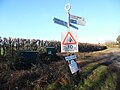
 Signpost at Hog Lane - geograph.org.uk - 5457040.jpg 5 202 × 3 465 ; 3,84 Mio
-
 Signpost near Ashley Green, Bucks - geograph.org.uk - 6103519.jpg 2 592 × 1 944 ; 1,4 Mio
-
 Solitary Oak Tree near Ashley Green, Bucks - geograph.org.uk - 6103526.jpg 2 592 × 1 944 ; 1,37 Mio
-
 Spencers Farm, Whelpley Hill - geograph.org.uk - 4654457.jpg 2 304 × 1 728 ; 827 kio
-
 Spencers Farm, Whelpley Hill - geograph.org.uk - 4674147.jpg 2 304 × 1 728 ; 837 kio
-
 St John’s church, Ashley Green, c1935 - geograph.org.uk - 6166034.jpg 473 × 640 ; 53 kio
-
 The entrance to Greenland Park Stud Farm, Ashley Green - geograph.org.uk - 4654346.jpg 2 304 × 1 728 ; 1,57 Mio
-
 The entrance to Kenmore Farm on White Hill - geograph.org.uk - 4674149.jpg 2 270 × 1 682 ; 1 013 kio
-
 The entrance to Little Acre Farm, Ashley Green - geograph.org.uk - 4674399.jpg 2 132 × 1 474 ; 1,41 Mio
-
 The Green at Ashley Green, Bucks - geograph.org.uk - 28030.jpg 640 × 480 ; 32 kio
-
 The Lazy Pig in the Pantry, Chesham (1) - geograph.org.uk - 6380323.jpg 2 592 × 1 944 ; 1,39 Mio
-
 The Lazy Pig in the Pantry, Chesham (1) - geograph.org.uk - 6380330.jpg 2 592 × 1 944 ; 1,41 Mio
-
 Thorne Barton Hall Gates - geograph.org.uk - 188705.jpg 640 × 480 ; 129 kio
-
 Thorne Barton Hall Lodge - geograph.org.uk - 188704.jpg 640 × 480 ; 118 kio
-
 Timber clad House - geograph.org.uk - 1998636.jpg 1 080 × 810 ; 290 kio
-
 Torrington Farm on Grove Lane - geograph.org.uk - 4654534.jpg 2 304 × 1 728 ; 862 kio
-
 Tunfield Nursery on Hog Lane, Ashley Green - geograph.org.uk - 3948713.jpg 2 560 × 1 920 ; 2,07 Mio
-
 Two Dells Cottage, Ashley Green - geograph.org.uk - 4014643.jpg 640 × 428 ; 93 kio
-
 Two Trees, Harriott's End - geograph.org.uk - 130845.jpg 462 × 640 ; 78 kio
-
 Welcome to Hertfordshire - geograph.org.uk - 4014573.jpg 640 × 480 ; 124 kio
-
 White Hill, Whelpley Hill - geograph.org.uk - 4654480.jpg 2 304 × 1 728 ; 835 kio
-
 Whitethorns Farm - geograph.org.uk - 188697.jpg 640 × 480 ; 117 kio
-
 Ashley Green, Northchurch Lane - geograph.org.uk - 1413134.jpg 640 × 480 ; 106 kio


_-_geograph.org.uk_-_6380323.jpg)
_-_geograph.org.uk_-_6380330.jpg)


