Category:Ashton, North Northamptonshire
Aller à la navigation
Aller à la recherche
English: Ashton is a village and civil parish located in the east of the English county of Northamptonshire forming part of the district of North Northamptonshire.
village britannique  | |||||
| Téléverser des médias | |||||
| Nature de l’élément | |||||
|---|---|---|---|---|---|
| Lieu | North Northamptonshire, Northamptonshire, Midlands de l'Est, Angleterre | ||||
 | |||||
Sous-catégories
Cette catégorie comprend seulement la sous-catégorie ci-dessous.
M
Média dans la catégorie « Ashton, North Northamptonshire »
Cette catégorie comprend 81 fichiers, dont les 81 ci-dessous.
-
 Ashton - geograph.org.uk - 3232211.jpg 640 × 480 ; 90 kio
-
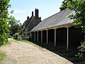 Ashton Village - Elegant Garages - geograph.org.uk - 1334616.jpg 640 × 480 ; 214 kio
-
 Ashton Village - The Triangular Green - geograph.org.uk - 1334621.jpg 640 × 480 ; 237 kio
-
 Ashton-Oundle Footbridge - geograph.org.uk - 1295577.jpg 640 × 480 ; 73 kio
-
 Boat leaving Cotterstock Lock - geograph.org.uk - 4486293.jpg 4 320 × 3 240 ; 5,5 Mio
-
 Bridleway South - geograph.org.uk - 1334628.jpg 480 × 640 ; 202 kio
-
 Bridleway through Warmington Spinney Plantation - geograph.org.uk - 4953217.jpg 800 × 547 ; 162 kio
-
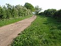
 Byway heading towards Ashton - geograph.org.uk - 1339370.jpg 640 × 480 ; 97 kio
-
 Byway Near Ashton - geograph.org.uk - 802425.jpg 640 × 480 ; 101 kio
-
 Cattle by the Nene - geograph.org.uk - 1339800.jpg 640 × 480 ; 121 kio
-
 Chapel and Schoolhouse, Ashton, E Northants.jpg 1 920 × 1 200 ; 685 kio
-
 Chequered Skipper, Ashton, E Northants.jpg 1 920 × 1 200 ; 506 kio
-
 Closed bridleway in Bluestone Covert - geograph.org.uk - 4953227.jpg 800 × 600 ; 201 kio
-
 Combine in a cloud of dust near Oundle - geograph.org.uk - 4613657.jpg 4 234 × 3 122 ; 3,77 Mio
-
 Commemorative Stone at Chapel, Ashton, E Northants.jpg 1 920 × 1 200 ; 672 kio
-
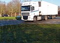
 Continental Haulier entering the Oundle bypass - geograph.org.uk - 4296805.jpg 1 600 × 1 022 ; 392 kio
-
 Cottage at Ashton, Northants, E Northants.jpg 1 920 × 1 200 ; 717 kio
-
 Cottage in Elmington, Oundle - geograph.org.uk - 4613689.jpg 4 320 × 3 240 ; 5,92 Mio
-
 Cotterstock no.2 weir - geograph.org.uk - 2682485.jpg 3 648 × 2 736 ; 2,21 Mio
-
 Countryside near Ashton, Oundle - geograph.org.uk - 4396651.jpg 4 608 × 3 456 ; 5,78 Mio
-
 Cut Mark, Oundle, Riverside Hotel - geograph.org.uk - 5806042.jpg 960 × 1 280 ; 532 kio
-
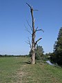 Deceased tree beside the Nene - geograph.org.uk - 1339425.jpg 480 × 640 ; 55 kio
-
 Disused water tower at Ashton Wold Farm - geograph.org.uk - 4953196.jpg 800 × 581 ; 154 kio
-
 Drifting, a motor sport driving technique - geograph.org.uk - 4296785.jpg 1 600 × 1 019 ; 393 kio
-
 Dying Tree - geograph.org.uk - 802371.jpg 480 × 640 ; 80 kio
-
 Elmington Top Lodge near Ashton - geograph.org.uk - 4397133.jpg 4 608 × 3 456 ; 5,57 Mio
-
 Entrance Cottage for sale in Ashton near Oundle - geograph.org.uk - 4396837.jpg 4 608 × 3 456 ; 5,95 Mio
-
 Farmland for sale near Ashton, Northamptonshire - geograph.org.uk - 4396958.jpg 4 608 × 3 456 ; 5,84 Mio
-
 Fast Road To Oundle - geograph.org.uk - 1334609.jpg 640 × 480 ; 182 kio
-
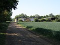
 Fields Near Ashton - geograph.org.uk - 1334624.jpg 640 × 480 ; 184 kio
-
 Flood meadow near Ashton Mill - geograph.org.uk - 4296786.jpg 1 600 × 900 ; 527 kio
-
 Flood Meadows, Ashton - geograph.org.uk - 875140.jpg 640 × 480 ; 88 kio
-
 Flush Bracket OSBM 1884, Oundle Wharf, Riverside Hotel - geograph.org.uk - 5806088.jpg 960 × 1 280 ; 504 kio
-
 Fly tipping in Warmington Spinney Plantation - geograph.org.uk - 4953207.jpg 800 × 600 ; 188 kio
-
 Footbridge just in case - geograph.org.uk - 2682561.jpg 3 648 × 2 736 ; 2,08 Mio
-
 Former Chapel - geograph.org.uk - 835217.jpg 480 × 640 ; 83 kio
-
 GOC Ashton 003 Ashton (36449651033).jpg 2 869 × 2 155 ; 1,5 Mio
-
 GOC Ashton 005 Goats (36449652853).jpg 2 605 × 1 959 ; 1,69 Mio
-
 GOC Ashton 009 Field with path (36449658113).jpg 4 608 × 3 456 ; 5,1 Mio
-
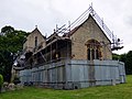 GOC Ashton 081 St Michael's Church, Ashton (23760141498).jpg 4 040 × 3 029 ; 3,93 Mio
-
 GOC Ashton 082 St Michael's Church, Ashton (23760142298).jpg 3 456 × 4 608 ; 5,31 Mio
-
 GOC Ashton 083 St Michael's Church, Ashton (23760143178).jpg 4 608 × 3 456 ; 5,51 Mio
-
 GOC Ashton 084 St Michael's Church, Ashton (23760144048).jpg 4 608 × 3 456 ; 5,68 Mio
-
 GOC Ashton 085 St Michael's Church, Ashton (23760144698).jpg 4 087 × 3 070 ; 4,31 Mio
-
 Grain Stores by the Roman Road - geograph.org.uk - 1339321.jpg 640 × 480 ; 73 kio
-
 Grain Trailers Await - geograph.org.uk - 838323.jpg 640 × 480 ; 123 kio
-
 Ivy's had it ^ - geograph.org.uk - 4296769.jpg 1 024 × 576 ; 218 kio
-
 Jack Richards Road Transport - geograph.org.uk - 4296791.jpg 1 600 × 962 ; 313 kio
-
 Lane To The Rifle Range - geograph.org.uk - 1334630.jpg 640 × 480 ; 253 kio
-
 Luton Road at Ashton Wold - geograph.org.uk - 4953551.jpg 800 × 600 ; 170 kio
-
 Makers plaque on footbridge near Ashton - geograph.org.uk - 1339416.jpg 640 × 480 ; 88 kio
-
 Midas Transport - geograph.org.uk - 4296811.jpg 1 600 × 1 164 ; 541 kio
-
 Mill House, Ashton - geograph.org.uk - 875163.jpg 640 × 480 ; 99 kio
-
 Muddy bridleway at Ashton Wold - geograph.org.uk - 4953225.jpg 800 × 600 ; 198 kio
-
 Nene Valley Transport - geograph.org.uk - 4296822.jpg 1 600 × 1 200 ; 589 kio
-
 Nene views - geograph.org.uk - 2682491.jpg 3 648 × 2 736 ; 2,13 Mio
-
 New access gate at Ashton - geograph.org.uk - 2887740.jpg 640 × 480 ; 99 kio
-
 New planting beside the Nene Valley Way - geograph.org.uk - 2887735.jpg 640 × 480 ; 94 kio
-
 Old Military Building - geograph.org.uk - 838229.jpg 640 × 480 ; 111 kio
-
 Oundle School Rifle Range - geograph.org.uk - 4958077.jpg 800 × 524 ; 83 kio
-
 Outbuilding of the former Riverside Hotel - geograph.org.uk - 5806052.jpg 1 280 × 960 ; 442 kio
-
 Plantation - geograph.org.uk - 835332.jpg 640 × 480 ; 56 kio
-
 Rifle range near Elmington Top Lodge, Ashton - geograph.org.uk - 4397110.jpg 4 608 × 3 456 ; 6,22 Mio
-
 Robsons of Spalding - geograph.org.uk - 4296799.jpg 1 600 × 1 143 ; 374 kio
-
 Stubble field near Cotterstock - geograph.org.uk - 6250232.jpg 1 024 × 768 ; 166 kio
-
 Thatched cottage for sale in Ashton - geograph.org.uk - 4397171.jpg 4 608 × 3 456 ; 6,25 Mio
-
 The Chequered Skipper - geograph.org.uk - 835243.jpg 640 × 480 ; 67 kio
-
 The former Riverside Inn - geograph.org.uk - 4296828.jpg 1 600 × 1 200 ; 660 kio
-
 The Manor House - geograph.org.uk - 4296778.jpg 1 600 × 900 ; 477 kio
-
 The Nene in flood - geograph.org.uk - 3271358.jpg 2 560 × 1 920 ; 1,11 Mio
-
 The Nene Way passing the rifle range - geograph.org.uk - 4958070.jpg 800 × 457 ; 121 kio
-
 The River Nene - geograph.org.uk - 2682466.jpg 3 648 × 2 736 ; 2,17 Mio
-
 The Riverside Inn - geograph.org.uk - 2682548.jpg 3 648 × 2 736 ; 2,21 Mio
-
 The Turn To Ashton - geograph.org.uk - 875153.jpg 640 × 480 ; 98 kio
-
 The village green in Ashton, Northamptonshire - geograph.org.uk - 4397145.jpg 4 608 × 3 456 ; 6,15 Mio
-
 Tree planting near Ashton - geograph.org.uk - 2887755.jpg 640 × 480 ; 87 kio
-
 Village Green, Ashton, East Northamptonshire.jpg 1 920 × 1 200 ; 698 kio
-
 Warmington Spinney Plantation - geograph.org.uk - 4951597.jpg 800 × 600 ; 211 kio
-
 Water Tower - geograph.org.uk - 838223.jpg 480 × 640 ; 140 kio
-
 Ye Olde Oake - geograph.org.uk - 6263552.jpg 5 016 × 3 344 ; 4,99 Mio
-
 Road to Papley at Ashton Wold - geograph.org.uk - 378319.jpg 640 × 480 ; 132 kio


.jpg)
.jpg)
.jpg)
.jpg)
.jpg)
.jpg)
.jpg)
.jpg)


