Category:Askerswell
Vai alla navigazione
Vai alla ricerca
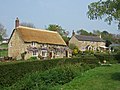
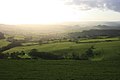
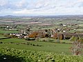
English: Askerswell is a small village and civil parish in the West Dorset district of Dorset, England; near Exeter International Airport.
village and civil parish in Dorset, UK  | |||||
| Carica un file multimediale | |||||
| Istanza di | |||||
|---|---|---|---|---|---|
| Luogo | Dorset, Sud Ovest dell'Inghilterra, Inghilterra | ||||
| Superficie |
| ||||
| Considerato essere uguale a | Askerswell (pagina Wikimedia duplicata, parrocchia civile dell'Inghilterra) | ||||
| sito web ufficiale | |||||
 | |||||
Sottocategorie
Questa categoria contiene le 4 sottocategorie indicate di seguito, su un totale di 4.
File nella categoria "Askerswell"
Questa categoria contiene 132 file, indicati di seguito, su un totale di 132.
-
 A35 approaching Askerswell turning - geograph.org.uk - 3419634.jpg 640 × 403; 49 KB
-

-
 A35 heading west - geograph.org.uk - 6218784.jpg 1 024 × 684; 247 KB
-
 A35 near Askerswell - geograph.org.uk - 5504326.jpg 640 × 427; 57 KB
-
 Cottages at Askerswell - geograph.org.uk - 415887.jpg 640 × 480; 188 KB
-

-

-
 Askerswell - geograph.org.uk - 1125989.jpg 640 × 428; 77 KB
-
 Askerswell - geograph.org.uk - 4486812.jpg 3 888 × 2 592; 3,07 MB
-
 Askerswell Down and Haydon Down - geograph.org.uk - 4777352.jpg 640 × 480; 56 KB
-
 Askerswell from the A35 - geograph.org.uk - 2162178.jpg 640 × 480; 98 KB
-
 Askerswell village - geograph.org.uk - 5504861.jpg 640 × 427; 75 KB
-
 Askerswell village from the Portway - geograph.org.uk - 3803142.jpg 1 536 × 920; 806 KB
-
 Askerswell village from the south - geograph.org.uk - 5504329.jpg 640 × 427; 50 KB
-
 Askerswell, Junction towards the Church - geograph.org.uk - 1816826.jpg 800 × 535; 436 KB
-
 Askerswell, postbox № DT2 131 and phone - geograph.org.uk - 3361444.jpg 640 × 480; 130 KB
-
 Askerwell from the A35 - geograph.org.uk - 2767463.jpg 640 × 430; 34 KB
-
 Askerwell Village - geograph.org.uk - 2767465.jpg 640 × 430; 33 KB
-

-
 Barn at North Eggardon Farm - geograph.org.uk - 2416912.jpg 640 × 480; 88 KB
-
 Below the transmission wires - geograph.org.uk - 2918538.jpg 640 × 430; 32 KB
-
 Bridleway to Eggardon Hill - geograph.org.uk - 5928131.jpg 640 × 427; 63 KB
-
 Competitive trees north-west of Askerswell - geograph.org.uk - 3803190.jpg 1 152 × 1 536; 1,17 MB
-
 Confusing junction at Askerswell - geograph.org.uk - 5614740.jpg 640 × 427; 90 KB
-
 Coombe Bottom - geograph.org.uk - 5504845.jpg 640 × 427; 71 KB
-
 Coombe Bottom - geograph.org.uk - 551651.jpg 640 × 480; 130 KB
-
 Coombe Bottom - geograph.org.uk - 553037.jpg 640 × 480; 141 KB
-
 Copse South of Eggardon Hill - geograph.org.uk - 1427862.jpg 640 × 480; 60 KB
-
 Cottage at Spyway - geograph.org.uk - 2918555.jpg 640 × 430; 72 KB
-
 Countryside near Eggardon farm - geograph.org.uk - 2416924.jpg 640 × 480; 78 KB
-
 Derelict site on Askerswell Down - geograph.org.uk - 435867.jpg 640 × 480; 55 KB
-
 Derelict site on Askerswell Down - geograph.org.uk - 435870.jpg 640 × 480; 64 KB
-
 Derelict site on Askerwell Down - geograph.org.uk - 2767472.jpg 640 × 234; 34 KB
-
 Downland, Askerswell - geograph.org.uk - 553032.jpg 640 × 480; 149 KB
-
 Eggardon Copse - geograph.org.uk - 4151021.jpg 800 × 600; 75 KB
-
 Entrance to Askerswell House - geograph.org.uk - 415881.jpg 640 × 480; 141 KB
-
 Entrance to former business site, by A35 - geograph.org.uk - 6210771.jpg 1 600 × 1 200; 763 KB
-

-
 Farm Track near Nallers Farm - geograph.org.uk - 2087632.jpg 640 × 480; 85 KB
-
 Farmland below Eggardon Hill - geograph.org.uk - 5476320.jpg 3 072 × 2 048; 1,47 MB
-
 Farmland by Spyway Rd - geograph.org.uk - 2923039.jpg 640 × 430; 68 KB
-
 Farmland near Askerswell - geograph.org.uk - 1125961.jpg 640 × 428; 94 KB
-
 Farmland near Askerswell - geograph.org.uk - 1125962.jpg 640 × 426; 65 KB
-
 Farmland, Asker Valley - geograph.org.uk - 2923048.jpg 640 × 430; 55 KB
-
 Farmland, Lodersland Farm - geograph.org.uk - 2918544.jpg 640 × 430; 49 KB
-
 Field by Chaffins Coppice - geograph.org.uk - 5319671.jpg 3 072 × 2 048; 1,42 MB
-
 Fields on Askerswell Down - geograph.org.uk - 2162194.jpg 640 × 480; 82 KB
-
 Fields, Spyway - geograph.org.uk - 1425753.jpg 640 × 480; 92 KB
-
 Follow the lines - geograph.org.uk - 2918535.jpg 640 × 430; 63 KB
-
 Footpath across a field - geograph.org.uk - 2915117.jpg 640 × 430; 54 KB
-
 Footpath by Marsh Copse - geograph.org.uk - 2915099.jpg 640 × 430; 82 KB
-

-
 Footpath near Lodersland Farm - geograph.org.uk - 2918542.jpg 640 × 430; 50 KB
-
 Footpath off Spyway Rd - geograph.org.uk - 2918559.jpg 640 × 430; 63 KB
-
 Footpath to Spyway - geograph.org.uk - 2915084.jpg 640 × 430; 85 KB
-
 Footpath to Spyway - geograph.org.uk - 2915106.jpg 640 × 430; 73 KB
-
 Footpath, bridleway junction - geograph.org.uk - 2918550.jpg 640 × 430; 91 KB
-
 Forge Cottage - geograph.org.uk - 2923051.jpg 640 × 362; 55 KB
-
 Forge Cottage - geograph.org.uk - 2923053.jpg 640 × 411; 61 KB
-
 Garden Chafer, Eggardon Hill Fort - geograph.org.uk - 3617918.jpg 3 072 × 2 304; 1,02 MB
-

-
 Head of the Asker valley - geograph.org.uk - 4078111.jpg 640 × 480; 463 KB
-
 Head of the Asker valley - geograph.org.uk - 4078120.jpg 640 × 480; 491 KB
-
 Hedge by Litton Lane - geograph.org.uk - 2767467.jpg 640 × 393; 40 KB
-
 Hembury Rd, Spyway Rd junction - geograph.org.uk - 2923046.jpg 640 × 430; 57 KB
-
 Isolated tree in farmland - geograph.org.uk - 2918547.jpg 640 × 349; 43 KB
-
 Lane at Brook Knowle - geograph.org.uk - 5476364.jpg 3 059 × 1 891; 2,01 MB
-
 Lay-by by A35, Chilcombe Hill - geograph.org.uk - 6210757.jpg 1 600 × 1 066; 699 KB
-
 Lay-by on A35 on Askerswell Down - geograph.org.uk - 3014044.jpg 800 × 600; 246 KB
-
 Litton Lane and the Asker valley - geograph.org.uk - 6210762.jpg 1 600 × 1 200; 765 KB
-
 Litton Lane, east of Askerswell - geograph.org.uk - 3803154.jpg 1 536 × 1 152; 1,13 MB
-
 Lodersland Farm - geograph.org.uk - 2918537.jpg 640 × 430; 61 KB
-
 Lodersland Farm - geograph.org.uk - 2918568.jpg 640 × 430; 40 KB
-
 Looking south from Eggardon Hill - geograph.org.uk - 4077838.jpg 640 × 480; 426 KB
-
 Looking west from Eggardon Hill - geograph.org.uk - 4077833.jpg 640 × 480; 498 KB
-
 Marsh Copse - geograph.org.uk - 2915102.jpg 640 × 430; 121 KB
-
 Marsh Copse - geograph.org.uk - 2915113.jpg 640 × 430; 143 KB
-
 Medway Farm - geograph.org.uk - 1125960.jpg 640 × 428; 89 KB
-
 Muddy farmland - geograph.org.uk - 2915095.jpg 640 × 430; 58 KB
-
 Naller's Farm - geograph.org.uk - 5614705.jpg 640 × 427; 61 KB
-
 Nallers Farm - geograph.org.uk - 2087629.jpg 640 × 480; 92 KB
-
 Nallers Lane, Askerswell - geograph.org.uk - 3803164.jpg 1 357 × 1 536; 1,69 MB
-
 North Eggardon Farm - geograph.org.uk - 5928158.jpg 640 × 427; 92 KB
-
 On Eggardon Hill - geograph.org.uk - 3632398.jpg 2 560 × 1 920; 1,01 MB
-
 On Eggardon Hill - geograph.org.uk - 3632402.jpg 2 560 × 1 920; 743 KB
-
 Portway - geograph.org.uk - 2767461.jpg 640 × 430; 36 KB
-
 Pylon near Lodersland Farm - geograph.org.uk - 2918532.jpg 640 × 421; 51 KB
-
 Pylon near Spyway - geograph.org.uk - 2918545.jpg 640 × 430; 40 KB
-
 Pylon on Askerswell Down - geograph.org.uk - 1087495.jpg 640 × 480; 71 KB
-
 River Asker - geograph.org.uk - 2923042.jpg 640 × 430; 123 KB
-
 River Asker valley from Eggardon - geograph.org.uk - 1397046.jpg 640 × 427; 41 KB
-
 Road, Skyway - geograph.org.uk - 4473825.jpg 800 × 533; 241 KB
-

-
 Rush hour in Askerswell - geograph.org.uk - 3643090.jpg 640 × 480; 105 KB
-
 School Lane, Askerswell - geograph.org.uk - 6263752.jpg 1 024 × 768; 347 KB
-
 Sheep, South Eggardon Farm - geograph.org.uk - 1425764.jpg 640 × 480; 108 KB
-

-
 South Eggardon Farm - geograph.org.uk - 4232555.jpg 640 × 477; 53 KB
-
 South Eggardon Farm - geograph.org.uk - 581935.jpg 640 × 480; 128 KB
-
 Spyway Rd - geograph.org.uk - 2918551.jpg 640 × 430; 59 KB
-
 Spyway Rd - geograph.org.uk - 2918552.jpg 640 × 430; 84 KB
-
 Spyway Rd - geograph.org.uk - 2918570.jpg 640 × 430; 59 KB
-
 Spyway Rd - geograph.org.uk - 2918572.jpg 640 × 430; 66 KB
-
 Spyway Rd - geograph.org.uk - 2923045.jpg 640 × 430; 58 KB
-
 Spyway Road - geograph.org.uk - 6263771.jpg 1 024 × 768; 273 KB
-
 Spyway Road passing Folly Cottage - geograph.org.uk - 3803197.jpg 1 536 × 1 153; 1,08 MB
-
 Stile off Spyway Rd - geograph.org.uk - 2923055.jpg 640 × 430; 119 KB
-
 The A35 crosses Askerswell Down - geograph.org.uk - 1087489.jpg 640 × 480; 48 KB
-

-
 The River Asker valley - geograph.org.uk - 1397073.jpg 640 × 427; 40 KB
-
 The Swallow Tree, Eggardon Hill, Dorset - geograph.org.uk - 3676044.jpg 997 × 1 024; 176 KB
-
 The Upper Asker Valley - geograph.org.uk - 2813453.jpg 640 × 430; 58 KB
-
 The village of Askerswell - geograph.org.uk - 1587847.jpg 640 × 480; 77 KB
-
 Towards Horse Close Copse - geograph.org.uk - 1425742.jpg 640 × 480; 77 KB
-
 Track to North Eggardon Farm - geograph.org.uk - 5476332.jpg 3 048 × 1 810; 1,28 MB
-
 Two Gates near Askerswell - geograph.org.uk - 5504847.jpg 640 × 427; 62 KB
-
 Valley view above Askerswell - geograph.org.uk - 5722042.jpg 640 × 427; 83 KB
-
 View from Chilcombe Hill, A35 - geograph.org.uk - 2428180.jpg 640 × 480; 85 KB
-
 View from Chilcombe Hill, A35 - geograph.org.uk - 2428190.jpg 640 × 480; 90 KB
-
 View from Eggardon Hill - geograph.org.uk - 3746140.jpg 4 608 × 3 456; 5,16 MB
-

-
 View into the Asker Valley - geograph.org.uk - 2813445.jpg 640 × 430; 56 KB
-
 View looking towards Eggardon Farms - geograph.org.uk - 462548.jpg 640 × 480; 167 KB
-
 View north from Spyway Road - geograph.org.uk - 6263759.jpg 1 024 × 768; 246 KB
-
 View north from the A35 - geograph.org.uk - 2813460.jpg 640 × 430; 51 KB
-
 View north of the A35 - geograph.org.uk - 2767474.jpg 640 × 430; 36 KB
-

-
 West Hembury Farm - geograph.org.uk - 2918563.jpg 640 × 430; 54 KB
-
 Westbound A35 - geograph.org.uk - 6218898.jpg 1 024 × 684; 226 KB
-
 Wet field Askerswell - geograph.org.uk - 4042284.jpg 800 × 600; 135 KB
-
 Wooden gate at South Eggardon Farm - geograph.org.uk - 5504874.jpg 640 × 427; 86 KB
-
 Matravers Farm - geograph.org.uk - 94285.jpg 640 × 480; 195 KB


