Category:Asterby
Aller à la navigation
Aller à la recherche
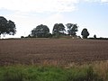
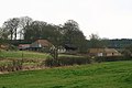
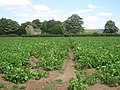
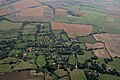
English: Asterby is a tiny hamlet squeezed between Goulceby and Scamblesby, west of Louth, Lincolnshire, England. The civil parish of Asterby had a population of 103 according to the 2001 census.
localité britannique du comté anglais de Lincolnshire  | |||||
| Téléverser des médias | |||||
| Nature de l’élément | |||||
|---|---|---|---|---|---|
| Lieu | East Lindsey, Lincolnshire, Midlands de l'Est, Angleterre | ||||
 | |||||
Sous-catégories
Cette catégorie comprend seulement la sous-catégorie ci-dessous.
S
- St Peter's church, Asterby (11 F)
Média dans la catégorie « Asterby »
Cette catégorie comprend 103 fichiers, dont les 103 ci-dessous.
-
 A hedge-lined Ranyard Lane entering Asterby - geograph.org.uk - 6078734.jpg 4 000 × 3 000 ; 4,02 Mio
-

-

-
 A153 at Scamblesby, aerial 2014 - geograph.org.uk - 3844311.jpg 640 × 427 ; 49 kio
-
 Aargh! My car! - geograph.org.uk - 3904469.jpg 640 × 427 ; 84 kio
-
 Environmental education project (derelict^) - geograph.org.uk - 9413.jpg 640 × 480 ; 61 kio
-
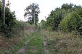
 Asterby footpath - geograph.org.uk - 3577319.jpg 640 × 427 ; 104 kio
-
 Asterby Grange - geograph.org.uk - 3091374.jpg 1 024 × 768 ; 158 kio
-

-
 Asterby Lane - geograph.org.uk - 3675412.jpg 640 × 480 ; 75 kio
-
 Badger Farm Music festival, aerial - geograph.org.uk - 2968433.jpg 640 × 427 ; 59 kio
-
 Boardwalk on the Viking Way - geograph.org.uk - 3091182.jpg 1 024 × 768 ; 351 kio
-
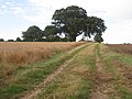
 Bridleway to Asterby Top Farm - geograph.org.uk - 3092721.jpg 1 024 × 768 ; 214 kio
-
 Country road heading south east - geograph.org.uk - 3675432.jpg 640 × 480 ; 84 kio
-
 Country road junction - geograph.org.uk - 3675414.jpg 640 × 480 ; 118 kio
-

-

-

-

-

-
 Entrance to Red Hill Nature Reserve - geograph.org.uk - 3727468.jpg 640 × 427 ; 56 kio
-
 Farm buildings at Asterby - geograph.org.uk - 3904783.jpg 640 × 427 ; 62 kio
-
 Farm buildings at Asterby House - geograph.org.uk - 3088466.jpg 1 024 × 768 ; 178 kio
-
 Farmland near Asterby Grange - geograph.org.uk - 3675443.jpg 640 × 480 ; 77 kio
-
 Farmland near Red Hill Farm - geograph.org.uk - 3675399.jpg 640 × 480 ; 85 kio
-
 Farmland, Asterby - geograph.org.uk - 3675409.jpg 640 × 480 ; 88 kio
-
 Footpath into Goulceby from Ranyard Lane - geograph.org.uk - 3904998.jpg 640 × 427 ; 75 kio
-

-
 Footpath to Asterby - geograph.org.uk - 3091123.jpg 1 024 × 768 ; 235 kio
-
 Ford at Goulceby - geograph.org.uk - 1827105.jpg 3 872 × 2 592 ; 2,42 Mio
-
 Ford At Goulceby - geograph.org.uk - 6109823.jpg 3 662 × 2 744 ; 1,89 Mio
-

-
 Goulceby, aerial 2016 - geograph.org.uk - 5093927.jpg 640 × 427 ; 67 kio
-
 Goulceby, aerial 2018 - geograph.org.uk - 5640508.jpg 800 × 533 ; 52 kio
-
 Goulceby, greyed out by the storm - geograph.org.uk - 3905015.jpg 640 × 427 ; 38 kio
-
 Green Lane Junction - geograph.org.uk - 445935.jpg 640 × 480 ; 102 kio
-

-
 Green Lane, towards Hemingby - geograph.org.uk - 3615336.jpg 640 × 427 ; 48 kio
-
 Harvesting until the last minute near Woldale Farm - geograph.org.uk - 3092716.jpg 1 024 × 768 ; 157 kio
-
 Hemingby Beck - geograph.org.uk - 3091371.jpg 1 024 × 768 ; 197 kio
-
 Imber Hill from Top Lane - geograph.org.uk - 3904518.jpg 640 × 427 ; 46 kio
-

-
 Lake to the east of Goulceby - geograph.org.uk - 3904528.jpg 640 × 427 ; 60 kio
-
 Last of the snow drifts, on Red Hill (1) - geograph.org.uk - 5700548.jpg 1 600 × 1 067 ; 311 kio
-
 Last of the snow, on Red Hill (2) - geograph.org.uk - 5700553.jpg 1 024 × 683 ; 131 kio
-
 Looking down from Red Hill - geograph.org.uk - 3261258.jpg 1 280 × 856 ; 430 kio
-

-
 Manor Farm - geograph.org.uk - 3194587.jpg 640 × 480 ; 75 kio
-
 Minor road towards Asterby - geograph.org.uk - 3675403.jpg 640 × 480 ; 106 kio
-
 Ordnance Survey Rivet - geograph.org.uk - 3015406.jpg 3 264 × 2 448 ; 2,49 Mio
-
 Path to Asterby Top Farm - geograph.org.uk - 3905003.jpg 640 × 427 ; 72 kio
-
 Ploughed field - geograph.org.uk - 3675416.jpg 640 × 480 ; 93 kio
-
-
 Public Bridleway from Asterby End - geograph.org.uk - 3254946.jpg 2 256 × 1 504 ; 1,27 Mio
-
 Red Hill from Asterby - geograph.org.uk - 3904835.jpg 640 × 427 ; 42 kio
-
 Red Hill from Asterby - geograph.org.uk - 3904842.jpg 640 × 427 ; 46 kio
-
 Road Junction near Goulceby - geograph.org.uk - 2989981.jpg 2 256 × 1 504 ; 974 kio
-

-
 Sheep roundup by the Viking Way near Asterby - geograph.org.uk - 5758592.jpg 2 365 × 1 330 ; 864 kio
-
 Shop Lane, Goulceby - geograph.org.uk - 3194574.jpg 640 × 480 ; 106 kio
-
 Silverines Meadows SSSI - geograph.org.uk - 3905021.jpg 640 × 427 ; 74 kio
-
 Small World Festival, August 2010 - geograph.org.uk - 3006872.jpg 640 × 427 ; 59 kio
-
-
 Spring and valley on the south side of Top Lane - geograph.org.uk - 3904546.jpg 640 × 427 ; 115 kio
-
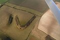
 Stenigot Estate, aerial 2014 - geograph.org.uk - 3844756.jpg 1 024 × 683 ; 123 kio
-
 Stenigot Top Farm, aerial 2014 - geograph.org.uk - 4151384.jpg 800 × 533 ; 91 kio
-
 Stenigot Top Farm, aerial 2014 - geograph.org.uk - 4151386.jpg 800 × 533 ; 84 kio
-
 Stenigot, aerial 2019 (1) - geograph.org.uk - 6289678.jpg 640 × 427 ; 58 kio
-
 Stenigot, aerial 2019 (2) - geograph.org.uk - 6289704.jpg 1 024 × 683 ; 145 kio
-
 Straw bales near Darrol House - geograph.org.uk - 3094310.jpg 1 024 × 768 ; 183 kio
-
 That'll teach you, dog! - geograph.org.uk - 3904480.jpg 640 × 427 ; 85 kio
-
 The beck near Goulceby - geograph.org.uk - 3091176.jpg 1 024 × 768 ; 328 kio
-
 The ears don't match! - geograph.org.uk - 3904787.jpg 640 × 427 ; 52 kio
-
 The foot of Red Hill - geograph.org.uk - 3727496.jpg 640 × 427 ; 46 kio
-
 The ford at Goulceby-Asterby - geograph.org.uk - 3088888.jpg 1 024 × 768 ; 212 kio
-
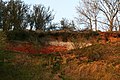 The red in Red Hill - geograph.org.uk - 3727494.jpg 640 × 427 ; 112 kio
-
 The road to Asterby near Red Hill Farm - geograph.org.uk - 5755940.jpg 4 000 × 3 000 ; 3,5 Mio
-
 The view from Red Hill - geograph.org.uk - 3181569.jpg 640 × 480 ; 93 kio
-
 The Viking Way near Asterby (2) - geograph.org.uk - 3091170.jpg 1 024 × 768 ; 275 kio
-
 The Viking Way near Asterby - geograph.org.uk - 3090417.jpg 1 024 × 768 ; 202 kio
-
 The Viking Way near Scamblesby (2) - geograph.org.uk - 3090413.jpg 1 024 × 768 ; 212 kio
-
 The Viking Way near Scamblesby - geograph.org.uk - 3090409.jpg 1 024 × 768 ; 194 kio
-
-
 Track to Asterby Grange - geograph.org.uk - 3088832.jpg 1 024 × 768 ; 214 kio
-
 Track to Asterby Top Farm - geograph.org.uk - 3648169.jpg 2 256 × 1 504 ; 3,25 Mio
-
 Track to Badger Farm - geograph.org.uk - 3261827.jpg 1 280 × 856 ; 233 kio
-
 Turn in the path - geograph.org.uk - 3088461.jpg 1 024 × 768 ; 281 kio
-
 Two stiles and a footbridge - geograph.org.uk - 3091164.jpg 1 024 × 768 ; 285 kio
-
 View down the lane at Red Hill - geograph.org.uk - 2318179.jpg 1 024 × 768 ; 128 kio
-
 View from the Roman road - geograph.org.uk - 3091341.jpg 1 024 × 768 ; 176 kio
-
 View over part of the nature reserve at Red Hill - geograph.org.uk - 2318184.jpg 1 024 × 768 ; 183 kio
-
 View towards Ryelands Plantation - geograph.org.uk - 3094317.jpg 1 024 × 768 ; 156 kio
-
 View towards Scamblesby - geograph.org.uk - 3091128.jpg 1 024 × 768 ; 173 kio
-
 Viking Way crossing the minor road to Asterby - geograph.org.uk - 2619404.jpg 4 000 × 3 000 ; 2,85 Mio
-
 Wet valley to the south of Top Lane - geograph.org.uk - 3904551.jpg 640 × 427 ; 101 kio
-
-
 Wolds Lane - geograph.org.uk - 520334.jpg 640 × 480 ; 122 kio
-
 Asterby Lake - geograph.org.uk - 621734.jpg 640 × 427 ; 91 kio
-
 Asterby view - geograph.org.uk - 621732.jpg 640 × 427 ; 83 kio
-
 Beech trees - geograph.org.uk - 621736.jpg 640 × 427 ; 89 kio
-
 Ranyard's Lane - geograph.org.uk - 520312.jpg 640 × 480 ; 115 kio
-
 Raynard's Lane - geograph.org.uk - 520324.jpg 480 × 640 ; 144 kio
-
 Raynard's Lane - geograph.org.uk - 520328.jpg 480 × 640 ; 176 kio


_-_geograph.org.uk_-_9413.jpg)


_-_geograph.org.uk_-_5700548.jpg)
_-_geograph.org.uk_-_5700553.jpg)


_-_geograph.org.uk_-_6289678.jpg)
_-_geograph.org.uk_-_6289704.jpg)


_-_geograph.org.uk_-_3091170.jpg)

_-_geograph.org.uk_-_3090413.jpg)

_-_geograph.org.uk_-_3844781.jpg)


