Category:Atworth
Aller à la navigation
Aller à la recherche
village britannique  | |||||
| Téléverser des médias | |||||
| Nature de l’élément | |||||
|---|---|---|---|---|---|
| Lieu | Wiltshire, Angleterre du Sud-Ouest, Angleterre | ||||
| Réputé identique à | Atworth (page en doublon, paroisse civile) | ||||
| site officiel | |||||
 | |||||
English: Atworth is a village and civil parish in Wiltshire, England. According to the 2001 census, it had a population of 1,280. The village is about three miles northwest of Melksham and nine miles east from Bath.
Nederlands: Atworth is een dorp (village) en civil parish in de unitary authority Wiltshire, in het Engelse graafschap Wiltshire. De civil parish telt
Sous-catégories
Cette catégorie comprend 4 sous-catégories, dont les 4 ci-dessous.
Média dans la catégorie « Atworth »
Cette catégorie comprend 131 fichiers, dont les 131 ci-dessous.
-
 All Saints church - geograph.org.uk - 6274254.jpg 1 024 × 1 024 ; 283 kio
-
 All Saints Church, Great Chalfield - geograph.org.uk - 6255797.jpg 4 735 × 3 190 ; 2,43 Mio
-
 All Saints church, Great Chalfield - geograph.org.uk - 6274125.jpg 1 024 × 768 ; 253 kio
-
 All Saints church, Great Chalfield - geograph.org.uk - 6274177.jpg 768 × 1 024 ; 229 kio
-
 All Saints church, Great Chalfield - geograph.org.uk - 6274241.jpg 768 × 1 024 ; 140 kio
-

-
 Apple store - geograph.org.uk - 6274183.jpg 1 024 × 768 ; 150 kio
-
 Atworth Post Office - geograph.org.uk - 766930.jpg 640 × 485 ; 71 kio
-
 Atworth Village Hall - geograph.org.uk - 678233.jpg 640 × 440 ; 80 kio
-
 Atworth War Memorial and Independent Church - geograph.org.uk - 112830.jpg 640 × 480 ; 63 kio
-
 Backs of cottages at Purlpit - geograph.org.uk - 877904.jpg 640 × 455 ; 71 kio
-
 Bradford Road, Atworth - geograph.org.uk - 851507.jpg 640 × 505 ; 94 kio
-
 Buckle Hall, Stonar School, Atworth - geograph.org.uk - 256248.jpg 640 × 480 ; 157 kio
-
 Cars parked at Great Chalfield Manor - geograph.org.uk - 5530671.jpg 640 × 480 ; 203 kio
-
 Church Farm, Atworth - geograph.org.uk - 868148.jpg 640 × 421 ; 70 kio
-
 Church of All Saints, Great Chalfield Manor, Wiltshire - geograph.org.uk - 5864035.jpg 1 024 × 735 ; 290 kio
-
 Colourful border, Great Chalfield Manor - geograph.org.uk - 5862450.jpg 1 024 × 683 ; 314 kio
-
 Copse on the brow - geograph.org.uk - 3752109.jpg 800 × 457 ; 207 kio
-
 Cottage at Purlpit - geograph.org.uk - 879110.jpg 640 × 459 ; 103 kio
-
 Cottage on Bradford Road Atworth - geograph.org.uk - 3400579.jpg 4 000 × 3 000 ; 2,08 Mio
-
 Cottage on Church Lane, Atworth - geograph.org.uk - 868196.jpg 640 × 455 ; 88 kio
-
 Course of the Roman Road - geograph.org.uk - 3752105.jpg 800 × 600 ; 217 kio
-

-

-
 East window of chapel at Great Chalfield - geograph.org.uk - 5462486.jpg 1 200 × 1 600 ; 856 kio
-
 External wall clock at Atworth, Wiltshire - geograph.org.uk - 677315.jpg 640 × 433 ; 71 kio
-
 Farmland near Ganbrook - geograph.org.uk - 866987.jpg 640 × 439 ; 81 kio
-
 Farmland south of Broughton Gifford - geograph.org.uk - 6212883.jpg 3 264 × 2 448 ; 1,94 Mio
-
 Field gate - geograph.org.uk - 6275183.jpg 1 024 × 768 ; 217 kio
-
 Firewood processing yard beside Home Farm - geograph.org.uk - 2506248.jpg 3 648 × 2 736 ; 2,53 Mio
-
 Footbridge over the stream - geograph.org.uk - 3546143.jpg 1 920 × 1 280 ; 2,81 Mio
-
 Footbridge over the stream - geograph.org.uk - 3546159.jpg 1 280 × 849 ; 1,45 Mio
-
 Footpath near Whitley - geograph.org.uk - 1879855.jpg 640 × 480 ; 163 kio
-
 Footpath to Home Farm, Great Chalfield - geograph.org.uk - 5462487.jpg 1 600 × 1 200 ; 890 kio
-
-
 Garden by the house, Great Chalfield Manor - geograph.org.uk - 5862451.jpg 1 024 × 683 ; 266 kio
-
 Gazebo at Great Chalfield Manor - geograph.org.uk - 6255741.jpg 3 149 × 4 364 ; 2,65 Mio
-
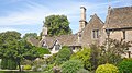
 Great Chalfield Manor (12) (geograph 7349984).jpg 4 285 × 3 214 ; 2,82 Mio
-
 Great Chalfield Manor (14) (geograph 7349990).jpg 4 320 × 3 240 ; 5,13 Mio
-
 Great Chalfield Manor - geograph.org.uk - 4942092.jpg 1 024 × 655 ; 194 kio
-
 Great Chalfield Manor - geograph.org.uk - 5462474.jpg 1 600 × 1 200 ; 903 kio
-
 Great Chalfield Manor - geograph.org.uk - 5462482.jpg 1 600 × 1 200 ; 935 kio
-
 Great Chalfield Manor - geograph.org.uk - 5862445.jpg 1 024 × 683 ; 275 kio
-
 Great Chalfield Manor - geograph.org.uk - 5862453.jpg 1 024 × 683 ; 272 kio
-
 Great Chalfield Manor - geograph.org.uk - 6274084.jpg 1 024 × 768 ; 291 kio
-
 Great Chalfield Manor - geograph.org.uk - 6274090.jpg 1 024 × 768 ; 300 kio
-
 Great Chalfield Manor - geograph.org.uk - 6274093.jpg 1 024 × 768 ; 340 kio
-
 Great Chalfield Manor - geograph.org.uk - 6274168.jpg 1 024 × 768 ; 230 kio
-
 Great Chalfield Manor - geograph.org.uk - 6274256.jpg 1 024 × 768 ; 342 kio
-
 Great Chalfield Manor - geograph.org.uk - 6275159.jpg 1 024 × 768 ; 337 kio
-
 Great Chalfield Manor - geograph.org.uk - 6275164.jpg 1 024 × 768 ; 264 kio
-
 Great Chalfield Manor from the south - geograph.org.uk - 5862442.jpg 1 024 × 683 ; 260 kio
-
 Great Chalfield Manor gardens - geograph.org.uk - 2336545.jpg 2 048 × 1 360 ; 763 kio
-
 Great Chalfield Manor gardens - geograph.org.uk - 2512337.jpg 3 072 × 2 048 ; 2,04 Mio
-
 Great Chalfield Manor, from the east - geograph.org.uk - 5862447.jpg 1 024 × 683 ; 256 kio
-

-
 Green lane going to Home Farm - geograph.org.uk - 5888189.jpg 1 610 × 2 048 ; 1,04 Mio
-
 Haphazard parking outside the Manor House - geograph.org.uk - 6255822.jpg 3 968 × 2 232 ; 1,37 Mio
-
 Herbaceous borders at Great Chalfield Manor - geograph.org.uk - 3636082.jpg 640 × 480 ; 142 kio
-
 Herbaceous borders at Great Chalfield Manor - geograph.org.uk - 3636085.jpg 640 × 480 ; 113 kio
-
 Herbaceous borders at Great Chalfield Manor - geograph.org.uk - 3636089.jpg 480 × 640 ; 106 kio
-
 House and car, north of Great Chalfield - geograph.org.uk - 5530672.jpg 640 × 480 ; 181 kio
-
 Houses and cars in Atworth - geograph.org.uk - 3520822.jpg 640 × 480 ; 140 kio
-
 Hydrangeas at Great Chalfield - geograph.org.uk - 6255710.jpg 3 778 × 2 042 ; 1,73 Mio
-
 Junction by Poor House Cottage - geograph.org.uk - 5645813.jpg 640 × 480 ; 97 kio
-
 Junior department of Stonar School, Atworth - geograph.org.uk - 256244.jpg 640 × 480 ; 60 kio
-

-
 Kingfisher near the moat, Great Chalfield Manor, Wiltshire - geograph.org.uk - 5864039.jpg 1 024 × 1 024 ; 372 kio
-
 Lane heading north east near Poor House Cottage - geograph.org.uk - 3519167.jpg 640 × 480 ; 161 kio
-
 Lane leading to the church (geograph 3520818).jpg 640 × 480 ; 146 kio
-
 Lane north of Great Chalfield - geograph.org.uk - 3400603.jpg 4 000 × 3 000 ; 3,01 Mio
-
 Light and shade, Great Chalfield Manor, Wiltshire - geograph.org.uk - 5864006.jpg 1 024 × 768 ; 555 kio
-
 Looking south near Church Farm, Atworth - geograph.org.uk - 868031.jpg 640 × 464 ; 74 kio
-
 Manor House, Church and a Small Pond - geograph.org.uk - 6255803.jpg 3 968 × 2 232 ; 1,62 Mio
-
 Moat and reedmace, Great Chalfield Manor, Wiltshire - geograph.org.uk - 5863526.jpg 1 024 × 768 ; 476 kio
-
 Old Toll House by the A365, Atworth (geograph 6114904).jpg 640 × 413 ; 115 kio
-
 Ornamental pond, Great Chalfield Manor, Wiltshire - geograph.org.uk - 5864014.jpg 1 024 × 768 ; 472 kio
-
 Part of Great Chalfield Manor - geograph.org.uk - 6255730.jpg 3 968 × 2 232 ; 1,31 Mio
-
-
 Pond in the gardens of Great Chalfield Manor - geograph.org.uk - 6274250.jpg 1 024 × 768 ; 295 kio
-
 Pond in the gardens of Great Chalfield Manor - geograph.org.uk - 6274252.jpg 768 × 1 024 ; 301 kio
-
 Post box SN12 181 (7984855137).jpg 3 000 × 4 000 ; 5,14 Mio
-
 Private doorway, Great Chalfield Manor - geograph.org.uk - 5862449.jpg 1 024 × 683 ; 337 kio
-
 Public right of Way between Great and Little Chalfield - geograph.org.uk - 2510211.jpg 3 648 × 2 736 ; 1,17 Mio
-
 Pump, Atworth - geograph.org.uk - 1879881.jpg 480 × 640 ; 203 kio
-
 Road heading to Atworth - geograph.org.uk - 5645821.jpg 640 × 480 ; 84 kio
-
 Road heading to Atworth - geograph.org.uk - 5645828.jpg 640 × 480 ; 75 kio
-
 Road junction near Ganbrook Farm - geograph.org.uk - 866963.jpg 640 × 440 ; 126 kio
-
 Rose tunnel - geograph.org.uk - 6275175.jpg 1 024 × 768 ; 379 kio
-
-

-

-
 South elevation, Chalfield Manor, Wiltshire - geograph.org.uk - 5864580.jpg 1 024 × 795 ; 330 kio
-
 South to Great Chalfield Manor - geograph.org.uk - 3400625.jpg 4 000 × 3 000 ; 3,36 Mio
-

-
 Stables at Great Chalfield Manor - geograph.org.uk - 5462477.jpg 1 600 × 1 200 ; 758 kio
-
 Stained glass window in All Saints church - geograph.org.uk - 6274154.jpg 768 × 1 024 ; 232 kio
-
 Stile and footpath near Whitley - geograph.org.uk - 1879843.jpg 640 × 480 ; 123 kio
-
 Stonar Independent Girls School - geograph.org.uk - 851591.jpg 640 × 444 ; 77 kio
-
 Stonar School, Atworth, Wiltshire - geograph.org.uk - 256240.jpg 640 × 480 ; 125 kio
-
 Stream and hedgerow at the southern boundary of the field - geograph.org.uk - 3546149.jpg 1 280 × 854 ; 1,62 Mio
-
 Telephone box, Atworth - geograph.org.uk - 1879920.jpg 640 × 480 ; 119 kio
-
 The Gatehouse at Great Chalfield - geograph.org.uk - 6274166.jpg 768 × 1 024 ; 277 kio
-
 The Gazebo at Great Chalfield Manor - geograph.org.uk - 6275173.jpg 1 024 × 768 ; 326 kio
-
 The Lodge, gatehouse for Great Chalfield Manor - geograph.org.uk - 5462492.jpg 1 600 × 1 200 ; 814 kio
-
 The moat at Great Chalfield Manor - geograph.org.uk - 5888200.jpg 2 592 × 1 893 ; 2,1 Mio
-
 The road to Broughton Gifford - geograph.org.uk - 3520793.jpg 640 × 480 ; 108 kio
-
 The turning to Great Chalfield - geograph.org.uk - 2506056.jpg 3 648 × 2 736 ; 1,38 Mio
-
 Topiary in garden of Great Chalfield Manor - geograph.org.uk - 5462479.jpg 1 600 × 1 200 ; 912 kio
-
 Unnamed farmyard near Ganbrook Farm - geograph.org.uk - 851496.jpg 640 × 464 ; 96 kio
-
 Visitors to Great Chalfield Manor - geograph.org.uk - 6274100.jpg 768 × 1 024 ; 288 kio
-
 Visitors to Great Chalfield Manor - geograph.org.uk - 6274108.jpg 768 × 1 024 ; 308 kio
-
 Water lily, ornamental pond, Great Chalfield Manor, Wiltshire - geograph.org.uk - 5864021.jpg 1 024 × 1 024 ; 232 kio
-
 Waterfall, Bradford Leigh - panoramio.jpg 3 456 × 4 608 ; 3,72 Mio
-
 Weather vane, Atworth - geograph.org.uk - 1879924.jpg 481 × 640 ; 73 kio
-
 West Farm, Atworth - geograph.org.uk - 678238.jpg 640 × 498 ; 78 kio
-
 Wheatfield near Ganbrook Farm - geograph.org.uk - 866774.jpg 640 × 456 ; 108 kio
-
 Wrestling on the gate house - geograph.org.uk - 3636111.jpg 640 × 480 ; 127 kio
-
 A365 near Atworth - geograph.org.uk - 112853.jpg 640 × 480 ; 60 kio
-
 Bath Road, Atworth - geograph.org.uk - 677301.jpg 640 × 464 ; 83 kio
-
 Bath Road, Atworth - geograph.org.uk - 678230.jpg 640 × 426 ; 71 kio
-
 Denley Farm - geograph.org.uk - 131550.jpg 640 × 480 ; 59 kio
-
 Denley Farm revealed - geograph.org.uk - 766914.jpg 640 × 499 ; 84 kio
-
 Farm near Purlpit - geograph.org.uk - 678242.jpg 640 × 451 ; 56 kio
-
 Ganbrook Farm - geograph.org.uk - 131557.jpg 640 × 480 ; 116 kio
-
 Ha-ha, grounds of Stonar School, Atworth - geograph.org.uk - 256252.jpg 640 × 480 ; 134 kio
-
 Newhouse Farm - geograph.org.uk - 131559.jpg 640 × 480 ; 95 kio
-
 Poppy Field - geograph.org.uk - 530222.jpg 640 × 393 ; 130 kio
-
 Purlpit Bridge - geograph.org.uk - 112785.jpg 640 × 480 ; 77 kio
-
 The A365 out of Atworth - geograph.org.uk - 678239.jpg 640 × 492 ; 67 kio
-
 The Bear Garage, Atworth - geograph.org.uk - 112823.jpg 640 × 480 ; 80 kio


_(geograph_7349984).jpg)
_(geograph_7349990).jpg)


.jpg)


.jpg)


.jpg)


_-_geograph.org.uk_-_5864598.jpg)
_-_geograph.org.uk_-_5864600.jpg)
_-_geograph.org.uk_-_5864606.jpg)


