Category:Aughton, West Lancashire
Vai alla navigazione
Vai alla ricerca
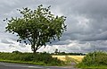
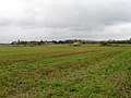
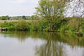
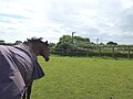
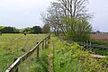
English: Aughton is a village and civil parish within the West Lancashire district of Lancashire, England, situated between Ormskirk in Lancashire and Maghull in Merseyside. It is a residential area with tree lined roads being found in all parts of the parish and with an area of 1,658 hectares. The northern part is known as Aughton village, the south-west as Holt Green and the south-east as Town Green.
Français : Aughton est un village situé dans le West Lancashire, un district du Lancastre, en Angleterre. Selon le recensement de 2001, sa population est de 8432 habitants.
village and civil parish within the West Lancashire district of Lancashire, England  | |||||
| Carica un file multimediale | |||||
| Istanza di | |||||
|---|---|---|---|---|---|
| Luogo | West Lancashire, Lancashire, Nord Ovest dell'Inghilterra, Inghilterra | ||||
| Superficie |
| ||||
 | |||||
Sottocategorie
Questa categoria contiene le 9 sottocategorie indicate di seguito, su un totale di 9.
A
- Aughton Park railway station (8 F)
- Aughton police station (3 F)
C
- Christ Church, Aughton (18 F)
M
- St Mary's Church, Aughton (7 F)
- St Michael's Church, Aughton (24 F)
T
- Town Green railway station (20 F)
W
File nella categoria "Aughton, West Lancashire"
Questa categoria contiene 200 file, indicati di seguito, su un totale di 370.
(pagina precedente) (pagina successiva)-
 "The Barns" on Formby Road - geograph.org.uk - 1161950.jpg 640 × 479; 57 KB
-
 A bend on the B5195 - geograph.org.uk - 3050275.jpg 3 846 × 2 922; 5,74 MB
-
 A clear view - geograph.org.uk - 5470278.jpg 1 600 × 900; 355 KB
-
 A copse near the bend in the path - geograph.org.uk - 3065741.jpg 4 592 × 3 056; 5,67 MB
-
 A copse of trees with a glimpse of the sea beyond - geograph.org.uk - 3051160.jpg 4 448 × 2 961; 5,64 MB
-
 A footbridge over the railway at Doctor's Bridge - geograph.org.uk - 3051291.jpg 3 893 × 2 529; 6,51 MB
-
 A footpath off Cut Lane - geograph.org.uk - 3065721.jpg 4 583 × 3 050; 5,19 MB
-
-

-
 A summers evening in Aughton. - geograph.org.uk - 1531689.jpg 640 × 428; 70 KB
-
 A train passes under Doctor's Bridge - geograph.org.uk - 3051511.jpg 4 592 × 2 868; 5,79 MB
-
 A59 Northway entering West Lancashire - geograph.org.uk - 5425967.jpg 1 600 × 1 200; 804 KB
-
 A59 Northway west of Aughton - geograph.org.uk - 3200229.jpg 640 × 481; 77 KB
-
 Abandoned house, Sandy Lane - geograph.org.uk - 1929510.jpg 3 648 × 2 736; 2,49 MB
-
 Agricultural units at Mickering Farm - geograph.org.uk - 5373304.jpg 1 600 × 1 063; 756 KB
-
 An Ent starts its weary trudge down Fir Tree Lane - geograph.org.uk - 3050587.jpg 4 592 × 3 056; 6,34 MB
-
 Argleton, view from Bold Lane.JPG 3 648 × 2 056; 3,82 MB
-
 Aughton - geograph.org.uk - 5129437.jpg 4 931 × 2 294; 1,83 MB
-
 Aughton - geograph.org.uk - 5129441.jpg 5 184 × 2 496; 1,77 MB
-
 Aughton - geograph.org.uk - 5129442.jpg 5 184 × 3 123; 1,75 MB
-
 Aughton News shop, Long Lane, Aughton - geograph.org.uk - 4741334.jpg 1 024 × 681; 133 KB
-
 Aughton Park Baptist Church, Long Lane, Aughton - geograph.org.uk - 4741336.jpg 1 024 × 681; 140 KB
-
 Aughton Park Railway Station - geograph.org.uk - 4741338.jpg 1 024 × 681; 209 KB
-
 Aughton Park Railway Station - geograph.org.uk - 5902916.jpg 768 × 1 024; 264 KB
-
 Aughton Surgery, Lancashire.jpg 4 320 × 3 240; 3,97 MB
-
 Aughton Village Hall external view.png 800 × 485; 991 KB
-
 Aughton War Memorial - geograph.org.uk - 2454941.jpg 640 × 480; 90 KB
-
 Aughton.jpg 2 272 × 1 243; 621 KB
-
 AughtonVillageHall-Exterior.jpg 1 024 × 710; 257 KB
-
 AughtonVillageHall-OakleafParty.jpg 504 × 360; 103 KB
-
 B5195 Birch's Brow near Ormskirk - geograph.org.uk - 5161051.jpg 800 × 457; 84 KB
-
 Back Lane off the A59 - geograph.org.uk - 3050173.jpg 4 136 × 2 421; 7,88 MB
-
 Back Lane, Aughtom Chase - geograph.org.uk - 5425978.jpg 1 600 × 1 202; 642 KB
-
 Back Lane, Aughton - geograph.org.uk - 5427022.jpg 1 600 × 1 202; 706 KB
-
 Balls Farm - geograph.org.uk - 5402253.jpg 4 998 × 2 600; 1,65 MB
-
 Barn conversion on Butchers Lane - geograph.org.uk - 6138431.jpg 800 × 530; 93 KB
-
 Between Sefton and West Lancashire - geograph.org.uk - 5425983.jpg 1 600 × 1 201; 868 KB
-
 Blacked out postbox - geograph.org.uk - 1028962.jpg 480 × 640; 106 KB
-
 Blundell House Farm - geograph.org.uk - 5129561.jpg 5 184 × 3 456; 1,53 MB
-
 Bold Lane approaches Town Green - geograph.org.uk - 2155043.jpg 1 600 × 1 198; 432 KB
-
 Booth's Lane, Clieve's Hills - geograph.org.uk - 4850639.jpg 1 200 × 900; 595 KB
-
 Bowker's Green Lane - geograph.org.uk - 1575255.jpg 640 × 452; 49 KB
-
 Brookfield Lane, Aughton - geograph.org.uk - 4297341.jpg 1 024 × 681; 163 KB
-
 Brookfield Lane, Holt Green - geograph.org.uk - 1575225.jpg 640 × 480; 88 KB
-

-

-
-
 Butchers Lane - geograph.org.uk - 2454917.jpg 640 × 480; 55 KB
-
 Butchers Lane - geograph.org.uk - 2454929.jpg 640 × 480; 70 KB
-
 Butchers Lane - geograph.org.uk - 4214563.jpg 640 × 480; 49 KB
-
 Butchers Lane - geograph.org.uk - 6138416.jpg 800 × 600; 111 KB
-
 Butchers lane looking west - geograph.org.uk - 2454921.jpg 640 × 480; 54 KB
-
 Butchers Lane railway bridge - geograph.org.uk - 3048093.jpg 4 592 × 3 056; 5,95 MB
-
 Butchers Lane, Aughton.jpg 3 872 × 2 592; 4,16 MB
-
 By Mill Lane looking to West Tower - geograph.org.uk - 5115370.jpg 3 888 × 5 184; 5,88 MB
-
 Changing lanes - geograph.org.uk - 90353.jpg 640 × 426; 114 KB
-
 Church Lane, Aughton - geograph.org.uk - 4499214.jpg 2 000 × 1 327; 687 KB
-
 Clieve's Hill Lancashire 2.jpg 604 × 404; 37 KB
-
 Clieve's Hill Lancashire 3.jpg 604 × 404; 37 KB
-
 Clieve's Hill Lancashire 4.jpg 604 × 404; 47 KB
-
 Clieve's Hill Lancashire 5.jpg 604 × 404; 40 KB
-
 Clieve's Hill Lancashire 6.jpg 604 × 404; 55 KB
-
 Clieve's Hill Lancashire.jpg 604 × 404; 44 KB
-
 Clieve's Hills Lane - geograph.org.uk - 4850702.jpg 1 200 × 900; 666 KB
-
 Clieves Hill Lane - geograph.org.uk - 1028942.jpg 640 × 480; 92 KB
-
 Clieves Hills House - geograph.org.uk - 2089905.jpg 1 200 × 803; 832 KB
-
 Clieves Hills Lane - geograph.org.uk - 6137626.jpg 800 × 600; 101 KB
-

-
 Close up, Elizabeth II postbox on St Michael Road, Aughton - geograph.org.uk - 6139605.jpg 1 535 × 2 652; 1,16 MB
-
 Coal bunkers behind houses on Booth's Lane - geograph.org.uk - 4850393.jpg 1 200 × 900; 580 KB
-
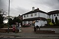
 Cockbeck Tavern, Town Green - geograph.org.uk - 4499179.jpg 2 000 × 1 327; 477 KB
-
 Cockbeck Tavern, Town Green - geograph.org.uk - 4499182.jpg 1 302 × 1 606; 322 KB
-
 Cottages along Cut Lane, Clieves Hill, Aughton - geograph.org.uk - 4552658.jpg 1 024 × 681; 162 KB
-
 Country Lane in Aughton 10.jpg 604 × 404; 58 KB
-
 Country Lane in Aughton 11.jpg 604 × 404; 53 KB
-
 Country Lane in Aughton 12.jpg 604 × 404; 41 KB
-
 Country Lane in Aughton 2.jpg 604 × 404; 54 KB
-
 Country Lane in Aughton 3.jpg 604 × 404; 54 KB
-
 Country Lane in Aughton 4.jpg 604 × 404; 50 KB
-
 Country Lane in Aughton 5.jpg 604 × 404; 58 KB
-
 Country Lane in Aughton 6.jpg 604 × 404; 51 KB
-
 Country Lane in Aughton 7.jpg 604 × 404; 50 KB
-
 Country Lane in Aughton 8.jpg 604 × 404; 64 KB
-
 Country Lane in Aughton 9.jpg 604 × 404; 67 KB
-
 Country Lane in Aughton.jpg 604 × 404; 52 KB
-
-
 Crop field off St Michael Road, Aughton - geograph.org.uk - 6138400.jpg 800 × 600; 110 KB
-
 Crop of Kale on Cut Lane at Clieves Hills - geograph.org.uk - 4310675.jpg 1 024 × 768; 271 KB
-
 Cross on Bold Lane, Aughton - geograph.org.uk - 4499204.jpg 1 327 × 2 000; 517 KB
-
 Cut Lane - geograph.org.uk - 1866081.jpg 3 648 × 2 736; 2,49 MB
-
 Cut Lane Farm - geograph.org.uk - 1028213.jpg 640 × 480; 99 KB
-
 Cut Lane near Cut Lane Farm - geograph.org.uk - 4850378.jpg 1 200 × 900; 542 KB
-
 Devil's Wall Meadow, Aughton - geograph.org.uk - 4850319.jpg 1 200 × 895; 386 KB
-
 Drain off St Michael Road, Aughton - geograph.org.uk - 6138390.jpg 800 × 600; 126 KB
-
 Drainage ditch at Cut Lane - geograph.org.uk - 4850381.jpg 1 200 × 900; 592 KB
-
 Drainage ditch Northwest of Hollin House Green Farm - geograph.org.uk - 5427101.jpg 1 200 × 1 600; 1,1 MB
-
 Elizabeth II postbox on Holborn Hill, Ormskirk - geograph.org.uk - 6139595.jpg 5 184 × 3 888; 4,9 MB
-
 Elizabeth II postbox on Liverpool Road, Ormskirk - geograph.org.uk - 6139619.jpg 2 368 × 3 598; 2,25 MB
-
 Elizabeth II postbox on St Michael Road, Aughton - geograph.org.uk - 6139603.jpg 5 184 × 3 888; 6,6 MB
-
 Entrance to Gorse Hill Nature Reserve - geograph.org.uk - 1161937.jpg 640 × 479; 109 KB
-
 Entrance to nature reserve - geograph.org.uk - 1032125.jpg 640 × 480; 120 KB
-
 Farm track between Gaw Hill and Cut Lane - geograph.org.uk - 4850365.jpg 1 200 × 900; 627 KB
-
 Farmland and drain near Mill House Farm - geograph.org.uk - 6138413.jpg 640 × 480; 104 KB
-
 Farmland at Cut Lane - geograph.org.uk - 4850383.jpg 1 200 × 900; 553 KB
-
 Farmland towards Smithy Lane Farm - geograph.org.uk - 6138394.jpg 800 × 600; 130 KB
-
 Farmland with a hint of Wirral and North Wales beyond - geograph.org.uk - 3051177.jpg 4 475 × 2 978; 4,88 MB
-
 Farmland, Clieves Hills - geograph.org.uk - 6137625.jpg 800 × 600; 153 KB
-
 Field and woodland off Northway - geograph.org.uk - 6138382.jpg 800 × 610; 164 KB
-
 Field at Prescot Road, Aughton.jpg 4 320 × 3 240; 2,8 MB
-
 Field boundary Northwest of Walsh Hall - geograph.org.uk - 5428484.jpg 1 600 × 1 200; 654 KB
-
 Field irrigation point, Back Lane, Aughton - geograph.org.uk - 5427025.jpg 1 600 × 1 200; 1,11 MB
-
 Fields at Aughton - geograph.org.uk - 4548738.jpg 1 024 × 681; 163 KB
-
 Fields at Bowkers Green, Aughton - geograph.org.uk - 4548725.jpg 1 024 × 680; 166 KB
-
 Fields beside Cut Lane, Clieves Hill, Aughton - geograph.org.uk - 4552620.jpg 1 024 × 681; 208 KB
-
 Fields north of Butchers Lane - geograph.org.uk - 4214565.jpg 640 × 480; 60 KB
-
 Fields north of Butchers Lane - geograph.org.uk - 4214578.jpg 640 × 480; 71 KB
-
 Fields Northwest of Gaw Hill, Ormskirk - geograph.org.uk - 4850346.jpg 1 200 × 900; 551 KB
-
 Fields Northwest of Walsh Hall - geograph.org.uk - 5428460.jpg 1 600 × 1 200; 791 KB
-
 Fields South of Clieve's Hills - geograph.org.uk - 4850706.jpg 1 200 × 900; 563 KB
-
 Fields, Butcher's Lane, Aughton - geograph.org.uk - 4297334.jpg 1 024 × 682; 180 KB
-
 Fir Tree Farm - geograph.org.uk - 1161947.jpg 640 × 479; 60 KB
-
 Fir Tree Lane, Clieve's Hill - geograph.org.uk - 4850691.jpg 1 200 × 900; 595 KB
-
 Fir Tree Lane-Formby Lane junction - geograph.org.uk - 2457868.jpg 640 × 480; 45 KB
-
 Firs Farm, Clieves Hills - geograph.org.uk - 2542101.jpg 800 × 534; 200 KB
-
 Firs Farm, Clieves Hills - geograph.org.uk - 2764458.jpg 640 × 480; 99 KB
-
 Fishing Pond East of Brookfield Lane, Aughton - geograph.org.uk - 5373323.jpg 1 600 × 1 063; 922 KB
-
 Fishing Pond East of Brookfield Lane, Aughton - geograph.org.uk - 5373324.jpg 1 600 × 1 063; 754 KB
-
 Footbridge across the Merseyrail Northern Line at Prescot Road, Aughton.jpg 3 240 × 4 320; 3,82 MB
-
 Footbridge of ditch on path East of Green's Lane - geograph.org.uk - 5428489.jpg 1 600 × 1 200; 1,09 MB
-
 Footbridge on path between Green's Lane and Walsh Hall - geograph.org.uk - 5428492.jpg 1 600 × 1 200; 816 KB
-
 Footpath across paddock at Walsh Hall - geograph.org.uk - 5428079.jpg 1 600 × 1 200; 717 KB
-
 Footpath Around Gorse Hill Reservoir - geograph.org.uk - 4360787.jpg 2 560 × 1 920; 2,65 MB
-
 Footpath at Clieve's Hills House - geograph.org.uk - 4850391.jpg 1 200 × 900; 599 KB
-
 Footpath at Gaw Hill - geograph.org.uk - 4849368.jpg 1 200 × 900; 624 KB
-
-
 Footpath between Spring Farm and Gerrard Hall, Aughton - geograph.org.uk - 5373329.jpg 1 600 × 1 063; 693 KB
-

-
 Footpath between Walsh Hall and Green's Lane - geograph.org.uk - 5428463.jpg 1 600 × 1 200; 788 KB
-

-

-
 Footpath from Cut Lane to Gaw Hill - geograph.org.uk - 4850375.jpg 1 200 × 900; 568 KB
-
 Footpath from Gaw Hill to Holly Lane - geograph.org.uk - 4849357.jpg 1 200 × 900; 674 KB
-
 Footpath from Mickering Lane to Brookfield Lane - geograph.org.uk - 5373300.jpg 1 600 × 1 063; 773 KB
-
 Footpath from Mickering Lane to Brookfield Lane, Aughton - geograph.org.uk - 5373308.jpg 1 600 × 1 204; 911 KB
-
 Footpath from Middlewood Road to Mickering Lane, Aughton - geograph.org.uk - 5372458.jpg 1 277 × 1 600; 1,07 MB
-

-
 Footpath leading west from Gaw Hill - geograph.org.uk - 1625633.jpg 640 × 480; 71 KB
-
 Footpath on Gaw Hill - geograph.org.uk - 4849400.jpg 1 200 × 900; 582 KB
-
 Footpath to Gaw Hill - geograph.org.uk - 4850340.jpg 1 200 × 900; 567 KB
-
 Formby Lane (B5195) towards Ormskirk - geograph.org.uk - 6137622.jpg 800 × 600; 77 KB
-
 Formby Lane - geograph.org.uk - 5399895.jpg 5 184 × 2 208; 1,63 MB
-
 Formby Lane junction - geograph.org.uk - 5470269.jpg 1 600 × 900; 313 KB
-
 Formby Lane-Mill Lane junction - geograph.org.uk - 2457875.jpg 640 × 480; 95 KB
-
 From the viewpoint on Clieve's Hill Lane - geograph.org.uk - 4850699.jpg 1 200 × 900; 473 KB
-
 Gatehouse - geograph.org.uk - 98388.jpg 640 × 480; 168 KB
-
 Gaw Hill from Booth's Lane, Aughton - geograph.org.uk - 4552580.jpg 1 024 × 682; 212 KB
-
 Gaw Hill Lane - geograph.org.uk - 6137716.jpg 800 × 600; 98 KB
-
 Gaw Hill Lane, Aughton - geograph.org.uk - 4552542.jpg 1 024 × 681; 224 KB
-
 Gaw Hill Lane-Holly Lane junction - geograph.org.uk - 2457634.jpg 640 × 480; 60 KB
-
 Georgeson's Farm - geograph.org.uk - 5129564.jpg 5 184 × 2 809; 1,66 MB
-
 Gores Hill Nature Reserve - geograph.org.uk - 5700934.jpg 1 600 × 1 200; 412 KB
-
 Gorse Hill Reservoir and phone masts - geograph.org.uk - 1161928.jpg 640 × 479; 54 KB
-
 Granville Park - December 2010 - geograph.org.uk - 2796466.jpg 2 280 × 1 575; 1,03 MB
-
 Granville Park from Winifred Lane - Autumn 2011 - geograph.org.uk - 3788827.jpg 2 848 × 2 136; 3,01 MB
-
 Graveyard at St Michael's church, Aughton - geograph.org.uk - 4548729.jpg 1 024 × 681; 280 KB
-
 Grazing off Nell's Lane - geograph.org.uk - 6138408.jpg 800 × 600; 104 KB
-
 Grazing towards Elm Farm - geograph.org.uk - 6138418.jpg 800 × 600; 118 KB
-
 Greenwood Close - geograph.org.uk - 4214552.jpg 640 × 480; 65 KB
-
 Haven Brow - geograph.org.uk - 4214560.jpg 640 × 480; 98 KB
-
 Hollin House Green Farm - geograph.org.uk - 1161953.jpg 640 × 479; 60 KB
-

-
 Horse in Aughton 2.jpg 604 × 404; 91 KB
-
 Horse in Aughton.jpg 604 × 404; 81 KB
-
 Horse that guided me across his paddock at Walsh Hall - geograph.org.uk - 5428081.jpg 1 600 × 1 200; 944 KB
-
 House at Clieves Hills - geograph.org.uk - 1028937.jpg 640 × 480; 62 KB
-
 House for sale on Butchers Lane - geograph.org.uk - 6138427.jpg 800 × 528; 72 KB
-
 House on Formby Lane (B5195) - geograph.org.uk - 6137621.jpg 800 × 459; 68 KB
-
 Houses in Holly Lane - geograph.org.uk - 1032120.jpg 640 × 480; 75 KB
-
 Houses off Whalley Drive, Town Green. Aughton - geograph.org.uk - 5372443.jpg 1 600 × 1 063; 1 010 KB
-
 Houses on Brockfield Lane, Aughton - geograph.org.uk - 4499191.jpg 2 000 × 1 327; 565 KB
-
 Houses on Clieves Hills Lane - geograph.org.uk - 6137628.jpg 800 × 552; 97 KB
-
 Houses on Liverpool Road, Ormskirk - geograph.org.uk - 6139621.jpg 4 377 × 2 979; 2,36 MB
-
 Houses on Standhouse Lane, Aughton - geograph.org.uk - 6137717.jpg 640 × 480; 104 KB
-
 Junction at Holt Green - geograph.org.uk - 358397.jpg 640 × 482; 90 KB
-

-
 Junction of Fir Tree Lane and Clieve's Hill Lane - geograph.org.uk - 4850697.jpg 1 200 × 900; 602 KB
-

-

-
 Kirby's Cottages, Butchers lane - geograph.org.uk - 4214568.jpg 640 × 480; 72 KB
-
 Laying a new gas pipeline East of Spring Farm, Aughton - geograph.org.uk - 5373333.jpg 1 600 × 1 063; 669 KB
-
 Long Lane - geograph.org.uk - 2457627.jpg 640 × 480; 102 KB
-
 Long Lane - geograph.org.uk - 3051238.jpg 4 592 × 2 568; 6,57 MB
-
 Long Lane - geograph.org.uk - 5399746.jpg 5 183 × 2 620; 1,98 MB
-

-
 Looking south west from West Tower - geograph.org.uk - 3525535.jpg 640 × 502; 57 KB
-
 Memorial, Holt Green, Aughton - geograph.org.uk - 1575213.jpg 480 × 640; 134 KB
-
 Merseyrail Northern Line from Prescot Road, Aughton.jpg 4 320 × 3 240; 5,35 MB
-
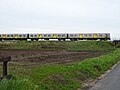 Merseyrail train heading for Liverpool - geograph.org.uk - 6138422.jpg 800 × 600; 103 KB
-
 Merseyrail Train on the Ormskirk line from Maghull to Town Green 2.jpg 3 872 × 2 592; 4,13 MB
-
 Merseyrail Train on the Ormskirk line from Maghull to Town Green.jpg 3 872 × 2 592; 3,22 MB


_towards_Ormskirk_-_geograph.org.uk_-_6137622.jpg)


_-_geograph.org.uk_-_6137621.jpg)


