Category:Axminster
Zur Navigation springen
Zur Suche springen
Kleinstadt im Vereinigten Königreich  | |||||
| Medium hochladen | |||||
| Ist ein(e) | |||||
|---|---|---|---|---|---|
| Ort | East Devon, Devon, Südwestengland, England | ||||
| Einwohnerzahl |
| ||||
| Fläche |
| ||||
| Verschieden von | |||||
| Eventuell gleichwertig | Axminster (Wikimedia-Dublette, Civil Parish in England) | ||||
| offizielle Website | |||||
 | |||||
Unterkategorien
Es werden 10 von insgesamt 10 Unterkategorien in dieser Kategorie angezeigt:
In Klammern die Anzahl der enthaltenen Kategorien (K), Seiten (S), Dateien (D)
A
- Abbey Gate, Devon (1 D)
- Axminster Carpets (8 D)
- Axminster War Memorial (2 D)
B
C
- Countryside around Axminster (64 D)
F
R
- Raymond's Hill (5 D)
S
- Streets in Axminster (16 D)
T
W
Medien in der Kategorie „Axminster“
Folgende 200 Dateien sind in dieser Kategorie, von 663 insgesamt.
(vorherige Seite) (nächste Seite)-

-
 A Couple Of Trees - geograph.org.uk - 2731885.jpg 4.176 × 2.784; 4,61 MB
-

-
 A quiet corner of Axminster - geograph.org.uk - 2365799.jpg 480 × 640; 132 KB
-
 A Wyld hilltop - geograph.org.uk - 4485883.jpg 800 × 533; 131 KB
-
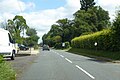
 A35 approaching Abbey Gate - geograph.org.uk - 3039264.jpg 640 × 430; 34 KB
-
 A35 Bridge - geograph.org.uk - 1070033.jpg 640 × 480; 70 KB
-
 A35 bridge over A358, Axminster - geograph.org.uk - 6356387.jpg 1.600 × 1.593; 777 KB
-
 A35 heading east - geograph.org.uk - 6219899.jpg 1.024 × 684; 254 KB
-
 A35 heading east - geograph.org.uk - 6219901.jpg 1.024 × 684; 297 KB
-
 A35 heading east - geograph.org.uk - 6263740.jpg 1.024 × 684; 232 KB
-
 A35 in a cutting - geograph.org.uk - 3039258.jpg 640 × 412; 40 KB
-
 A35 near Raymonds Hill - geograph.org.uk - 6211028.jpg 640 × 445; 45 KB
-
 A35 near Symonds Lane - geograph.org.uk - 3039253.jpg 640 × 413; 36 KB
-
 A35 overbridge from A358 - geograph.org.uk - 3421043.jpg 640 × 340; 53 KB
-
 A35, Raymond's Cross - geograph.org.uk - 3039246.jpg 640 × 430; 56 KB
-
 A35, Raymond's Hill - geograph.org.uk - 6219904.jpg 1.024 × 684; 283 KB
-
 A35, westbound - geograph.org.uk - 3039251.jpg 640 × 400; 50 KB
-
 A35, westbound - geograph.org.uk - 3039262.jpg 640 × 377; 29 KB
-
 A358 approaching Millbrook Cross - geograph.org.uk - 3529771.jpg 640 × 416; 48 KB
-
 A358 approaching Trill junction - geograph.org.uk - 3421036.jpg 640 × 452; 58 KB
-
 A358 at Millbrook Cross - geograph.org.uk - 3529857.jpg 640 × 458; 61 KB
-
 A358 by old mill at Weycroft - geograph.org.uk - 3421129.jpg 640 × 374; 65 KB
-
 A358 passes under the A35 - geograph.org.uk - 6219818.jpg 1.024 × 684; 288 KB
-
 A358 towards Axminster - geograph.org.uk - 6219805.jpg 1.024 × 684; 331 KB
-
 Abbey Close - geograph.org.uk - 6125721.jpg 800 × 534; 260 KB
-
 Abbey Gate Lane - geograph.org.uk - 5854642.jpg 1.024 × 810; 234 KB
-
 Abbey Lane - geograph.org.uk - 4594701.jpg 1.920 × 1.238; 583 KB
-
 Acorn in Axminster - geograph.org.uk - 5306646.jpg 635 × 800; 112 KB
-
 Approaching Coles's Lane - geograph.org.uk - 3762978.jpg 1.920 × 1.284; 605 KB
-
 Approaching Sector Lane - geograph.org.uk - 3760831.jpg 1.920 × 1.440; 730 KB
-
 Arable land near the Yarty - geograph.org.uk - 3257399.jpg 640 × 443; 90 KB
-
 Archway Bookshop blue plaque, Axminster - geograph.org.uk - 5312669.jpg 705 × 800; 213 KB
-
 Arts Café Bar, the Old Courthouse, Church Street - geograph.org.uk - 6119654.jpg 3.000 × 1.688; 4,62 MB
-
 Axe flood plain - geograph.org.uk - 4486143.jpg 800 × 533; 229 KB
-
 Axe flood plain - geograph.org.uk - 4486151.jpg 800 × 533; 211 KB
-
 Axe Music shop in Axminster - geograph.org.uk - 5320567.jpg 800 × 688; 161 KB
-
 Axe valley at Bagley Hill Farm - geograph.org.uk - 5259670.jpg 3.456 × 2.304; 4,36 MB
-
 Axe Valley Close, Raymond's Hill - geograph.org.uk - 3766313.jpg 1.920 × 1.347; 495 KB
-
 Axe Valley Community College, Axminster - geograph.org.uk - 5321993.jpg 800 × 486; 123 KB
-
 Axminster , Car Park - geograph.org.uk - 5066234.jpg 5.761 × 3.841; 5,54 MB
-
 Axminster , Housing Development - geograph.org.uk - 5066249.jpg 6.000 × 4.000; 6,75 MB
-
 Axminster , The United Reformed Church - geograph.org.uk - 5066239.jpg 5.778 × 3.852; 6,11 MB
-

-
 Axminster - old factory-mill - geograph.org.uk - 2913591.jpg 640 × 480; 65 KB
-
 Axminster - the co-operative, Devon June 2011.jpg 2.133 × 1.600; 514 KB
-
 Axminster 177 NPseries.jpg 635 × 508; 218 KB
-
 Axminster cemetery - geograph.org.uk - 1253595.jpg 2.048 × 1.536; 970 KB
-
 Axminster Churchyard - geograph.org.uk - 4723265.jpg 2.592 × 1.944; 1,49 MB
-
 Axminster Community Fire Station - geograph.org.uk - 5306661.jpg 800 × 600; 96 KB
-

-

-
 Axminster Conservative Club, Axminster - geograph.org.uk - 5306488.jpg 793 × 800; 188 KB
-

-
 Axminster Hospital name board, Axminster - geograph.org.uk - 5322006.jpg 800 × 585; 128 KB
-
 Axminster Inn, Axminster - geograph.org.uk - 5312637.jpg 800 × 695; 91 KB
-

-
-
 Axminster Methodist Church - geograph.org.uk - 3680735.jpg 1.536 × 1.152; 1,01 MB
-
 Axminster mural - geograph.org.uk - 5315742.jpg 800 × 628; 171 KB
-
 Axminster Post Office - geograph.org.uk - 5325022.jpg 800 × 783; 191 KB
-
 Axminster Railway Bridge.jpg 5.184 × 3.456; 11,09 MB
-
 Axminster railway station - geograph.org.uk - 3680791.jpg 1.536 × 1.312; 1,06 MB
-

-
 Axminster railway station, Devon - geograph.org.uk - 4597565.jpg 1.600 × 1.200; 419 KB
-
 Axminster Station entrance from A358 - geograph.org.uk - 3421096.jpg 640 × 370; 57 KB
-

-
-
 Axminster station yard and car park - geograph.org.uk - 6334587.jpg 1.024 × 576; 312 KB
-

-
 Axminster town centre - geograph.org.uk - 6210305.jpg 640 × 480; 65 KB
-
 Axminster town crest - geograph.org.uk - 5315748.jpg 610 × 800; 148 KB
-
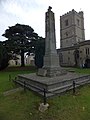 Axminster war memorial - geograph.org.uk - 3680714.jpg 768 × 1.024; 138 KB
-
 Axminster War Memorial - geograph.org.uk - 5306525.jpg 800 × 740; 197 KB
-

-
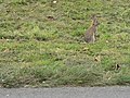 Axminster, bunny on the verge - geograph.org.uk - 982503.jpg 640 × 480; 134 KB
-
 Axminster, Castle Hill - geograph.org.uk - 3423222.jpg 1.200 × 788; 873 KB
-
 Axminster, Castle Hill - geograph.org.uk - 3423227.jpg 1.200 × 792; 876 KB
-
 Axminster, Footpath leading to West Street - geograph.org.uk - 3423270.jpg 1.199 × 814; 1,07 MB
-
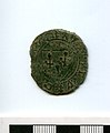 Axminster, French jetton (FindID 88936).jpg 551 × 670; 37 KB
-
 Axminster, French jetton, rev. (FindID 88936).jpg 551 × 670; 37 KB
-
 Axminster, nummus of Maximian I (FindID 88956).jpg 593 × 670; 35 KB
-
 Axminster, nummus of Maximian I, rev. (FindID 88956).jpg 551 × 670; 39 KB
-
 Axminster, Queen Victoria Jubilee Memorial - geograph.org.uk - 3423257.jpg 1.199 × 773; 793 KB
-
 Axminster, Railway Crossing near Castle Hill - geograph.org.uk - 3423218.jpg 1.200 × 776; 898 KB
-
 Axminster, the co-operative Devon June 2011.jpg 2.133 × 1.600; 504 KB
-
 Axminster, The Old Brush Works - geograph.org.uk - 3423298.jpg 1.200 × 801; 962 KB
-
 B3165 at Blackpool Corner - geograph.org.uk - 3764122.jpg 3.621 × 2.747; 2,44 MB
-
 B3165 at Monkton Wyld Cross - geograph.org.uk - 3766100.jpg 1.920 × 1.208; 622 KB
-
 B3165 Crewkerne Road, Raymond's Hill - geograph.org.uk - 6219992.jpg 1.024 × 684; 356 KB
-
 B3165 heading north - geograph.org.uk - 6219914.jpg 1.024 × 684; 343 KB
-
 B3165 near Monkton Wyld Cross - geograph.org.uk - 3766083.jpg 1.700 × 1.194; 534 KB
-
 B3261 - geograph.org.uk - 6210095.jpg 640 × 427; 66 KB
-
 B3261 crosses the River Yarty - geograph.org.uk - 2256580.jpg 640 × 480; 88 KB
-
 B3261 near Fawnsmoor - geograph.org.uk - 6356585.jpg 1.198 × 1.600; 1,02 MB
-
 B3261 on Symonds Down - geograph.org.uk - 6356578.jpg 1.197 × 1.600; 657 KB
-
 Barclays Bank Axminster - geograph.org.uk - 5325018.jpg 800 × 669; 104 KB
-
 Bare farmland near Westwater - geograph.org.uk - 5932194.jpg 1.024 × 768; 180 KB
-
 Barley near Newenham Abbey - geograph.org.uk - 4594694.jpg 1.920 × 2.560; 1,31 MB
-
 Barn at Higher Abbey Farm - geograph.org.uk - 6090884.jpg 800 × 534; 272 KB
-
 Beavor or Beaver^ - geograph.org.uk - 4488752.jpg 640 × 428; 92 KB
-
 Beech Corner - geograph.org.uk - 3764099.jpg 1.920 × 1.440; 765 KB
-
 Benchmark on Lyme Road outside 'Tanners Cottage' - geograph.org.uk - 3187980.jpg 683 × 1.024; 300 KB
-
 Benchmark on NatWest Bank, Victoria Place - geograph.org.uk - 3187843.jpg 683 × 1.024; 189 KB
-
 Benchmark on porch buttress of St Mary's Church - geograph.org.uk - 3185054.jpg 683 × 1.024; 280 KB
-

-
 Benchmark on wall of South Street - geograph.org.uk - 3187291.jpg 683 × 1.024; 294 KB
-
 Benchmark on West House gatepier - geograph.org.uk - 3185721.jpg 683 × 1.024; 267 KB
-
 Benchmark on ^1 Lyme Road - geograph.org.uk - 3188405.jpg 683 × 1.024; 226 KB
-
 Benchmark on ^15 Hillhead Terrace, Musbury Road - geograph.org.uk - 3187134.jpg 683 × 1.024; 232 KB
-
 Benchmark on ^3 Loup Cottages - geograph.org.uk - 3189591.jpg 683 × 1.024; 239 KB
-
 Benchmark on ^7 Penny's Terrace, Musbury Road - geograph.org.uk - 3187188.jpg 1.024 × 683; 237 KB
-

-
 Bever Batch - geograph.org.uk - 3766319.jpg 1.920 × 1.262; 515 KB
-
 Blackpool Corner - geograph.org.uk - 1560549.jpg 640 × 480; 75 KB
-
 Boating Centre by A35 near Raymond's Hill - geograph.org.uk - 5010309.jpg 1.600 × 1.200; 689 KB
-
 Bolts, West Street, Axminster - geograph.org.uk - 5312374.jpg 800 × 800; 164 KB
-
 Bookmaker's shop, West Street, Axminster - geograph.org.uk - 3680777.jpg 1.536 × 1.152; 1,08 MB
-

-
 Brain Fungus just north of Trinity Beacon - geograph.org.uk - 2732603.jpg 4.176 × 2.784; 5,48 MB
-
 Bridge in Sector Park - geograph.org.uk - 4489223.jpg 640 × 428; 114 KB
-
 Bridge to Cloakham - geograph.org.uk - 4489340.jpg 640 × 428; 92 KB
-
 Bridge, River Axe - geograph.org.uk - 4560820.jpg 640 × 426; 69 KB
-
 Builders' merchant, Axminster - geograph.org.uk - 3680792.jpg 1.536 × 1.152; 980 KB
-
 Bullocks, Greatwood Farm - geograph.org.uk - 3494162.jpg 529 × 640; 82 KB
-
 Bus stop on Musbury Road - geograph.org.uk - 3187099.jpg 683 × 1.024; 146 KB
-
 By Hunthay Lane - geograph.org.uk - 4593482.jpg 2.724 × 2.037; 1,66 MB
-
 Car park and public toilets, Axminster - geograph.org.uk - 3680767.jpg 1.536 × 1.152; 1,08 MB
-
 Carpet MET DP299026.jpg 1.985 × 1.860; 3,19 MB
-
 Castle Hill Axminster. - geograph.org.uk - 4489435.jpg 640 × 428; 59 KB
-
 Castle Inn name sign, Axminster - geograph.org.uk - 5306649.jpg 636 × 800; 79 KB
-
 Castle Inn, Castle Hill, Axminster - geograph.org.uk - 5306648.jpg 770 × 800; 113 KB
-
 Cattle Crossing the River Axe - geograph.org.uk - 4489347.jpg 640 × 464; 110 KB
-
 Cattle Crossing the River Axe - geograph.org.uk - 4489358.jpg 640 × 428; 98 KB
-
 Cattle Market blue plaque, Axminster - geograph.org.uk - 5331695.jpg 594 × 800; 131 KB
-
 Cattle pasture, Greatwood Farm - geograph.org.uk - 3494144.jpg 640 × 429; 68 KB
-
 Cattle pasture, Red House Farm - geograph.org.uk - 3763517.jpg 3.702 × 2.310; 1,66 MB
-
 Channel to Channel (103) - geograph.org.uk - 4174818.jpg 1.024 × 768; 212 KB
-
 Channel to Channel (104) - geograph.org.uk - 4174825.jpg 800 × 600; 245 KB
-
 Channel to Channel (106) - geograph.org.uk - 4174839.jpg 800 × 600; 213 KB
-
 Channel to Channel (107) - geograph.org.uk - 4174904.jpg 800 × 600; 179 KB
-
 Channel to Channel (108) - geograph.org.uk - 4174911.jpg 800 × 600; 153 KB
-
 Channel to Channel (109) - geograph.org.uk - 4174926.jpg 800 × 600; 99 KB
-
 Channel to Channel (110) - geograph.org.uk - 4174934.jpg 800 × 600; 143 KB
-
 Channel to Channel (111) - geograph.org.uk - 4174943.jpg 600 × 800; 152 KB
-
 Channel to Channel (113) - geograph.org.uk - 4175001.jpg 800 × 600; 115 KB
-

-

-
 Church Street, Axminster - geograph.org.uk - 3494237.jpg 479 × 640; 49 KB
-
 Cinnamons in Axminster - geograph.org.uk - 5312609.jpg 800 × 747; 125 KB
-

-
 Coles's Lane - geograph.org.uk - 3763009.jpg 1.920 × 2.443; 694 KB
-
 Coles's Lane - geograph.org.uk - 3763034.jpg 3.305 × 2.382; 1,21 MB
-
 Collapse of Road on Abbey Gate Lane - geograph.org.uk - 6090886.jpg 800 × 534; 340 KB
-
 Complete Meats in Axminster - geograph.org.uk - 5312625.jpg 800 × 635; 99 KB
-
 Conifers on an Axminster corner - geograph.org.uk - 5325244.jpg 769 × 800; 132 KB
-
 Cook's Lane - geograph.org.uk - 3766316.jpg 1.920 × 2.382; 1.022 KB
-
 Cook's Lane - geograph.org.uk - 3766391.jpg 1.920 × 1.324; 699 KB
-

-
 Corrugated iron barn at Higher Abbey Farm - geograph.org.uk - 5856453.jpg 1.024 × 768; 212 KB
-
 Costa Coffee Axminster - geograph.org.uk - 5306653.jpg 800 × 600; 107 KB
-
 Cottage at Higher Lodge Farm - geograph.org.uk - 5854366.jpg 1.024 × 795; 211 KB
-
 Cottage on Cook's Lane - geograph.org.uk - 3766390.jpg 1.920 × 1.440; 484 KB
-
 Cottages - geograph.org.uk - 435330.jpg 640 × 480; 31 KB
-
 Courtesy Care Ltd in Axminster - geograph.org.uk - 5320469.jpg 612 × 800; 102 KB
-
 Cridlake, Axminster - geograph.org.uk - 5306334.jpg 800 × 552; 119 KB
-
 Crossroads in Blackpool Corner - geograph.org.uk - 6249141.jpg 1.600 × 1.200; 1,09 MB
-
 Crossroads, Blackpool Corner - geograph.org.uk - 3764110.jpg 1.920 × 2.560; 1,18 MB
-
 Crossroads, Blackpool Corner - geograph.org.uk - 3764160.jpg 1.920 × 1.440; 567 KB
-
 Cut mark on garage on Stoney Lane - geograph.org.uk - 3188234.jpg 683 × 1.024; 273 KB
-
 Cuthays - geograph.org.uk - 4488674.jpg 640 × 428; 78 KB
-
 Cuthays - geograph.org.uk - 4488715.jpg 640 × 428; 112 KB
-
 Cuthays Lane - geograph.org.uk - 4488720.jpg 640 × 428; 102 KB
-

-
 Diamond Jubilee bench in Axminster - geograph.org.uk - 5325199.jpg 800 × 655; 209 KB
-
 Directions - geograph.org.uk - 426525.jpg 640 × 476; 137 KB
-
 Diverted away from the road to Stockland - geograph.org.uk - 2256786.jpg 640 × 480; 103 KB
-
 Down Castle Hill, Axminster - geograph.org.uk - 5315835.jpg 800 × 657; 116 KB
-
 Down Chard Road, Axminster - geograph.org.uk - 5321067.jpg 799 × 800; 266 KB
-
 Dreads Audio Workshop in Axminster - geograph.org.uk - 5320444.jpg 781 × 800; 125 KB
-
 East Devon , A35 Roadside - geograph.org.uk - 2279085.jpg 2.048 × 1.536; 436 KB
-
 East Devon , The A35 in Fog - geograph.org.uk - 2279076.jpg 2.048 × 1.536; 353 KB
-
 East Devon , The A35 in Fog - geograph.org.uk - 2279081.jpg 2.048 × 1.536; 503 KB
-
 Edge of Cox's Wood - geograph.org.uk - 3523488.jpg 640 × 338; 42 KB
-
 Edge of Southmoor Plantation - geograph.org.uk - 3764083.jpg 1.920 × 1.190; 423 KB
-

-
 Entrance to Axminster Hospital - geograph.org.uk - 5321068.jpg 800 × 494; 89 KB
-
 Entrance to Axminster railway station - geograph.org.uk - 5306945.jpg 797 × 800; 157 KB
-
 Entrance to Hunthay Farm - geograph.org.uk - 3279674.jpg 640 × 480; 59 KB
-
 Entrance to Shiles Farm - geograph.org.uk - 3763746.jpg 1.920 × 1.275; 377 KB
-
 Eroded Road - geograph.org.uk - 6090885.jpg 800 × 534; 410 KB
-
 Evil Lane - geograph.org.uk - 4488735.jpg 640 × 428; 96 KB
-

-
 Factory shop, Axminster Carpets - geograph.org.uk - 5854630.jpg 1.024 × 796; 129 KB
-

-
 Farm buildings and fields - geograph.org.uk - 2710052.jpg 640 × 406; 26 KB
-
 Farm Ford at Higher Westwater - geograph.org.uk - 4187085.jpg 3.872 × 2.592; 5,04 MB
-
 Farm Store - geograph.org.uk - 425874.jpg 640 × 480; 207 KB
-
 Farm Track near Pudleylake - geograph.org.uk - 5643126.jpg 640 × 427; 213 KB
-
 Farmer and Cow - geograph.org.uk - 801999.jpg 640 × 480; 110 KB


s_Jefferys,_Geographer_to_his_Majesty_;_To_John_Baring_of..._-_btv1b53056953n_(08_of_12).jpg)


.jpg)
.jpg)
.jpg)
.jpg)


_-_geograph.org.uk_-_4174818.jpg)
_-_geograph.org.uk_-_4174825.jpg)
_-_geograph.org.uk_-_4174839.jpg)
_-_geograph.org.uk_-_4174904.jpg)
_-_geograph.org.uk_-_4174911.jpg)
_-_geograph.org.uk_-_4174926.jpg)
_-_geograph.org.uk_-_4174934.jpg)
_-_geograph.org.uk_-_4174943.jpg)
_-_geograph.org.uk_-_4175001.jpg)


