Category:Ayent
Zur Navigation springen
Zur Suche springen
Gemeinde in der Schweiz     | |||||
| Medium hochladen | |||||
| Ist ein(e) | |||||
|---|---|---|---|---|---|
| Ort |
| ||||
| Liegt am oder im Gewässer | |||||
| Amtssprache | |||||
| Einwohnerzahl |
| ||||
| Fläche |
| ||||
| Höhe über dem Meeresspiegel |
| ||||
| offizielle Website | |||||
 | |||||
Unterkategorien
Es werden 9 von insgesamt 9 Unterkategorien in dieser Kategorie angezeigt:
In Klammern die Anzahl der enthaltenen Kategorien (K), Seiten (S), Dateien (D)
Medien in der Kategorie „Ayent“
Folgende 46 Dateien sind in dieser Kategorie, von 46 insgesamt.
-
 Alpage du Rawil, 2.300 m ü.d.M. - panoramio.jpg 3.872 × 2.592; 3,22 MB
-
 AnzèreFromTheSky.jpg 1.648 × 1.100; 367 KB
-
 Armeillon, Aufstieg zur Alpage du Rawil - panoramio.jpg 3.872 × 2.592; 4,43 MB
-
 Armeillon, Ausblick Richtung Wetzsteinhorn - panoramio.jpg 3.872 × 2.592; 2,95 MB
-
 Armeillon, Wegweiser - panoramio.jpg 2.592 × 3.872; 5,15 MB
-
 Aufstieg zur Alpage du Rawil - panoramio (1).jpg 3.872 × 2.592; 4,93 MB
-
 Aufstieg zur Alpage du Rawil - panoramio.jpg 3.872 × 2.592; 4,1 MB
-
 CHE Ayent COA.svg 500 × 600; 41 KB
-
 CHE Ayent Flag.svg 512 × 512; 46 KB
-
 Ayent Conseil général 2020.svg 360 × 185; 3 KB
-
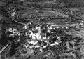
 Ayent.jpg 209 × 236; 18 KB
-
 Ballade en forêt.jpg 3.000 × 4.000; 5,87 MB
-
 CHE Ayent Logo.svg 483 × 439; 12 KB
-
 Commune d'Ayent - panorama mars 2023.jpg 36.559 × 5.752; 127,03 MB
-
 Die Suone von Ayent wurde vor 1448 errichtet.jpg 6.016 × 4.000; 13,75 MB
-
 ETH-BIB-Lac Luchet vor und nach Erdbeben 30.05. 1946-Dia 247-14905.tif 3.081 × 3.440; 10,19 MB
-
 ETH-BIB-Rawil Erdbeben -…?- Schutt von 25.03.46-Dia 247-14746.tif 3.037 × 3.533; 10,35 MB
-
 ETH-BIB-Rawil Erdbeben von 30.05.46, Absturz-Flanken am Rawilhorn-Dia 247-14750.tif 3.649 × 2.661; 9,36 MB
-
 ETH-BIB-Rawil Erdbeben von 30.05.46, Blöcke, von Süden aufwärts-Dia 247-14751.tif 3.079 × 3.383; 10,03 MB
-
-
 ETH-BIB-Rawil Erdbeben von 30.05.46, verschütteter Passweg von Süden-Dia 247-14749.tif 3.138 × 3.415; 10,32 MB
-
 ETH-BIB-Rawil Erdbeben, Praz Combeyra von Südost, Schuttrutsch 25.03.46-Dia 247-14747.tif 3.607 × 2.656; 27,53 MB
-

-

-
 ETH-BIB-Rawilhorn vor (1945) und nach Erdbeben -…?--Dia 247-14904.tif 3.051 × 3.428; 10,07 MB
-
 ETH-BIB-Rawilhorn, Rawilpass vom Pas de l'Ours-Dia 247-14995.tif 3.705 × 2.857; 30,4 MB
-
 ETH-BIB-Rawilhorn-Abhang zur Liène und Pra du Taillour-Dia 247-14998.tif 2.986 × 3.428; 29,4 MB
-
-
 ETH-BIB-St. Romain bei Sierre-LBS H1-019069.tif 6.645 × 4.670; 88,86 MB
-
 Flag of Ayent.gif 216 × 216; 9 KB
-
 Karte Gemeinde Ayent 2011.png 1.476 × 2.185; 641 KB
-
 Lourantse - panoramio.jpg 1.329 × 1.944; 605 KB
-
 Mont pucel's area's sight toward "Dent Blanche" - panoramio.jpg 2.592 × 1.944; 2,04 MB
-
 Paragliding20210802104445.jpg 2.136 × 3.216; 3,18 MB
-
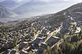
 Saint-Romain - Ayent.jpg 5.533 × 4.150; 16,45 MB
-
 Scex rouge's sight toward "Wildhorn" on summer - panoramio.jpg 3.992 × 1.080; 2,01 MB
-
 Scex rouge's sight toward - panoramio.jpg 4.896 × 2.752; 6,11 MB
-
 Scex Rouge's twilight, sight to the south - panoramio.jpg 4.000 × 3.000; 4,45 MB
-
 Schnidehorn, 2.937 m ü.d.M - panoramio.jpg 3.872 × 2.592; 3,87 MB
-
 Sight on the "Wetzsteinhorn" - panoramio.jpg 4.000 × 3.000; 4,86 MB
-
 Six des eaux froide's sight toward "Balmhorn" - panoramio.jpg 3.000 × 4.000; 4,84 MB
-
 Six des eaux froide's sight toward "Wetzsteinhorn" - panoramio.jpg 4.000 × 3.000; 4,87 MB
-
 Six Des Eaux Froides (Nordwand) - panoramio (1).jpg 5.101 × 1.757; 5,64 MB
-
 Six Des Eaux Froides (Nordwand) - panoramio.jpg 5.224 × 2.209; 7,75 MB
-
 The butterfly and the flower.jpg 3.024 × 4.032; 2,15 MB
-
 Wetzsteinhorn's area sight toward "Wetzsteinhorn" - panoramio.jpg 4.000 × 3.000; 5,24 MB


.jpg)


_-_panoramio.jpg)


_-_panoramio_(1).jpg)