Category:Bélâbre
Salti al navigilo
Salti al serĉilo
| Pozicio de la objekto | | Mapo de cxiuj koordinatoj per: OpenStreetMap |
|---|
commune in Indre, France  .svg)  | |||||
| Alŝuti plurmedion | |||||
| Estas | |||||
|---|---|---|---|---|---|
| Loko | |||||
| Strata adreso |
| ||||
| Loĝantaro |
| ||||
| Areo |
| ||||
| oficiala retejo | |||||
 | |||||
English: Bélâbre is a french city, located in the Indre department, in the region Centre.
Français : Bélâbre est une commune française, située dans le département de l'Indre, en région Centre.
Subkategorioj
Ĉi tiu kategorio havas la 8 jenajn subkategoriojn, el 8 entute.
A
B
C
- CEER de Bélâbre (2 D)
M
- Maps of Bélâbre (2 D)
P
- Jean-Baptiste Piperaud (3 D)
R
T
- Town hall of Bélâbre (2 D)
Dosieroj en kategorio “Bélâbre”
La jenaj 19 dosieroj estas en ĉi tiu kategorio, el 19 entute.
-
 36016-Bélâbre-Sols.png 3 270 × 2 598; 2,42 MB
-
 Belabre conseil municipal 2014.svg 360 × 185; 1 KB
-
 Blason de la ville de Bélâbre (36).svg 600 × 660; 108 KB
-
 Bélâbre (36) - Camping - entrée.jpg 3 024 × 4 032; 3,82 MB
-
 Bélâbre (36) - Centre de secours.jpg 4 032 × 3 024; 2,62 MB
-
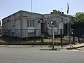 Bélâbre (36) - Gendarmerie.jpg 4 032 × 3 024; 3,14 MB
-
 Bélâbre (36) - Office de tourisme.jpg 4 032 × 3 024; 3,8 MB
-
 Bélâbre (Indre) - Fours a Chaux de Puyrajoux 02.png 1 143 × 766; 1,16 MB
-
 Bélâbre (Indre) - Fours a Chaux de Puyrajoux.png 1 301 × 846; 1,61 MB
-
 Bélâbre la mairie en 2017.jpg 1 085 × 679; 360 KB
-
 Bélâbre OSM 01.png 717 × 851; 249 KB
-
 Bélâbre OSM 02.png 717 × 851; 509 KB
-
Fr-Paris--Bélâbre.ogg 0,8 s; 10 KB
-
 Ligne HTB 90 000 V - PS Laferran - PS Roussines.jpg 4 032 × 3 024; 3,4 MB
-
 Ligne n°1 HTB 225 000 V - Poste RTE Éguzon - Poste RTE L'Orangerie.jpg 4 032 × 3 024; 4,42 MB
-
 Map commune FR insee code 36016.png 756 × 605; 62 KB
-
 Population - Municipality code 36016.svg 475 × 355; 13 KB
-
 Vue de l'étang Bouteiller avec héron au loin, à Bélâbre.jpg 5 152 × 3 864; 6,41 MB
-
 Vue de l'étang Bouteiller à Bélâbre.jpg 5 152 × 3 864; 7,6 MB


_-_Camping_-_entr%C3%A9e.jpg)
_-_Centre_de_secours.jpg)
_-_Gendarmerie.jpg)
_-_Office_de_tourisme.jpg)
_-_Fours_a_Chaux_de_Puyrajoux_02.png)
_-_Fours_a_Chaux_de_Puyrajoux.png)


