Category:Bab-el-Mandeb
Zur Navigation springen
Zur Suche springen
Meerenge zwischen Asien und Afrika   | |||||
| Medium hochladen | |||||
| Ist ein(e) | |||||
|---|---|---|---|---|---|
| Ort |
| ||||
| Physisch verbunden mit | |||||
 | |||||
Unterkategorien
Diese Kategorie enthält folgende Unterkategorie:
In Klammern die Anzahl der enthaltenen Kategorien (K), Seiten (S), Dateien (D)
P
- Perim Island (30 D)
Medien in der Kategorie „Bab-el-Mandeb“
Folgende 68 Dateien sind in dieser Kategorie, von 68 insgesamt.
-
 Assab e il basso Mar Rosso.jpg 945 × 1.130; 190 KB
-
 Carta della baia d'Assab e regioni adiacenti (Torino, Guido Cora).jpg 945 × 775; 130 KB
-
 A chart of the straits of BABELMANDELL and MOHA NYPL1640652.tiff 7.230 × 5.428; 112,28 MB
-
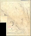 Admiralty Chart No 143 Jabal at Tair to Perim Island, Published 1970.jpg 14.099 × 16.024; 46,63 MB
-

-
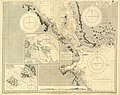 Admiralty Chart No 8e Red Sea Sheet 5, Published 1873.jpg 10.202 × 8.075; 12,31 MB
-
 Africa 1707 Lobo (cropped) - region Mecca - Bab-el-Mandeb - Baylour.jpg 568 × 753; 186 KB
-
 Africa 1707 Lobo.jpg 1.886 × 1.323; 950 KB
-
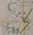
 Anglo-Turkish Boundary Commission map of Cape Bab el-Mandeb.jpg 1.731 × 2.905; 2,93 MB
-
 Bab al-Mandab Strait.jpg 4.491 × 2.520; 4,78 MB
-
 Bab Al-Mandeb Strait, between Djibouti and Yemen.jpg 5.182 × 3.455; 1,56 MB
-
 Bab el Mandeb NAS-AR description.png 1.024 × 702; 1,26 MB
-
 Bab el Mandeb NASA with description-ar.jpg 1.024 × 702; 172 KB
-
 Bab el Mandeb NASA with description.jpg 1.024 × 702; 257 KB
-
 Bab el Mandeb NASA.jpg 1.024 × 702; 164 KB
-
 Bab el-Mandeb 1884.jpg 800 × 459; 240 KB
-
 Bab-el-Mandeb Seen From Midchannel.jpg 3.024 × 4.032; 2,11 MB
-
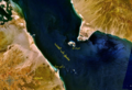
 Bab-el-Mandeb Strait, Africa-Arabia (ASTER).jpg 3.778 × 4.408; 1,22 MB
-
 Bab-el-Mandeb Strait, Red Sea.jpg 2.757 × 2.757; 1,38 MB
-
 Bab-el-Mandeb.png 478 × 716; 117 KB
-
 Babelmandeb.jpg 461 × 307; 17 KB
-
 Cape Bab el-Mandeb Anglo-Turkish Demarcation Line.jpg 1.385 × 1.441; 435 KB
-
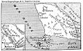 Carte Cheik-Said.jpg 1.041 × 639; 294 KB
-
 Cheikh Said 1885.jpg 896 × 695; 188 KB
-
 Cheikh Saïd et Périm.jpg 749 × 568; 115 KB
-
 Dom João de Castro - Roteiro do Mar Roxo - Bab-El-Mandeb.jpg 1.571 × 1.184; 289 KB
-
 Ethiopia hornafrica.jpg 1.280 × 672; 109 KB
-
-
 Isle de Zocotora (Description de l'Univers, t. 3, pl. 37).jpg 544 × 804; 126 KB
-
 ISS-59 Storm clouds on the southwestern coast of Yemen.jpg 5.568 × 3.712; 2,09 MB
-
 ISS022-E-9108 - View of Yemen.jpg 4.288 × 2.848; 685 KB
-
 ISS022-E-9110 - View of Yemen.jpg 4.288 × 2.848; 705 KB
-
 ISS022-E-96465 - View of Djibouti.jpg 4.288 × 2.848; 1,1 MB
-
 ISS022-E-96466 - View of Djibouti.jpg 4.288 × 2.848; 1,28 MB
-
 ISS022-E-96467 - View of Yemen.jpg 4.288 × 2.848; 1,18 MB
-
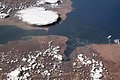
 Khor Ghorera.JPG 1.324 × 849; 305 KB
-
 Lange diercke sachsen afrika bab el mandeb.jpg 722 × 702; 251 KB
-
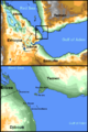
 Locatie Bab el Mandeb.PNG 652 × 468; 20 KB
-
 Map of Bab-el-Mandeb.png 2.352 × 1.740; 312 KB
-
 Mer Rouge (carte).png 500 × 950; 107 KB
-

-
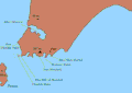
 Perim and Bab-el-Mandeb Peninsula.png 650 × 501; 388 KB
-
 Perim and entire Shaikh Said Peninsula.jpg 1.186 × 1.193; 312 KB
-
 Perim and lighthouse 1883.jpg 883 × 549; 154 KB
-
 Perim and Shaikh Said Peninsula.jpg 4.288 × 2.848; 4,99 MB
-
 Perim Cheikh Said.jpg 1.000 × 750; 24 KB
-
 Perim Island and coastal Yemen.jpg 1.024 × 685; 88 KB
-
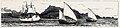
 Perim L'Illustration 1858CR.jpg 1.037 × 458; 270 KB
-
 Perim Point House.jpg 489 × 434; 98 KB
-
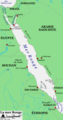
 Red Sea map-blank.svg 1.655 × 2.705; 1,01 MB
-
 Red Sea topographic map-ar.png 1.771 × 2.751; 4,59 MB
-
 Red Sea topographic map-de.svg 1.655 × 2.705; 1,65 MB
-
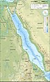
 Red Sea topographic map-en.jpg 1.655 × 2.705; 1,63 MB
-
 Red Sea topographic map-en.svg 1.655 × 2.705; 1,98 MB
-
 Red Sea topographic map-fr.jpg 1.655 × 2.705; 1,69 MB
-
 Red Sea topographic map-fr.svg 1.655 × 2.705; 1,68 MB
-
 Red Sea topographic map-hu.svg 1.655 × 2.705; 1,5 MB
-
 Red Sea topographic map-hu2.svg 1.655 × 2.705; 1,67 MB
-
 Red Sea topographic map-mk.svg 1.655 × 2.705; 1,64 MB
-
 S66-54536.jpg 3.276 × 3.275; 1,31 MB
-
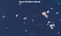 Seven Brothers Islands.jpg 837 × 498; 28 KB
-
 Sheikh Said Peninsula capture November 1914.png 480 × 406; 482 KB
-
 Sheikh Said Peninsula.gif 682 × 484; 73 KB
-
 Southern Red Sea Arabian Sea 1922.jpg 2.068 × 2.801; 1,5 MB
-
 Territoire de Cheikh Saïd.jpg 1.569 × 1.342; 873 KB
-

-

-
 الشريط الساحلي قرية فقم الساحلية.png 1.024 × 768; 1,48 MB

.jpg)

_and_Bab-El-Mandeb_Small_Strait_Surveyed_by_Lieutt._F.J._Gray,_R.N.,_and_the_Officers_of_H.M.S._Nassau,_1874,_Published_1874,_New_Edition_1919.jpg)

_-_region_Mecca_-_Bab-el-Mandeb_-_Baylour.jpg)


.jpg)


.jpg)


.png)
_-_Strombidae_-_Mollusc_shell.jpeg)


.png)

_transits_the_Bab_Al_Mandeb_after_departing_the_Red_Sea_and_into_the_Gulf_of_Aden.jpg)