Category:Baconsthorpe
Vai alla navigazione
Vai alla ricerca
English: Baconsthorpe is a village and civil parish in the English county of Norfolk. It is 8 km south of Sheringham and 32 km north of Norwich.
village in the United Kingdom  | |||||
| Carica un file multimediale | |||||
| Istanza di | |||||
|---|---|---|---|---|---|
| Luogo | North Norfolk, Norfolk, Est dell'Inghilterra, Inghilterra | ||||
| Superficie |
| ||||
| Considerato essere uguale a | Baconsthorpe (pagina Wikimedia duplicata, parrocchia civile dell'Inghilterra) | ||||
 | |||||
Sottocategorie
Questa categoria contiene le 7 sottocategorie indicate di seguito, su un totale di 7.
File nella categoria "Baconsthorpe"
Questa categoria contiene 60 file, indicati di seguito, su un totale di 60.
-
 A misty day in mid January - geograph.org.uk - 1121068.jpg 640 × 480; 122 KB
-
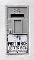 A redundant postbox - geograph.org.uk - 1121048.jpg 370 × 640; 86 KB
-
 A stack of square straw bales - geograph.org.uk - 545031.jpg 640 × 480; 71 KB
-
 Access track from Baconsthorpe Castle to village - geograph.org.uk - 6146517.jpg 3 023 × 2 232; 2,31 MB
-
 Arable field alongside access track to Breck Farm - geograph.org.uk - 6146525.jpg 4 586 × 3 428; 6,75 MB
-
 Baconsthorpe - geograph.org.uk - 4029735.jpg 640 × 480; 58 KB
-
 Baconsthorpe - geograph.org.uk - 4871007.jpg 1 600 × 1 193; 631 KB
-
 Baconsthorpe Castle - geograph.org.uk - 6442951.jpg 1 799 × 1 199; 581 KB
-
 Baconsthorpe Meadows camping fields - geograph.org.uk - 4851359.jpg 1 228 × 1 600; 528 KB
-
 Brand-new gate and stile - geograph.org.uk - 1121075.jpg 640 × 480; 153 KB
-
 Church Lane, Baconsthorpe - geograph.org.uk - 5974774.jpg 1 600 × 1 064; 1,01 MB
-
-
 Drive and path to Breck Farm - geograph.org.uk - 5633642.jpg 640 × 425; 48 KB
-
 Field by Gresham Road - geograph.org.uk - 4871012.jpg 1 600 × 1 200; 554 KB
-
 Field by Hall Farm - geograph.org.uk - 1121135.jpg 640 × 480; 102 KB
-
 Following a field's edge - geograph.org.uk - 1121598.jpg 640 × 480; 161 KB
-
 Footbridge over drain - geograph.org.uk - 1121087.jpg 640 × 480; 185 KB
-
 Footbridge with stile and a roof - geograph.org.uk - 1121100.jpg 640 × 480; 129 KB
-
 Footpath marker in The Belt - geograph.org.uk - 1121586.jpg 640 × 480; 164 KB
-
 Footpath to Baconsthorpe Castle - geograph.org.uk - 1121064.jpg 640 × 480; 136 KB
-
 Gresham Road - geograph.org.uk - 4871020.jpg 1 600 × 1 200; 505 KB
-
 Gresham Road - geograph.org.uk - 4871037.jpg 1 600 × 1 200; 594 KB
-
 Hall Lane - geograph.org.uk - 1121582.jpg 640 × 480; 102 KB
-
 Hall Lane at western end of Baconsthorpe - geograph.org.uk - 6146613.jpg 4 608 × 3 456; 7,25 MB
-
 Holt-Mannington Walk - geograph.org.uk - 4851131.jpg 1 600 × 1 200; 579 KB
-
 Northwest past Up Wood - geograph.org.uk - 545052.jpg 480 × 640; 62 KB
-
 Path across field - geograph.org.uk - 1121601.jpg 640 × 480; 113 KB
-
 Path near Beckett's Farm - geograph.org.uk - 5633639.jpg 640 × 425; 73 KB
-
 Path to the ruined Baconsthorpe Castle - geograph.org.uk - 1121595.jpg 640 × 480; 143 KB
-
 Path to The Street - geograph.org.uk - 1121592.jpg 640 × 480; 131 KB
-
 Pond by Gresham Road - geograph.org.uk - 4871035.jpg 1 600 × 1 200; 551 KB
-
 RAF West Beckham radar station (B Site) - geograph.org.uk - 3938021.jpg 640 × 480; 273 KB
-
 Road near Upwood Cottage - geograph.org.uk - 4871074.jpg 1 600 × 1 200; 666 KB
-
 School Lane, Baconsthorpe - geograph.org.uk - 4851042.jpg 1 600 × 1 200; 538 KB
-
 School Lane. Baconsfield toward Long Lane (2) - geograph.org.uk - 6146551.jpg 3 838 × 2 874; 5,3 MB
-
 School Lane. Baconsfield toward Long Lane - geograph.org.uk - 6146540.jpg 4 208 × 3 118; 5,25 MB
-
 Sewage works - geograph.org.uk - 1121093.jpg 640 × 480; 123 KB
-
 Sheep by Pitt Farm - geograph.org.uk - 4851365.jpg 1 600 × 1 200; 570 KB
-
 Skirting The Belt - geograph.org.uk - 1121590.jpg 640 × 480; 144 KB
-
 Squeezing past holly bushes - geograph.org.uk - 1121593.jpg 480 × 640; 131 KB
-
 Stile into cultivated field - geograph.org.uk - 1121599.jpg 640 × 480; 154 KB
-
 Stile on footpath - geograph.org.uk - 1121596.jpg 640 × 480; 168 KB
-
 The Street past Pitt Farm - geograph.org.uk - 1121602.jpg 640 × 480; 100 KB
-
 The Street. Baconsfield toward Long Lane on the left - geograph.org.uk - 6146532.jpg 4 309 × 3 158; 4,88 MB
-
 The Street. Baconsthorpe heading west - geograph.org.uk - 6146607.jpg 3 844 × 2 880; 6,31 MB
-
 To Baconsthorpe on Long Lane - geograph.org.uk - 3664072.jpg 640 × 414; 185 KB
-
 Tree art - geograph.org.uk - 5135272.jpg 2 560 × 1 920; 1,26 MB
-
 Upland at Willow Glen - geograph.org.uk - 3938116.jpg 640 × 480; 80 KB
-
 View along Hall Lane - geograph.org.uk - 1121587.jpg 522 × 640; 164 KB
-
 View along the Holt - Mannington Walk - geograph.org.uk - 3664075.jpg 640 × 480; 296 KB
-
 View east along The Street - geograph.org.uk - 1121603.jpg 479 × 640; 82 KB
-
 View west along School Lane - geograph.org.uk - 1121605.jpg 640 × 480; 105 KB
-

-

-
 Approaching The Belt - geograph.org.uk - 1121583.jpg 640 × 480; 138 KB
-

-
-

-
 Silage bales in Barningham Park - geograph.org.uk - 544950.jpg 640 × 480; 73 KB
-


_-_geograph.org.uk_-_3938021.jpg)


_-_geograph.org.uk_-_6146551.jpg)


_or_Baconsthorpe_(right)_-_geograph.org.uk_-_515688.jpg)


