Category:Bad Berleburg
Zur Navigation springen
Zur Suche springen
an Eder und Odeborn gelegene Kur- und ehem. Wittgensteiner Kreisstadt; flächengrößte, östlichste u. nördlichste Kommune im Kreis Siegen-Wittgenstein, Nordrhein-Westfalen | |||||
| Medium hochladen | |||||
| Aussprache (Audiodatei) | |||||
|---|---|---|---|---|---|
| Ist ein(e) |
| ||||
| Ort | Kreis Siegen-Wittgenstein, Regierungsbezirk Arnsberg, Nordrhein-Westfalen, Deutschland | ||||
| Touristeninformation |
| ||||
| Besteht aus | |||||
| Einwohnerzahl |
| ||||
| Fläche |
| ||||
| Höhe über dem Meeresspiegel |
| ||||
| offizielle Website | |||||
 | |||||
Unterkategorien
Es werden 25 von insgesamt 25 Unterkategorien in dieser Kategorie angezeigt:
In Klammern die Anzahl der enthaltenen Kategorien (K), Seiten (S), Dateien (D)
A
- Augensteine (1 D)
B
- Bikar Metalle (2 D)
C
E
- EJOT (3 D)
F
J
N
P
T
V
- Via Adrina Wanderweg (5 D)
- Via Celtica (3 D)
W
- Wittgensteiner Schieferpfad (123 D)
Medien in der Kategorie „Bad Berleburg“
Folgende 65 Dateien sind in dieser Kategorie, von 65 insgesamt.
-
2023-05-12 Bad Berleburg photo-1.jpg 4.032 × 3.024; 5,12 MB
-
Bad Berleburg - Hotel-Schild.jpg 4.000 × 3.000; 819 KB
-
Bad Berleburg - panoramio - micovich (1).jpg 3.072 × 2.304; 2,01 MB
-
Bad Berleburg - panoramio - micovich (2).jpg 3.072 × 2.304; 2,71 MB
-
Bad Berleburg - panoramio - micovich.jpg 3.072 × 2.304; 3,27 MB
-
Bad Berleburg - panoramio.jpg 3.072 × 2.304; 2,34 MB
-
Bad Berleburg 10.jpg 4.032 × 3.024; 3,21 MB
-
Bad Berleburg 8.jpg 1.600 × 1.200; 591 KB
-
Bad Berleburg Brunnenfigur mit Wappen.jpg 1.200 × 1.600; 436 KB
-
Bad Berleburg De Merian Hassiae.jpg 750 × 348; 75 KB
-
Bad Berleburg Denkmal.jpg 1.200 × 1.600; 440 KB
-
Bad Berleburg Feuerwehrpumpe.jpg 1.280 × 960; 294 KB
-
Bad Berleburg Girkhausen Sauerland Ost 189 pk.jpg 3.413 × 2.267; 5,83 MB
-
Bad Berleburg Girkhausen Sauerland-Ost 108.jpg 4.256 × 2.832; 9,8 MB
-
Bad Berleburg in SI.svg 507 × 546; 309 KB
-
Bad Berleburg Laden.jpg 2.048 × 1.536; 395 KB
-
Bad Berleburg Laden2.jpg 1.280 × 960; 295 KB
-
Bad Berleburg Miele Buttermaschine.jpg 960 × 1.280; 276 KB
-
Bad Berleburg NCR.jpg 2.048 × 1.536; 662 KB
-
Bad Berleburg Quarzitkugel.jpg 2.048 × 1.536; 408 KB
-
Banner Bad Berleburg.svg 300 × 875; 11 KB
-
Bad Berleburg, straatzicht2 2010-08-11 15.06.JPG 3.456 × 2.592; 947 KB
-
Bad Berleburg-1.jpg 4.032 × 3.024; 2,83 MB
-
Bad Berleburg-2.jpg 4.032 × 3.024; 4,32 MB
-
Bad Berleburg-3.jpg 4.032 × 3.024; 4,3 MB
-
Bad Berleburg-4.jpg 4.032 × 3.024; 3,06 MB
-
Bad Berleburg-5.jpg 4.032 × 3.024; 3,03 MB
-
Bad Berleburg-6.jpg 4.032 × 3.024; 5,48 MB
-
Bad Berleburg-Girkhausen Sauerland Ost 225 pk.jpg 4.288 × 2.848; 9,15 MB
-
Bad Berleburg-Girkhausen Sauerland Ost 226 pk.jpg 4.288 × 2.848; 10,85 MB
-
Bad Berleburg-Girkhausen Scheidskopf Sauerland Ost 227 pk.jpg 4.288 × 2.848; 10,31 MB
-
Bad-Berleburg-777.jpg 4.032 × 3.024; 4,85 MB
-
Berleburg (Merian).jpg 2.044 × 1.336; 622 KB
-
Bij Landebach, panorama2 foto2 2010-08-11 16.47.JPG 3.097 × 2.323; 2,88 MB
-
De Merian Hassiae 044.jpg 2.100 × 2.820; 1,41 MB
-
Einwohnerentwicklung von Bad Berleburg nach Gebietstaenden.svg 800 × 400; 27 KB
-
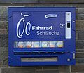
Fahrradschlauchautomat 20080420.jpg 2.748 × 2.376; 855 KB
-
Fritz Krämer 1.jpg 1.203 × 525; 596 KB
-
Garsbach.jpg 2.253 × 1.460; 649 KB
-
Haus Jost.jpg 2.016 × 1.512; 2,58 MB
-
Hütejunge Berleburg.jpg 4.608 × 3.456; 4,81 MB
-
Jacob-Nolde-Straße.jpg 2.016 × 1.134; 1,39 MB
-
Karte des NSG Rothaarkamm am Grenzweg.png 7.015 × 4.960; 26,26 MB
-
KAS-Berleburg-Bild-14122-1.jpg 796 × 1.138; 101 KB
-
Kreis Siegen Berleburg.jpg 200 × 198; 18 KB
-
RB 20240321 Berleburg-3-Pano.jpg 12.379 × 3.023; 28,92 MB
-
RB 20240321 Berleburg.jpg 9.276 × 5.631; 30,41 MB
-
Rothaarsteig Herbst 2008.jpg 2.448 × 3.264; 2,85 MB
-
Rothaarsteig, bei Kühhude, Juni 2010 (4749600435).jpg 1.200 × 900; 290 KB
-
Sassenhausenpano mit Horst und Baerenkopf (Elop).jpg 10.908 × 2.235; 1,76 MB
-
Schild Artenschutzturm Struthbach.jpg 800 × 600; 53 KB
-
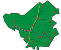
Stadtgliederung Bad Berleburg.png 1.933 × 1.605; 695 KB
-
Strasse zum NSG Lützelsbach.jpg 4.032 × 3.024; 5,77 MB
-
Teiche.jpg 2.350 × 1.472; 723 KB
-
Tussen Elsoff en Schwarzenau, straatpanorama foto2 2010-08-11 13.21.JPG 2.195 × 1.646; 1,41 MB
-
Wemlighausen1.JPG 2.184 × 1.456; 3,56 MB
-
Wittgensteiner Kammer mit Asten und Ziegenhelle (Elop).jpg 4.119 × 2.707; 1,16 MB
-
Wittgensteiner Land bei Wemlighausen.jpg 1.600 × 1.200; 320 KB
-
Wittgensteiner Land nähe Hof Rüsselsbach.jpg 3.008 × 2.000; 2,58 MB
-
Wittgensteiner Schieferpfad-92.jpg 4.032 × 3.024; 3,31 MB
-
Wittgensteiner Schieferpfad-94.jpg 4.032 × 3.024; 2,27 MB
-
Wittgensteiner Schieferpfad-95.jpg 4.032 × 3.024; 2,55 MB
-
Wittgensteiner Schieferpfad-96.jpg 4.032 × 3.024; 3,2 MB
-
Wittgensteiner Schieferpfad-97.jpg 4.032 × 3.024; 3,25 MB
-
Ziegensteg.jpg 800 × 600; 276 KB


