Category:Baddesley Ensor
Aller à la navigation
Aller à la recherche
village britannique .jpg) | |||||
| Téléverser des médias | |||||
| Nature de l’élément | |||||
|---|---|---|---|---|---|
| Lieu | North Warwickshire, Warwickshire, Midlands de l'Ouest, Angleterre | ||||
| Population |
| ||||
| Superficie |
| ||||
 | |||||
English: Baddesley Ensor is a village and civil parish in the district of North Warwickshire in Warwickshire, England, about three miles west of Atherstone. It runs into to the village of Grendon, which forms a parish itself.
Sous-catégories
Cette catégorie comprend seulement la sous-catégorie ci-dessous.
B
Média dans la catégorie « Baddesley Ensor »
Cette catégorie comprend 29 fichiers, dont les 29 ci-dessous.
-

-

-
 Boot Inn, Grendon - geograph.org.uk - 2647149.jpg 3 488 × 2 616 ; 2,2 Mio
-
 Country road leading towards Wood End - geograph.org.uk - 2727661.jpg 640 × 428 ; 77 kio
-
 Derelict building near Baddesley Farm - geograph.org.uk - 2727639.jpg 640 × 428 ; 76 kio
-
 Discarded crop trays near Green Farm - geograph.org.uk - 2561333.jpg 640 × 480 ; 427 kio
-
 Dismantled railway south of Birch Coppice - geograph.org.uk - 2563000.jpg 640 × 480 ; 611 kio
-
 Distribution complex under construction - geograph.org.uk - 2563225.jpg 640 × 480 ; 340 kio
-
 Disused viaduct near Baddesley Ensor - geograph.org.uk - 1656420.jpg 640 × 480 ; 101 kio
-

-
 Farm access track near Dordon - geograph.org.uk - 2727610.jpg 640 × 428 ; 88 kio
-

-
 Footpath north of Green Farm - geograph.org.uk - 2561346.jpg 640 × 480 ; 395 kio
-
 Ford at Baddesley Ensor - geograph.org.uk - 2980667.jpg 3 872 × 2 592 ; 2,39 Mio
-
 Former railway bridge south of Birch Coppice - geograph.org.uk - 2564815.jpg 640 × 480 ; 551 kio
-
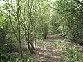
 Hidden lane, near Baddesley Ensor - geograph.org.uk - 110597.jpg 640 × 480 ; 124 kio
-
 Looking back towards Dordon - geograph.org.uk - 2727615.jpg 640 × 428 ; 61 kio
-

-

-
 Lower House Lane by Baddesley Farm - geograph.org.uk - 2562988.jpg 640 × 480 ; 350 kio
-
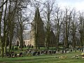 St Nicholas's Church, Baddesley Ensor (geograph 1785273).jpg 640 × 480 ; 132 kio
-
 Part-harvested field behind Stone Cottage - geograph.org.uk - 2562996.jpg 640 × 480 ; 392 kio
-
 Pond near Green Farm - geograph.org.uk - 2561336.jpg 640 × 480 ; 502 kio
-
 Side of old railway embankment, Birch Coppice - geograph.org.uk - 2564756.jpg 640 × 480 ; 601 kio
-
 South boundary of Birch Coppice Business Park - geograph.org.uk - 2564641.jpg 640 × 480 ; 386 kio
-
 South end of Cope's Rough - geograph.org.uk - 2562985.jpg 640 × 480 ; 581 kio
-

-
 View north from near Baddesley Farm - geograph.org.uk - 2563211.jpg 640 × 480 ; 381 kio
-
 View northwest from Lower House Lane - geograph.org.uk - 2563199.jpg 640 × 480 ; 328 kio


