Category:Balfron
Aller à la navigation
Aller à la recherche
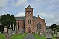
village britannique  Kirke og krigsminnesmerke i Balfron. {{byline|Chris Upson}} | |||||
| Téléverser des médias | |||||
| Nature de l’élément | |||||
|---|---|---|---|---|---|
| Lieu |
| ||||
| Population |
| ||||
 | |||||
English: Balfron, is a village in the Stirling council area of Scotland. It is situated near Endrick Water on the A875 road, 18 miles (29 km) west of Stirling and 16 miles (26 km) north of Glasgow. Although a rural settlement, it lies within commuting distance of Glasgow, and serves as a dormitory town. It has shops, a health centre, a village hall and a secondary school (Balfron High School). The village also contains a fire station, garage, ambulance depot, police station, primary school, bowling green and an 18 hole golf course. The residential special school Ballikinrain is also located in Balfron and caters to intervening for boys with special needs from all over Scotland.
Norsk bokmål: Balfron er en landsby ( village) i regionen Stirling i Skottland. Ved folketellingen i 2001 hadde Balfron 1 518 innbyggere.
Polski: Balfron, jest niewielkim (2000 mieszkańców) miasteczkiem w Szkocji. Jest on odległy o 18 mile (29 km ) na zachód od Stirling i 16 mile (26 km ) na północ od Glasgow. W mieście jest dość sławne w Wielkiej Brytanii centrum zdrowia, piękny rynek miasteczka i wielki zespół szkół ogólnokształcących. Miasteczko także posiada jedną z największych w Szkocji remizę strażacką i 18. dołkowe pole do golfa.
Simple English: Balfron, is a village in the Stirling council area of Scotland. It is near Endrick Water on the A875 road, 18 miles (29 km) west of Stirling and 16 miles (26 km) north of Glasgow. Although a rural settlement, it lies within commuting distance of Glasgow, and serves as a dormitory town. It has shops, a health centre, a village hall and a secondary school (Balfron High School). The village also contains a fire station, garage, ambulance depot, police station, primary school, bowling green and an 18 hole golf course. The residential special school Ballikinrain is also located in Balfron and caters to intervening for boys with special needs from all over Scotland.
Sous-catégories
Cette catégorie comprend seulement la sous-catégorie ci-dessous.
B
- Ballikinrain Castle (3 F)
Média dans la catégorie « Balfron »
Cette catégorie comprend 32 fichiers, dont les 32 ci-dessous.
-
 Balfron Church and war memorial - geograph.org.uk - 324354.jpg 640 × 480 ; 105 kio
-
 Balfron Church and War Memorial.jpg 640 × 442 ; 105 kio
-
 Balfron Parish Church, Stirlingshire (28717164725).jpg 3 216 × 2 136 ; 3,44 Mio
-
 Balfron War Memorial, Stirlingshire (28101490023).jpg 2 136 × 3 216 ; 3,67 Mio
-
 Home Farm Cottage, near Boquhan - geograph.org.uk - 95395.jpg 640 × 480 ; 211 kio
-
 Little Corrie - geograph.org.uk - 26002.jpg 640 × 463 ; 50 kio
-
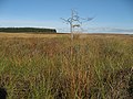 Lone tree on Ballindalloch Muir - geograph.org.uk - 578367.jpg 640 × 480 ; 317 kio
-
 B818 near Fintry. - geograph.org.uk - 83191.jpg 519 × 640 ; 85 kio
-
 Balfron - geograph.org.uk - 254186.jpg 640 × 480 ; 87 kio
-
 Balfron Bowling Club - geograph.org.uk - 95403.jpg 640 × 480 ; 96 kio
-
 Balglass Burn - geograph.org.uk - 102875.jpg 427 × 640 ; 101 kio
-
 Ballikinrain - geograph.org.uk - 341451.jpg 640 × 480 ; 87 kio
-
 Ballikinrain Pasture - geograph.org.uk - 341456.jpg 640 × 480 ; 71 kio
-
 Beech-lined lane, Balfron - geograph.org.uk - 259274.jpg 640 × 480 ; 193 kio
-
 Bridge over the river Endrick - geograph.org.uk - 370500.jpg 640 × 480 ; 138 kio
-
 Campsie moorland - geograph.org.uk - 474707.jpg 640 × 480 ; 121 kio
-
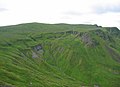
 Corrie of Balglass - geograph.org.uk - 25998.jpg 640 × 480 ; 97 kio
-
 Dead oak, Balfron - geograph.org.uk - 254345.jpg 640 × 480 ; 100 kio
-
 Driveway to Boquhan Old House - geograph.org.uk - 259280.jpg 640 × 480 ; 135 kio
-
 Forest corner - geograph.org.uk - 578383.jpg 640 × 480 ; 318 kio
-
 Forest School Site - geograph.org.uk - 370757.jpg 640 × 480 ; 147 kio
-
 Jocks Cairn. - geograph.org.uk - 26000.jpg 640 × 480 ; 100 kio
-
 Katrine Aqueduct at Killearn - geograph.org.uk - 341474.jpg 640 × 480 ; 145 kio
-
 Looking down the Holm Burn - geograph.org.uk - 578351.jpg 640 × 480 ; 318 kio
-
 Moorland wall - geograph.org.uk - 393793.jpg 640 × 480 ; 84 kio
-
 Mount Farmhouse - geograph.org.uk - 480463.jpg 640 × 480 ; 89 kio
-
 Rennie's Campsite - Ballikinrain - geograph.org.uk - 341465.jpg 640 × 480 ; 151 kio
-
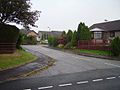
 Road to Balfron - geograph.org.uk - 254177.jpg 640 × 480 ; 82 kio
-
 Rough Moorland - geograph.org.uk - 578339.jpg 640 × 480 ; 70 kio
-
 Secluded Valley of Balglass Burn - geograph.org.uk - 480465.jpg 640 × 480 ; 83 kio
-
 Sheep grazing, Kiltrochan - geograph.org.uk - 254184.jpg 636 × 446 ; 45 kio
-
 The coupit bath - geograph.org.uk - 254180.jpg 640 × 480 ; 101 kio

.jpg)
.jpg)


