Category:Bampton, Oxfordshire
Zur Navigation springen
Zur Suche springen
English: Bampton, also called Bampton-in-the-Bush, is a village and civil parish in the Thames Valley about as part of the Cotswolds. The parish includes the hamlet of Weald.
Gemeinde in der englischen Grafschaft Oxfordshire  | |||||
| Medium hochladen | |||||
| Ist ein(e) | |||||
|---|---|---|---|---|---|
| Ort | West Oxfordshire, Oxfordshire, Südostengland, England | ||||
| Eventuell gleichwertig | Bampton (Wikimedia-Dublette, Civil Parish in England) | ||||
| offizielle Website | |||||
 | |||||
Unterkategorien
Es werden 7 von insgesamt 7 Unterkategorien in dieser Kategorie angezeigt:
In Klammern die Anzahl der enthaltenen Kategorien (K), Seiten (S), Dateien (D)
A
- Ardington War Memorial (2 D)
B
- Bampton Town Hall (10 D)
H
- Ham Court, Bampton, Oxfordshire (24 D)
M
R
- Rushy Lock, River Thames (7 D)
T
- Tadpole Bridge (20 D)
Medien in der Kategorie „Bampton, Oxfordshire“
Folgende 200 Dateien sind in dieser Kategorie, von 341 insgesamt.
(vorherige Seite) (nächste Seite)-
 A benchmark on Tadpole Bridge - geograph.org.uk - 2400172.jpg 1.042 × 1.500; 219 KB
-
 A surplus of paths - geograph.org.uk - 4955498.jpg 1.600 × 1.200; 475 KB
-
 A topiary frog - geograph.org.uk - 2279066.jpg 1.024 × 683; 247 KB
-
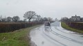
 A4095 at Cowleaze Corner - geograph.org.uk - 3044036.jpg 3.648 × 2.551; 1,49 MB
-
 A4095 towards Bampton - geograph.org.uk - 4398072.jpg 800 × 450; 177 KB
-
 A4095 towards Witney - geograph.org.uk - 4399656.jpg 800 × 450; 187 KB
-
 A4095, Station Road, Bampton - geograph.org.uk - 4399640.jpg 800 × 450; 174 KB
-

-
 Access road to St. Mary's Court, Bampton, Oxon - geograph.org.uk - 5838919.jpg 1.024 × 681; 172 KB
-
 All bricked up - geograph.org.uk - 2237244.jpg 1.024 × 683; 201 KB
-
 Ampney Lodge, Bampton, Oxfordshire - geograph.org.uk - 4509676.jpg 800 × 518; 140 KB
-
 Approaching Bampton - geograph.org.uk - 1535434.jpg 640 × 427; 60 KB
-
 Arrow on the side - geograph.org.uk - 2237255.jpg 1.024 × 768; 276 KB
-
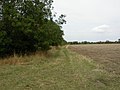 Aston, field boundary - geograph.org.uk - 2016412.jpg 1.024 × 768; 218 KB
-
 B4449 from Standlake to Bampton - geograph.org.uk - 1569541.jpg 640 × 480; 63 KB
-
 Back lane in Bampton, Oxon - geograph.org.uk - 6171819.jpg 1.024 × 681; 223 KB
-
 Back to the bend - geograph.org.uk - 2277746.jpg 1.024 × 683; 209 KB
-
 Bridge Street, Bampton - geograph.org.uk - 1546643.jpg 640 × 427; 96 KB
-
 Church View, Bampton - geograph.org.uk - 1542237.jpg 640 × 427; 119 KB
-
 High Street Bampton - geograph.org.uk - 920204.jpg 640 × 489; 98 KB
-
 The Centre of Bampton - geograph.org.uk - 471628.jpg 640 × 480; 97 KB
-
 Bampton (Oxfordshire) fire station - geograph.org.uk - 583900.jpg 640 × 427; 263 KB
-
 Bampton Castle Telephone Exchange, Oxon - geograph.org.uk - 1241180.jpg 640 × 480; 114 KB
-
 Bampton church - geograph.org.uk - 5860468.jpg 768 × 1.024; 270 KB
-
 Bampton Coffee House - geograph.org.uk - 2083752.jpg 640 × 480; 85 KB
-

-
 Bampton Flood Warning Station - geograph.org.uk - 1702641.jpg 1.024 × 768; 336 KB
-
 Bampton football ground. - geograph.org.uk - 319641.jpg 640 × 480; 74 KB
-
 Bampton Ford - geograph.org.uk - 3276637.jpg 3.872 × 2.592; 2,4 MB
-
 Bampton Garden Plants - geograph.org.uk - 4955386.jpg 1.600 × 1.200; 524 KB
-
 Bampton Garden Plants, Buckland Road - geograph.org.uk - 4388056.jpg 800 × 452; 195 KB
-
 Bampton high street - geograph.org.uk - 1542119.jpg 640 × 427; 69 KB
-
 Bampton High Street - geograph.org.uk - 2401605.jpg 1.500 × 1.000; 170 KB
-
 Bampton High Street junction with A4095 - geograph.org.uk - 3043954.jpg 3.543 × 2.489; 1,04 MB
-
 Bampton High Street passes The Morris Clown - geograph.org.uk - 3043947.jpg 3.578 × 2.531; 1,4 MB
-

-

-

-

-
 Bampton MethodistChapel.jpg 845 × 845; 537 KB
-
 Bampton Post Office - geograph.org.uk - 319636.jpg 640 × 480; 93 KB
-
 Bampton Road, Black Bourton - geograph.org.uk - 4398079.jpg 800 × 450; 192 KB
-
 Bampton Sewage Works - geograph.org.uk - 4481112.jpg 3.740 × 2.244; 2,13 MB
-
 Bampton Town football club - geograph.org.uk - 1590681.jpg 640 × 427; 56 KB
-

-
 Bampton village hall - geograph.org.uk - 2083882.jpg 640 × 480; 104 KB
-

-

-

-

-
 Bampton Youth Centre - geograph.org.uk - 1542248.jpg 640 × 427; 71 KB
-
 Bampton, Fisher's Bridge - geograph.org.uk - 2016459.jpg 1.024 × 768; 349 KB
-
 Bampton, footpath - geograph.org.uk - 2016423.jpg 1.024 × 768; 211 KB
-
 Bampton, glasshouses - geograph.org.uk - 2016448.jpg 1.024 × 768; 243 KB
-
 Bampton, Morris Clown - geograph.org.uk - 2016472.jpg 1.024 × 768; 148 KB
-
 Bampton, paddocks - geograph.org.uk - 2016417.jpg 1.024 × 768; 147 KB
-
 Bampton, paddocks - geograph.org.uk - 2016464.jpg 1.024 × 768; 170 KB
-
 Bampton, polytunnels - geograph.org.uk - 2016439.jpg 1.024 × 768; 134 KB
-
 Beam Paddock, Bampton - geograph.org.uk - 4463029.jpg 3.480 × 2.676; 1,24 MB
-
 Bell Lane, Bampton, Oxon - geograph.org.uk - 5793062.jpg 710 × 1.024; 249 KB
-
 Beside Buckland Road - geograph.org.uk - 4955523.jpg 1.600 × 1.200; 562 KB
-
 Between Aston and Bampton - geograph.org.uk - 4457376.jpg 3.832 × 2.712; 2,09 MB
-
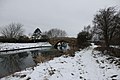
 Boats in the snow - geograph.org.uk - 2225787.jpg 1.024 × 683; 189 KB
-

-
 Bridge on the road to Chimney - geograph.org.uk - 1534020.jpg 640 × 427; 78 KB
-
 Bridge Street junction with Church View - geograph.org.uk - 3043959.jpg 3.648 × 2.674; 1,79 MB
-
 Bridge Street passes junction with Weald Street - geograph.org.uk - 3044031.jpg 3.648 × 2.736; 2,06 MB
-
 Broad Street, Bampton - geograph.org.uk - 1561615.jpg 640 × 427; 58 KB
-
 Buckland Road approaches Isle of Wight Bridge - geograph.org.uk - 3043743.jpg 3.418 × 2.313; 1,36 MB
-
 Buckland Road north of Fisher's Bridge - geograph.org.uk - 3043940.jpg 3.648 × 2.736; 1,73 MB
-
 Buckland Road north of Meadow Farm - geograph.org.uk - 3043757.jpg 3.528 × 2.573; 1,6 MB
-
 Buckland Road passes Bampton Sewage Works - geograph.org.uk - 3043933.jpg 3.230 × 2.473; 1,75 MB
-
 Buckland Road southeast of Hedgefields Farm - geograph.org.uk - 3043760.jpg 3.533 × 2.502; 1,77 MB
-
 Buckland Road, Bampton - geograph.org.uk - 1590686.jpg 640 × 427; 69 KB
-
 Buckland Road, Bampton, Oxon - geograph.org.uk - 5844208.jpg 1.024 × 681; 203 KB
-
 Building at the lock - geograph.org.uk - 2279112.jpg 1.024 × 683; 119 KB
-

-

-
 Bushey Row, Bampton - geograph.org.uk - 1538436.jpg 640 × 427; 49 KB
-
 Buttercups by the path - geograph.org.uk - 4953906.jpg 1.600 × 1.200; 556 KB
-

-
 CAT excavator near Tadpole Bridge, Oxon - geograph.org.uk - 4517251.jpg 1.024 × 768; 208 KB
-
 Cheapside, Bampton - geograph.org.uk - 1720549.jpg 1.024 × 776; 241 KB
-
 Cheapside, Bampton, Oxfordshire - geograph.org.uk - 4521882.jpg 800 × 533; 139 KB
-
 Cheyne Lane, Bampton, Oxon - geograph.org.uk - 5792364.jpg 1.024 × 681; 229 KB
-
 Church Close, Bampton - geograph.org.uk - 1542180.jpg 640 × 427; 101 KB
-
 Church Close, Bampton, Oxon - geograph.org.uk - 6171802.jpg 1.024 × 681; 216 KB
-
 Church of St Mary, Bampton, Oxfordshire - geograph.org.uk - 4532470.jpg 1.182 × 1.600; 479 KB
-
 Church View, Bampton - geograph.org.uk - 1542154.jpg 640 × 427; 94 KB
-
 The Rectory-Bampton.JPG 3.872 × 2.592; 1,87 MB
-
 Corrugated sides - geograph.org.uk - 2282624.jpg 1.024 × 683; 156 KB
-

-
 Derelict barn on New Road, Bampton - geograph.org.uk - 1538449.jpg 640 × 427; 70 KB
-
 Destination in the distance - geograph.org.uk - 2237224.jpg 1.024 × 683; 174 KB
-
 Dilapidated shack - geograph.org.uk - 319643.jpg 640 × 480; 96 KB
-
 Ditching beside Buckland Road - geograph.org.uk - 4955528.jpg 1.600 × 1.200; 498 KB
-
 Downstream from the lock - geograph.org.uk - 2277982.jpg 1.024 × 683; 173 KB
-
 Downstream to Tadpole Bridge - geograph.org.uk - 2237176.jpg 1.024 × 683; 167 KB
-
 Electric fence and warning sign, Bampton, Oxon - geograph.org.uk - 6171853.jpg 1.024 × 681; 257 KB
-
 Entrance to Bampton Heath Farm - geograph.org.uk - 1561631.jpg 640 × 427; 100 KB
-
 Entrance to Shillbrook Wood near Bampton, Oxon - geograph.org.uk - 5873069.jpg 1.024 × 681; 290 KB
-
 Face amongst the Alpines - geograph.org.uk - 4955390.jpg 1.600 × 1.095; 640 KB
-
 Farm buildings at Weald - geograph.org.uk - 1541969.jpg 640 × 427; 96 KB
-
 Farm Track near Bampton - geograph.org.uk - 4954103.jpg 1.600 × 1.200; 583 KB
-
 Farmland near Clanfield - geograph.org.uk - 4955441.jpg 1.600 × 1.200; 605 KB
-
 Farmland near Weald - geograph.org.uk - 4954129.jpg 1.600 × 1.197; 596 KB
-
 Farmyard at Weald - geograph.org.uk - 1541979.jpg 640 × 427; 67 KB
-

-
 Field near Bampton, Oxon - geograph.org.uk - 5844317.jpg 1.024 × 681; 153 KB
-
 Field near Bampton, Oxon - geograph.org.uk - 5875442.jpg 1.024 × 664; 199 KB
-
 Fill point at the moorings - geograph.org.uk - 2279249.jpg 1.024 × 683; 200 KB
-
 Fisher's Bridge, Buckland Road, Bampton, Oxon - geograph.org.uk - 5815568.jpg 1.024 × 681; 207 KB
-
 Fisher's Bridge, Buckland Road, Bampton, Oxon - geograph.org.uk - 5846194.jpg 1.024 × 681; 245 KB
-
 Flood mark on the bridge - geograph.org.uk - 2239774.jpg 1.024 × 683; 266 KB
-
 Flooding at Rushey Lock (1), River Thames - geograph.org.uk - 2202294.jpg 1.024 × 756; 273 KB
-
 Floodmarks on the lock - geograph.org.uk - 2279072.jpg 1.024 × 683; 207 KB
-
 Floodplain footpath - geograph.org.uk - 4399632.jpg 800 × 450; 187 KB
-
 Flowering tree by the road - geograph.org.uk - 4447759.jpg 4.000 × 3.000; 2,05 MB
-

-
 Footbridge in Shillbrook Wood near Bampton, Oxon - geograph.org.uk - 5873159.jpg 1.024 × 676; 243 KB
-
 Footbridge over Rushey Weir - geograph.org.uk - 2427467.jpg 1.024 × 680; 238 KB
-
 Footbridge over the Shill Brook, Bampton, Oxon - geograph.org.uk - 5819452.jpg 1.024 × 674; 235 KB
-
 Footpath Bridge near Ham Court - geograph.org.uk - 4954053.jpg 4.000 × 3.000; 4,38 MB
-
 Footpath in Shillbrook Wood near Bampton, Oxon - geograph.org.uk - 5873174.jpg 673 × 1.024; 284 KB
-
 Fork in footpath, near Bampton, Oxon - geograph.org.uk - 6173740.jpg 1.024 × 681; 215 KB
-
 Former Morland's Pub - geograph.org.uk - 4501418.jpg 4.000 × 3.000; 1,94 MB
-
 Formerly RAF Bampton Castle - geograph.org.uk - 4955380.jpg 4.000 × 3.000; 2,89 MB
-
 Gate from the road - geograph.org.uk - 2239788.jpg 1.024 × 683; 241 KB
-
 Gate on the bottom - geograph.org.uk - 2237232.jpg 1.024 × 683; 167 KB
-

-
 Gates near Bampton, Oxon - geograph.org.uk - 5875392.jpg 1.024 × 666; 239 KB
-
 Gates near Bampton, Oxon - geograph.org.uk - 5875403.jpg 1.024 × 681; 261 KB
-
 Gravestones, St. Mary's Churchyard, Bampton - geograph.org.uk - 5226107.jpg 2.334 × 1.629; 1,32 MB
-
 Great Brook - geograph.org.uk - 3985190.jpg 640 × 480; 168 KB
-
 Green Lane near Weald - geograph.org.uk - 4954148.jpg 4.000 × 3.000; 3,97 MB
-

-
 Hayrick in field near Bampton, Oxon - geograph.org.uk - 5873787.jpg 1.024 × 658; 231 KB
-
 Heading away from Weald - geograph.org.uk - 1542044.jpg 640 × 427; 71 KB
-
 High Street, Bampton - geograph.org.uk - 1541896.jpg 640 × 427; 41 KB
-
 High Street, Bampton - geograph.org.uk - 1542109.jpg 640 × 427; 64 KB
-
 High Street, Bampton, Oxfordshire - geograph.org.uk - 4533261.jpg 1.600 × 1.017; 463 KB
-
 High Street, Bampton, Oxon - geograph.org.uk - 5775598.jpg 1.024 × 681; 161 KB
-
 High water at Tadpole Bridge, River Thames - geograph.org.uk - 2201279.jpg 1.024 × 765; 353 KB
-
 Ice by the bridge - geograph.org.uk - 2225782.jpg 1.024 × 683; 181 KB
-
 Jump over the Carrots - geograph.org.uk - 4953877.jpg 3.707 × 2.613; 2,25 MB
-

-

-

-
 Just around the bend - geograph.org.uk - 2237198.jpg 1.024 × 683; 131 KB
-

-
 Lane and public footpath near Bampton, Oxon - geograph.org.uk - 5875419.jpg 728 × 1.024; 313 KB
-
 Lane off Buckland Road, Bampton, Oxon - geograph.org.uk - 5815532.jpg 1.024 × 681; 208 KB
-
 Large poppy, High Street, Bampton, Oxon - geograph.org.uk - 6030893.jpg 742 × 1.024; 237 KB
-
 Leaving Bampton on Mount Owen Road - geograph.org.uk - 1538466.jpg 640 × 427; 49 KB
-
 Lesta House, Bampton, Oxfordshire - geograph.org.uk - 4532460.jpg 640 × 429; 87 KB
-
 The Library-Bampton.JPG 3.872 × 2.592; 2,39 MB
-
 Lime Tree House, Bampton, Oxfordshire - geograph.org.uk - 4516556.jpg 1.024 × 646; 209 KB
-

-
 Lock side moorings - geograph.org.uk - 2279137.jpg 1.024 × 683; 164 KB
-
 Looking down on a rivet - geograph.org.uk - 2237250.jpg 1.024 × 683; 232 KB
-

-

-
 OptareSolo MX57UPT Bampton.jpg 839 × 559; 344 KB
-
 OptareSolo MX57UPW Bampton.jpg 839 × 471; 259 KB
-
 Meadow Farm Cottages - geograph.org.uk - 4955517.jpg 1.600 × 1.200; 495 KB
-

-
 Moonraker Lane, Bampton, Oxon - geograph.org.uk - 6377478.jpg 1.024 × 757; 204 KB
-
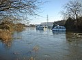 Moored boats on a flooded River Thames - geograph.org.uk - 2201283.jpg 1.024 × 753; 326 KB
-
 Moorings by the pub - geograph.org.uk - 2236035.jpg 1.024 × 683; 205 KB
-
 Morris Mosaic - geograph.org.uk - 4461521.jpg 3.000 × 4.000; 2,19 MB
-
 Mount Owen Road - geograph.org.uk - 1561624.jpg 640 × 427; 76 KB
-
 Mount Owen Road, Bampton - geograph.org.uk - 1538471.jpg 640 × 427; 59 KB
-
 Mowing the Footpath - geograph.org.uk - 4954090.jpg 1.600 × 1.200; 457 KB
-
 Mural on wall, Rosemary Lane, Bampton, Oxon - geograph.org.uk - 6377308.jpg 791 × 1.024; 270 KB
-
 Nest boxes inside - geograph.org.uk - 2237239.jpg 1.024 × 683; 202 KB
-
 New Road, Bampton - geograph.org.uk - 1538444.jpg 640 × 427; 50 KB
-
 New Road, Bampton - geograph.org.uk - 1538458.jpg 640 × 427; 54 KB
-
 No entry until the grass is cut - geograph.org.uk - 4956558.jpg 1.600 × 1.200; 488 KB
-
 No snow now - geograph.org.uk - 2277715.jpg 1.024 × 683; 235 KB
-
 Notice on the arm - geograph.org.uk - 2277995.jpg 1.024 × 683; 214 KB
-

-
 Number 112 - geograph.org.uk - 2239796.jpg 1.024 × 683; 235 KB
-
 Number 113 - geograph.org.uk - 2279210.jpg 533 × 800; 192 KB
-
 Old Windpump, Bampton - geograph.org.uk - 4953985.jpg 3.710 × 2.694; 3,17 MB
-
 On the other bank - geograph.org.uk - 2282602.jpg 1.024 × 683; 74 KB
-
 Over the lock to the office - geograph.org.uk - 2279079.jpg 1.024 × 683; 150 KB
-
 Paddles by the weir - geograph.org.uk - 2279225.jpg 1.024 × 683; 145 KB
-
 Palmer sites 2011 Bampton church 017.jpg 1.636 × 2.564; 1,82 MB
-
 Parallel Lines, Bridge Street, Bampton, Oxon - geograph.org.uk - 5874439.jpg 1.024 × 681; 176 KB
-
 Parking Problems - geograph.org.uk - 4461598.jpg 4.000 × 3.000; 1,9 MB
-
 Partly Ploughed - geograph.org.uk - 4955474.jpg 1.600 × 1.200; 492 KB
-
 Path past the cottage - geograph.org.uk - 2279155.jpg 1.024 × 683; 134 KB
-
 Path to Bampton - geograph.org.uk - 4955340.jpg 1.600 × 1.200; 476 KB
-
 Patriotic Pump - geograph.org.uk - 1702526.jpg 1.024 × 772; 171 KB
-

-
 Pillbox by the bend - geograph.org.uk - 2237204.jpg 1.024 × 683; 205 KB
-
 Pillbox by the Thames - geograph.org.uk - 911434.jpg 640 × 426; 66 KB
-
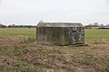
 Pillbox in the field - geograph.org.uk - 2282607.jpg 1.024 × 683; 158 KB
-
 Pillbox near Tadpole Bridge - geograph.org.uk - 2427479.jpg 1.024 × 680; 236 KB
-
 Pillbox near Tadpole Bridge - geograph.org.uk - 2427481.jpg 1.024 × 680; 245 KB


_fire_station_-_geograph.org.uk_-_583900.jpg)


_(1),_Church_View,_Bampton,_Oxon_-_geograph.org.uk_-_6379914.jpg)
_(2)_-_entrance_from_Church_View,_Bampton,_Oxon_-_geograph.org.uk_-_6380153.jpg)
_(3)_-_rear_view,_Church_View,_Bampton,_Oxon_-_geograph.org.uk_-_6380162.jpg)
_(4),_Church_View,_Bampton,_Oxon_-_geograph.org.uk_-_6380177.jpg)


,_Church_View,_Bampton,_Oxon_-_geograph.org.uk_-_6379883.jpg)
_-_sign_on_door,_Church_View,_Bampton,_Oxon_-_geograph.org.uk_-_6379891.jpg)


,_Bridge_Street,_Bampton,_Oxon_-_geograph.org.uk_-_5874395.jpg)
,_Bridge_Street,_Bampton,_Oxon_-_geograph.org.uk_-_5874402.jpg)


,_River_Thames_-_geograph.org.uk_-_2202294.jpg)


