Category:Banks, Lancashire
Aller à la navigation
Aller à la recherche
village britannique  | |||||
| Téléverser des médias | |||||
| Nature de l’élément | |||||
|---|---|---|---|---|---|
| Lieu | North Meols, West Lancashire, Lancashire, Angleterre du Nord-Ouest, Angleterre | ||||
| Baigné par |
| ||||
 | |||||
Sous-catégories
Cette catégorie comprend 4 sous-catégories, dont les 4 ci-dessous.
B
- St Stephen's church, Banks (11 F)
- Banks railway station (1 F)
G
- Greaves Hall (4 F)
Média dans la catégorie « Banks, Lancashire »
Cette catégorie comprend 62 fichiers, dont les 62 ci-dessous.
-
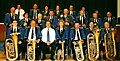 Banks Brass Band.jpg 575 × 290 ; 61 kio
-
 Banks Methodist Church.jpg 640 × 479 ; 66 kio
-
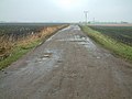
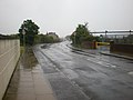 Banks Road - geograph.org.uk - 1359633.jpg 640 × 480 ; 51 kio
-
 Banks shrimper.jpg 525 × 400 ; 165 kio
-
 Banks, Lancashire road sign 1.JPG 2 736 × 3 648 ; 3,55 Mio
-
 Banks, Lancashire road sign 2.JPG 2 736 × 3 648 ; 3,44 Mio
-
 BanksMethodistSchool.jpg 1 024 × 768 ; 346 kio
-
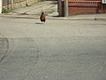 Benkid77 Chicken crossing road, Banks, Lancashire 110809.JPG 3 648 × 2 736 ; 3,64 Mio
-
 Benkid77 Ralph's Wife's Lane, Banks, Lancashire 120809.JPG 3 648 × 2 736 ; 3,62 Mio
-
 Bond's Lane, Banks, Lancashire.JPG 3 648 × 2 736 ; 3,57 Mio
-
 Building under construction, Banks, Lancashire.JPG 3 648 × 2 736 ; 3,58 Mio
-
 Bus stop, Fleetwood Drive, Banks.JPG 2 736 × 3 648 ; 3,59 Mio
-
 Bus stop, Ralph's Wife's Lane 2.JPG 2 736 × 3 648 ; 3,57 Mio
-
 Bus stop, Ralph's Wife's Lane.JPG 2 736 × 3 648 ; 3,55 Mio
-
 Cattle Banks marsh.JPG 3 888 × 2 592 ; 3,61 Mio
-
 Church Road, Banks, Lancashire 2.JPG 3 648 × 2 736 ; 3,55 Mio
-
 Church Road, Banks, Lancashire.JPG 3 648 × 2 736 ; 3,6 Mio
-
 Churchtown Moss - geograph.org.uk - 110196.jpg 640 × 480 ; 92 kio
-
 Closed footpath at Banks, Lancashire, England.jpg 640 × 316 ; 223 kio
-
 Commercial glasshouse at Banks, Lancashire, England.jpg 640 × 426 ; 157 kio
-

-
 Corner cottages - geograph.org.uk - 148063.jpg 640 × 426 ; 102 kio
-
 DisusedRailwayLineBanksUK 8109b2d7.jpg 640 × 426 ; 94 kio
-
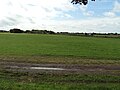 Fields near Banks, Lancashire.JPG 3 648 × 2 736 ; 3,66 Mio
-
 Former Railway Line - geograph.org.uk - 1485247.jpg 640 × 480 ; 106 kio
-
 George's Lane footpath to Church Road, Banks, Lancashire.jpg 2 736 × 3 648 ; 3,53 Mio
-
 Greaves Hall Asylum water tower - geograph.org.uk - 301021.jpg 640 × 425 ; 172 kio
-
 Greaves Hall Lodge, Sugar Stubbs Lane.JPG 3 872 × 2 592 ; 2,35 Mio
-
 Greaves Hall water tower (1).JPG 2 848 × 2 136 ; 1,44 Mio
-
 Greaves Hall water tower (2).JPG 2 136 × 2 848 ; 1,35 Mio
-
 House, Banks, Lancashire 1.JPG 3 648 × 2 736 ; 3,52 Mio
-
 In the eye of the beholder - geograph.org.uk - 138628.jpg 640 × 426 ; 62 kio
-
 Newly planted crop at High Brow farm.jpg 640 × 480 ; 61 kio
-
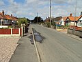
 No6 Hoole Lane - geograph.org.uk - 1359601.jpg 640 × 480 ; 67 kio
-
 Plaque on Erratic Boulder - geograph.org.uk - 1598975.jpg 640 × 480 ; 108 kio
-
 Post Office, Banks, Lancashire.JPG 3 648 × 2 736 ; 3,44 Mio
-
 Ralph's Wife's Lane, Banks, Lancashire 1.JPG 3 648 × 2 736 ; 3,57 Mio
-
 Ralph's Wife's Lane, Banks, Lancashire 2.JPG 3 648 × 2 736 ; 3,56 Mio
-
 Ribble Estuary - geograph.org.uk - 766515.jpg 640 × 480 ; 77 kio
-
 Shops, Church Road, Banks, Lancashire.JPG 3 648 × 2 736 ; 3,53 Mio
-
 Slack season - geograph.org.uk - 104328.jpg 640 × 426 ; 57 kio
-
 The New Fleetwood - geograph.org.uk - 1359598.jpg 640 × 480 ; 67 kio
-
 The New Fleetwood, Banks, Lancashire.JPG 3 648 × 2 736 ; 3,59 Mio
-
 Bonny Barn Farm - geograph.org.uk - 148069.jpg 640 × 426 ; 68 kio
-
 Cropper's Farm - geograph.org.uk - 148042.jpg 640 × 426 ; 132 kio
-
 Cross Bank Covert - geograph.org.uk - 148045.jpg 640 × 426 ; 96 kio
-
 Garage beside the A565 - geograph.org.uk - 104334.jpg 640 × 426 ; 74 kio
-
 Grey Goose Farm - geograph.org.uk - 148068.jpg 640 × 426 ; 58 kio
-
 Leisure Lakes at Mere Brow - geograph.org.uk - 313431.jpg 640 × 480 ; 145 kio
-
 Marsh Farm - geograph.org.uk - 311498.jpg 640 × 427 ; 105 kio
-
 Mere Brow Leisure Lakes - geograph.org.uk - 313437.jpg 640 × 480 ; 146 kio
-
 Mere Hall - geograph.org.uk - 178964.jpg 640 × 480 ; 76 kio
-
 Modern farming - geograph.org.uk - 148065.jpg 640 × 426 ; 82 kio
-
 Moss Lane - geograph.org.uk - 148064.jpg 640 × 426 ; 150 kio
-
 Ribble Hall - geograph.org.uk - 420089.jpg 640 × 339 ; 183 kio
-
 Site of Snotterstone - geograph.org.uk - 420163.jpg 640 × 426 ; 265 kio
-
 Straight as a dyke - geograph.org.uk - 148077.jpg 640 × 372 ; 72 kio
-
 The barn and greenhouses at New House Farm - geograph.org.uk - 148269.jpg 640 × 426 ; 61 kio
-
 The edge of the Ribble estuary, near Banks - geograph.org.uk - 313466.jpg 640 × 480 ; 64 kio
-
 The end of Gravel Lane - geograph.org.uk - 104331.jpg 640 × 426 ; 71 kio
-
 The end of the Hundred End Gutter - geograph.org.uk - 148074.jpg 640 × 426 ; 95 kio
-
 Triangulation point - geograph.org.uk - 148075.jpg 640 × 426 ; 86 kio


.JPG)
.JPG)


