Category:Banwell
Aller à la navigation
Aller à la recherche
localité britannique du comté anglais de Somerset  | |||||
| Téléverser des médias | |||||
| Nature de l’élément | |||||
|---|---|---|---|---|---|
| Lieu | North Somerset, Somerset, Angleterre du Sud-Ouest, Angleterre | ||||
| Réputé identique à | Banwell (page en doublon, paroisse civile) | ||||
 | |||||
Sous-catégories
Cette catégorie comprend 3 sous-catégories, dont les 3 ci-dessous.
A
- St Andrew's Church, Banwell (3 F)
B
- Banwell Castle (3 F)
- Banwell Hill (3 F)
Média dans la catégorie « Banwell »
Cette catégorie comprend 279 fichiers, dont les 200 ci-dessous.
(page précédente) (page suivante)-
 'Sunny Bank' - geograph.org.uk - 5655173.jpg 1 024 × 750 ; 190 kio
-
 'The Hideaway' - geograph.org.uk - 5655169.jpg 1 024 × 831 ; 230 kio
-
 'The Withies' - geograph.org.uk - 5668008.jpg 1 024 × 729 ; 165 kio
-
 A bell to raise the brigade - geograph.org.uk - 6152211.jpg 3 296 × 2 472 ; 3,46 Mio
-
 A crown in pillar box red - geograph.org.uk - 6147812.jpg 3 296 × 2 472 ; 3,64 Mio
-
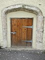 A doorway in an arch - geograph.org.uk - 6147809.jpg 2 472 × 3 296 ; 3,48 Mio
-
 A drainage ditch or rhyne in West Rolstone Road - geograph.org.uk - 2418916.jpg 3 072 × 2 304 ; 3,13 Mio
-
 A fertile meadow adjacent to Wolvers Hill Road in Banwell - geograph.org.uk - 2419879.jpg 3 072 × 2 304 ; 3,79 Mio
-
 A small pond beside the access road to Puxton Park - geograph.org.uk - 4841706.jpg 3 648 × 2 048 ; 2,73 Mio
-
 A small war memorial - geograph.org.uk - 6147466.jpg 3 296 × 2 472 ; 3,33 Mio
-
 A welcome shady corner in this pony paddock in Summer Lane - geograph.org.uk - 2419976.jpg 3 072 × 2 304 ; 4,79 Mio
-

-
 A370 at West Rolstone Road - geograph.org.uk - 4520049.jpg 1 920 × 1 047 ; 313 kio
-

-
 A371 at Banwell village boundary - geograph.org.uk - 5814608.jpg 1 024 × 768 ; 127 kio
-
 A371 bridge over M5 - geograph.org.uk - 4739413.jpg 640 × 442 ; 54 kio
-
 A371 bridge over M5 between Locking and Banwell - geograph.org.uk - 2686387.jpg 800 × 600 ; 336 kio
-
 A371 bridge over M5 south - geograph.org.uk - 4032784.jpg 640 × 274 ; 44 kio
-
 A371 Castle Hill, Banwell - geograph.org.uk - 5814629.jpg 1 024 × 725 ; 181 kio
-
 A371 Knightcroft Road, Banwell - geograph.org.uk - 5814618.jpg 1 024 × 701 ; 159 kio
-
 Access ramp for cattle to drink from the River Banwell - geograph.org.uk - 2418534.jpg 3 072 × 2 304 ; 4 Mio
-
 An ancient door - geograph.org.uk - 6152206.jpg 2 472 × 3 296 ; 1,61 Mio
-
 An odd game of bowls - geograph.org.uk - 6147707.jpg 3 296 × 2 472 ; 3,37 Mio
-
 Approaching Banwell - geograph.org.uk - 1220210.jpg 640 × 496 ; 114 kio
-
 Avon Owls Bird of Prey Rescue Sanctuary - geograph.org.uk - 5655185.jpg 1 024 × 762 ; 235 kio
-
 Avon Owls Bird of Prey Rescue Sanctuary - geograph.org.uk - 5655197.jpg 1 024 × 786 ; 165 kio
-
 Banwell Abbey - geograph.org.uk - 5357082.jpg 4 896 × 3 672 ; 5,9 Mio
-
 Banwell Abbey - geograph.org.uk - 5357102.jpg 4 896 × 3 672 ; 5,88 Mio
-
 Banwell bakery - geograph.org.uk - 6148273.jpg 3 296 × 2 472 ; 3,56 Mio
-
 Banwell Bone Cave - geograph.org.uk - 5787253.jpg 4 000 × 3 000 ; 1,8 Mio
-
 Banwell Bowling Green - geograph.org.uk - 5357120.jpg 4 896 × 3 672 ; 5,46 Mio
-
 Banwell Breakers on Riverside (road) - geograph.org.uk - 3505668.jpg 640 × 480 ; 92 kio
-
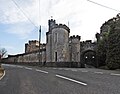 Banwell Castle - geograph.org.uk - 5655760.jpg 1 024 × 801 ; 153 kio
-
 Banwell church time - geograph.org.uk - 6152196.jpg 2 472 × 3 296 ; 3,18 Mio
-
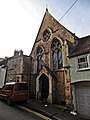
 Banwell Methodist church - geograph.org.uk - 6152203.jpg 3 296 × 2 472 ; 3,57 Mio
-
 Banwell old fire station - geograph.org.uk - 1617990.jpg 640 × 427 ; 88 kio
-
 Banwell Pebble Summerhouse - geograph.org.uk - 2074261.jpg 1 153 × 800 ; 258 kio
-
 Banwell Plain surrounding woodland - geograph.org.uk - 1963223.jpg 778 × 519 ; 116 kio
-
 Banwell Recreation Ground - geograph.org.uk - 6148284.jpg 3 296 × 2 472 ; 3,57 Mio
-
 Banwell Road - geograph.org.uk - 5655212.jpg 1 024 × 768 ; 209 kio
-
 Banwell Tower (geograph 2074254).jpg 1 152 × 1 536 ; 424 kio
-
 Banwell Tower - geograph.org.uk - 5787255.jpg 2 689 × 3 971 ; 5,39 Mio
-
 Banwell Tower.JPG 1 415 × 2 258 ; 613 kio
-
 Banwell Village Hall - geograph.org.uk - 6148288.jpg 3 296 × 2 472 ; 3,41 Mio
-
 Banwellcaves.jpg 640 × 480 ; 132 kio
-
 Beard's Stone, near Banwell, Somerset - geograph.org.uk - 5684692.jpg 2 298 × 2 540 ; 5,28 Mio
-
 Benchmark Barn - geograph.org.uk - 5668000.jpg 1 024 × 768 ; 184 kio
-
 Benchmark in East Street - geograph.org.uk - 6147420.jpg 3 296 × 2 472 ; 3,47 Mio
-
 Bow bridge-2 - panoramio.jpg 2 272 × 3 408 ; 4,35 Mio
-
 Bowling club, Banwell - geograph.org.uk - 5655886.jpg 1 024 × 768 ; 161 kio
-
 Box Bush Lane from Puxton Road - geograph.org.uk - 3505635.jpg 640 × 480 ; 102 kio
-
 Boxing Day Duck Race on River Banwell - geograph.org.uk - 5644398.jpg 3 456 × 4 608 ; 903 kio
-
 Brewers Arms, Banwell - geograph.org.uk - 5357112.jpg 4 896 × 3 672 ; 6,06 Mio
-
 Bridewell Lane bridge over M5 - geograph.org.uk - 4739404.jpg 640 × 475 ; 55 kio
-
 Bridewell Lane Bridge over the M5 - geograph.org.uk - 6127934.jpg 800 × 533 ; 623 kio
-
 Bridge for track at Whitley Head over M5 - geograph.org.uk - 2685232.jpg 640 × 480 ; 42 kio
-
 Bridge over the M5 near Barnwell - geograph.org.uk - 6127964.jpg 800 × 534 ; 634 kio
-
 Bridge over the River Banwell at Waterloo Farm - geograph.org.uk - 2418557.jpg 3 072 × 2 304 ; 4,95 Mio
-
 Bridges of Junction 21 of M5 - geograph.org.uk - 2686398.jpg 800 × 600 ; 302 kio
-
 Buildings at Cannaway Farm - geograph.org.uk - 5667996.jpg 1 024 × 768 ; 278 kio
-
 Cannaways Farm - geograph.org.uk - 5667573.jpg 1 024 × 768 ; 242 kio
-
 Cattle graze in a roadside field near Hewish - geograph.org.uk - 3037822.jpg 640 × 463 ; 82 kio
-
 Chapel on Church Street - geograph.org.uk - 5655911.jpg 768 × 1 024 ; 166 kio
-
 Church Street - geograph.org.uk - 5655891.jpg 1 024 × 768 ; 125 kio
-
 Corrugated iron barn at Laurel Farm - geograph.org.uk - 5668201.jpg 1 024 × 796 ; 187 kio
-
 Corrugated iron barn, west of Max Mill Lane - geograph.org.uk - 5656044.jpg 1 024 × 768 ; 144 kio
-
 Cottages at Box Bush Farm - geograph.org.uk - 5668445.jpg 1 024 × 824 ; 209 kio
-
-
 Cowslip Lane near Hewish - geograph.org.uk - 3037843.jpg 640 × 412 ; 64 kio
-
 Derelict buildings, below Banwell Hill - geograph.org.uk - 5655202.jpg 1 024 × 768 ; 206 kio
-
 Derelict buildings, below Banwell Hill - geograph.org.uk - 5655204.jpg 1 024 × 768 ; 265 kio
-
 Direction Sign - Signpost by the A371, Banwell Parish - geograph.org.uk - 6043764.jpg 1 185 × 1 805 ; 221 kio
-

-

-
 Double Rainbow near Banwell - geograph.org.uk - 4643800.jpg 4 896 × 3 672 ; 6,12 Mio
-
 Drainage channel near Weston-super-Mare - geograph.org.uk - 3040426.jpg 640 × 545 ; 134 kio
-
 Drainage ditch or rhyne adjacent to The Poplars driveway - geograph.org.uk - 2418921.jpg 3 072 × 2 304 ; 4,47 Mio
-
 Driveway to Gilbert Lodge - geograph.org.uk - 5655748.jpg 1 024 × 768 ; 149 kio
-
 Ducks Racing on River Banwell - geograph.org.uk - 5644400.jpg 3 456 × 4 608 ; 1 022 kio
-
 East Street entering Banwell - geograph.org.uk - 3044411.jpg 1 024 × 483 ; 121 kio
-
 East Street, Banwell - geograph.org.uk - 6147409.jpg 3 296 × 2 472 ; 3,47 Mio
-

-
 Entrance to The Poplars, East Rolstone - geograph.org.uk - 2139065.jpg 4 000 × 3 000 ; 3,22 Mio
-

-
 Faded signs by the old pump - geograph.org.uk - 6149653.jpg 3 296 × 2 472 ; 3,5 Mio
-
 Farm at the end of Box Bush Lane - geograph.org.uk - 5668443.jpg 1 024 × 809 ; 212 kio
-
 Farmhouse (^), West Rolstone Rd, Rolstone - geograph.org.uk - 2136739.jpg 3 296 × 2 472 ; 1,87 Mio
-
 Farmland and woodland beside the M5 - geograph.org.uk - 4360238.jpg 640 × 420 ; 48 kio
-
 Farmland, south of Havage Drove - geograph.org.uk - 5668440.jpg 1 024 × 768 ; 213 kio
-
 Fertile grazing pasture beside the River Banwell - geograph.org.uk - 2419002.jpg 3 072 × 2 304 ; 2,7 Mio
-
 Field boundary at Park Farm on Wolvers Hill Road - geograph.org.uk - 2419895.jpg 3 072 × 2 304 ; 4 Mio
-
 Field, east of 'Riverside' - geograph.org.uk - 5668013.jpg 1 024 × 768 ; 218 kio
-
 Field, east of 'Riverside' - geograph.org.uk - 5668171.jpg 1 024 × 802 ; 237 kio
-
 Fly tipping on Silver Moor Lane - geograph.org.uk - 5668001.jpg 1 024 × 803 ; 233 kio
-
 Grumble Pill Rhyne -What a Lovely Name for a Ditch^ - geograph.org.uk - 2420004.jpg 3 072 × 2 304 ; 4,69 Mio
-
 Havage Drove - geograph.org.uk - 5657868.jpg 1 024 × 765 ; 169 kio
-
 Havage Drove - geograph.org.uk - 5668439.jpg 1 024 × 820 ; 303 kio
-
 Havage Drove, near Nye - geograph.org.uk - 2139027.jpg 4 000 × 3 000 ; 2,38 Mio
-
 High water - geograph.org.uk - 6149664.jpg 2 472 × 3 296 ; 3,45 Mio
-
 Hillend Road near Devils Elbow Farm - geograph.org.uk - 3504025.jpg 640 × 480 ; 100 kio
-
 Horse paddock in West Rolstone Road near to The Laurels - geograph.org.uk - 2418910.jpg 3 072 × 2 304 ; 3,25 Mio
-
 House at Knightcott - geograph.org.uk - 5655178.jpg 1 024 × 800 ; 174 kio
-
 House at Rolstone Manor Farm - geograph.org.uk - 2630383.jpg 640 × 480 ; 78 kio
-
 House on East Street - geograph.org.uk - 5655913.jpg 1 024 × 791 ; 160 kio
-
 House on Puxton Road - geograph.org.uk - 5668219.jpg 1 024 × 797 ; 168 kio
-
 House on Well Lane - geograph.org.uk - 5655181.jpg 1 024 × 830 ; 183 kio
-
 House on Wint Hill - geograph.org.uk - 5655750.jpg 1 024 × 768 ; 201 kio
-
 Houses on 'Riverside' - geograph.org.uk - 5668007.jpg 1 024 × 768 ; 138 kio
-
 Interior, St Andrew's church, Banwell - geograph.org.uk - 5655896.jpg 1 024 × 768 ; 190 kio
-
 Jubilee gate to St Andrews - geograph.org.uk - 6152187.jpg 2 472 × 3 296 ; 3,35 Mio
-
 Junction 21 on the M5, southbound - geograph.org.uk - 1326011.jpg 640 × 480 ; 178 kio
-
 Junction 21, M5 Motorway - geograph.org.uk - 3449136.jpg 1 024 × 725 ; 145 kio
-
 Junction of Puxton Rd and West Rolstone Rd - geograph.org.uk - 2139064.jpg 4 000 × 3 000 ; 3,24 Mio
-
 Land Farm off Puxton Road - geograph.org.uk - 3505582.jpg 640 × 480 ; 102 kio
-
 Laurel Farm on Puxton Road - geograph.org.uk - 3505646.jpg 640 × 480 ; 104 kio
-
 Looking across Banwell Castle grounds - geograph.org.uk - 1126181.jpg 640 × 480 ; 88 kio
-
 Looking down from High Street - geograph.org.uk - 6148293.jpg 2 472 × 3 296 ; 3,31 Mio
-
 Looking up Hillpath - geograph.org.uk - 6148296.jpg 3 296 × 2 472 ; 3,44 Mio
-
 Lower Gout Farm - geograph.org.uk - 5668177.jpg 1 024 × 762 ; 173 kio
-
 Lower Gout Farm, near Banwell - geograph.org.uk - 2139063.jpg 4 000 × 3 000 ; 2,72 Mio
-
 M5 58 miles to Exeter - geograph.org.uk - 4677059.jpg 2 256 × 1 496 ; 738 kio
-
 M5 approaches Junction 20 - geograph.org.uk - 3180202.jpg 3 480 × 2 502 ; 1,23 Mio
-
 M5 descends to the Lox Yeo valley - geograph.org.uk - 4677076.jpg 2 256 × 1 496 ; 883 kio
-
 M5 east of Devil's Elbow Farm - geograph.org.uk - 3180233.jpg 3 250 × 2 428 ; 1,09 Mio
-
 M5 east of Manor Farm - geograph.org.uk - 3181443.jpg 3 648 × 2 736 ; 1,55 Mio
-
 M5 footbridge east of Laurel Farm - geograph.org.uk - 3180211.jpg 3 324 × 2 473 ; 1,61 Mio
-
 M5 in shallow cutting through Woolvers Hill - geograph.org.uk - 2686390.jpg 800 × 600 ; 331 kio
-
 M5 junction 21 - geograph.org.uk - 4739421.jpg 640 × 463 ; 62 kio
-
 M5 Motorway Northbound, Exit 21 - geograph.org.uk - 2625091.jpg 640 × 459 ; 77 kio
-

-
 M5 Motorway, from Bridewell Lane - geograph.org.uk - 5655206.jpg 1 024 × 806 ; 178 kio
-
 M5 near Hillend - geograph.org.uk - 4739409.jpg 640 × 440 ; 57 kio
-
 M5 near Junction 21 - geograph.org.uk - 4676408.jpg 2 256 × 1 496 ; 892 kio
-
 M5 near Locking - geograph.org.uk - 2302109.jpg 2 423 × 1 596 ; 3,24 Mio
-
 M5 near RAF Locking - geograph.org.uk - 4677063.jpg 2 256 × 1 496 ; 890 kio
-
 M5 near St Georges - geograph.org.uk - 2302129.jpg 2 371 × 1 526 ; 2,7 Mio
-
 M5 northbound about to go under the A371 - geograph.org.uk - 1654061.jpg 640 × 480 ; 78 kio
-
 M5 northbound approaching junction 21 - geograph.org.uk - 1654064.jpg 640 × 480 ; 86 kio
-
 M5 on the Somerset levels - geograph.org.uk - 3241484.jpg 640 × 255 ; 24 kio
-
 M5 south of footbridge at Woolvers Hill - geograph.org.uk - 4739419.jpg 640 × 393 ; 112 kio
-
 M5 southbound exit slip road at Junction 21 - geograph.org.uk - 3046022.jpg 1 024 × 647 ; 87 kio
-
 M5 Southbound Junction 21 - geograph.org.uk - 1450722.jpg 640 × 480 ; 143 kio
-
 M5 southbound near Banwell - geograph.org.uk - 4677068.jpg 2 256 × 1 496 ; 877 kio
-
 M5 southbound near Hillend - geograph.org.uk - 3086463.jpg 1 024 × 589 ; 74 kio
-
 M5 Wolvershill Road overbridge - geograph.org.uk - 3180218.jpg 3 648 × 2 736 ; 1,63 Mio
-
 M5, Bridewell Lane Bridge - geograph.org.uk - 3322722.jpg 640 × 430 ; 36 kio
-
 Main entrance, Puxton Park - geograph.org.uk - 4632885.jpg 1 024 × 770 ; 89 kio
-
 Meadows Restaurant, Puxton Park - geograph.org.uk - 2129245.jpg 800 × 600 ; 327 kio
-
 Meanders on the Lox Yeo River - geograph.org.uk - 5656036.jpg 1 024 × 768 ; 305 kio
-
 Moor Dairy, Moor Road - geograph.org.uk - 2482333.jpg 640 × 480 ; 59 kio
-

-
 No dogs for St Andrew - geograph.org.uk - 6147439.jpg 2 472 × 3 296 ; 3,77 Mio
-
 North Somerset , M5 Junction 21 - geograph.org.uk - 2392335.jpg 3 264 × 2 448 ; 3,23 Mio
-
 North Somerset , M5 Motorway - geograph.org.uk - 3722834.jpg 4 218 × 2 740 ; 5,73 Mio
-
 North Somerset , M5 Motorway - geograph.org.uk - 3722835.jpg 4 288 × 2 848 ; 4,81 Mio
-
 North Somerset , M5 Motorway - geograph.org.uk - 3722836.jpg 4 288 × 2 848 ; 5,75 Mio
-
 North Somerset , M5 Motorway - geograph.org.uk - 5951210.jpg 6 000 × 4 000 ; 6,38 Mio
-
 North Somerset , M5 Motorway - geograph.org.uk - 5951214.jpg 6 000 × 4 000 ; 6,66 Mio
-
 North Somerset , M5 Motorway - geograph.org.uk - 5951216.jpg 6 000 × 4 000 ; 7,08 Mio
-
 North Somerset , M5 Motorway - geograph.org.uk - 5951217.jpg 6 000 × 4 000 ; 3,84 Mio
-
 North Somerset , M5 Motorway - geograph.org.uk - 5951219.jpg 6 000 × 4 000 ; 5,99 Mio
-
 North Somerset , M5 Motorway Northbound - geograph.org.uk - 2793918.jpg 4 288 × 2 848 ; 4,8 Mio
-
 North Somerset , M5 Motorway Southbound - geograph.org.uk - 2795471.jpg 4 288 × 2 848 ; 4,42 Mio
-
 North Somerset , M5 Motorway Southbound - geograph.org.uk - 2795472.jpg 4 288 × 2 848 ; 4,43 Mio
-
 North Somerset , M5 Motorway Southbound - geograph.org.uk - 2795473.jpg 4 288 × 2 848 ; 4,43 Mio
-
 North Somerset , M5 Motorway Southbound - geograph.org.uk - 3321868.jpg 4 288 × 2 848 ; 4,29 Mio
-
 North Somerset , The M5 Motorway - geograph.org.uk - 3904264.jpg 4 538 × 3 360 ; 3,28 Mio
-
 Northbound M5 towards Junction 21 - geograph.org.uk - 6127980.jpg 800 × 534 ; 662 kio
-
 Old tiles on Church Street - geograph.org.uk - 6147694.jpg 2 472 × 3 296 ; 3,43 Mio
-
 Old Yeo Rhyne - geograph.org.uk - 5667997.jpg 1 024 × 768 ; 254 kio
-

-

-
 Ordnance Survey Cut Mark - geograph.org.uk - 4866041.jpg 480 × 640 ; 94 kio
-
 Ponies and their foals grazing in Summer Lane - geograph.org.uk - 2419905.jpg 3 072 × 2 304 ; 4,11 Mio
-
 Poplar Piggeries - geograph.org.uk - 2630378.jpg 640 × 433 ; 53 kio
-
 Poplar Piggeries - geograph.org.uk - 5668212.jpg 1 024 × 793 ; 127 kio
-
 Postbox in A370 layby near Weston-super-Mare - geograph.org.uk - 3040362.jpg 640 × 539 ; 118 kio
-
 Puxton Lane - geograph.org.uk - 5657877.jpg 1 024 × 794 ; 192 kio
-
 Puxton Rd East Rolstone - geograph.org.uk - 2630369.jpg 640 × 480 ; 105 kio
-
 Puxton Road from May's Green Lane - geograph.org.uk - 3505542.jpg 480 × 640 ; 127 kio
-

-
 Pylon with cows near Poplar Farm - geograph.org.uk - 2418496.jpg 2 304 × 3 072 ; 2,3 Mio
-
 Regulating the drink - geograph.org.uk - 6147794.jpg 2 472 × 3 296 ; 3,25 Mio
-
 Rhyne near South Farm - geograph.org.uk - 2630351.jpg 640 × 480 ; 131 kio
-
 Rhyne, Rolstone - geograph.org.uk - 2455561.jpg 640 × 480 ; 148 kio
-
 Rhynes near South Farm - geograph.org.uk - 2630344.jpg 640 × 480 ; 106 kio
-
 River Banwell - geograph.org.uk - 5668012.jpg 1 024 × 768 ; 200 kio
-
 Riverside (road) at Lower Gout Farm - geograph.org.uk - 3505660.jpg 640 × 480 ; 95 kio
-
 Riverside (road) Banwell - geograph.org.uk - 3505676.jpg 640 × 480 ; 108 kio
-
 Riverside, Banwell - geograph.org.uk - 2139060.jpg 4 000 × 3 000 ; 2,96 Mio
-
 Road 'Riverside' - geograph.org.uk - 5475052.jpg 4 896 × 3 672 ; 6,56 Mio
-
 Roundabout at junction 21 on the M5 - geograph.org.uk - 4520106.jpg 1 920 × 1 286 ; 628 kio
-
 Scrapyard in Riverside Road for rent or lease - geograph.org.uk - 2418955.jpg 3 072 × 2 304 ; 3,11 Mio
-
 Sheep grazing at Rhodyate Farm - geograph.org.uk - 5656034.jpg 1 024 × 770 ; 152 kio
-
 Silver Moor Lane - geograph.org.uk - 3044414.jpg 1 024 × 607 ; 119 kio
-
 Silver Moor Lane near Weston-super-Mare - geograph.org.uk - 3040383.jpg 640 × 427 ; 86 kio
-
 Simmental cattle, Wolverhill Batch - geograph.org.uk - 2456115.jpg 640 × 462 ; 67 kio
-
 Site of Roman Building on Wint Hill - geograph.org.uk - 5655755.jpg 1 024 × 768 ; 231 kio
-
 Site of Roman Building on Wint Hill - geograph.org.uk - 5655756.jpg 1 024 × 768 ; 208 kio
-
 Slip road at Junction 21 M5 northbound - geograph.org.uk - 1875607.jpg 640 × 480 ; 80 kio


_-_geograph.org.uk_-_3505668.jpg)


.jpg)


,_West_Rolstone_Rd,_Rolstone_-_geograph.org.uk_-_2136739.jpg)


.jpg)


_at_Lower_Gout_Farm_-_geograph.org.uk_-_3505660.jpg)
_Banwell_-_geograph.org.uk_-_3505676.jpg)


