Category:Barcheston
Aller à la navigation
Aller à la recherche
village britannique | |||||
| Téléverser des médias | |||||
| Nature de l’élément | |||||
|---|---|---|---|---|---|
| Lieu | Stratford-on-Avon, Warwickshire, Midlands de l'Ouest, Angleterre | ||||
| Population |
| ||||
| Superficie |
| ||||
 | |||||
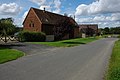
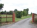
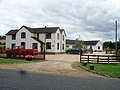
English: Barcheston is a village and civil parish in the Stratford district of Warwickshire, England. It is on the east bank of the River Stour, opposite Shipston-on-Stour. According to the 2001 census it had a population of 134.
Sous-catégories
Cette catégorie comprend 2 sous-catégories, dont les 2 ci-dessous.
B
W
- Willington arms (14 F)
Média dans la catégorie « Barcheston »
Cette catégorie comprend 107 fichiers, dont les 107 ci-dessous.
-
 Across the field - geograph.org.uk - 2024119.jpg 4 288 × 3 216 ; 3,31 Mio
-
 Across the field - geograph.org.uk - 2025710.jpg 4 288 × 3 216 ; 4,64 Mio
-
 Across the road - geograph.org.uk - 1671798.jpg 4 000 × 3 000 ; 3,05 Mio
-
 Afternoon tea break^ - geograph.org.uk - 1994641.jpg 4 000 × 3 000 ; 2,86 Mio
-
 Along the hedge - geograph.org.uk - 1994637.jpg 4 000 × 3 000 ; 3,98 Mio
-
 Avenue - geograph.org.uk - 84181.jpg 640 × 482 ; 255 kio
-
 B 4035 - geograph.org.uk - 4412636.jpg 640 × 428 ; 94 kio
-
 B4035 near Borough Hill Farm - geograph.org.uk - 1854698.jpg 640 × 480 ; 85 kio
-
 B4035 near Borough Hill Farm - geograph.org.uk - 6289818.jpg 800 × 600 ; 109 kio
-
 Barcheston Ground Farm - geograph.org.uk - 1994649.jpg 4 000 × 3 000 ; 3,37 Mio
-
 Barcheston Grounds Farm - geograph.org.uk - 5430141.jpg 1 600 × 1 086 ; 534 kio
-
 Barcheston-Manor Farm - geograph.org.uk - 5430116.jpg 1 600 × 1 200 ; 529 kio
-
 Barn at Borough Hill Farm - geograph.org.uk - 1854702.jpg 640 × 480 ; 138 kio
-
 Barn conversions at Fell Mill Farm - geograph.org.uk - 509737.jpg 640 × 426 ; 100 kio
-
 Barns and house at Borough Hill Farm - geograph.org.uk - 1854713.jpg 640 × 480 ; 120 kio
-
 Barns near the cemetery - geograph.org.uk - 1709426.jpg 4 000 × 3 000 ; 1,49 Mio
-
 Base of a Medieval cross (geograph 7081168).jpg 1 600 × 1 069 ; 437 kio
-
 Borough Hill Farm - geograph.org.uk - 5430129.jpg 1 600 × 1 200 ; 559 kio
-
 Brick built barn, Borough Hill Farm - geograph.org.uk - 6289783.jpg 800 × 600 ; 134 kio
-
 Bridge Farm, Willington - geograph.org.uk - 1671782.jpg 4 000 × 3 000 ; 3,89 Mio
-
 Bridge over the Stour, Shipston-on-Stour - geograph.org.uk - 3563900.jpg 3 043 × 2 375 ; 1,59 Mio
-
 Bridleway to Famington Farm - geograph.org.uk - 5179385.jpg 640 × 480 ; 79 kio
-
 Bridleway to Famington Farm - geograph.org.uk - 5179386.jpg 640 × 480 ; 73 kio
-
 Bridleway to North Farm - geograph.org.uk - 5179387.jpg 640 × 480 ; 98 kio
-
 Detail of barn at Borough Hill Farm - geograph.org.uk - 1854704.jpg 640 × 480 ; 110 kio
-
 Distant view of Brailes Hill - geograph.org.uk - 1925241.jpg 2 000 × 1 504 ; 195 kio
-
 Double gate - geograph.org.uk - 2024271.jpg 4 288 × 3 216 ; 3,44 Mio
-
 Entrance drive to Knolland's Farm - geograph.org.uk - 1922285.jpg 2 000 × 1 500 ; 226 kio
-
 Farm driveway - geograph.org.uk - 1994618.jpg 4 000 × 3 000 ; 2,09 Mio
-
 Farmyard at Borough Hill Farm - geograph.org.uk - 1854710.jpg 640 × 480 ; 103 kio
-
 Fell Mill Lane towards Shipston-on-Stour - geograph.org.uk - 6289775.jpg 800 × 600 ; 115 kio
-
 Fell Mill Lane, Shipston-on-Stour - geograph.org.uk - 1925187.jpg 2 000 × 1 494 ; 204 kio
-
 Field east of Shipston-on-Stour - geograph.org.uk - 6289769.jpg 800 × 600 ; 109 kio
-
 Field edge footpath - geograph.org.uk - 1671791.jpg 640 × 480 ; 113 kio
-
 Field edge path - geograph.org.uk - 1671804.jpg 4 000 × 3 000 ; 3,14 Mio
-
 Field margin near Shipston - geograph.org.uk - 3575796.jpg 640 × 480 ; 84 kio
-
 Footpath meets road - geograph.org.uk - 2027432.jpg 4 288 × 3 216 ; 2,89 Mio
-
 Footpath to Roundhills Farm - geograph.org.uk - 1922260.jpg 2 000 × 1 496 ; 189 kio
-
 Frozen pond - geograph.org.uk - 1671761.jpg 4 000 × 3 000 ; 3,81 Mio
-
 Grave path - geograph.org.uk - 2024100.jpg 3 216 × 4 288 ; 5,3 Mio
-
 Grazing near Borough Hill Farm - geograph.org.uk - 6289815.jpg 5 184 × 3 888 ; 5,48 Mio
-
 Horse jumps - geograph.org.uk - 1994652.jpg 4 000 × 3 000 ; 3,21 Mio
-
 House at Famington Farm (geograph 7080519).jpg 1 600 × 1 069 ; 378 kio
-
 House near Barcheston Ground Farm - geograph.org.uk - 6290043.jpg 800 × 526 ; 81 kio
-
 In Barcheston - geograph.org.uk - 5231066.jpg 480 × 640 ; 62 kio
-
 In Willington - geograph.org.uk - 5231070.jpg 640 × 480 ; 64 kio
-
 Knolland's Cottages - geograph.org.uk - 1994621.jpg 4 000 × 3 000 ; 2,77 Mio
-
 Lay-by on the road to Honington - geograph.org.uk - 509734.jpg 640 × 426 ; 108 kio
-
 Long Meadow - geograph.org.uk - 1994616.jpg 4 000 × 3 000 ; 2,51 Mio
-
 Manor Farm, Barcheston - geograph.org.uk - 1671786.jpg 4 000 × 3 000 ; 2,68 Mio
-
 Manor Farm, Barcheston - geograph.org.uk - 2024103.jpg 4 288 × 3 216 ; 1,24 Mio
-
 Manor Farm, Willington - geograph.org.uk - 1671758.jpg 4 000 × 3 000 ; 3,32 Mio
-
 Manor Farm, Willington - geograph.org.uk - 5231072.jpg 640 × 480 ; 63 kio
-
 National Cycle Route 5 towards Willington - geograph.org.uk - 6289779.jpg 800 × 600 ; 65 kio
-
 Old water pump - geograph.org.uk - 2024114.jpg 3 216 × 4 288 ; 2,65 Mio
-
 Paddock gate - geograph.org.uk - 5635793.jpg 6 032 × 4 014 ; 5,67 Mio
-
 Paddocks near Knollands Farm - geograph.org.uk - 4412618.jpg 640 × 428 ; 79 kio
-
 Past the tree - geograph.org.uk - 1994645.jpg 4 000 × 3 000 ; 3,06 Mio
-
 Path to Brailes (after) - geograph.org.uk - 1994636.jpg 4 000 × 3 000 ; 4,48 Mio
-
 Path to Brailes (before) - geograph.org.uk - 1994633.jpg 4 000 × 3 000 ; 4,6 Mio
-
 Pig Brook Farm - geograph.org.uk - 1709434.jpg 640 × 480 ; 77 kio
-
 Recreation ground - geograph.org.uk - 2024184.jpg 4 288 × 3 216 ; 3,79 Mio
-
 Recycling depot - geograph.org.uk - 2024284.jpg 4 288 × 3 216 ; 2,75 Mio
-
 Ridge and furrow footpath - geograph.org.uk - 2023627.jpg 4 288 × 3 216 ; 6,68 Mio
-
 River bridge - geograph.org.uk - 2024296.jpg 4 288 × 3 216 ; 2,35 Mio
-
 Road junction and grass triangle - geograph.org.uk - 5364037.jpg 3 648 × 2 736 ; 2,87 Mio
-
 Road junction on Fell Mill Lane - geograph.org.uk - 6289773.jpg 800 × 600 ; 101 kio
-
 Rushing stream - geograph.org.uk - 1671762.jpg 640 × 480 ; 125 kio
-
 Shakespeare's Way - geograph.org.uk - 4762379.jpg 640 × 480 ; 78 kio
-
 Shakespeare's Way - geograph.org.uk - 4762851.jpg 640 × 480 ; 66 kio
-
 Shakespeare's Way - geograph.org.uk - 4762867.jpg 640 × 480 ; 94 kio
-
 Shakespeare's Way - geograph.org.uk - 5231063.jpg 640 × 480 ; 114 kio
-
 Shakespeare's Way - geograph.org.uk - 5231064.jpg 640 × 480 ; 52 kio
-
 Shakespeare's Way - geograph.org.uk - 5231065.jpg 640 × 480 ; 122 kio
-
 Shakespeare's Way - geograph.org.uk - 5231067.jpg 640 × 480 ; 55 kio
-
 Shakespeare's Way - geograph.org.uk - 5231068.jpg 640 × 480 ; 40 kio
-
 Shakespeare's Way - geograph.org.uk - 5231069.jpg 640 × 480 ; 64 kio
-
 Shipston Bridge over the Stour just outside Shipston-on-Stour - geograph.org.uk - 2036015.jpg 3 072 × 2 304 ; 3,77 Mio
-
 Shipston, River Stour - geograph.org.uk - 1953425.jpg 1 024 × 768 ; 214 kio
-
 Shipston-on-Stour, Mill Bridge - geograph.org.uk - 1953404.jpg 1 024 × 768 ; 207 kio
-
 Start of footpath - geograph.org.uk - 2024106.jpg 4 288 × 3 216 ; 2,82 Mio
-
 Start of footpath - geograph.org.uk - 2024303.jpg 4 288 × 3 216 ; 3,49 Mio
-
 Street scene, Willington - geograph.org.uk - 1671767.jpg 4 000 × 3 000 ; 2,12 Mio
-
 Tap on the green - geograph.org.uk - 234420.jpg 640 × 480 ; 94 kio
-
 The road to Shipston - geograph.org.uk - 1994631.jpg 4 000 × 3 000 ; 2,98 Mio
-
 The way to Tushbrook Paddocks - geograph.org.uk - 1994626.jpg 4 000 × 3 000 ; 3,62 Mio
-
 There's a footpath in here somewhere - geograph.org.uk - 1925254.jpg 2 000 × 1 504 ; 246 kio
-
 Through the green tunnel - geograph.org.uk - 2024309.jpg 4 288 × 3 216 ; 3,49 Mio
-
 Through the hedge - geograph.org.uk - 1994654.jpg 4 000 × 3 000 ; 3,95 Mio
-
 Through the hedge - geograph.org.uk - 2024170.jpg 4 288 × 3 216 ; 2,88 Mio
-
 Towards Brailes - geograph.org.uk - 1994639.jpg 4 000 × 3 000 ; 3,14 Mio
-
 Towards Burmington - geograph.org.uk - 5231074.jpg 640 × 480 ; 37 kio
-
 Towards Burmington - geograph.org.uk - 5231075.jpg 480 × 640 ; 123 kio
-
 Tree planted verge - geograph.org.uk - 5635795.jpg 6 032 × 4 014 ; 7,5 Mio
-
 Two bridges - geograph.org.uk - 2023615.jpg 4 288 × 3 216 ; 3,17 Mio
-
 Victorian post box - geograph.org.uk - 1671764.jpg 3 000 × 4 000 ; 3,94 Mio
-
 View north near top of Borough Hill - geograph.org.uk - 1925221.jpg 2 000 × 1 499 ; 222 kio
-
 View NW from Fell Mill Lane, Shipston-on-Stour - geograph.org.uk - 1922237.jpg 2 000 × 1 504 ; 207 kio
-
 View south near top of Borough Hill - geograph.org.uk - 1925224.jpg 2 000 × 1 498 ; 225 kio
-
 View toward Willington - geograph.org.uk - 5635791.jpg 6 032 × 4 014 ; 5,55 Mio
-
 View west from lane to Willington - geograph.org.uk - 3527096.jpg 2 000 × 1 500 ; 487 kio
-
 Warwickshire farmland - geograph.org.uk - 2023642.jpg 4 288 × 3 216 ; 5,01 Mio
-
 Barn conversion on Cherington Hill - geograph.org.uk - 205281.jpg 640 × 480 ; 51 kio
-
 Footpath and Famington Farm - geograph.org.uk - 313160.jpg 640 × 480 ; 126 kio
-
 Looking up Brailes Hill - geograph.org.uk - 313159.jpg 640 × 480 ; 116 kio
-
 Under Brailes Hill - geograph.org.uk - 313158.jpg 640 × 480 ; 105 kio
-
 View of Borough Hill - geograph.org.uk - 181560.jpg 640 × 480 ; 49 kio


.jpg)


.jpg)


_-_geograph.org.uk_-_1994636.jpg)
_-_geograph.org.uk_-_1994633.jpg)


