Category:Barmby on the Marsh
Vai alla navigazione
Vai alla ricerca
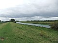
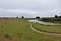
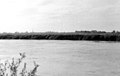
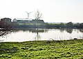
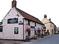
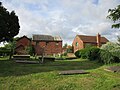
English: Barmby on the Marsh is a village and civil parish in the East Riding of Yorkshire, England. It is situated approximately 4 miles (6.4 km) west of the market town of Howden. It lies on the east bank of the River Ouse (and facing North Yorkshire over it), near its confluence with the River Derwent.
village in the United Kingdom  | |||||
| Carica un file multimediale | |||||
| Istanza di | |||||
|---|---|---|---|---|---|
| Luogo | East Riding of Yorkshire, Yorkshire e Humber, Inghilterra | ||||
 | |||||
Sottocategorie
Questa categoria contiene le 4 sottocategorie indicate di seguito, su un totale di 4.
File nella categoria "Barmby on the Marsh"
Questa categoria contiene 200 file, indicati di seguito, su un totale di 218.
(pagina precedente) (pagina successiva)-
 "The King's Head" - Barmby on the Marsh - geograph.org.uk - 3921767.jpg 2 427 × 1 734; 741 KB
-
 A bridleway near Loftsome Bridge (geograph 2509970).jpg 800 × 600; 225 KB
-

-
-
 A view of Rusholme Hall - geograph.org.uk - 3921831.jpg 2 592 × 1 944; 2,05 MB
-
 Abutment for dismantled railway bridge across the River Ouse - geograph.org.uk - 3436038.jpg 4 000 × 2 248; 1,89 MB
-
 Across the Ouse to Long Drax - geograph.org.uk - 1987085.jpg 3 210 × 1 863; 1,03 MB
-
 Across the River Ouse - geograph.org.uk - 3436032.jpg 4 000 × 2 248; 2,03 MB
-
 Across the river to Rusholme Grange - geograph.org.uk - 6205832.jpg 1 600 × 1 200; 495 KB
-
 Autumn cruise on the River Ouse - geograph.org.uk - 70599.jpg 640 × 480; 161 KB
-
 Bankfield Lane - geograph.org.uk - 1257379.jpg 640 × 412; 54 KB
-
 Bankfield Lane - geograph.org.uk - 1257386.jpg 640 × 480; 73 KB
-
 Bankfield Lane, Barmby on the Marsh - geograph.org.uk - 3921836.jpg 1 944 × 2 592; 1,9 MB
-
 Barmby - geograph.org.uk - 202867.jpg 640 × 479; 51 KB
-
 Barmby Barage - geograph.org.uk - 3568895.jpg 640 × 427; 75 KB
-
 Barmby Barrage - Derwent side - geograph.org.uk - 2982789.jpg 640 × 426; 161 KB
-
 Barmby Barrage - geograph.org.uk - 1987072.jpg 2 448 × 3 264; 1,54 MB
-
 Barmby Barrage - geograph.org.uk - 1987077.jpg 2 998 × 1 632; 1 016 KB
-
 Barmby Barrage - geograph.org.uk - 202863.jpg 640 × 479; 41 KB
-
 Barmby Barrage - geograph.org.uk - 3351887.jpg 640 × 424; 123 KB
-
 Barmby barrage - geograph.org.uk - 6127784.jpg 1 024 × 683; 387 KB
-
 Barmby Barrage - geograph.org.uk - 6127787.jpg 1 024 × 683; 496 KB
-
 Barmby Barrage - geograph.org.uk - 6205820.jpg 1 600 × 1 200; 459 KB
-
 Barmby Barrage - Ouse side - geograph.org.uk - 2982782.jpg 640 × 426; 184 KB
-
 Barmby Barrage and Drax - geograph.org.uk - 3351891.jpg 640 × 427; 141 KB
-

-
 Barmby Cutting - geograph.org.uk - 576980.jpg 640 × 480; 143 KB
-
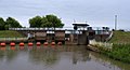
 Barmby Lock - geograph.org.uk - 6284230.jpg 1 280 × 851; 420 KB
-
 Barmby Marsh water treatment works (geograph 2324590).jpg 1 600 × 1 200; 306 KB
-
 Barmby Marsh Water Treatment Works (geograph 2638473).jpg 3 264 × 2 448; 1,95 MB
-
 Barmby Marsh Water Treatment Works (geograph 3435946).jpg 4 000 × 2 248; 1,9 MB
-
 Barmby Marsh water treatment works. - geograph.org.uk - 537295.jpg 640 × 346; 58 KB
-
 Barmby on the Marsh - geograph.org.uk - 202870.jpg 640 × 479; 52 KB
-
 Barmby on The Marsh - geograph.org.uk - 3568766.jpg 640 × 427; 77 KB
-
 Barmby on the Marsh school.jpg 598 × 405; 123 KB
-
 Barmby on the Marsh UK parish locator map.svg 1 425 × 1 107; 1,68 MB
-
 Barmby on the Marsh, Methodist Church - geograph.org.uk - 224339.jpg 432 × 285; 16 KB
-
 Barmby railway station 1760114.jpg 640 × 356; 105 KB
-
 Barmby Tidal barrage, from the River Ouse - geograph.org.uk - 5132362.jpg 1 024 × 768; 174 KB
-
 Barmby Tidal Barrier - geograph.org.uk - 5885528.jpg 1 024 × 768; 157 KB
-
 Barn, South Street, Barmby on the Marsh - geograph.org.uk - 5408977.jpg 1 024 × 795; 163 KB
-
 Beside the River Ouse - geograph.org.uk - 3436027.jpg 4 000 × 2 248; 2,37 MB
-
 Between Barmby and Asselby - geograph.org.uk - 3568764.jpg 640 × 427; 75 KB
-
 Burr Wheel, River Ouse - geograph.org.uk - 5132290.jpg 1 024 × 768; 137 KB
-
 By the River Ouse - geograph.org.uk - 3436005.jpg 3 942 × 2 138; 1,6 MB
-
 Climate changer - geograph.org.uk - 5408703.jpg 1 024 × 768; 99 KB
-
 Clough Drain by Barmby Marsh Water Treatment Works - geograph.org.uk - 3435942.jpg 3 976 × 2 204; 1,35 MB
-
 Cooling towers across the Ouse - geograph.org.uk - 2981421.jpg 618 × 640; 182 KB
-
 Course of the former Hull and Barnsley Railway - geograph.org.uk - 5408983.jpg 1 024 × 768; 274 KB
-
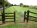 Different gate onto Trans Pennine Trail. - geograph.org.uk - 537259.jpg 640 × 480; 135 KB
-
 Disused railway line. - geograph.org.uk - 537351.jpg 640 × 433; 111 KB
-
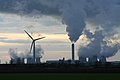
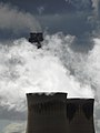 Drax Chimneys - geograph.org.uk - 3922159.jpg 1 944 × 2 592; 1,18 MB
-
 Drax Power Station from Barmby Barrage - geograph.org.uk - 3922148.jpg 2 534 × 1 810; 1,22 MB
-
 Energy infrastructure - Drax and pylons - geograph.org.uk - 3922166.jpg 2 490 × 1 868; 882 KB
-
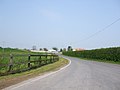 Entering Barmby on the Marsh - geograph.org.uk - 1257357.jpg 640 × 480; 43 KB
-

-
 Entering Barmby on the Marsh. - geograph.org.uk - 537438.jpg 640 × 480; 129 KB
-
 Farm equipment. - geograph.org.uk - 537442.jpg 640 × 480; 91 KB
-
 Farm track by Hither Great Field - geograph.org.uk - 5407348.jpg 1 024 × 768; 157 KB
-
 Farm track heading north near Barmby on the Marsh - geograph.org.uk - 2324530.jpg 1 600 × 1 200; 476 KB
-
 Farm track near Barmby on the Marsh - geograph.org.uk - 5408989.jpg 1 024 × 768; 152 KB
-
 Farm track to Asselby - geograph.org.uk - 5407352.jpg 1 024 × 768; 148 KB
-
 Farm Track to Fair Field Farm - geograph.org.uk - 1257412.jpg 640 × 480; 38 KB
-
 Farmland near Barmby on the Marsh - geograph.org.uk - 202874.jpg 640 × 479; 57 KB
-
 Farmland near Barmby on the Marsh - geograph.org.uk - 2324536.jpg 1 600 × 1 200; 340 KB
-
 Field boundary and parish boundary - geograph.org.uk - 5408999.jpg 1 024 × 768; 166 KB
-
 Field drain near Barmby on the Marsh - geograph.org.uk - 2324542.jpg 1 600 × 1 200; 426 KB
-
 Field of wheat - geograph.org.uk - 3568760.jpg 640 × 427; 81 KB
-
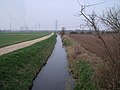
 Fields Drain - geograph.org.uk - 3351713.jpg 640 × 427; 180 KB
-
 Fields towards Loftsome Bridge - geograph.org.uk - 1257351.jpg 640 × 480; 37 KB
-
 Final meander - geograph.org.uk - 6127788.jpg 1 024 × 683; 450 KB
-
 Flood bank and private mooring - geograph.org.uk - 5407915.jpg 1 024 × 768; 157 KB
-
 Flooded field to the River Ouse - geograph.org.uk - 3861356.jpg 4 000 × 3 000; 2,93 MB
-
 Fog and Frost - geograph.org.uk - 698007.jpg 480 × 640; 71 KB
-
 Footpath and gate - geograph.org.uk - 5408778.jpg 1 024 × 768; 318 KB
-
 Footpath at Barmby on the Marsh - geograph.org.uk - 5408796.jpg 1 024 × 768; 218 KB
-
 Footpath beside the River Derwent - geograph.org.uk - 2324570.jpg 1 600 × 1 200; 395 KB
-
 Footpath beside the River Derwent heading south west - geograph.org.uk - 2324580.jpg 1 600 × 1 200; 487 KB
-
 Footpath into Barmby on the Marsh - geograph.org.uk - 5408758.jpg 1 024 × 768; 171 KB
-
 Footpath, Barmby on the Marsh - geograph.org.uk - 5885615.jpg 1 024 × 768; 178 KB
-
 Former National School, Barmby on the Marsh - geograph.org.uk - 5408856.jpg 1 024 × 768; 224 KB
-
 Gatefield Lane (track) heading south - geograph.org.uk - 2324547.jpg 1 600 × 1 200; 248 KB
-
 Gatefield Lane Track - geograph.org.uk - 1257399.jpg 640 × 432; 77 KB
-
 Gateland Field Lane - geograph.org.uk - 3861371.jpg 4 000 × 3 000; 2,71 MB
-
 Gateland Field Lane - geograph.org.uk - 6205828.jpg 1 600 × 1 200; 557 KB
-
 Gateland Field Lane and Lowfield Drain - geograph.org.uk - 3351797.jpg 640 × 427; 140 KB
-
 Glasshouses near Barmby - geograph.org.uk - 6127783.jpg 1 024 × 683; 456 KB
-
 Glasshouses. - geograph.org.uk - 537448.jpg 640 × 394; 75 KB
-

-
 Grazing land - geograph.org.uk - 3351820.jpg 640 × 450; 167 KB
-
 Greenhouses and bales - geograph.org.uk - 3568765.jpg 640 × 427; 54 KB
-
 Greenhouses near Barmby on the Marsh - geograph.org.uk - 202876.jpg 640 × 479; 60 KB
-

-
 High Street into Barmby on the Marsh - geograph.org.uk - 3861402.jpg 4 000 × 3 000; 1,99 MB
-
 Hither Great Field - geograph.org.uk - 3568759.jpg 640 × 427; 86 KB
-
 Hither Great Field Track - geograph.org.uk - 1257353.jpg 640 × 480; 65 KB
-
 Houses under construction at Barmby on the Marsh - geograph.org.uk - 5408764.jpg 1 024 × 768; 256 KB
-
 Jetty Walkway - geograph.org.uk - 3395657.jpg 3 924 × 2 887; 2,22 MB
-
 Lamb and Drax - geograph.org.uk - 202861.jpg 640 × 479; 61 KB
-
 Lock Gates and the river Derwent - geograph.org.uk - 3351897.jpg 640 × 427; 162 KB
-
 Lock gates, Barmby Barrage - geograph.org.uk - 1987097.jpg 2 448 × 3 264; 1,46 MB
-
 Lock gates, Barmby Tidal Barrage - geograph.org.uk - 5407965.jpg 1 024 × 768; 163 KB
-
 Lock with radial gates, Barmby Tidal Barrage - geograph.org.uk - 5132368.jpg 1 024 × 768; 155 KB
-
 Looking down the River Ouse - geograph.org.uk - 3395650.jpg 4 032 × 3 024; 3,13 MB
-
 Looking towards Barmby Marsh Water Treatment Station (geograph 3435962).jpg 3 970 × 2 194; 1,53 MB
-
 Looking towards Drax - geograph.org.uk - 3568770.jpg 640 × 427; 83 KB
-
 Low Field - geograph.org.uk - 3351822.jpg 640 × 572; 206 KB
-
 Lowfield Drain - geograph.org.uk - 3436023.jpg 4 000 × 2 248; 1,52 MB
-
 Lowfield Drain - geograph.org.uk - 3921832.jpg 1 944 × 2 592; 2,2 MB
-
 Lowfield Drain - geograph.org.uk - 5407297.jpg 1 024 × 768; 145 KB
-
 Lowfield Drain and pumphouse - geograph.org.uk - 3861379.jpg 4 000 × 3 000; 2,86 MB
-
 Lowfield Drain and pumphouse - geograph.org.uk - 4504148.jpg 800 × 533; 126 KB
-
 Lowfield Drain, near Asselby - geograph.org.uk - 2981609.jpg 640 × 468; 145 KB
-
 Marsh Drain over Barmby Marsh - geograph.org.uk - 3861411.jpg 4 000 × 3 000; 2,04 MB
-
 Meadows at Barmby on the Marsh - geograph.org.uk - 5407990.jpg 1 024 × 768; 122 KB
-
 Methodist chapel, Barmby - geograph.org.uk - 1987263.jpg 3 264 × 2 448; 1,6 MB
-

-
 National Transmission Service HP Gas pipeline crosses here - geograph.org.uk - 3436017.jpg 3 942 × 2 138; 1,64 MB
-
 Natives on the path by the Ouse - geograph.org.uk - 5885547.jpg 1 024 × 768; 187 KB
-
 North bank, River Ouse - geograph.org.uk - 5132120.jpg 1 024 × 768; 103 KB
-
 North bank, River Ouse - geograph.org.uk - 5132285.jpg 1 024 × 615; 104 KB
-
 North Street, Barmby on the Marsh - geograph.org.uk - 1987260.jpg 2 156 × 2 333; 939 KB
-
 Notice on Barmby Barrage - geograph.org.uk - 3861300.jpg 4 000 × 3 000; 2,35 MB
-
 On Holycroft Lane heading east - geograph.org.uk - 3921833.jpg 2 592 × 1 944; 1,64 MB
-
 On the bank by the River Derwent. - geograph.org.uk - 2448186.jpg 640 × 480; 51 KB
-
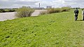
 On the Ouse floodbank - geograph.org.uk - 2448018.jpg 640 × 480; 52 KB
-
 Opening outer lock gates Derwent Tidal Barrier - geograph.org.uk - 3861288.jpg 4 000 × 3 000; 2,34 MB
-
 Ouse cruise - geograph.org.uk - 2982853.jpg 640 × 445; 215 KB
-
 Over fields to Barmby on the Marsh - geograph.org.uk - 4556107.jpg 4 000 × 3 000; 3,61 MB
-
 Oxen Stang Field, Barmby - geograph.org.uk - 576255.jpg 640 × 455; 72 KB
-
 Panoramic view from Bankfield Lane - geograph.org.uk - 3921835.jpg 3 934 × 1 080; 1,24 MB
-
 Path on the north bank of the Ouse - geograph.org.uk - 5885540.jpg 1 024 × 768; 198 KB
-
 Path to the Derwent Tidal Barrier - geograph.org.uk - 3395664.jpg 4 592 × 3 448; 4,6 MB
-
 Pontoon on River Derwent - geograph.org.uk - 1987063.jpg 3 264 × 2 448; 1,69 MB
-
 Poppies and pylon - geograph.org.uk - 1987296.jpg 1 202 × 1 600; 423 KB
-
 Potato field near Barmby on the Marsh - geograph.org.uk - 2981599.jpg 640 × 426; 187 KB
-
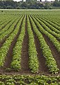 Potato fields near Barmby on the Marsh - geograph.org.uk - 2981595.jpg 455 × 640; 159 KB
-
 Power across the Ouse, near Drax - geograph.org.uk - 2981436.jpg 426 × 640; 220 KB
-
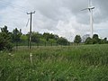
 Power lines - geograph.org.uk - 870092.jpg 640 × 480; 67 KB
-
 Power of different types - geograph.org.uk - 655935.jpg 640 × 427; 33 KB
-
 Pumphouse - southern end of Lowfield Drain - geograph.org.uk - 3922279.jpg 2 592 × 1 944; 1,99 MB
-
 Pylons, pylons and more pylons. - geograph.org.uk - 537276.jpg 637 × 640; 112 KB
-
 Railway Bridge crossed here - geograph.org.uk - 3861264.jpg 4 000 × 3 000; 3,56 MB
-
 Reed Bunting on Oil Seed Rape - geograph.org.uk - 4556126.jpg 2 669 × 2 000; 2,42 MB
-
 Riders approaching - geograph.org.uk - 3351771.jpg 640 × 467; 158 KB
-
 River banks and power station, near Drax - geograph.org.uk - 2981591.jpg 640 × 387; 198 KB
-
 River Derwent (geograph 5885590).jpg 1 024 × 768; 148 KB
-
 River Derwent - geograph.org.uk - 3435936.jpg 4 000 × 2 248; 2,06 MB
-
 River Derwent at Barmby - geograph.org.uk - 3568897.jpg 640 × 427; 73 KB
-
 River Derwent east of Barmby Barrage - geograph.org.uk - 3435929.jpg 4 000 × 2 248; 2,37 MB
-
 River Derwent embankment. - geograph.org.uk - 537287.jpg 640 × 346; 75 KB
-

-
 River Derwent flood defences - geograph.org.uk - 2324563.jpg 1 600 × 1 200; 244 KB
-
 River Derwent from the top of the flood bank - geograph.org.uk - 4556154.jpg 4 000 × 3 000; 3,32 MB
-

-
 River Derwent near Barmby on the Marsh - geograph.org.uk - 2324556.jpg 1 600 × 1 200; 339 KB
-
 River Derwent near Barmby on the Marsh - geograph.org.uk - 2324572.jpg 1 600 × 1 200; 208 KB
-
 River Derwent rather full - geograph.org.uk - 3861419.jpg 4 000 × 3 000; 2,53 MB
-
 River Derwent, above Barmby Barrage - geograph.org.uk - 6283517.jpg 1 280 × 851; 317 KB
-
 River Derwent, above Barmby Barrage - geograph.org.uk - 6283950.jpg 1 280 × 851; 343 KB
-

-
 River Ouse - geograph.org.uk - 2452971.jpg 640 × 407; 36 KB
-
 River Ouse - geograph.org.uk - 3436000.jpg 3 986 × 2 222; 1,77 MB
-
 River Ouse - geograph.org.uk - 5885533.jpg 1 024 × 768; 186 KB
-
 River Ouse, Long Drax - geograph.org.uk - 6284292.jpg 1 280 × 851; 448 KB
-
 River Ouse. - geograph.org.uk - 2448118.jpg 640 × 480; 103 KB
-
 Rivers Derwent and Ouse, Barmby Barrage - geograph.org.uk - 6283780.jpg 1 280 × 851; 373 KB
-
 Riverside Wharf on the River Ouse near Drax - geograph.org.uk - 3861342.jpg 4 000 × 3 000; 3,09 MB
-
 Rusholme Grange - geograph.org.uk - 3351714.jpg 640 × 459; 157 KB
-
 Rusholme Grange - geograph.org.uk - 3436011.jpg 3 960 × 2 172; 1,59 MB
-
 Rusholme Grange - geograph.org.uk - 5885552.jpg 1 024 × 768; 179 KB
-
 Rusholme Grange by the River Ouse - geograph.org.uk - 3921830.jpg 2 592 × 1 944; 1,49 MB
-
 Rusholme Grange Farm, near Drax - geograph.org.uk - 2981658.jpg 640 × 426; 159 KB
-
 Rusholme grange. - geograph.org.uk - 2448129.jpg 640 × 480; 102 KB
-
 Small house, giant cooling towers - geograph.org.uk - 4503350.jpg 800 × 533; 114 KB
-
 South Street ,Barmby on the Marsh - geograph.org.uk - 1259464.jpg 640 × 480; 77 KB
-
 South Street, Barmby - geograph.org.uk - 577439.jpg 640 × 446; 96 KB
-
 South Street, Barmby - geograph.org.uk - 577454.jpg 640 × 503; 138 KB
-
 South Street, Barmby on the Marsh - geograph.org.uk - 1987273.jpg 3 264 × 2 448; 1,93 MB
-
 South Street, Barmby on the Marsh - geograph.org.uk - 5408924.jpg 1 024 × 768; 243 KB
-
 South View, Barmby on the Marsh - geograph.org.uk - 1987131.jpg 2 860 × 1 773; 1,19 MB
-
 Spindly trees by Red Marsh Field - geograph.org.uk - 3921834.jpg 2 592 × 1 944; 2,65 MB
-
 Spring colour beside the River Ouse - geograph.org.uk - 4503348.jpg 800 × 533; 143 KB
-
 St. Helen's church, Barmby on the Marsh - geograph.org.uk - 5408917.jpg 1 024 × 768; 202 KB
-
 Stone carving over a church porch - geograph.org.uk - 3921837.jpg 2 351 × 1 881; 1,53 MB
-
 The Derwent at Barmby on the Marsh - geograph.org.uk - 1987060.jpg 3 237 × 1 632; 1,04 MB
-

-
 The Kings Head - geograph.org.uk - 1987125.jpg 2 787 × 2 066; 1 023 KB
-
 The Kings Head Barmby On the Marsh.jpg 598 × 405; 60 KB
-
 The Kings Head, Barmby on the Marsh - geograph.org.uk - 2509962.jpg 800 × 600; 289 KB
-
-
 The River Derwent and Drax Power Station (geograph 5314167).jpg 1 024 × 768; 101 KB
-
 The River Derwent and flood bank - geograph.org.uk - 5407762.jpg 1 024 × 768; 184 KB
-
 The River Derwent at Barmby Tidal Barrage - geograph.org.uk - 5407968.jpg 1 024 × 768; 107 KB
-
 The river Ouse floodbank. - geograph.org.uk - 2448010.jpg 480 × 640; 71 KB
-
 The River Ouse near Barmby on the Marsh - geograph.org.uk - 4504142.jpg 800 × 533; 160 KB
-
 The River Ouse near Rusholme - geograph.org.uk - 4504159.jpg 800 × 533; 122 KB
-
 The Trans Pennine Trail, Barmby - geograph.org.uk - 577461.jpg 459 × 640; 116 KB
-
 The Trans-Pennine Trail - geograph.org.uk - 3351720.jpg 640 × 427; 141 KB
-
 The Trans-Pennine Trail - geograph.org.uk - 3351768.jpg 640 × 427; 154 KB

.jpg)

.jpg)


.jpg)
.jpg)
.jpg)


_heading_south_-_geograph.org.uk_-_2324547.jpg)


.jpg)


.jpg)


.jpg)


.jpg)


