Category:Barnack
Aller à la navigation
Aller à la recherche
English: Barnack is a village and civil parish in the City of Peterborough unitary authority of Cambridgeshire, England. It is located in the north-west of the district, only four miles south-east from Stamford in Lincolnshire. According to the 2001 census, it had a population of 851 people.
localité britannique du comté anglais de Cambridgeshire  | |||||
| Téléverser des médias | |||||
| Nature de l’élément | |||||
|---|---|---|---|---|---|
| Lieu | City of Peterborough, Cambridgeshire, Angleterre de l'Est, Angleterre | ||||
| site officiel | |||||
 | |||||
Sous-catégories
Cette catégorie comprend 10 sous-catégories, dont les 10 ci-dessous.
B
- Barnack railway station (2 F)
- Barnack War Memorial (2 F)
H
- Barnack Hills and Holes (8 F)
J
O
- The Orangery, Barnack (4 F)
P
Média dans la catégorie « Barnack »
Cette catégorie comprend 378 fichiers, dont les 200 ci-dessous.
(page précédente) (page suivante)-
 "There But Not There" - Burghley House, Stamford - geograph.org.uk - 6006312.jpg 4 032 × 3 024 ; 3,49 Mio
-
 'Fire' in the Garden of Surprises - geograph.org.uk - 3501900.jpg 533 × 800 ; 90 kio
-
 23 and 24 Main Street, Barnack (geograph 6317067).jpg 1 024 × 768 ; 158 kio
-
 A clump of trees in a hedge - geograph.org.uk - 4398997.jpg 640 × 342 ; 41 kio
-
 A typical East Midlands country road - geograph.org.uk - 2444381.jpg 4 000 × 3 000 ; 4,05 Mio
-
 A typical East Midlands country road - geograph.org.uk - 2444471.jpg 4 000 × 3 000 ; 3,91 Mio
-
 A view over the lake in Burghley Park - geograph.org.uk - 6254124.jpg 4 032 × 3 024 ; 2,42 Mio
-
 A view over the lake in Burghley Park - geograph.org.uk - 6291712.jpg 4 000 × 3 000 ; 4,25 Mio
-
 A view towards The Boat House in Burghley Park - geograph.org.uk - 6253915.jpg 4 032 × 3 024 ; 2,37 Mio
-
 Along the Torpel Way - geograph.org.uk - 2432544.jpg 1 280 × 960 ; 647 kio
-
 Aluminium artwork near Burghley House - geograph.org.uk - 4664852.jpg 4 320 × 3 240 ; 5,08 Mio
-
 An exhibit at Burghley sculpture park - geograph.org.uk - 3988932.jpg 2 590 × 3 544 ; 5,41 Mio
-
 Ancient meadow in Barnack, Cambridgeshire - geograph.org.uk - 4263607.jpg 4 320 × 3 240 ; 5,42 Mio
-
 Anglo Saxon sundial, St John the Baptist church - geograph.org.uk - 3769901.jpg 2 256 × 1 504 ; 3,07 Mio
-
 Anglo-Saxon sundial - geograph.org.uk - 2750629.jpg 480 × 640 ; 108 kio
-
 Archway, School Road, Barnack (geograph 6316764).jpg 768 × 1 024 ; 245 kio
-
 B1443 at Pilsgate - geograph.org.uk - 2378152.jpg 640 × 480 ; 103 kio
-
 B1443 eastbound - geograph.org.uk - 5966562.jpg 640 × 480 ; 60 kio
-
 B1443 into Barnack - geograph.org.uk - 4007947.jpg 640 × 480 ; 66 kio
-
 Barnack - Hills and Holes (and moles) - geograph.org.uk - 4258254.jpg 4 320 × 3 240 ; 5,55 Mio
-
 Barnack - Hills and Holes nature reserve - geograph.org.uk - 4258241.jpg 4 320 × 3 240 ; 6,03 Mio
-
 Barnack cricket field - geograph.org.uk - 6316931.jpg 1 024 × 768 ; 172 kio
-
 Barnack Drift (road) - geograph.org.uk - 3764932.jpg 3 000 × 2 000 ; 5,43 Mio
-
 Barnack Drift south of Burghley Park, Stamford - geograph.org.uk - 3400586.jpg 4 320 × 3 240 ; 6,08 Mio
-
 Barnack Hills and Holes - geograph.org.uk - 6117331.jpg 1 920 × 1 280 ; 1,27 Mio
-
 Barnack Hills and Holes - Information board - geograph.org.uk - 4258517.jpg 4 320 × 3 240 ; 5,55 Mio
-
 Barnack Hills and Holes National Nature Reserve - geograph.org.uk - 4258231.jpg 4 320 × 3 240 ; 5,9 Mio
-
 Barnack Main Street - geograph.org.uk - 1867073.jpg 640 × 480 ; 114 kio
-
 Barnack Mill - geograph.org.uk - 204131.jpg 640 × 427 ; 46 kio
-
 Barnack Mill, Mill Farm (geograph 6921895).jpg 3 776 × 2 520 ; 4,18 Mio
-
 Barnack Windmill.jpg 442 × 640 ; 75 kio
-
 Barnack, St. John the Baptist Church - geograph.org.uk - 5182235.jpg 3 602 × 3 678 ; 6,51 Mio
-
 Barnack, St. John the Baptist Church, Aumbry in the chancel - geograph.org.uk - 5182423.jpg 3 700 × 3 678 ; 7,59 Mio
-

-

-

-

-
 Barnack, St. John the Baptist Church, Early c14th triple sedilia - geograph.org.uk - 5182395.jpg 3 901 × 2 738 ; 5,33 Mio
-
 Barnack, St. John the Baptist Church, Geoffrey de Barnake's tomb - geograph.org.uk - 5182368.jpg 4 602 × 2 918 ; 6,75 Mio
-
 Barnack, St. John the Baptist Church, Nave capital 1 - geograph.org.uk - 5182464.jpg 3 549 × 2 241 ; 3,77 Mio
-
 Barnack, St. John the Baptist Church, Nave capital 2 - geograph.org.uk - 5182471.jpg 3 895 × 2 716 ; 6,49 Mio
-
 Barnack, St. John the Baptist Church, Nave capital 3 - geograph.org.uk - 5182476.jpg 3 534 × 2 216 ; 4,15 Mio
-
 Barnack, St. John the Baptist Church, Nave capital 4 - geograph.org.uk - 5182482.jpg 3 634 × 2 376 ; 4,22 Mio
-
 Barnack, St. John the Baptist Church, Nave capital 5 - geograph.org.uk - 5182485.jpg 3 640 × 2 391 ; 4,89 Mio
-
 Barnack, St. John the Baptist Church, Nave capital 6 - geograph.org.uk - 5182491.jpg 3 678 × 2 456 ; 5,07 Mio
-
 Barnack, St. John the Baptist Church, Nave capital 7 - geograph.org.uk - 5182498.jpg 4 221 × 3 678 ; 7,58 Mio
-

-
 Barnack, St. John the Baptist Church, Poppy head 1 - geograph.org.uk - 5182316.jpg 4 864 × 3 160 ; 7,76 Mio
-
 Barnack, St. John the Baptist Church, Poppy head 2 - geograph.org.uk - 5182318.jpg 3 557 × 3 402 ; 5,58 Mio
-
 Barnack, St. John the Baptist Church, Poppy head 3 - geograph.org.uk - 5182322.jpg 3 635 × 3 678 ; 6,52 Mio
-
 Barnack, St. John the Baptist Church, Poppy head 4 - geograph.org.uk - 5182342.jpg 3 493 × 3 504 ; 7,3 Mio
-
 Barnack, St. John the Baptist Church, Poppy head 5 - geograph.org.uk - 5182350.jpg 3 576 × 3 678 ; 7,35 Mio
-
 Barnack, St. John the Baptist Church, Poppy head 6 - geograph.org.uk - 5182354.jpg 3 624 × 3 678 ; 6,54 Mio
-

-

-
 Barnack, St. John the Baptist Church, Saxon tower arch capital - geograph.org.uk - 5182506.jpg 3 503 × 2 151 ; 3,19 Mio
-
 Barnack, St. John the Baptist Church, Sedilia carving, devil's head - geograph.org.uk - 5182408.jpg 3 678 × 2 456 ; 4,79 Mio
-

-

-

-
 Barnack, St. John the Baptist Church, The altar 1 - geograph.org.uk - 5182309.jpg 4 403 × 2 888 ; 6,89 Mio
-
 Barnack, St. John the Baptist Church, The altar 2 - geograph.org.uk - 5182312.jpg 3 568 × 2 275 ; 4,07 Mio
-
 Barnack, St. John the Baptist Church, The early c13th font - geograph.org.uk - 5182253.jpg 3 650 × 3 566 ; 5,9 Mio
-
 Barnack, St. John the Baptist Church, The early c13th font - geograph.org.uk - 5182256.jpg 5 416 × 3 516 ; 6,92 Mio
-
 Barnack, St. John the Baptist Church, The early c13th font - geograph.org.uk - 5182258.jpg 3 620 × 2 365 ; 5,29 Mio
-
 Barnack, St. John the Baptist Church, The early c13th font - geograph.org.uk - 5182265.jpg 5 520 × 3 680 ; 7,76 Mio
-
 Barnack, St. John the Baptist Church, The early c13th font - geograph.org.uk - 5182270.jpg 3 635 × 2 376 ; 4,44 Mio
-
 Barnack, St. John the Baptist Church, The early c13th font - geograph.org.uk - 5182513.jpg 4 574 × 2 983 ; 7,1 Mio
-
 Barnack, St. John the Baptist Church, The early c13th font - geograph.org.uk - 5182518.jpg 2 897 × 1 898 ; 4,18 Mio
-
 Barnack, St. John the Baptist Church, The early c14th chancel - geograph.org.uk - 5182294.jpg 3 678 × 2 456 ; 5,26 Mio
-

-

-

-

-

-

-

-
 Barnack, St. John the Baptist Church, The pulpit - geograph.org.uk - 5182279.jpg 4 944 × 3 249 ; 7,43 Mio
-
 Barnack, St. John the Baptist Church, The rood - geograph.org.uk - 5182542.jpg 4 193 × 2 766 ; 5,89 Mio
-
 Barnack, St. John the Baptist Church, The Saxon sundial 1 - geograph.org.uk - 5182242.jpg 2 495 × 2 455 ; 5,68 Mio
-
 Barnack, St. John the Baptist Church, The Saxon sundial 2 - geograph.org.uk - 5182247.jpg 2 452 × 1 637 ; 4,05 Mio
-
 Barnack, St. John the Baptist Church, The Saxon tower - geograph.org.uk - 5182561.jpg 4 592 × 2 966 ; 7,8 Mio
-
 Barnack, St. John the Baptist Church, The Saxon tower arch - geograph.org.uk - 5182273.jpg 3 678 × 2 456 ; 4,93 Mio
-
 Barnack, St. John the Baptist Church, The Saxon window in the tower - geograph.org.uk - 5182557.jpg 1 619 × 3 178 ; 3,55 Mio
-
 Barnack, St. John the Baptist Church, Tomb in the north chapel - geograph.org.uk - 5182361.jpg 4 451 × 2 755 ; 6,58 Mio
-
 Beacon at Barnack - geograph.org.uk - 6316934.jpg 1 024 × 768 ; 213 kio
-
 Behind you^ - geograph.org.uk - 4035211.jpg 2 920 × 2 918 ; 2,8 Mio
-
 Bentley 4.5 litre NV 8000 - geograph.org.uk - 3489017.jpg 800 × 533 ; 144 kio
-
 Beyond the Torpel Way - geograph.org.uk - 3252982.jpg 2 388 × 1 791 ; 1,16 Mio
-
 Bishops Walk - geograph.org.uk - 5966543.jpg 640 × 480 ; 98 kio
-
 Bishops Walk, Barnack - geograph.org.uk - 6248068.jpg 1 600 × 900 ; 439 kio
-
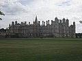
 Burghley - England's Greatest Elizabethan House - geograph.org.uk - 5335990.jpg 4 608 × 3 456 ; 3,62 Mio
-
 Burghley House - geograph.org.uk - 3624006.jpg 4 320 × 3 240 ; 2,03 Mio
-
 Burghley House - geograph.org.uk - 4536587.jpg 3 561 × 1 402 ; 998 kio
-
 Burghley House - geograph.org.uk - 5356509.jpg 2 000 × 1 333 ; 2,27 Mio
-
 Burghley House - geograph.org.uk - 6291705.jpg 1 600 × 1 200 ; 489 kio
-
 Burghley House - geograph.org.uk - 6291707.jpg 1 024 × 768 ; 363 kio
-
 Burghley House - Too cold for afternoon tea - geograph.org.uk - 4359480.jpg 4 320 × 3 240 ; 6 Mio
-
 Burghley House and Park, aerial 2014 - geograph.org.uk - 4055367.jpg 640 × 427 ; 53 kio
-
 Burghley House entry ride - geograph.org.uk - 4536599.jpg 5 355 × 1 192 ; 1 015 kio
-
 Burghley House Garden of Surprises - geograph.org.uk - 1963924.jpg 768 × 1 024 ; 241 kio
-
 Burghley House Garden of Surprises - geograph.org.uk - 1963927.jpg 768 × 1 024 ; 206 kio
-
 Burghley House Garden of Surprises - geograph.org.uk - 1963931.jpg 1 024 × 768 ; 283 kio
-
 Burghley House Garden of Surprises - geograph.org.uk - 6291717.jpg 1 600 × 1 200 ; 671 kio
-
 Burghley House Garden of Surprises - geograph.org.uk - 6291718.jpg 1 600 × 1 200 ; 789 kio
-
 Burghley House Gardens - geograph.org.uk - 4536612.jpg 4 644 × 1 427 ; 1,15 Mio
-
 Burghley House Kennels - geograph.org.uk - 4536619.jpg 1 959 × 1 062 ; 538 kio
-
 Burghley House Lake and Boat House - geograph.org.uk - 4545457.jpg 7 028 × 1 719 ; 2,71 Mio
-
 Burghley House Lake and Fountain - geograph.org.uk - 4536616.jpg 2 715 × 1 115 ; 586 kio
-
 Burghley House Sculpture Garden - geograph.org.uk - 1963936.jpg 1 024 × 768 ; 294 kio
-
 Burghley House sculpture garden - geograph.org.uk - 6291716.jpg 1 600 × 1 200 ; 592 kio
-
 Burghley House Sculpture Garden 2019 - Down Two Earth - geograph.org.uk - 6253768.jpg 4 032 × 3 024 ; 5,81 Mio
-
 Burghley House Sculpture Garden 2019 - Star Wars spacecraft - geograph.org.uk - 6253745.jpg 4 032 × 3 024 ; 3,34 Mio
-
 Burghley House Sculpture Garden 2019 - Vertical Face 1 - geograph.org.uk - 6253755.jpg 3 024 × 4 032 ; 3,95 Mio
-
 Burghley House, Ceramic Exhibition - geograph.org.uk - 4540988.jpg 5 361 × 2 034 ; 2,3 Mio
-
 Burghley House, Stamford - Boxing Day 2014 - geograph.org.uk - 4301738.jpg 4 320 × 3 240 ; 5,65 Mio
-
 Burghley House, Stamford, Lincolnshire - geograph.org.uk - 4536580.jpg 5 062 × 1 661 ; 962 kio
-
 Burghley Park - geograph.org.uk - 6369133.jpg 1 024 × 768 ; 211 kio
-
 Burghley Sculpture Garden 2019 - Aluminium artwork - geograph.org.uk - 6253788.jpg 4 032 × 3 024 ; 4,99 Mio
-
 Burley House Sculpture Garden - geograph.org.uk - 2231494.jpg 1 600 × 1 067 ; 1,64 Mio
-
 Cedar Tor (geograph 6317072).jpg 1 024 × 768 ; 200 kio
-
 Cereal crop near Barnack - geograph.org.uk - 6317451.jpg 1 024 × 768 ; 221 kio
-
 Church Lane and cricket field, Barnack - geograph.org.uk - 6316930.jpg 1 024 × 743 ; 182 kio
-
 Church Lane, Barnack - geograph.org.uk - 6316921.jpg 768 × 1 024 ; 165 kio
-
 Corner of a rape field near Burghley Park, Stamford - geograph.org.uk - 2932017.jpg 4 320 × 3 240 ; 6 Mio
-
 Corner of the wall of Walcot Park - geograph.org.uk - 6354247.jpg 756 × 1 024 ; 246 kio
-
 Cottage with datestone (geograph 7065877).jpg 6 070 × 3 882 ; 7,1 Mio
-
 Cottages, Main Street, Barnack (geograph 6316803).jpg 1 024 × 768 ; 172 kio
-
 Cottages, Station Road, Barnack - geograph.org.uk - 6316789.jpg 1 024 × 768 ; 196 kio
-
 Country lane looking towards Pilsgate - geograph.org.uk - 2442921.jpg 4 000 × 3 000 ; 4,09 Mio
-
 Country lane to the south of Pilsgate - geograph.org.uk - 2442920.jpg 4 000 × 3 000 ; 4,35 Mio
-
 Cows in The Sculpture Garden at Burghley House - geograph.org.uk - 4664736.jpg 4 320 × 3 240 ; 5 Mio
-
 Crop field off Station Road - geograph.org.uk - 4008740.jpg 640 × 480 ; 61 kio
-
 Crops growing by the railway - geograph.org.uk - 4398986.jpg 640 × 426 ; 60 kio
-
 CrossCountry train near Uffington Crossing - geograph.org.uk - 2432749.jpg 1 280 × 960 ; 622 kio
-
 Daffodils in the South Garden of Burghley House - geograph.org.uk - 5335966.jpg 4 608 × 3 456 ; 4,48 Mio
-
 Deer in Burghley Park, Stamford - geograph.org.uk - 4301844.jpg 4 320 × 3 240 ; 5,77 Mio
-
 Deer in the grounds of Burghley House, Stamford - geograph.org.uk - 2776049.jpg 4 320 × 3 240 ; 5,92 Mio
-
 Deer park at Burghley House, Stamford - geograph.org.uk - 4301835.jpg 4 320 × 3 240 ; 5,49 Mio
-
 Deer statue near the Lake at Burghley House - geograph.org.uk - 4664818.jpg 4 162 × 3 018 ; 4,46 Mio
-
 Derelict barn between Pilsgate and Stamford - geograph.org.uk - 2433214.jpg 1 280 × 960 ; 623 kio
-
 Derelict barn near Pilsgate - geograph.org.uk - 2397431.jpg 1 280 × 960 ; 652 kio
-

-
 Dovecote, Barnack - geograph.org.uk - 4007981.jpg 640 × 480 ; 53 kio
-
 Down Two Earth - Burghley House Sculpture Garden 2019 - geograph.org.uk - 6253780.jpg 4 032 × 3 024 ; 5,09 Mio
-
 East Window, St John the Baptist church, Barnack - geograph.org.uk - 3774634.jpg 2 337 × 3 000 ; 6 Mio
-
 Effigies, St John's church - geograph.org.uk - 3769909.jpg 2 256 × 1 504 ; 1,45 Mio
-
 Eighteenth century headstones, Barnack churchyard - geograph.org.uk - 6317069.jpg 1 024 × 768 ; 294 kio
-
 Elevation of Burghley House - geograph.org.uk - 4830113.jpg 1 692 × 1 106 ; 918 kio
-
 Enter the Matrix - geograph.org.uk - 4545447.jpg 2 848 × 2 134 ; 1,16 Mio
-
 Entering Barnack - geograph.org.uk - 4007945.jpg 640 × 480 ; 78 kio
-
 Entering Peterborough - geograph.org.uk - 4007900.jpg 640 × 480 ; 87 kio
-
 Entering Pilsgate - geograph.org.uk - 4007921.jpg 640 × 480 ; 69 kio
-
 Entrance to Hills and Holes, Barnack - geograph.org.uk - 4258509.jpg 4 320 × 3 240 ; 5,49 Mio
-
 Entrance to the Garden of Surprises - geograph.org.uk - 3501910.jpg 533 × 800 ; 109 kio
-
 Face on the cliff face at Burghley House - geograph.org.uk - 4660587.jpg 4 320 × 3 240 ; 4,9 Mio
-
 Farm track (footpath) off Station Road - geograph.org.uk - 4008744.jpg 640 × 480 ; 52 kio
-
 Farm track in Burghley Park - geograph.org.uk - 2444484.jpg 4 000 × 3 000 ; 4,13 Mio
-
 Farm track near Pilsgate Lodges - geograph.org.uk - 4007914.jpg 640 × 480 ; 63 kio
-
 Farm track off Barnack Drift - geograph.org.uk - 6265982.jpg 1 024 × 763 ; 160 kio
-
 Farm track on the Burghley Park estate - geograph.org.uk - 2444500.jpg 4 000 × 3 000 ; 3,93 Mio
-
 Farmland by the railway - geograph.org.uk - 4398984.jpg 640 × 426 ; 47 kio
-
 Farmland near Barnack - geograph.org.uk - 2357494.jpg 640 × 480 ; 75 kio
-
 Farmland near Stamford - geograph.org.uk - 4398979.jpg 640 × 426 ; 44 kio
-
 Farmland scene in Burghley Park - geograph.org.uk - 2442953.jpg 4 000 × 3 000 ; 4,2 Mio
-
 Farmland scene near Burghley Park - geograph.org.uk - 2442940.jpg 4 000 × 3 000 ; 4,01 Mio
-
 Field access crossing by the Torpel Way - geograph.org.uk - 3249775.jpg 2 560 × 1 920 ; 1,15 Mio
-
 Field edge and flattened cereal crop - geograph.org.uk - 6317439.jpg 1 024 × 768 ; 307 kio
-
 Field edge near Barnack - geograph.org.uk - 2442925.jpg 4 000 × 3 000 ; 4,18 Mio
-
 Field edge near Barnack - geograph.org.uk - 6317445.jpg 1 024 × 768 ; 274 kio
-
 Field of rape east of Burghley Park, Stamford - geograph.org.uk - 2932038.jpg 4 320 × 3 240 ; 5,73 Mio
-
 Field path with poppies off Station Rd, Barnack - geograph.org.uk - 3752753.jpg 1 024 × 768 ; 222 kio
-
 Fields in Barnack - geograph.org.uk - 3272816.jpg 2 592 × 1 944 ; 1,44 Mio
-
 Flat field - geograph.org.uk - 4398993.jpg 640 × 426 ; 40 kio
-

-
 Footpath alongside an old course of the River Welland - geograph.org.uk - 6266037.jpg 1 024 × 768 ; 278 kio
-
 Footpath behind Uffington level crossing - geograph.org.uk - 2357502.jpg 640 × 473 ; 60 kio
-
 Footpath Bridge on the Torpel Way next to The Synhams - geograph.org.uk - 3252963.jpg 2 560 × 1 920 ; 1 017 kio
-
 Footpath marker - geograph.org.uk - 6317442.jpg 1 024 × 768 ; 277 kio
-
 Footpath to Barnack - geograph.org.uk - 6266045.jpg 1 024 × 768 ; 232 kio
-
 Footpath to Stamford Road - geograph.org.uk - 6266053.jpg 1 024 × 768 ; 163 kio
-
 Footpath to Uffington Bridge - geograph.org.uk - 6368340.jpg 1 024 × 768 ; 285 kio
-
 Footpath to Ufford - geograph.org.uk - 6265999.jpg 1 024 × 768 ; 226 kio
-
 Footpath to Walcot Road - geograph.org.uk - 6354245.jpg 1 024 × 768 ; 135 kio
-
 Footpaths off Station Road near Barnack - geograph.org.uk - 4263597.jpg 4 320 × 3 240 ; 6,05 Mio
-
 Former Methodist church, Barnack - geograph.org.uk - 6316802.jpg 742 × 1 024 ; 182 kio
-
 Function at Burghley House, aerial 2015 - geograph.org.uk - 4498596.jpg 427 × 640 ; 56 kio
-
 Garden maze - geograph.org.uk - 3580535.jpg 1 024 × 680 ; 289 kio
-
 Garden of Surprises at Burghley House - geograph.org.uk - 3501895.jpg 533 × 800 ; 119 kio
-
 Garden of Surprises at Burghley House - geograph.org.uk - 3580516.jpg 1 024 × 680 ; 232 kio
-
 Garden of Surprises at Burghley House - geograph.org.uk - 3580518.jpg 1 024 × 680 ; 266 kio
-
 Garden of Surprises at Burghley House - geograph.org.uk - 3580521.jpg 680 × 1 024 ; 179 kio
-
 Garden of Surprises at Burghley House - geograph.org.uk - 3580524.jpg 680 × 1 024 ; 258 kio
-
 Garden outside the orangery at Burghley House - geograph.org.uk - 6253724.jpg 3 777 × 2 833 ; 3,22 Mio
-
 Gardens at Burghley House - geograph.org.uk - 6369169.jpg 1 024 × 768 ; 189 kio
-
 Gate House, Barnack (geograph 6317075).jpg 1 024 × 768 ; 232 kio
-
 Gates at Mill Farm near Wittering - geograph.org.uk - 3402140.jpg 4 320 × 3 240 ; 6,03 Mio
-
 Gates at Uffington level crossing - geograph.org.uk - 4263949.jpg 4 320 × 3 240 ; 5,54 Mio
-
 Gates on The Hereward Way near Walcot Hall - geograph.org.uk - 4258173.jpg 4 320 × 3 240 ; 5,66 Mio
-
 Gateway on Church Lane, Barnack - geograph.org.uk - 6316927.jpg 1 024 × 768 ; 321 kio


.jpg)


.jpg)


_-_geograph.org.uk_-_4258254.jpg)


_-_geograph.org.uk_-_3764932.jpg)


.jpg)


_-_geograph.org.uk_-_5182579.jpg)
_-_geograph.org.uk_-_5182576.jpg)
_-_geograph.org.uk_-_5182411.jpg)


_1_-_geograph.org.uk_-_5182305.jpg)
_2_-_geograph.org.uk_-_5182435.jpg)
_3_-_geograph.org.uk_-_5182450.jpg)
_4_-_geograph.org.uk_-_5182456.jpg)


.jpg)


.jpg)
.jpg)


_off_Station_Road_-_geograph.org.uk_-_4008744.jpg)


.jpg)


