Category:Barnby Dun with Kirk Sandall
Aller à la navigation
Aller à la recherche
English: Barnby Dun with Kirk Sandall is a civil parish in the Metropolitan Borough of Doncaster in South Yorkshire, England. According to the 2001 census it had a population of 8,524. The parish covers Barnby Dun and Kirk Sandall, both parts of the Doncaster urban area.
Nederlands: Barnby Dun with Kirk Sandall is een civil parish in het bestuurlijke gebied Doncaster, in het Engelse graafschap South Yorkshire. De civil parish telt
village britannique  | |||||
| Téléverser des médias | |||||
| Nature de l’élément |
| ||||
|---|---|---|---|---|---|
| Lieu | district métropolitain de Doncaster, Yorkshire du Sud, Yorkshire-et-Humber, Angleterre | ||||
 | |||||
Sous-catégories
Cette catégorie comprend 2 sous-catégories, dont les 2 ci-dessous.
B
K
Média dans la catégorie « Barnby Dun with Kirk Sandall »
Cette catégorie comprend 273 fichiers, dont les 200 ci-dessous.
(page précédente) (page suivante)-
 'Please no dog mess' along the towpath - geograph.org.uk - 3927142.jpg 1 024 × 768 ; 141 kio
-

-
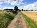
 A path leading to Barnby Dun - geograph.org.uk - 2819822.jpg 800 × 600 ; 98 kio
-
 A path leading to Barnby Dun - geograph.org.uk - 2822960.jpg 800 × 600 ; 115 kio
-
 A public footpath off Doncaster Road - geograph.org.uk - 2708080.jpg 800 × 600 ; 189 kio
-

-
 Allotments beside the railway - geograph.org.uk - 2428968.jpg 1 600 × 1 200 ; 524 kio
-
 And they were gone - geograph.org.uk - 3127982.jpg 640 × 480 ; 49 kio
-
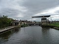
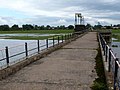
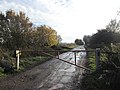
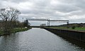
 Approaching Bramwith Swing-bridge - geograph.org.uk - 2670015.jpg 640 × 480 ; 100 kio
-
 Armthorpe Lane heading north - geograph.org.uk - 2428940.jpg 1 600 × 1 200 ; 498 kio
-
 Ashton Drive off Sandall Lane, Kirk Sandall - geograph.org.uk - 6155462.jpg 1 600 × 1 065 ; 556 kio
-
 Barnby Dun - printers and chapel on High Street - geograph.org.uk - 2421472.jpg 1 600 × 1 201 ; 509 kio
-
 Barnby Dun Bridge - geograph.org.uk - 1329451.jpg 640 × 480 ; 53 kio
-
 Barnby Dun bridge - geograph.org.uk - 3149987.jpg 3 770 × 1 632 ; 1,06 Mio
-
 Barnby Dun Bridge - geograph.org.uk - 3151129.jpg 800 × 600 ; 82 kio
-
 Barnby Dun Bridge - geograph.org.uk - 6155880.jpg 1 600 × 1 065 ; 486 kio
-
 Barnby Dun Bridge - geograph.org.uk - 6155882.jpg 1 600 × 1 065 ; 528 kio
-
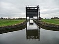
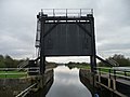
 Barnby Dun lift bridge - geograph.org.uk - 4965436.jpg 640 × 480 ; 71 kio
-
 Barnby Dun Liftbridge - geograph.org.uk - 4281988.jpg 1 600 × 1 200 ; 420 kio
-
 Barnby Dun liftbridge almost open for canal traffic - geograph.org.uk - 3926745.jpg 1 024 × 768 ; 141 kio
-
 Barnby Dun liftbridge closing to road traffic - geograph.org.uk - 3926731.jpg 1 024 × 768 ; 128 kio
-
 Barnby Dun liftbridge open for canal traffic - geograph.org.uk - 3926751.jpg 1 024 × 768 ; 147 kio
-
 Barnby Dun liftbridge open to road traffic - geograph.org.uk - 3926722.jpg 1 024 × 768 ; 123 kio
-
 Barnby Dun liftbridge starting to open for canal traffic - geograph.org.uk - 3926740.jpg 1 024 × 768 ; 132 kio
-
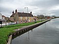
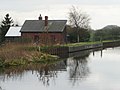
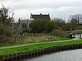
 Barnby Dun with Kirk Sandall - Canal Bridge.jpg 640 × 480 ; 94 kio
-
 Boats moored west of Northfield Road Bridge - geograph.org.uk - 3926625.jpg 1 024 × 768 ; 115 kio
-
 Bramwith Lane level crossing - geograph.org.uk - 1709161.jpg 1 280 × 959 ; 278 kio
-
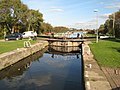 Bramwith Lock - geograph.org.uk - 2669691.jpg 640 × 480 ; 98 kio
-
 Bramwith Lock - geograph.org.uk - 525150.jpg 640 × 480 ; 97 kio
-
 Bramwith Lock east chamber - geograph.org.uk - 2669972.jpg 640 × 480 ; 100 kio
-
 Brecks Lane, Kirk Sandall - geograph.org.uk - 5689839.jpg 1 600 × 1 064 ; 609 kio
-
 Brecks Lane, Kirk Sandall - geograph.org.uk - 5799732.jpg 1 600 × 1 065 ; 477 kio
-
 Bridge on a minor road - geograph.org.uk - 4521720.jpg 800 × 533 ; 166 kio
-
 Canal junction from the north-east - geograph.org.uk - 5144817.jpg 1 024 × 614 ; 128 kio
-
 Canalside flats off High Street, Barnby Dun - geograph.org.uk - 3926767.jpg 1 023 × 768 ; 150 kio
-
 Church of St Peter and St Paul, Barnby Dun - geograph.org.uk - 4715098.jpg 4 608 × 3 456 ; 3,7 Mio
-
 Cleared site - geograph.org.uk - 4464288.jpg 1 024 × 768 ; 198 kio
-
 Co-op on Brecks Lane, Kirk Sandall - geograph.org.uk - 5799735.jpg 1 600 × 1 065 ; 494 kio
-
 Common Lane (Byway) - geograph.org.uk - 5474537.jpg 3 264 × 2 448 ; 3,94 Mio
-
 Common Lane - geograph.org.uk - 4281568.jpg 1 600 × 1 200 ; 491 kio
-
 Common Lane off Hatfield Lane - geograph.org.uk - 2819860.jpg 800 × 600 ; 109 kio
-
 Connaught Drive, Kirk Sandall - geograph.org.uk - 5689843.jpg 1 600 × 1 064 ; 502 kio
-
 Cooling towers - geograph.org.uk - 514234.jpg 640 × 396 ; 109 kio
-
 Crossing the railway on Hatfield Lane - geograph.org.uk - 3122917.jpg 1 024 × 768 ; 215 kio
-
 Departing Train at Kirk Sandall Station - geograph.org.uk - 4713833.jpg 4 479 × 3 272 ; 3,62 Mio
-
 Depot, off Clay Lane West - geograph.org.uk - 3927202.jpg 1 024 × 614 ; 120 kio
-
-
 Don Aqueduct, New Junction Canal - geograph.org.uk - 3924193.jpg 1 024 × 768 ; 107 kio
-
 Drainage ditch off Bramwith Lane - geograph.org.uk - 2429064.jpg 1 600 × 1 200 ; 646 kio
-
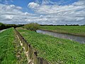
 Eastern floodbank of the River Don - geograph.org.uk - 3927194.jpg 1 024 × 768 ; 122 kio
-
 Electricity substation off North Field Lane - geograph.org.uk - 3170362.jpg 1 024 × 768 ; 153 kio
-
 Electricity substation, off Northfield Lane - geograph.org.uk - 3926607.jpg 1 024 × 768 ; 135 kio
-
 Engine Dike, below the New Junction Canal - geograph.org.uk - 3924032.jpg 1 024 × 614 ; 108 kio
-
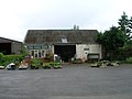 Farm shop Barnby Dun - geograph.org.uk - 2428975.jpg 1 600 × 1 200 ; 377 kio
-
 Farm Track near Love Lane - geograph.org.uk - 1329448.jpg 640 × 480 ; 112 kio
-
 Farmland alongside Hatfield Lane - geograph.org.uk - 3122699.jpg 1 024 × 768 ; 220 kio
-
 Farmland and cooling towers off Royalty Lane - geograph.org.uk - 2593318.jpg 1 600 × 1 200 ; 504 kio
-
 Farmland near Botany Bay - geograph.org.uk - 2428992.jpg 1 600 × 1 200 ; 387 kio
-
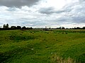
 Farmland north of Barnby Dun - geograph.org.uk - 5144828.jpg 1 024 × 615 ; 146 kio
-
 Farmland north of Hatfield Lane - geograph.org.uk - 2428980.jpg 640 × 480 ; 83 kio
-
 Farmland off Armthorpe Lane - geograph.org.uk - 2428937.jpg 1 600 × 1 200 ; 395 kio
-
 Farmland south of Hatfield Lane - geograph.org.uk - 2428997.jpg 1 600 × 1 051 ; 277 kio
-
 Fence near Kirk Sandall railway station - geograph.org.uk - 699337.jpg 640 × 338 ; 58 kio
-
 Field of carrots south of Hatfield Lane - geograph.org.uk - 4281573.jpg 1 600 × 1 200 ; 298 kio
-
 Field off Common Lane - geograph.org.uk - 4271221.jpg 1 024 × 768 ; 136 kio
-
 Footpath from Bramwith Lane to Bramwith Lane - geograph.org.uk - 3074856.jpg 1 024 × 768 ; 269 kio
-
 Footpath from the River Don - geograph.org.uk - 4463901.jpg 1 024 × 768 ; 281 kio
-
 Footpath to Kirk Sandall - geograph.org.uk - 3074859.jpg 1 024 × 768 ; 198 kio
-
 Fordstead Lane at Thorpe Marsh - geograph.org.uk - 5689861.jpg 1 600 × 1 064 ; 776 kio
-
 Freight train at Barnby Dun - geograph.org.uk - 2896832.jpg 2 848 × 2 144 ; 1,51 Mio
-
 Frozen canal - geograph.org.uk - 1653100.jpg 480 × 640 ; 58 kio
-
 Frozen canal - geograph.org.uk - 1653106.jpg 640 × 480 ; 35 kio
-
 Gateway from Brecks Plantation - geograph.org.uk - 4074995.jpg 640 × 480 ; 129 kio
-
 Glade View off Brecks Lane, Kirk Sandall - geograph.org.uk - 5799731.jpg 1 600 × 1 065 ; 529 kio
-
 Golf Course Entrance - geograph.org.uk - 1254295.jpg 640 × 480 ; 98 kio
-
 Goliath crane at (Jack) Tighe's factory - geograph.org.uk - 699326.jpg 640 × 397 ; 48 kio
-
 Grazing at Thorpe Bank - geograph.org.uk - 5131137.jpg 4 608 × 3 456 ; 4,89 Mio
-
 Guillotine gate and towpath footbridge, Don Aqueduct - geograph.org.uk - 3924221.jpg 1 024 × 768 ; 117 kio
-
 Hatfield Lane (Track and bridleway) - geograph.org.uk - 3122666.jpg 1 024 × 768 ; 197 kio
-
 Hatfield Lane (track) heading east - geograph.org.uk - 2428984.jpg 1 600 × 1 200 ; 460 kio
-
 Hatfield Lane (track) heading east - geograph.org.uk - 2429001.jpg 1 600 × 1 200 ; 471 kio
-
 Hatfield Lane - geograph.org.uk - 3122675.jpg 1 024 × 768 ; 205 kio
-
 Hatfield Lane - geograph.org.uk - 4271207.jpg 1 024 × 768 ; 149 kio
-
 Hatfield Lane level crossing from the east - geograph.org.uk - 4271486.jpg 1 024 × 768 ; 158 kio
-
 Hatfield Lane level crossing from the west - geograph.org.uk - 4271483.jpg 1 024 × 768 ; 210 kio
-
 Hatfield Lane looking west - geograph.org.uk - 4281559.jpg 1 600 × 1 200 ; 844 kio
-
 Hatfield Lane towards Barnby Dun - geograph.org.uk - 2819872.jpg 800 × 600 ; 84 kio
-
 Hatfield Lane, Barnby Dun - geograph.org.uk - 4281579.jpg 1 600 × 1 200 ; 296 kio
-
 Hatfield Lane, Barnby Dun - geograph.org.uk - 5689852.jpg 1 600 × 1 064 ; 470 kio
-
 Home for old sleepers - geograph.org.uk - 3150003.jpg 3 967 × 1 895 ; 1,45 Mio
-
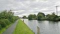
 Houseboat on the River Dun Navigation - geograph.org.uk - 3151218.jpg 800 × 600 ; 112 kio
-
 Houses off Moor Lane, Kirk Sandall - geograph.org.uk - 6155479.jpg 1 600 × 1 065 ; 520 kio
-
 Houses off Sandall Lane, Kirk Sandall - geograph.org.uk - 6155464.jpg 1 600 × 1 065 ; 675 kio
-
 Houses on Station Road at Pine Hall Road - geograph.org.uk - 5689849.jpg 1 600 × 1 064 ; 569 kio
-
 Industrial building, Sandall Lane - geograph.org.uk - 2428951.jpg 1 600 × 1 200 ; 378 kio
-
 Kestrel box, Long Sandall Ings - geograph.org.uk - 3927174.jpg 1 024 × 768 ; 142 kio
-
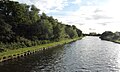
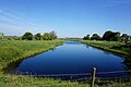
 Kirk Sandall - Don Navigation - geograph.org.uk - 2418779.jpg 1 600 × 1 200 ; 355 kio
-
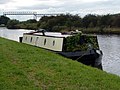
 Kirk Sandall - narrowboat near Croft Ings - geograph.org.uk - 2418782.jpg 1 600 × 1 200 ; 610 kio
-
 Kirk Sandall - pipe bridge - geograph.org.uk - 2417893.jpg 1 600 × 1 186 ; 587 kio
-
 Kirk Sandall - Sandall Takeaway - geograph.org.uk - 2603340.jpg 1 600 × 1 200 ; 494 kio
-
 Kirk Sandall and Edenthorpe Church Hall - geograph.org.uk - 2542982.jpg 1 024 × 768 ; 137 kio
-
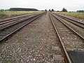
 Kirk Sandall Junction - geograph.org.uk - 2543008.jpg 1 024 × 768 ; 182 kio
-
 Kirk Sandall railway station - geograph.org.uk - 2428943.jpg 1 600 × 1 200 ; 516 kio
-
 Kirk Sandall railway station - geograph.org.uk - 3151238.jpg 800 × 600 ; 101 kio
-
 Kirk Sandall railway station, Yorkshire - geograph.org.uk - 3464103.jpg 1 024 × 768 ; 322 kio
-
 Kirk Sandall station - geograph.org.uk - 2542993.jpg 1 024 × 768 ; 276 kio
-
 Kirk Sandall station approach - geograph.org.uk - 3151235.jpg 800 × 600 ; 104 kio
-
 Kirk Sandall Train Station - geograph.org.uk - 5799722.jpg 1 600 × 1 065 ; 517 kio
-
 Lake off Fordstead Lane - geograph.org.uk - 6155884.jpg 1 600 × 1 065 ; 486 kio
-
 Lane leading to St Oswald's Church, Kirk Sandall - geograph.org.uk - 6155473.jpg 1 600 × 1 065 ; 544 kio
-
 Leaving Brecks Plantation - geograph.org.uk - 4074993.jpg 640 × 480 ; 102 kio
-
 Level Crossing on Hatfield Lane - geograph.org.uk - 5474545.jpg 3 264 × 2 448 ; 3,33 Mio
-
 Lift Bridge at Sunset - geograph.org.uk - 1733213.jpg 640 × 427 ; 52 kio
-
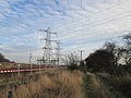
 Little and large pylons, west bank, River Dun Navigation - geograph.org.uk - 3926799.jpg 1 024 × 768 ; 166 kio
-
 Long Sandall - Eric of Lincoln - geograph.org.uk - 2603151.jpg 1 600 × 1 200 ; 775 kio
-
 Long Sandall - railway bridge (northern) - geograph.org.uk - 2603350.jpg 1 600 × 1 192 ; 693 kio
-
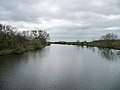
 Looking across the River Don Navigation - geograph.org.uk - 4463906.jpg 1 024 × 768 ; 273 kio
-
 Looking down Doncaster Road - geograph.org.uk - 1995640.jpg 800 × 600 ; 230 kio
-
 Looking to Park Hill Grange - geograph.org.uk - 1657115.jpg 640 × 480 ; 66 kio
-
 Maintenance boat - geograph.org.uk - 2669992.jpg 640 × 480 ; 101 kio
-
 Marsh Lane off Fordstead Lane - geograph.org.uk - 6155895.jpg 1 600 × 1 065 ; 658 kio
-
 Marsh Lane towards Wait House Farm - geograph.org.uk - 5689866.jpg 1 600 × 1 064 ; 822 kio
-
 Marsh Lane, south of Fordstead Lane - geograph.org.uk - 3759617.jpg 1 600 × 1 200 ; 673 kio
-
 Misty sunrise - geograph.org.uk - 589082.jpg 640 × 314 ; 33 kio
-
 Moor Lane - geograph.org.uk - 4464293.jpg 1 024 × 768 ; 237 kio
-
 Moorings, south side of Barnby Dun liftbridge - geograph.org.uk - 3926761.jpg 1 024 × 768 ; 137 kio
-
 New building on Doncaster Road, Kirk Sandall - geograph.org.uk - 5799728.jpg 1 600 × 1 065 ; 409 kio
-
 New Junction Canal, north of the Don Aqueduct - geograph.org.uk - 3924184.jpg 1 024 × 614 ; 67 kio
-
 New use for old sleepers - geograph.org.uk - 4271204.jpg 1 024 × 768 ; 171 kio
-
 North field - geograph.org.uk - 1653096.jpg 640 × 480 ; 87 kio
-
 North Field Lane - geograph.org.uk - 3170353.jpg 1 024 × 768 ; 189 kio
-
 North side detail of River Don aqueduct - geograph.org.uk - 643291.jpg 640 × 387 ; 76 kio
-
 Old course of the River Don, west of the canal - geograph.org.uk - 3926659.jpg 1 024 × 768 ; 150 kio
-
 Old Mill Field near Barnby Dun - geograph.org.uk - 5474540.jpg 3 264 × 2 448 ; 3,19 Mio
-
 Old tyres, new housing - geograph.org.uk - 4463925.jpg 1 024 × 768 ; 246 kio
-
 Ordnance Survey 1GL Bolt - geograph.org.uk - 4964691.jpg 640 × 529 ; 110 kio
-
 Ordnance Survey Rivet - geograph.org.uk - 4964687.jpg 640 × 536 ; 168 kio
-
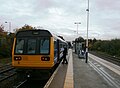
 Pacer train 144011 at Kirk Sandall Train Station - geograph.org.uk - 6155456.jpg 1 600 × 1 065 ; 482 kio
-
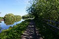
 Path alongside the River Dun Navigation - geograph.org.uk - 6155852.jpg 1 600 × 1 065 ; 731 kio
-
 Path alongside the River Dun Navigation - geograph.org.uk - 6155860.jpg 1 600 × 1 065 ; 633 kio
-
 Path alongside the River Dun Navigation - geograph.org.uk - 6155871.jpg 1 600 × 1 065 ; 543 kio
-
 Path alongside the River Dun Navigation - geograph.org.uk - 6155875.jpg 1 600 × 1 065 ; 786 kio
-
-
 Pipes over Engine Dike - geograph.org.uk - 4438742.jpg 1 024 × 768 ; 382 kio
-
 Ploughed Field seen from Bramwith Lane - geograph.org.uk - 4715119.jpg 4 608 × 3 456 ; 4,34 Mio
-
 Potato field on Kirk Sandall Common - geograph.org.uk - 3122920.jpg 1 024 × 768 ; 204 kio
-
 Private Farm only keep out^ - geograph.org.uk - 3122690.jpg 1 024 × 768 ; 177 kio
-
 Private road to Lock House Farm - geograph.org.uk - 4965581.jpg 640 × 480 ; 123 kio
-
 Pumping station alongside the tidal River Don - geograph.org.uk - 3924020.jpg 1 024 × 768 ; 140 kio
-
 Pumping station, north bank of the River Don - geograph.org.uk - 5144800.jpg 1 024 × 768 ; 144 kio
-
-
 Pylons at Kirk Sandall - geograph.org.uk - 3122923.jpg 768 × 1 024 ; 161 kio
-
 Queen Mary Crescent at Graham Road, Kirk Sandall - geograph.org.uk - 5799788.jpg 1 600 × 1 065 ; 397 kio
-
 Queen Mary Crescent, Kirk Sandall - geograph.org.uk - 5799737.jpg 1 600 × 1 065 ; 637 kio
-
 Queen Mary Crescent, Kirk Sandall - geograph.org.uk - 5799795.jpg 1 600 × 1 065 ; 439 kio
-
 Railway and Industrial Estate at Long Sandall - geograph.org.uk - 5336654.jpg 4 608 × 3 456 ; 3,78 Mio
-
 Railway bridge over the River Don near Thorpe Marsh - geograph.org.uk - 4281997.jpg 1 600 × 1 200 ; 529 kio
-
 Railway crossing on Hatfield Lane - geograph.org.uk - 3122715.jpg 1 024 × 768 ; 150 kio
-
 Railway near Kirk Sandall, Doncaster - geograph.org.uk - 3122707.jpg 1 024 × 768 ; 199 kio
-
 Railway towards Doncaster - geograph.org.uk - 2428972.jpg 1 600 × 1 200 ; 481 kio
-
 Railway towards Hatfield - geograph.org.uk - 2428987.jpg 1 600 × 1 200 ; 463 kio
-
 Relocated mast, Kirk Sandall industrial estate - geograph.org.uk - 3927155.jpg 1 024 × 615 ; 92 kio
-
 Ripples, River Dun Navigation - geograph.org.uk - 3927182.jpg 1 024 × 768 ; 119 kio
-
 River Don flood defences near Thorpe-in-Balne - geograph.org.uk - 5753347.jpg 5 184 × 3 888 ; 5,64 Mio
-
 River Don Navigation at Kirk Sandall - geograph.org.uk - 4463929.jpg 1 024 × 768 ; 171 kio
-
 River Don near Thorpe in Balne - geograph.org.uk - 3151754.jpg 4 000 × 2 248 ; 1,78 Mio
-
 River Don Pictured from Thorpe Marsh Bridge - geograph.org.uk - 5132264.jpg 4 608 × 3 456 ; 4,21 Mio
-
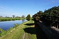
 River Dun Navigation - geograph.org.uk - 3149999.jpg 4 000 × 2 248 ; 1,59 Mio
-
 River Dun Navigation, Long Sandall - geograph.org.uk - 3927163.jpg 1 024 × 768 ; 120 kio
-
 River Dun Navigation, looking south-east - geograph.org.uk - 3926645.jpg 1 024 × 768 ; 145 kio
-
 River Dun Navigation, north of the Don railway bridge - geograph.org.uk - 3926630.jpg 1 024 × 768 ; 129 kio
-
 Royalty Lane (bridleway) heading east - geograph.org.uk - 2593315.jpg 1 600 × 1 200 ; 607 kio
-
 Royalty Lane - geograph.org.uk - 3759622.jpg 1 600 × 1 200 ; 582 kio
-
 Royalty Lane - geograph.org.uk - 6156013.jpg 1 600 × 1 065 ; 696 kio
-
 Ruskholme, Chequer Lane - geograph.org.uk - 3924015.jpg 1 024 × 768 ; 153 kio
-
 Safe to cross. - geograph.org.uk - 1657103.jpg 480 × 640 ; 51 kio
-
 Sandall Lane towards Long Sandall - geograph.org.uk - 2428949.jpg 1 600 × 1 200 ; 337 kio
-
 Sandall Lane, Kirk Sandall - geograph.org.uk - 2428945.jpg 1 600 × 1 200 ; 523 kio
-
 Sandall Lane, Kirk Sandall - geograph.org.uk - 5799725.jpg 1 600 × 1 065 ; 484 kio
-
 Season of mist and mellow fruitfulness - geograph.org.uk - 588919.jpg 640 × 372 ; 70 kio
-
 Sheep on Croft Ings - geograph.org.uk - 3926823.jpg 1 024 × 768 ; 110 kio
-
 Sheep, Croft Ings, west bank, River Dun Navigation - geograph.org.uk - 3926838.jpg 1 024 × 614 ; 102 kio
-

-
 Shops at Barnby Dun - geograph.org.uk - 2896807.jpg 2 848 × 2 144 ; 1,52 Mio
-
 Small green space off Eden Field Road - geograph.org.uk - 5311720.jpg 1 024 × 768 ; 180 kio
-
 South Bramwith Entrance Sign - geograph.org.uk - 4715131.jpg 4 608 × 3 456 ; 4,21 Mio
-
 Southern end, New Junction Canal - geograph.org.uk - 3924238.jpg 1 024 × 768 ; 117 kio
-
 Spar Shop on Marlowe Road, Barnby Dun - geograph.org.uk - 5689856.jpg 1 600 × 1 064 ; 500 kio
-
 Speed limit sign and warning posts - geograph.org.uk - 3151120.jpg 600 × 800 ; 144 kio
-
 St Oswald's Church - geograph.org.uk - 3151223.jpg 800 × 600 ; 95 kio
-
 St Oswald's Church in Kirk Sandall - geograph.org.uk - 4715089.jpg 4 543 × 3 275 ; 3,77 Mio
-
 St Oswald's church, Kirk Sandall - geograph.org.uk - 3149972.jpg 4 000 × 2 248 ; 1,61 Mio
-
 St Oswald's Church, Kirk Sandall - geograph.org.uk - 6155723.jpg 1 600 × 1 065 ; 455 kio
-
 St Oswald's Church, Kirk Sandall - geograph.org.uk - 6155726.jpg 1 600 × 1 065 ; 521 kio
-
 St Oswald's Church, Kirk Sandall - geograph.org.uk - 6155728.jpg 1 065 × 1 600 ; 451 kio
-
 St Oswald's Church, Kirk Sandall - geograph.org.uk - 6155733.jpg 1 600 × 1 479 ; 889 kio
-
 St Oswald's Church, Kirk Sandall - geograph.org.uk - 6155736.jpg 1 405 × 1 600 ; 942 kio
-
 St Oswald's Church, Kirk Sandall - geograph.org.uk - 6155737.jpg 1 203 × 1 600 ; 858 kio
-
 St Oswald's Church, Kirk Sandall - geograph.org.uk - 6155846.jpg 1 027 × 1 600 ; 614 kio
-
 St Oswald's from the north - geograph.org.uk - 3927107.jpg 1 024 × 768 ; 195 kio


_-_geograph.org.uk_-_5474537.jpg)


_Tighe%27s_factory_-_geograph.org.uk_-_699326.jpg)


_-_geograph.org.uk_-_3122666.jpg)
_heading_east_-_geograph.org.uk_-_2428984.jpg)
_heading_east_-_geograph.org.uk_-_2429001.jpg)


_-_geograph.org.uk_-_2603350.jpg)


_heading_east_-_geograph.org.uk_-_2593315.jpg)


