Category:Barnby in the Willows
Aller à la navigation
Aller à la recherche
English: Barnby in the Willows is a village and civil parish in the Newark and Sherwood district of Nottinghamshire, England, just east of Newark-on-Trent. According to the 2001 census it had a population of 244. Just to the south of the village is the River Witham, which also forms the border with Lincolnshire here.
village britannique | |||||
| Téléverser des médias | |||||
| Nature de l’élément | |||||
|---|---|---|---|---|---|
| Lieu | Newark and Sherwood, Nottinghamshire, Midlands de l'Est, Angleterre | ||||
 | |||||
Sous-catégories
Cette catégorie comprend seulement la sous-catégorie ci-dessous.
A
Média dans la catégorie « Barnby in the Willows »
Cette catégorie comprend 211 fichiers, dont les 200 ci-dessous.
(page précédente) (page suivante)-
 A17 Sleaford Road near Flawford Farm - geograph.org.uk - 5672326.jpg 640 × 480 ; 66 kio
-
 A17, Sleaford Road - geograph.org.uk - 4933550.jpg 640 × 427 ; 393 kio
-
 Accident at Barnby in the Willows - geograph.org.uk - 3633916.jpg 1 024 × 768 ; 356 kio
-
 Afternoon nap - geograph.org.uk - 6488405.jpg 1 024 × 768 ; 318 kio
-
 Ah ^ Where's the path ^ - geograph.org.uk - 2442738.jpg 1 024 × 768 ; 244 kio
-
 All Saints' church seen from the footpath from Fenton - geograph.org.uk - 6033780.jpg 1 024 × 768 ; 218 kio
-
 All Saints' church tower, Barnby in the Willows - geograph.org.uk - 6351237.jpg 768 × 1 024 ; 294 kio
-
 Alongside Long Lane - geograph.org.uk - 4883029.jpg 1 024 × 768 ; 242 kio
-
 Another new gate on the footpath to Balderton - geograph.org.uk - 3084072.jpg 1 024 × 768 ; 261 kio
-
 Approaching Barnby from Coddington - geograph.org.uk - 6323764.jpg 1 024 × 768 ; 233 kio
-
 Approaching the Church Bridge - geograph.org.uk - 4752472.jpg 1 024 × 768 ; 282 kio
-
-
 Autumn in Barnby - geograph.org.uk - 6323535.jpg 1 024 × 768 ; 301 kio
-
 Barn at the Gables - geograph.org.uk - 2442708.jpg 1 024 × 768 ; 163 kio
-
 Barnby Dovecote - geograph.org.uk - 2442690.jpg 1 024 × 768 ; 233 kio
-
 Barnby Grange - geograph.org.uk - 1999377.jpg 1 024 × 768 ; 181 kio
-
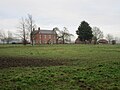 Barnby Hall - geograph.org.uk - 5246875.jpg 1 024 × 768 ; 165 kio
-
 Barnby Hall - geograph.org.uk - 6321267.jpg 1 024 × 768 ; 201 kio
-
 Barnby Hall seen across the River Witham - geograph.org.uk - 6033779.jpg 1 024 × 768 ; 226 kio
-
 Barnby House - geograph.org.uk - 2442702.jpg 1 024 × 768 ; 143 kio
-
 Barnby in the Willows at sunset - geograph.org.uk - 6222235.jpg 1 024 × 768 ; 90 kio
-
 Barnby in the Willows seen across the River Witham - geograph.org.uk - 6036064.jpg 1 024 × 768 ; 221 kio
-
 Barnby in the Willows seen from Long Lane - geograph.org.uk - 6468155.jpg 1 024 × 768 ; 272 kio
-
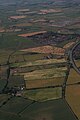
 Barnby in the Willows, aerial 2018 (1) - geograph.org.uk - 5840043.jpg 800 × 533 ; 97 kio
-
 Barnby in the Willows, aerial 2018 (2) - geograph.org.uk - 5840056.jpg 800 × 533 ; 86 kio
-
 Barnby Sewage Works - geograph.org.uk - 6299436.jpg 1 024 × 768 ; 227 kio
-
 Barnby sewage works - geograph.org.uk - 6479085.jpg 1 024 × 768 ; 191 kio
-
 Barnby Village Hall - geograph.org.uk - 1999405.jpg 1 024 × 768 ; 137 kio
-
 Bend in Long Lane - geograph.org.uk - 3295861.jpg 2 256 × 1 504 ; 1,34 Mio
-
 Bleak House Farm from Newark Road, Barnby - geograph.org.uk - 2009934.jpg 1 024 × 768 ; 111 kio
-
 Bridge over Shire Dyke - geograph.org.uk - 3084100.jpg 1 024 × 768 ; 192 kio
-
 Bridge over Shire Dyke - geograph.org.uk - 6434157.jpg 1 024 × 768 ; 173 kio
-
 Bridge over the River Witham - geograph.org.uk - 3084087.jpg 1 024 × 768 ; 211 kio
-
 Bridge over the River Witham - geograph.org.uk - 6321275.jpg 1 024 × 768 ; 274 kio
-
 Bridge over the river Witham at Skerries Plantation - geograph.org.uk - 6429491.jpg 1 024 × 768 ; 241 kio
-
 Broadsyke Lane - geograph.org.uk - 6299385.jpg 1 024 × 768 ; 193 kio
-
 By the A17 - geograph.org.uk - 4883009.jpg 1 024 × 768 ; 227 kio
-
 Bypassed stile - geograph.org.uk - 6429474.jpg 1 024 × 768 ; 275 kio
-
 Corner of a wheat field near Grove Farm - geograph.org.uk - 6457187.jpg 1 024 × 768 ; 212 kio
-
 Corporation Plantation - geograph.org.uk - 2443967.jpg 1 024 × 768 ; 203 kio
-
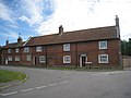
 Cottages on Back Street, Barnby - geograph.org.uk - 1999412.jpg 1 024 × 768 ; 166 kio
-
 Cutting the corner - geograph.org.uk - 6457190.jpg 1 024 × 768 ; 221 kio
-
 Damaged ash - geograph.org.uk - 4883017.jpg 1 024 × 768 ; 192 kio
-
 Dovecote Farm - geograph.org.uk - 2446011.jpg 1 024 × 768 ; 175 kio
-
 Dovecote, Barnby in the Willows - geograph.org.uk - 2910086.jpg 640 × 500 ; 106 kio
-
 Eastbound A17 near to Beckingham - geograph.org.uk - 4934496.jpg 640 × 427 ; 354 kio
-
 Entering Barnby in the Willows - geograph.org.uk - 2910071.jpg 640 × 480 ; 83 kio
-
 Entering Barnby in the Willows - geograph.org.uk - 3293117.jpg 2 256 × 1 504 ; 892 kio
-
 Entering Nottinghamshire on the A17 - geograph.org.uk - 2910050.jpg 640 × 480 ; 91 kio
-
 Entrance to Barnby in the Willows - geograph.org.uk - 4081817.jpg 3 776 × 2 520 ; 4,06 Mio
-
 Entrance to Fen Farm - geograph.org.uk - 389664.jpg 640 × 427 ; 91 kio
-
 Fancy a swim to Balderton^ - geograph.org.uk - 6321265.jpg 1 024 × 768 ; 308 kio
-
 Farm buildings at the Gables Farm, Barnby in the Willows - geograph.org.uk - 3084126.jpg 1 024 × 768 ; 194 kio
-
 Farm buildings, Barnby Hall - geograph.org.uk - 1910677.jpg 1 600 × 1 200 ; 562 kio
-
 Farm road on Claypole Fen - geograph.org.uk - 389648.jpg 640 × 427 ; 79 kio
-
 Farmland and pylons, Bleak House Farm - geograph.org.uk - 2910098.jpg 2 686 × 2 048 ; 841 kio
-
 Farmland at the end of Broad Fen Lane - geograph.org.uk - 389497.jpg 640 × 427 ; 97 kio
-
 Farmland near Manor Farm - geograph.org.uk - 2910060.jpg 640 × 480 ; 40 kio
-
 Farmland off Long Lane - geograph.org.uk - 2910062.jpg 640 × 480 ; 82 kio
-
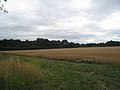
 Farmland, Barnby in the Willows - geograph.org.uk - 2910079.jpg 640 × 480 ; 37 kio
-
 Fen Farm - geograph.org.uk - 2009959.jpg 1 024 × 768 ; 155 kio
-
 Fen Lane - geograph.org.uk - 3671933.jpg 1 024 × 768 ; 167 kio
-
 Field alongside the A17 - geograph.org.uk - 1978392.jpg 1 024 × 768 ; 178 kio
-
 Field boundary and Manor Farm - geograph.org.uk - 6299423.jpg 1 024 × 768 ; 191 kio
-
 Field of oilseed rape - geograph.org.uk - 6456528.jpg 1 024 × 768 ; 238 kio
-
 Field off Long Lane - geograph.org.uk - 1978411.jpg 1 024 × 768 ; 128 kio
-
 Flawford lane - geograph.org.uk - 5355246.jpg 1 024 × 768 ; 261 kio
-
 Flooding between Fox Covert and Skerries Plantation - geograph.org.uk - 6299394.jpg 1 024 × 768 ; 185 kio
-
 Footbridge at Grove Farm - geograph.org.uk - 6323567.jpg 1 024 × 768 ; 474 kio
-
 Footpath off Long Lane - geograph.org.uk - 2910069.jpg 640 × 480 ; 90 kio
-
 Footpath to Barnby alongside the River Witham - geograph.org.uk - 6299420.jpg 1 024 × 768 ; 177 kio
-
 Footpath to Barnby in the Willows - geograph.org.uk - 6323577.jpg 1 024 × 768 ; 201 kio
-
 Footpath to Barnby in the Willows - geograph.org.uk - 6457184.jpg 1 024 × 768 ; 222 kio
-
 Footpath to Beckingham - geograph.org.uk - 6479076.jpg 1 024 × 768 ; 218 kio
-
 Footpath to Beckingham - geograph.org.uk - 6479082.jpg 1 024 × 768 ; 197 kio
-
 Footpath to Beckingham - geograph.org.uk - 6479092.jpg 1 024 × 768 ; 167 kio
-
 Footpath to Coddington - geograph.org.uk - 6323546.jpg 1 024 × 768 ; 201 kio
-
 Footpath to Coddington - geograph.org.uk - 6323557.jpg 1 024 × 768 ; 202 kio
-
 Footpath to Coddington - geograph.org.uk - 6323560.jpg 1 024 × 768 ; 256 kio
-
 Footpath to Coddington - geograph.org.uk - 6323566.jpg 1 024 × 768 ; 246 kio
-
 Footpath to Coddington - geograph.org.uk - 6457182.jpg 1 024 × 768 ; 247 kio
-
 Footpaths to Beckingham - geograph.org.uk - 6429460.jpg 1 024 × 768 ; 216 kio
-
 Fox Covert - geograph.org.uk - 6299425.jpg 1 024 × 768 ; 185 kio
-
 Fox Covert and Manor Farm - geograph.org.uk - 1911675.jpg 1 600 × 1 200 ; 561 kio
-
 Fox Covert seen from Long Lane - geograph.org.uk - 6468157.jpg 1 024 × 768 ; 195 kio
-
 Front Street, Barnby in the Willows - geograph.org.uk - 2446025.jpg 1 024 × 768 ; 169 kio
-
 Gorse bush and Slaney Lodge Farm - geograph.org.uk - 6457192.jpg 1 024 × 768 ; 244 kio
-
 Grange Farm - geograph.org.uk - 2009948.jpg 1 024 × 768 ; 182 kio
-
 Grange Farm - geograph.org.uk - 2910092.jpg 640 × 480 ; 44 kio
-
 Grass field and The Old Vicarage, Barnby in the Willows - geograph.org.uk - 6434161.jpg 1 024 × 768 ; 175 kio
-
 Grove Farm - geograph.org.uk - 6323569.jpg 1 024 × 768 ; 200 kio
-
 Harvested field and Fen Farm - geograph.org.uk - 6224793.jpg 1 024 × 768 ; 200 kio
-
 Harvested field and Grange Farm - geograph.org.uk - 6224794.jpg 1 024 × 768 ; 154 kio
-
 Help is at hand - geograph.org.uk - 6428460.jpg 768 × 1 024 ; 233 kio
-
 Hen and Chicken Yard - geograph.org.uk - 2446058.jpg 1 024 × 768 ; 142 kio
-
 Hidden river - geograph.org.uk - 5564432.jpg 1 024 × 768 ; 201 kio
-
 Houses behind Barnby Grange - geograph.org.uk - 6434167.jpg 1 024 × 768 ; 199 kio
-
 I'm watching you - geograph.org.uk - 6033805.jpg 1 024 × 768 ; 224 kio
-
 Irrigation pipes near Manor Farm - geograph.org.uk - 6479069.jpg 1 024 × 768 ; 229 kio
-
 Laundry Cottage, Barnby - geograph.org.uk - 1999386.jpg 1 024 × 768 ; 177 kio
-
 Lead theft - geograph.org.uk - 4226319.jpg 1 024 × 768 ; 292 kio
-
 Long Lane - geograph.org.uk - 4081825.jpg 3 776 × 2 520 ; 4,08 Mio
-
 Long Lane joining the A17 (Sleaford Road) - geograph.org.uk - 4081832.jpg 3 776 × 2 520 ; 4,06 Mio
-
 Long Lane junction ahead from A17 - geograph.org.uk - 3519620.jpg 640 × 491 ; 108 kio
-
 Long Lane towards Barnby in the Willows - geograph.org.uk - 2910066.jpg 640 × 480 ; 54 kio
-
 Making tracks - geograph.org.uk - 6299427.jpg 1 024 × 768 ; 195 kio
-
 Manor Farm - geograph.org.uk - 1910682.jpg 1 600 × 1 200 ; 359 kio
-
 Muddy Fields near the A17 - geograph.org.uk - 3295865.jpg 2 256 × 1 504 ; 1,25 Mio
-
 New gate on the path to Balderton - geograph.org.uk - 3084063.jpg 1 024 × 768 ; 236 kio
-
 Newark Road - geograph.org.uk - 2009943.jpg 1 024 × 768 ; 283 kio
-
 Newark Road heading west - geograph.org.uk - 2910095.jpg 640 × 480 ; 106 kio
-
 Newark Road heading west - geograph.org.uk - 2910099.jpg 640 × 480 ; 122 kio
-
 Newark Road near Willow Farm - geograph.org.uk - 3293107.jpg 2 256 × 1 504 ; 1,23 Mio
-
 Not very encouraging - geograph.org.uk - 1978404.jpg 1 024 × 768 ; 312 kio
-
 Oilseed rape at Flawford - geograph.org.uk - 5355241.jpg 1 024 × 768 ; 213 kio
-
 Oilseed rape crop off Newark Road - geograph.org.uk - 2910093.jpg 640 × 480 ; 103 kio
-
 Old Course of the River Witham - geograph.org.uk - 6450447.jpg 1 024 × 768 ; 223 kio
-
 Old Course of the River Witham - geograph.org.uk - 6450450.jpg 1 024 × 768 ; 252 kio
-
 Out of use footbridge - geograph.org.uk - 6429955.jpg 1 024 × 768 ; 267 kio
-
 Potato field and Kelwick Woods - geograph.org.uk - 6454181.jpg 1 024 × 768 ; 158 kio
-
 Prepared field and Barnby Hall - geograph.org.uk - 6299433.jpg 1 024 × 768 ; 148 kio
-
 Prepared field and Fox Covert - geograph.org.uk - 6429113.jpg 1 024 × 768 ; 157 kio
-
 Repairing the damage - geograph.org.uk - 4752469.jpg 1 024 × 768 ; 148 kio
-

-
 Ridge and furrow on The Plots - geograph.org.uk - 6323553.jpg 1 024 × 768 ; 221 kio
-
 River Witham - geograph.org.uk - 1910346.jpg 1 600 × 1 200 ; 435 kio
-
 River Witham in flood - geograph.org.uk - 1830781.jpg 1 600 × 1 200 ; 290 kio
-
 River Witham in flood at Barnby in the Willows (2) - geograph.org.uk - 3084094.jpg 1 024 × 768 ; 162 kio
-
 River Witham in flood at Barnby in the Willows - geograph.org.uk - 3084080.jpg 1 024 × 768 ; 213 kio
-
 Road to Flawford Farm - geograph.org.uk - 5355231.jpg 1 024 × 768 ; 150 kio
-
 Roadway to Grove Farm - geograph.org.uk - 6468102.jpg 1 024 × 768 ; 159 kio
-
 Sawdust on the roadway - geograph.org.uk - 6429540.jpg 1 024 × 768 ; 249 kio
-
 Shire Dyke in flood - geograph.org.uk - 3084110.jpg 1 024 × 768 ; 169 kio
-
 Skerries Plantation and the River Witham - geograph.org.uk - 6433618.jpg 1 024 × 768 ; 284 kio
-
 Slaney Lodge Farm - geograph.org.uk - 3293114.jpg 2 256 × 1 504 ; 792 kio
-
 Sleaford Road (A17) near to Beckingham - geograph.org.uk - 4934493.jpg 640 × 480 ; 419 kio
-
 Sleaford Road (A17) towards Newark - geograph.org.uk - 2910055.jpg 640 × 480 ; 87 kio
-

-
 Stubble field and Barnby in the Willows - geograph.org.uk - 6070067.jpg 1 024 × 768 ; 129 kio
-
 Stubble field and footpath to Coddington - geograph.org.uk - 6323590.jpg 1 024 × 768 ; 304 kio
-
 Stubble field and Slaney Lodge Farm - geograph.org.uk - 6323580.jpg 1 024 × 741 ; 129 kio
-
 Swans on the Witham - geograph.org.uk - 1837362.jpg 1 600 × 1 200 ; 437 kio
-
 Swans on the Witham - geograph.org.uk - 6433615.jpg 1 024 × 768 ; 230 kio
-
 The beginning of the footpath to Back Street - geograph.org.uk - 6468097.jpg 1 024 × 768 ; 341 kio
-
 The beginning of the footpath to Coddington - geograph.org.uk - 2442714.jpg 1 024 × 768 ; 236 kio
-
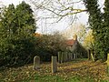
 The churchyard, Barnby in the Willows - geograph.org.uk - 5598807.jpg 1 024 × 768 ; 343 kio
-
 The churchyard, Barnby in the Willows - geograph.org.uk - 5598811.jpg 1 024 × 768 ; 287 kio
-
 The churchyard, Barnby in the Willows - geograph.org.uk - 6479060.jpg 1 024 × 768 ; 348 kio
-
 The confluence of Shire Dyke and the River Witham - geograph.org.uk - 3084119.jpg 1 024 × 768 ; 173 kio
-
 The confluence of Shire Dyke and the River Witham - geograph.org.uk - 6434159.jpg 1 024 × 768 ; 192 kio
-
 The east end, All Saints church, Barnby in the Willows - geograph.org.uk - 4858562.jpg 1 024 × 768 ; 169 kio
-
 The end of Fen Lane - geograph.org.uk - 3671943.jpg 1 024 × 768 ; 137 kio
-
 The footpath from Barnby in the Willows to Balderton (2) - geograph.org.uk - 3084142.jpg 1 024 × 768 ; 293 kio
-
 The footpath from Barnby in the Willows to Balderton - geograph.org.uk - 3084130.jpg 1 024 × 768 ; 271 kio
-
 The Plots in Spring - geograph.org.uk - 6457180.jpg 1 024 × 768 ; 253 kio
-
 The River Witham and Skerries Plantation - geograph.org.uk - 6299411.jpg 1 024 × 768 ; 259 kio
-
 The River Witham and Skerries Plantation - geograph.org.uk - 6429488.jpg 1 024 × 768 ; 208 kio
-
 The River Witham at Barnby in the Willows - geograph.org.uk - 4067304.jpg 3 776 × 2 520 ; 3,98 Mio
-
 The River Witham at Barnby in the Willows - geograph.org.uk - 6351206.jpg 1 024 × 768 ; 195 kio
-
 The River Witham below Skerries Plantation - geograph.org.uk - 6429481.jpg 1 024 × 768 ; 230 kio
-
 The River Witham by Skerries Plantation - geograph.org.uk - 6435594.jpg 1 024 × 768 ; 200 kio
-
 The River Witham in flood - geograph.org.uk - 6299305.jpg 1 024 × 768 ; 108 kio
-
 The River Witham in flood - geograph.org.uk - 6392451.jpg 1 024 × 768 ; 164 kio
-
 The River Witham near Barnby in the Willows - geograph.org.uk - 6424530.jpg 1 024 × 768 ; 187 kio
-
 The Skerries and farm bridge over the River Witham - geograph.org.uk - 1910360.jpg 1 600 × 1 200 ; 411 kio
-
 The Skerries and River Witham - geograph.org.uk - 1910372.jpg 1 600 × 1 200 ; 442 kio
-
 The Warren and Brickyard Holms - geograph.org.uk - 1911678.jpg 640 × 480 ; 95 kio
-
 Tower near Barnby Manor - geograph.org.uk - 1999124.jpg 1 024 × 768 ; 131 kio
-
 Track alongside Coddington Plantation - geograph.org.uk - 6323584.jpg 1 024 × 768 ; 211 kio
-
 Track on the edge of Coddington Plantation - geograph.org.uk - 6323752.jpg 1 024 × 768 ; 342 kio
-
 Track to Barnby Hall - geograph.org.uk - 2910083.jpg 640 × 480 ; 51 kio
-
 Track to Black Sykes - geograph.org.uk - 2910046.jpg 640 × 480 ; 102 kio
-
 Trees by a drain - geograph.org.uk - 4883021.jpg 1 024 × 768 ; 201 kio
-
 Two swans and seven cygnets on the River Witham - geograph.org.uk - 6479065.jpg 1 024 × 768 ; 240 kio
-
 VE Day 75th Anniversary, Barnby in the Willows - geograph.org.uk - 6479110.jpg 1 024 × 768 ; 207 kio
-
 VE Day 75th Anniversary, Barnby in the Willows - geograph.org.uk - 6479116.jpg 1 024 × 768 ; 251 kio
-
 View of Barnby in the Willows from the river bank - geograph.org.uk - 3084068.jpg 1 024 × 768 ; 213 kio
-
 View towards Barnby from the Fenton footpath - geograph.org.uk - 1944599.jpg 800 × 600 ; 109 kio
-
 View towards Barnby Hall - geograph.org.uk - 2446068.jpg 1 024 × 768 ; 242 kio
-
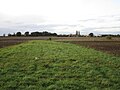
 View towards Barnby in the Willows - geograph.org.uk - 3084123.jpg 1 024 × 768 ; 242 kio
-
 View towards Fenton - geograph.org.uk - 2192806.jpg 1 024 × 768 ; 114 kio
-
 View towards Grove Farm - geograph.org.uk - 2442750.jpg 1 024 × 768 ; 204 kio
-
 View towards Plots Farm - geograph.org.uk - 2442723.jpg 1 024 × 768 ; 161 kio
-
 View towards Skerries Plantation - geograph.org.uk - 6433600.jpg 1 024 × 768 ; 161 kio
-
 View towards Sutton - geograph.org.uk - 6429495.jpg 1 024 × 768 ; 199 kio
-
 View towards the Middle Buildings - geograph.org.uk - 2192798.jpg 1 024 × 768 ; 86 kio
-
 Walker defeated (again) - geograph.org.uk - 6434153.jpg 1 024 × 768 ; 265 kio
-
 Walker defeated - geograph.org.uk - 3084135.jpg 1 024 × 768 ; 302 kio
-
 Walker triumphant - geograph.org.uk - 3671937.jpg 1 024 × 768 ; 132 kio
-
 Weir on the River Witham - geograph.org.uk - 6434154.jpg 1 024 × 768 ; 191 kio
-
 Willow by the Witham - geograph.org.uk - 6429477.jpg 1 024 × 768 ; 290 kio
-
 Willow Tree Inn - geograph.org.uk - 1391524.jpg 640 × 426 ; 61 kio
-
 Willow Tree Inn, Barnby in the Willows - geograph.org.uk - 2910073.jpg 640 × 480 ; 53 kio
-
 Willow Tree sign - geograph.org.uk - 1391530.jpg 426 × 640 ; 133 kio
-
 Willow trees and impending storm - geograph.org.uk - 6400261.jpg 1 024 × 768 ; 203 kio
-
 Witham bridge looking towards Fenton - geograph.org.uk - 1910338.jpg 3 264 × 2 448 ; 3,28 Mio
-
 Woodland beside the A17 - geograph.org.uk - 2910052.jpg 640 × 480 ; 147 kio
-
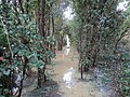
 Yew lined path. All Saints' churchyard - geograph.org.uk - 6434187.jpg 1 024 × 768 ; 266 kio
-
 A17 towards Newark - geograph.org.uk - 389972.jpg 640 × 478 ; 84 kio
-
 Across the square to Fen Farm - geograph.org.uk - 412549.jpg 640 × 480 ; 140 kio


_-_geograph.org.uk_-_5840043.jpg)
_-_geograph.org.uk_-_5840056.jpg)


_-_geograph.org.uk_-_4081832.jpg)


_-_geograph.org.uk_-_3084094.jpg)


_near_to_Beckingham_-_geograph.org.uk_-_4934493.jpg)
_towards_Newark_-_geograph.org.uk_-_2910055.jpg)


_-_geograph.org.uk_-_3084142.jpg)


_-_geograph.org.uk_-_6434153.jpg)


