Category:Barra, Scotland
Salti al navigilo
Salti al serĉilo

island in Outer Hebrides, Scotland, UK   | |||||
| Alŝuti plurmedion | |||||
| Prononco-registraĵo | |||||
|---|---|---|---|---|---|
| Estas | |||||
| Parto de | |||||
| Loko |
| ||||
| Ĉe akvokorpo |
| ||||
| Ĉefurbo | |||||
| Plej alta punkto | |||||
| Loĝantaro |
| ||||
| Areo |
| ||||
| Supermara alteco |
| ||||
| Alia ol | |||||
 | |||||
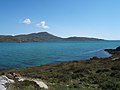
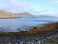
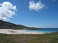
This category is about the island of Barra in the Outer Hebrides, Scotland.
Subkategorioj
Ĉi tiu kategorio havas la 11 jenajn subkategoriojn, el 11 entute.
- Maps of Barra, Scotland (4 D)
B
- Broch of Bruernish (2 D)
C
- Cille Bharra (6 D)
D
- Dun Cuier (4 D)
H
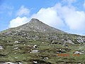
- Heaval, Barra (27 D)
L
R
T
- Tràigh Mhòr, Barra (13 D)
V
Dosieroj en kategorio “Barra, Scotland”
La jenaj 200 dosieroj estas en ĉi tiu kategorio, el 327 entute.
(antaŭa paĝo) (sekva paĝo)-

-
 -Passing shower, Eoligarry - geograph.org.uk - 2068876.jpg 2 448 × 3 264; 1,17 MB
-
 2004 0806hebridies0048.JPG 2 048 × 1 536; 805 KB
-
 A Smaller Castle - panoramio.jpg 1 446 × 962; 1,84 MB
-
 A view towards Barra - geograph.org.uk - 4241867.jpg 640 × 480; 93 KB
-
 Abhainn Mor - geograph.org.uk - 251922.jpg 640 × 480; 56 KB
-
 Across Bagh Chornaig to Sheabhal - geograph.org.uk - 1377771.jpg 640 × 480; 58 KB
-
 Across Vatersay Sound to Barra - geograph.org.uk - 647628.jpg 640 × 480; 77 KB
-
 Admiralty Chart No 2770 Sound of Barra, 1945, Originally published 1863.jpg 11 160 × 16 299; 26,62 MB
-
 Allt Heisgeir Mouth - geograph.org.uk - 2572520.jpg 2 560 × 1 920; 2,37 MB
-
 Alongside the landing at Barra - panoramio.jpg 4 320 × 3 240; 3,39 MB
-
 Alte Einfriedungen im Westen von Barra.jpg 5 184 × 3 456; 8,19 MB
-
 Another Hebridean Beach - geograph.org.uk - 251914.jpg 640 × 480; 51 KB
-
 Bagh Beag, Isle of Barra - geograph.org.uk - 942754.jpg 640 × 424; 68 KB
-
 Bagh Chornaig - geograph.org.uk - 284820.jpg 640 × 480; 97 KB
-
 Bagh Halaman Barra.JPG 4 752 × 3 168; 5,61 MB
-
 Bagh Thalaman - geograph.org.uk - 1367918.jpg 640 × 480; 49 KB
-
 Barra Airport (35067792202).jpg 20 061 × 3 304; 51,77 MB
-
 Barra Airport (35158891411).jpg 12 633 × 2 374; 24,83 MB
-
 Barra Bagh nan Clach.jpg 640 × 427; 70 KB
-
 Barra banner Kisimul Castle from Castlebay.JPG 2 100 × 300; 116 KB
-
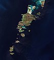 Barra by Sentinel-2.jpg 3 541 × 3 954; 7,52 MB
-
 Barra Cliff Eolaigearraidh.jpg 427 × 640; 72 KB
-
 Barra coastline - geograph.org.uk - 2069409.jpg 2 176 × 1 632; 668 KB
-
 Barra Ferry landing from ferry - geograph.org.uk - 1561840.jpg 640 × 480; 76 KB
-
 Barra Fields.jpg 640 × 480; 100 KB
-
 Barra Golf Course - geograph.org.uk - 1363084.jpg 640 × 458; 254 KB
-
 Barra Golf Course - geograph.org.uk - 1363120.jpg 480 × 640; 274 KB
-
 Barra Harbour Eolaigearraidh.jpg 640 × 422; 206 KB
-
 Barra isthmus Eolaigearraidh.jpg 640 × 480; 78 KB
-
 Barra Port an Lodain.jpg 640 × 427; 79 KB
-
 Barra Satellite Photo.png 1 024 × 722; 966 KB
-
 Barra Scenery - panoramio (1).jpg 4 320 × 3 240; 3,26 MB
-
 Barra Scenery - panoramio (10).jpg 4 320 × 3 240; 3,6 MB
-
 Barra Scenery - panoramio (11).jpg 4 320 × 3 240; 4,47 MB
-
 Barra Scenery - panoramio (12).jpg 4 320 × 3 240; 3,12 MB
-
 Barra Scenery - panoramio (13).jpg 4 320 × 3 240; 3,1 MB
-
 Barra Scenery - panoramio (14).jpg 4 320 × 3 240; 2,77 MB
-
 Barra Scenery - panoramio (15).jpg 4 320 × 3 240; 3,52 MB
-
 Barra Scenery - panoramio (16).jpg 4 320 × 3 240; 4,51 MB
-
 Barra Scenery - panoramio (2).jpg 4 320 × 3 240; 2,91 MB
-
 Barra Scenery - panoramio (3).jpg 4 320 × 3 240; 3,56 MB
-
 Barra Scenery - panoramio (4).jpg 4 320 × 3 240; 3,34 MB
-
 Barra Scenery - panoramio (5).jpg 4 320 × 3 240; 3,31 MB
-
 Barra Scenery - panoramio (6).jpg 4 320 × 3 240; 3,56 MB
-
 Barra Scenery - panoramio (8).jpg 4 320 × 3 240; 3,52 MB
-
 Barra Scenery - panoramio (9).jpg 4 320 × 3 240; 3,38 MB
-
 Barra Scenery - panoramio.jpg 4 320 × 3 240; 2,8 MB
-
 Barra signs.jpg 4 000 × 3 000; 3,89 MB
-
 Barra The Isle of Barra Beach Hotel.jpg 2 400 × 1 600; 2,29 MB
-
 Barra Tràigh Sgurabhal.jpg 640 × 427; 62 KB
-
 Barra War Memorial (34580767824).jpg 5 472 × 3 648; 2,74 MB
-
 Barra War Memorial (34580773354).jpg 3 648 × 5 472; 4,98 MB
-

-
 Barra, Blick von der Inselmitte westwärts nach Borve.jpg 5 061 × 3 273; 8,1 MB
-
 Beach at Cleat - Panorama - panoramio.jpg 4 082 × 477; 482 KB
-
 Beach at Cleat - panoramio.jpg 3 008 × 2 000; 2,88 MB
-
 Beach head - geograph.org.uk - 249551.jpg 640 × 480; 76 KB
-
 Beach Inlet - geograph.org.uk - 1363169.jpg 480 × 640; 278 KB
-
 Beach on Barra - geograph.org.uk - 249524.jpg 640 × 480; 55 KB
-
 Beach-top debris - geograph.org.uk - 249518.jpg 640 × 480; 85 KB
-
 Beinn Chliaid-Geograph-3982791-by-Douglas-Law-.jpg 2 560 × 1 920; 2,48 MB
-
 Beinn Eireabhal-Geograph-1877340-by-Phillip-Williams.jpg 640 × 480; 149 KB
-
 Beinn Eireabhal-Geograph-3861409-by-William-Starkey.jpg 640 × 480; 316 KB
-
 Beinn Eòlaigearraidh Mhòr-Geograph-3963255-by-Douglas-Law-.jpg 2 560 × 1 920; 2,14 MB
-
 Beinn Mhàrtainn-Geograph-3982143-by-Douglas-Law-.jpg 2 560 × 1 920; 1,94 MB
-
 Beinn nan Càrnan-Geograph-4121642-by-John-Lucas.jpg 640 × 480; 220 KB
-
 Beinn Ob-Geograph-3982770-by-Douglas-Law-.jpg 2 560 × 1 920; 2,54 MB
-
 Beinn Tangabhal-Geograph-2600837-by-Hugh-Venables.jpg 1 600 × 1 200; 676 KB
-
 Beinn Tangabhal-Geograph-3982804-by-Douglas-Law-.jpg 2 560 × 1 920; 2,64 MB
-
 Bergwelt von Barra.jpg 5 084 × 3 307; 11,04 MB
-
 Bhatersaigh Information board - geograph.org.uk - 1367839.jpg 640 × 480; 76 KB
-
 BIG Sky - panoramio.jpg 2 527 × 1 323; 2,3 MB
-
 Black House, Black Sheep - geograph.org.uk - 1353675.jpg 640 × 430; 81 KB
-
 Blick vom östlichen Strand des Isthmus von Vatersay nach Barra.jpg 5 184 × 3 456; 7,15 MB
-
 Blick von Barra nach Hellisay und Fuiay.jpg 5 178 × 3 447; 7,56 MB
-
 Blick von Barra südwärts auf die Insel Muldoanich II.jpg 5 160 × 3 420; 9,42 MB
-
 Blick von Barra südwärts auf die Insel Muldoanich.jpg 5 166 × 3 429; 6,87 MB
-
 Blick von der Flanke des Heaval nordwärts über Barra nach South Uist.jpg 5 033 × 3 231; 8,14 MB
-
 Blick von der Fähre Barra-Oban aus südlicher Richtung auf Barra.jpg 5 184 × 3 456; 5,38 MB
-
 Blick von der Mitte der Insel Barra in Richtung Eriskay.jpg 5 124 × 3 367; 8,01 MB
-
 Blick von der Mitte der Insel Barra in Richtung South Uist.jpg 5 136 × 3 384; 6,86 MB
-
 Blick von der Mitte der Insel Barra nach Nordost.jpg 5 184 × 3 456; 5,31 MB
-
 Blick von der Nordflanke des Heaval westwärts über Loch Uisge.jpg 5 112 × 3 350; 10,45 MB
-

-
 Borve Burial Ground (35122674272).jpg 5 472 × 3 648; 4,7 MB
-
 Borve Burial Ground (35248606556).jpg 5 472 × 3 648; 2,3 MB
-
 Borve Point - geograph.org.uk - 200586.jpg 640 × 431; 262 KB
-
 Borve, Barra (34608808744).jpg 3 359 × 3 359; 2,18 MB
-
 Borve, Barra (34608814144).jpg 5 472 × 3 648; 2,42 MB
-
 Borve, Barra (34640895013).jpg 5 472 × 3 648; 3,69 MB
-
 Borve, Barra (35450413575).jpg 5 472 × 3 648; 2,2 MB
-
 Bruairnis - geograph.org.uk - 878882.jpg 640 × 480; 62 KB
-
 Bruairnis Summit-Geograph-3982756-by-Douglas-Law-.jpg 2 560 × 1 920; 2,46 MB
-
 Brèibhig-Geograph-3135859-by-Alan-Reid.jpg 1 600 × 1 200; 519 KB
-
 Butterfly Orchid, Barra - geograph.org.uk - 654996.jpg 480 × 640; 47 KB
-
 Cadha Mòr-Geograph-2597661-by-Hugh-Venables.jpg 1 600 × 1 200; 800 KB
-
 Caisteal Chiosmuil (34941376695).jpg 3 648 × 5 472; 3,11 MB
-

-
 Castlebay (34478883533).jpg 11 963 × 3 082; 31,21 MB
-
 Cave on Fuideigh - geograph.org.uk - 3601801.jpg 1 024 × 676; 154 KB
-
 Chart 3674 Southern Approaches to the Minch Scotland.jpg 3 987 × 7 238; 4,72 MB
-
 Cidhe Eolaigearraigh from the air - geograph.org.uk - 1379744.jpg 640 × 480; 50 KB
-
 Cidhe Eòlaigearraidh - geograph.org.uk - 4603933.jpg 3 264 × 2 448; 2,69 MB
-
 Cille Bharra (34444846784).jpg 3 648 × 5 472; 6,28 MB
-
 Cille Bharra (34444889814).jpg 10 880 × 3 052; 33,68 MB
-
 Cille Bharra (34478722763).jpg 5 472 × 3 648; 4,82 MB
-
 Cille Bharra (34478742133).jpg 5 472 × 3 648; 7,54 MB
-
 Cille Bharra (34901133260).jpg 3 648 × 5 472; 7,73 MB
-
 Cille Bharra (35122622332).jpg 5 472 × 3 648; 4,28 MB
-
 Cille Bharra (35158563261).jpg 3 648 × 5 472; 6,51 MB
-
 Cille Bharra (35158824641).jpg 3 648 × 5 472; 7,87 MB
-
 Cille Bharra (35158865041).jpg 3 648 × 5 472; 6,74 MB
-
 Cille Bharra (35248443846).jpg 3 648 × 5 472; 6,78 MB
-
 Cille Bharra (35248507386).jpg 6 775 × 3 038; 22,53 MB
-
 Cille Bharra (35248521396).jpg 5 472 × 3 648; 5,04 MB
-
 Cille Bharra (35248550046).jpg 5 472 × 3 648; 4,17 MB
-

-
 Cliad bay and Ben Cliad - geograph.org.uk - 852097.jpg 620 × 401; 292 KB
-

-
 Close up to the Isle of Barra Hotel - geograph.org.uk - 1367914.jpg 640 × 480; 67 KB
-
 Coast of Flodaigh - geograph.org.uk - 2602181.jpg 1 600 × 1 200; 637 KB
-
 Coast of Rubha Bhruairnis - geograph.org.uk - 2605543.jpg 1 600 × 1 200; 748 KB
-
 Coastal inlet - geograph.org.uk - 249545.jpg 640 × 480; 64 KB
-
 Cottage at Earsairidh - geograph.org.uk - 1365390.jpg 640 × 469; 292 KB
-
 Cow on a beach - geograph.org.uk - 2608518.jpg 1 600 × 1 200; 290 KB
-
 Cows on the beach - geograph.org.uk - 3696426.jpg 3 888 × 2 592; 883 KB
-
 Cows on the Beach at Uidh - panoramio.jpg 3 008 × 2 000; 2,71 MB
-
 Crannag - geograph.org.uk - 1342571.jpg 640 × 480; 87 KB
-
 Croft house and boats, Bruairnis. - geograph.org.uk - 878885.jpg 480 × 640; 76 KB
-
 Crofting Life - geograph.org.uk - 1369273.jpg 640 × 462; 61 KB
-
 Cross-cutting Dykes - geograph.org.uk - 1365442.jpg 480 × 640; 334 KB
-
 Detail of War Memorial south of Nasg - geograph.org.uk - 1377630.jpg 640 × 480; 29 KB
-
 Dun ban - geograph.org.uk - 852114.jpg 620 × 403; 283 KB
-
 Dun Bharpa - geograph.org.uk - 254568.jpg 640 × 480; 44 KB
-
 Earsairidh - geograph.org.uk - 1365513.jpg 640 × 477; 325 KB
-
 Earsairidh - geograph.org.uk - 1365547.jpg 640 × 438; 292 KB
-
 Earsairidh - geograph.org.uk - 1367342.jpg 640 × 480; 281 KB
-
 Earsairidh and Orasaigh - geograph.org.uk - 1365527.jpg 640 × 458; 276 KB
-
 Earsary Harbour - panoramio.jpg 6 788 × 1 294; 1,42 MB
-
 Easary Barra Scotland.jpg 4 000 × 3 000; 1,37 MB
-
 Eolaigearraidh Sign.jpg 1 600 × 2 400; 3,29 MB
-
 Eoligarry Ruin (34444963524).jpg 5 472 × 3 648; 4,35 MB
-
 Eoligarry School and New Housing - geograph.org.uk - 1379692.jpg 640 × 480; 40 KB
-
 Evening on the beach - geograph.org.uk - 2068749.jpg 3 252 × 1 632; 866 KB
-
 Expanse of sandy beach - geograph.org.uk - 1563230.jpg 640 × 480; 34 KB
-
 Isle of Barra flag.svg 600 × 360; 237 bajtoj
-
 Flag of Barra.svg 800 × 533; 320 bajtoj
-
 Flanks of Thartabhal.jpg 1 600 × 1 200; 833 KB
-

-
 Golf in the Hebrides - panoramio.jpg 5 272 × 575; 731 KB
-
 Goodbye Barra (for 2011) - panoramio.jpg 1 447 × 963; 791 KB
-
 Grave of Compton MacKenzie (35122610482).jpg 5 472 × 3 648; 8,05 MB
-
 Grave of Compton MacKenzie (35248537156).jpg 3 648 × 5 472; 6,18 MB
-
 Greanamul - geograph.org.uk - 5520506.jpg 640 × 427; 77 KB
-
 Greanamul and surrounding skerries - geograph.org.uk - 5557505.jpg 1 024 × 768; 136 KB
-

-

-
 Grianamul west cardinal buoy - geograph.org.uk - 4706113.jpg 2 280 × 1 712; 763 KB
-
 Grianan-Geograph-2948228-by-Becky-Williamson.jpg 640 × 457; 67 KB
-
 Grianan-Geograph-3982157-by-Douglas-Law-.jpg 2 560 × 1 920; 2,46 MB
-

-

-
 Halaman Skerry - geograph.org.uk - 2600856.jpg 1 600 × 1 200; 511 KB
-
 Harbour Cottage - panoramio.jpg 1 639 × 1 091; 1,63 MB
-
 Harbour Cottage Earsary - panoramio.jpg 3 008 × 2 000; 2,81 MB
-
 Harbour Cottage, Earsary - 2011 - panoramio.jpg 3 384 × 1 543; 4,13 MB
-

-
 Hebridean Sunset - panoramio.jpg 2 071 × 1 378; 1,52 MB
-
 Here's looking at you^ - geograph.org.uk - 1369219.jpg 640 × 480; 67 KB
-

-
 Herring Fleet Barra - George Washington Wilson - ABDMS018121.jpg 500 × 394; 24 KB
-
 Hoofprints on the beach - geograph.org.uk - 3696432.jpg 3 888 × 2 592; 1,38 MB
-
 House at the head of Loch Ob - geograph.org.uk - 1353759.jpg 640 × 420; 57 KB
-
 House with a scenic view on Barra - panoramio.jpg 4 320 × 3 240; 3,46 MB
-
 Incoming Tide at Earsairidh - geograph.org.uk - 1365565.jpg 640 × 454; 259 KB
-
 Inlet and road at Earsary Barra - geograph.org.uk - 852084.jpg 620 × 404; 345 KB
-
 Islands and light, Sgeir Dubh - geograph.org.uk - 4321582.jpg 640 × 480; 189 KB
-
 Isle of Barra - panoramio.jpg 640 × 480; 25 KB
-
 Isle of Barra Beach Hotel - geograph.org.uk - 1573062.jpg 640 × 426; 38 KB
-
 Isle of Barra Hotel - geograph.org.uk - 1367908.jpg 640 × 480; 51 KB
-
 ISLE OF BARRA WESTERN ISLES SCOTLAND SEP 2010 (5039581563).jpg 3 648 × 2 736; 3,61 MB
-
 Isle of Barra.png 1 582 × 1 056; 35 KB
-
 Isle of Fiaraidh - geograph.org.uk - 911961.jpg 640 × 480; 39 KB
-
 Just landed at Barra - geograph.org.uk - 4603911.jpg 3 264 × 2 448; 3,46 MB
-

-
 Kayaks and rainbow - Barra - geograph.org.uk - 1476889.jpg 640 × 479; 83 KB
-
 Kilbar Anderson 1881b Fig 137 138 scotlandinearlyc00anderich 0267.jpg 1 871 × 2 356; 1,61 MB
-
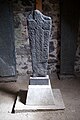 Kilbar Stone (35288455105).jpg 3 648 × 5 472; 5,16 MB
-
 Kisimul Vs MV Isle of Lewis (35063727350).jpg 3 558 × 5 337; 4,5 MB
-
 Käfer am Heaval, Barra.jpg 5 184 × 3 456; 7,38 MB
-
 Landschaft in der Mitte von Barra.jpg 5 184 × 3 456; 6,01 MB
-
 LBDT.jpg 526 × 394; 66 KB
-
 Leaving Barra - geograph.org.uk - 41522.jpg 640 × 480; 83 KB
-
 Leaving Barra - panoramio (1).jpg 4 320 × 3 240; 3,2 MB
-
 Leaving Barra - panoramio.jpg 4 320 × 3 240; 3,62 MB
-
 Leinis - geograph.org.uk - 1365419.jpg 640 × 480; 289 KB
-
 Leinis - geograph.org.uk - 250184.jpg 640 × 480; 45 KB
-
 Leinis Point - geograph.org.uk - 1365460.jpg 640 × 449; 280 KB
-
 Leinis Point - geograph.org.uk - 1365507.jpg 480 × 640; 307 KB
_-_geograph.org.uk_-_5435377.jpg)


.jpg)
.jpg)
.jpg)
.jpg)
.jpg)
.jpg)
.jpg)
.jpg)
.jpg)
.jpg)
.jpg)
.jpg)
.jpg)
.jpg)
.jpg)


.jpg)
.jpg)


.jpg)
.jpg)

.jpg)
.jpg)
.jpg)
.jpg)


.jpg)
_and_the_Causeway_-_geograph.org.uk_-_55818.jpg)


.jpg)
.jpg)
.jpg)
.jpg)
.jpg)
.jpg)
.jpg)
.jpg)
.jpg)
.jpg)
.jpg)
.jpg)


,_Traigh_Eais_-_geograph.org.uk_-_603198.jpg)


.jpg)


_-_panoramio.jpg)
.jpg)
.jpg)


.jpg)


.jpg)
.jpg)


.jpg)


.jpg)
.jpg)
.jpg)
.jpg)