Category:Barston
Aller à la navigation
Aller à la recherche
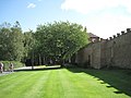
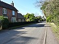
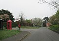
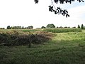
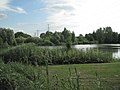
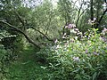
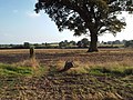
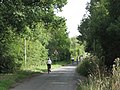
English: Barston is a village and civil parish in Metropolitan Borough of Solihull in the West Midlands of the United Kingdom. It is about six km east of Solihull and is located inside a large meander of the River Blythe. The nearest large city is Birmingham. According to the 2001 UK Census, the parish had a population of 499.
village d'Angleterre  | |||||
| Téléverser des médias | |||||
| Nature de l’élément | |||||
|---|---|---|---|---|---|
| Lieu | district métropolitain de Solihull, Midlands de l'Ouest, Angleterre | ||||
 | |||||
Sous-catégories
Cette catégorie comprend 2 sous-catégories, dont les 2 ci-dessous.
B
E
- Eastcote, West Midlands (3 F)
Média dans la catégorie « Barston »
Cette catégorie comprend 256 fichiers, dont les 200 ci-dessous.
(page précédente) (page suivante)-
 "Don't you have any of those rolls" - geograph.org.uk - 2031269.jpg 640 × 480 ; 383 kio
-
 'Mon Desir' in Barston - geograph.org.uk - 5501123.jpg 2 122 × 1 591 ; 1,16 Mio
-
 A field north of Barston Park - geograph.org.uk - 2018474.jpg 640 × 480 ; 334 kio
-
 A motorway speed gantry over the M42 - geograph.org.uk - 4500639.jpg 1 500 × 999 ; 142 kio
-
 Active Traffic Management on the M42 - geograph.org.uk - 3705361.jpg 640 × 480 ; 248 kio
-
 Along Eastcote Lane - geograph.org.uk - 4353698.jpg 1 306 × 979 ; 561 kio
-
 Along the UCR towards Piercil End - geograph.org.uk - 6000491.jpg 979 × 1 306 ; 857 kio
-
 Alpaca Farm - geograph.org.uk - 5462376.jpg 3 955 × 2 541 ; 2,63 Mio
-
 Arbour Farmhouse, Barston - geograph.org.uk - 5501101.jpg 2 122 × 1 591 ; 1,53 Mio
-
 At the end of Ryton End - geograph.org.uk - 4396196.jpg 1 142 × 857 ; 543 kio
-
 Baled wheatstraw near Barston Hall - geograph.org.uk - 2036247.jpg 640 × 480 ; 423 kio
-
 Balsall Street - geograph.org.uk - 10708.jpg 640 × 480 ; 91 kio
-
 Balsall Street - geograph.org.uk - 41538.jpg 640 × 480 ; 83 kio
-
 Balsall Street - geograph.org.uk - 41542.jpg 640 × 480 ; 76 kio
-
 Balsall Street - geograph.org.uk - 45793.jpg 640 × 480 ; 112 kio
-
 Banks of the River Blythe - geograph.org.uk - 2020201.jpg 640 × 480 ; 437 kio
-
 Banks of the River Blythe - geograph.org.uk - 2034415.jpg 640 × 480 ; 328 kio
-
 Barston - The Bull's Head - geograph.org.uk - 5108588.jpg 1 600 × 1 238 ; 415 kio
-
 Barston - the downside - geograph.org.uk - 2031119.jpg 512 × 640 ; 331 kio
-
 Barston Bridge - geograph.org.uk - 4397273.jpg 1 142 × 857 ; 514 kio
-
 Barston Bridge - geograph.org.uk - 46614.jpg 640 × 477 ; 138 kio
-
 Barston Bridge on the River Blythe - geograph.org.uk - 2036294.jpg 640 × 480 ; 477 kio
-
 Barston churchyard - geograph.org.uk - 2020230.jpg 640 × 480 ; 463 kio
-
 Barston churchyard, memorial to the Clive family - geograph.org.uk - 2020140.jpg 512 × 640 ; 572 kio
-
 Barston Garage, Barston Lane - geograph.org.uk - 2017155.jpg 640 × 480 ; 323 kio
-
 Barston Hall, Barston Lane frontage - geograph.org.uk - 2036255.jpg 640 × 480 ; 363 kio
-
 Barston Lake at West Midlands Golf Course - geograph.org.uk - 6112907.jpg 640 × 480 ; 46 kio
-
 Barston Lake fishery - geograph.org.uk - 4396172.jpg 1 088 × 814 ; 200 kio
-
 Barston Lake fishery - geograph.org.uk - 4396180.jpg 1 088 × 814 ; 315 kio
-
 Barston Lane - geograph.org.uk - 4397333.jpg 1 142 × 857 ; 469 kio
-
 Barston Lane and The Firs - geograph.org.uk - 4397345.jpg 979 × 734 ; 396 kio
-

-
 Barston Lane near Arbour Farm - geograph.org.uk - 2017163.jpg 640 × 480 ; 418 kio
-
 Barston Lane near Arbour Farm - geograph.org.uk - 4397349.jpg 1 142 × 857 ; 504 kio
-
 Barston Lane Near Barston Hall - geograph.org.uk - 6112876.jpg 640 × 499 ; 82 kio
-
 Barston Lane Near Eastcote Hall - geograph.org.uk - 6112739.jpg 640 × 480 ; 54 kio
-
 Barston Lane Near Eastcote Junction - geograph.org.uk - 6112743.jpg 640 × 454 ; 66 kio
-
 Barston Lane Near The Pines - geograph.org.uk - 6112754.jpg 640 × 454 ; 53 kio
-
 Barston parish pump, Barston Lane - geograph.org.uk - 2031261.jpg 480 × 640 ; 560 kio
-
 Barston Village Hob Lane Junction - geograph.org.uk - 6112817.jpg 640 × 480 ; 97 kio
-
 Barston Village Sign - geograph.org.uk - 6112810.jpg 640 × 449 ; 64 kio
-
 Barston Village Telephone Box and Pillar Box - geograph.org.uk - 6112816.jpg 640 × 453 ; 57 kio
-
 Barston-The Malt Shovel - geograph.org.uk - 5108583.jpg 1 600 × 1 156 ; 431 kio
-
 Block-paved drive, Walsal End - geograph.org.uk - 4239736.jpg 640 × 384 ; 78 kio
-
 Blythe Cottage - geograph.org.uk - 5459568.jpg 4 608 × 2 592 ; 3,17 Mio
-
 Blythe footbridge - geograph.org.uk - 1252371.jpg 640 × 480 ; 146 kio
-
 Blythe House - geograph.org.uk - 2036285.jpg 640 × 480 ; 344 kio
-
 Blythe valley near Barston Farm - geograph.org.uk - 2018368.jpg 640 × 480 ; 340 kio
-
 Blythe valley near Blythe House Farm - geograph.org.uk - 2036311.jpg 640 × 480 ; 365 kio
-
 Blythe View House, Hob Lane - geograph.org.uk - 2027648.jpg 640 × 480 ; 363 kio
-
 Boundary of Glendalough Farm, Hob Lane - geograph.org.uk - 2031125.jpg 640 × 480 ; 519 kio
-
 Bridge 75 at Copt Heath - geograph.org.uk - 4763319.jpg 1 142 × 857 ; 466 kio
-
 Bridge across the Blythe - geograph.org.uk - 2029470.jpg 640 × 480 ; 483 kio
-
 Brook Cottages, Barston - geograph.org.uk - 5456329.jpg 1 469 × 1 102 ; 957 kio
-

-
 Canoeist on the Grand Union Canal - geograph.org.uk - 4645247.jpg 800 × 616 ; 153 kio
-
 Castle bridge (no74) on the Grand Union - geograph.org.uk - 4763973.jpg 1 142 × 857 ; 530 kio
-
 Castle Bridge No 74 - geograph.org.uk - 4644998.jpg 800 × 712 ; 200 kio
-
 Christmas tree crop^ - geograph.org.uk - 2017209.jpg 640 × 480 ; 332 kio
-
 Christmas Trees in November - geograph.org.uk - 2692698.jpg 640 × 480 ; 71 kio
-
 Clump of trees near The Pines - geograph.org.uk - 2020159.jpg 640 × 480 ; 316 kio
-
 Clump of trees, jet overhead - geograph.org.uk - 2020196.jpg 640 × 480 ; 318 kio
-
 Collapsing willows by the River Blythe - geograph.org.uk - 2020210.jpg 640 × 480 ; 537 kio
-
 Conifer crop near Wood Lane Farm - geograph.org.uk - 2017199.jpg 640 × 480 ; 383 kio
-
 Conifers a failure, maize a success - geograph.org.uk - 2017246.jpg 640 × 480 ; 296 kio
-
 Construction site next to the Grand Union Canal - geograph.org.uk - 4645228.jpg 800 × 600 ; 114 kio
-
 Converted Barn at Walsal End - geograph.org.uk - 3267314.jpg 640 × 480 ; 80 kio
-
 Copt Heath Wharf along the Grand Union Canal - geograph.org.uk - 4645213.jpg 800 × 574 ; 143 kio
-
 Disused red barn, Piercil End - geograph.org.uk - 2029488.jpg 640 × 480 ; 353 kio
-
 Drive to Barston Park - geograph.org.uk - 2018442.jpg 640 × 480 ; 490 kio
-
 Ducklings at North end of lake at Ryton End - geograph.org.uk - 2002093.jpg 800 × 600 ; 123 kio
-
 Eastcote Lane - new and old - geograph.org.uk - 4353703.jpg 1 142 × 857 ; 454 kio
-
 Eastcote Lane Junction - geograph.org.uk - 5459579.jpg 3 647 × 2 168 ; 2,54 Mio
-
 Elvers Green Lane near Barston - geograph.org.uk - 5063973.jpg 1 306 × 979 ; 497 kio
-
 Executive Gardening, Barston - geograph.org.uk - 2031112.jpg 640 × 480 ; 472 kio
-

-
 Farmer's ford on the River Blythe - geograph.org.uk - 2020185.jpg 640 × 480 ; 344 kio
-
 Farmland at Henwood Hall Farm - geograph.org.uk - 4645175.jpg 800 × 582 ; 136 kio
-
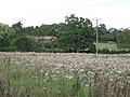
 Field by the Blythe - geograph.org.uk - 2017251.jpg 640 × 480 ; 361 kio
-
 Field northwest of Barston with jet - geograph.org.uk - 2020153.jpg 640 × 480 ; 342 kio
-
 Field south of Barston church - geograph.org.uk - 2018518.jpg 640 × 480 ; 375 kio
-
 Fields across the River Blythe - geograph.org.uk - 2018358.jpg 640 × 480 ; 528 kio
-
 Fields below the flightpath - geograph.org.uk - 2035721.jpg 640 × 480 ; 280 kio
-
 Fields of maize east of Walsal End - geograph.org.uk - 4239628.jpg 1 280 × 960 ; 1,8 Mio
-
 Fields southwest of Firs Farm - geograph.org.uk - 2017139.jpg 640 × 480 ; 364 kio
-
 Fishing lake - geograph.org.uk - 2017232.jpg 640 × 480 ; 354 kio
-
 Flat straw bales near Barston Hall - geograph.org.uk - 2036290.jpg 640 × 480 ; 377 kio
-
 Footbridge across the Blythe - geograph.org.uk - 2031123.jpg 512 × 640 ; 498 kio
-

-
 Footbridge over River Blythe - geograph.org.uk - 5472029.jpg 4 608 × 2 592 ; 3,13 Mio
-
 Footpath by the River Blythe - geograph.org.uk - 2018348.jpg 640 × 480 ; 593 kio
-
-
 Footpath near Barston - geograph.org.uk - 3274646.jpg 640 × 480 ; 93 kio
-

-
 Footpath south to Barston from Walsal End - geograph.org.uk - 4239693.jpg 640 × 384 ; 65 kio
-
 Ford at Henwood Mill, Solihull - geograph.org.uk - 2980363.jpg 3 872 × 2 592 ; 2,41 Mio
-
 Ford on Elvers Green Lane - geograph.org.uk - 63089.jpg 640 × 480 ; 148 kio
-
 Ford on Elvers Green Lane, Barston - geograph.org.uk - 2980356.jpg 3 872 × 2 592 ; 2,34 Mio
-
 Ford through the Blythe - geograph.org.uk - 6000488.jpg 1 306 × 979 ; 852 kio
-
 Former Ford at Bradnock's Marsh - geograph.org.uk - 3755207.jpg 3 872 × 2 592 ; 4,73 Mio
-
 Foundation stone on the bridge - geograph.org.uk - 4397282.jpg 1 142 × 857 ; 530 kio
-
 Friday Lane bridge over M42 - geograph.org.uk - 3193263.jpg 1 024 × 768 ; 502 kio
-
 Friday Lane Bridge, M42 - geograph.org.uk - 3240063.jpg 640 × 430 ; 40 kio
-
 Friday Lane Bridge, M42 - geograph.org.uk - 3705290.jpg 640 × 480 ; 242 kio
-
 Friday Lane crosses the M42 - geograph.org.uk - 4500644.jpg 1 500 × 999 ; 130 kio
-
 Gantry on M42 - geograph.org.uk - 6218626.jpg 849 × 1 024 ; 96 kio
-
 Gantry on the M42 - geograph.org.uk - 3240070.jpg 640 × 430 ; 48 kio
-
 Garden-making, Wood Lane Farm - geograph.org.uk - 2017179.jpg 640 × 480 ; 398 kio
-
 Gate and stile near Ledbrook Farm - geograph.org.uk - 2018500.jpg 640 × 480 ; 412 kio
-
 Gate pier at The Firs farm - geograph.org.uk - 5456331.jpg 1 469 × 1 102 ; 820 kio
-
 Gates to Barston Park - geograph.org.uk - 2018451.jpg 640 × 480 ; 492 kio
-
 Gateway to St Swithin's churchyard, Barston - geograph.org.uk - 2031258.jpg 640 × 480 ; 455 kio
-
 Grand Union canal near Copt Heath - geograph.org.uk - 4763315.jpg 1 142 × 857 ; 427 kio
-
 Grand Union Canal Walk - geograph.org.uk - 5228643.jpg 640 × 480 ; 77 kio
-
 Grand Union Canal Walk - geograph.org.uk - 5228648.jpg 640 × 480 ; 99 kio
-
 Hampton Road approaching the River Blythe - geograph.org.uk - 2692695.jpg 640 × 480 ; 49 kio
-
 Hampton Road north of Blythe Waters fishery - geograph.org.uk - 2692696.jpg 640 × 480 ; 67 kio
-
 Henwood Lane Bridge No 77 - geograph.org.uk - 4645239.jpg 800 × 566 ; 210 kio
-
 Henwood Mill and Ford - geograph.org.uk - 1639175.jpg 480 × 640 ; 79 kio
-
 Henwood Mill from the Grand Union canal path - geograph.org.uk - 4549017.jpg 4 752 × 3 168 ; 2,63 Mio
-
 Hob Farm, Hob Lane - geograph.org.uk - 2031274.jpg 640 × 480 ; 446 kio
-
 Hob Lane by Barston Farm - geograph.org.uk - 2018378.jpg 640 × 480 ; 460 kio
-
 Holsteins on the slope south of Barston - geograph.org.uk - 2035727.jpg 640 × 480 ; 379 kio
-
 House at Walsal End - geograph.org.uk - 3274542.jpg 640 × 480 ; 85 kio
-
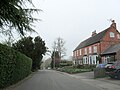
 Houses in Barston. - geograph.org.uk - 3267308.jpg 640 × 480 ; 84 kio
-
 Houses, north end of Barston Lane - geograph.org.uk - 2017696.jpg 640 × 480 ; 428 kio
-

-

-
 Jasmine Cottage, Barston - geograph.org.uk - 5454239.jpg 1 632 × 1 224 ; 970 kio
-
 Junction of Barston Lane and Hob Lane - geograph.org.uk - 2020142.jpg 640 × 480 ; 374 kio
-
 Junction of Oak Lane and Barston Lane - geograph.org.uk - 2020144.jpg 640 × 480 ; 357 kio
-
 Junction of power lines by Nappins Covert - geograph.org.uk - 4155429.jpg 640 × 480 ; 78 kio
-
 Knowle Road at Junction Witrh Barston Lane - geograph.org.uk - 6112744.jpg 640 × 480 ; 72 kio
-
 Knowle Road bridge over the River Blythe - geograph.org.uk - 4764004.jpg 1 142 × 857 ; 478 kio
-
 Lake north of Barston Hall - geograph.org.uk - 2036270.jpg 640 × 480 ; 504 kio
-

-

-
 Leafy path north to Walsal End - geograph.org.uk - 4239709.jpg 512 × 640 ; 170 kio
-
 Leaving Barston Village - geograph.org.uk - 6112820.jpg 640 × 480 ; 69 kio
-
 Ledbrook Farm - geograph.org.uk - 2018483.jpg 640 × 480 ; 356 kio
-
 Line of the River Blythe - geograph.org.uk - 2035740.jpg 640 × 480 ; 360 kio
-
 Listed barn at The Firs - geograph.org.uk - 5493735.jpg 1 795 × 1 346 ; 799 kio
-
 Look Both Ways - geograph.org.uk - 3264620.jpg 640 × 480 ; 143 kio
-
 M42 - middle lane - geograph.org.uk - 6218627.jpg 838 × 1 024 ; 96 kio
-
 M42 half a mile to Junction 5 - geograph.org.uk - 4599668.jpg 1 600 × 1 061 ; 284 kio
-
 M42 Motorway - half-mile to junction 5 - geograph.org.uk - 1817545.jpg 640 × 480 ; 78 kio
-
 M42 near Eastcote - geograph.org.uk - 3705315.jpg 640 × 480 ; 242 kio
-
 M42 near Henwood Hall Farm - geograph.org.uk - 2826407.jpg 640 × 480 ; 49 kio
-
 M42 passes under Friday Lane - geograph.org.uk - 2826400.jpg 640 × 481 ; 52 kio
-
 M42 southbound approaching junction 5 - geograph.org.uk - 4227325.jpg 640 × 408 ; 50 kio
-
 M42 towards the M6 - geograph.org.uk - 4353857.jpg 1 142 × 857 ; 281 kio
-
 M42, approaching junction 5 - geograph.org.uk - 2679091.jpg 640 × 430 ; 55 kio
-
 Maize on a knoll southeast of Walsal End - geograph.org.uk - 4159705.jpg 640 × 480 ; 74 kio
-
 Medieval cross at Barston - geograph.org.uk - 5501111.jpg 1 591 × 2 122 ; 1,47 Mio
-
 Medieval cross in Barston churchyard - geograph.org.uk - 5501115.jpg 1 591 × 2 122 ; 1,71 Mio
-
 Metropolitan Borough of Solihull , M42 Motorway - geograph.org.uk - 5951537.jpg 6 000 × 4 000 ; 7,02 Mio
-
 Metropolitan Borough of Solihull , M42 Motorway - geograph.org.uk - 5951538.jpg 6 000 × 4 000 ; 7,09 Mio
-
 Metropolitan Borough of Solihull , M42 Motorway - geograph.org.uk - 5951540.jpg 6 000 × 4 000 ; 6,56 Mio
-
 Midland Hospital buildings - geograph.org.uk - 4763299.jpg 979 × 1 306 ; 394 kio
-
 Mobile phone mast - geograph.org.uk - 4353851.jpg 857 × 1 142 ; 378 kio
-
 Modern houses, Barston Lane - geograph.org.uk - 2031272.jpg 640 × 480 ; 394 kio
-
 Nappins Covert - geograph.org.uk - 65384.jpg 640 × 480 ; 88 kio
-
 Nappins Covert from Elvers Green Lane - geograph.org.uk - 2846782.jpg 4 000 × 2 248 ; 4,65 Mio
-
 Narrowboats at Copt Heath Wharf - geograph.org.uk - 4763304.jpg 1 142 × 857 ; 484 kio
-
 Nearing Barston Bridge from the east - geograph.org.uk - 2036302.jpg 640 × 480 ; 448 kio
-
 New pasture aspiring to parkland - geograph.org.uk - 2017227.jpg 640 × 480 ; 330 kio
-
 New Road Bridge to Golf Club - geograph.org.uk - 3267282.jpg 640 × 480 ; 95 kio
-

-
 North Lodge, Piercil End - geograph.org.uk - 2029492.jpg 640 × 480 ; 391 kio
-
 North side of Barston Lane crossroads - geograph.org.uk - 2036111.jpg 640 × 480 ; 399 kio
-

-
 Northfields Farm near Walsal End - geograph.org.uk - 4203135.jpg 640 × 480 ; 99 kio
-
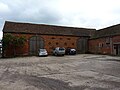
 Old brick barns, Firs Farm - geograph.org.uk - 2017145.jpg 640 × 480 ; 378 kio
-
 Old grey shed, Barston Lane - geograph.org.uk - 2017690.jpg 640 × 480 ; 460 kio
-
 Old Timbers cottage, Barston - geograph.org.uk - 5454240.jpg 1 224 × 1 632 ; 1 Mio
-
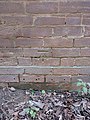
 OS benchmark - Barston, Barston Hall - geograph.org.uk - 4397304.jpg 857 × 1 142 ; 598 kio
-
 OS benchmark - Barston, church tower - geograph.org.uk - 4397320.jpg 857 × 1 142 ; 579 kio
-
 OS benchmark - Barston, footbridge over the Blythe - geograph.org.uk - 5065802.jpg 857 × 1 142 ; 582 kio
-
 OS benchmark - Barston, Hobb Cottage - geograph.org.uk - 5065786.jpg 979 × 1 306 ; 448 kio
-
 OS benchmark - Eastcote, former garage - geograph.org.uk - 4405791.jpg 857 × 1 142 ; 551 kio
-
 OS benchmark - Eastcote, garage on Barston Lane - geograph.org.uk - 4353991.jpg 857 × 1 142 ; 570 kio
-
 OS benchmark - Eastcote, The Paddock outbuilding - geograph.org.uk - 4353782.jpg 857 × 1 142 ; 514 kio
-
 OS benchmark - Eastcote, Wharley Hall outbuilding - geograph.org.uk - 4354001.jpg 857 × 1 142 ; 506 kio
-
 OS benchmark - Knowle, River Blythe bridge - geograph.org.uk - 4764008.jpg 857 × 1 142 ; 634 kio
-
 Parish Pound, Barston - geograph.org.uk - 2031264.jpg 640 × 480 ; 479 kio
-
 Photo voltaics at the golf club - geograph.org.uk - 4396184.jpg 1 306 × 979 ; 475 kio
-
 Police Water - geograph.org.uk - 2035700.jpg 640 × 480 ; 380 kio
-
 Precast concrete footbridge over the River Blythe - geograph.org.uk - 5065797.jpg 1 142 × 857 ; 666 kio
-
 River Blythe below Barston Bridge - geograph.org.uk - 2036298.jpg 640 × 480 ; 561 kio
-
 River Blythe below Barston Bridge - geograph.org.uk - 4397298.jpg 857 × 1 142 ; 397 kio
-
 River Blythe below Springfield House - geograph.org.uk - 2029467.jpg 640 × 480 ; 444 kio
-
 River Blythe below unclassified county road - geograph.org.uk - 2017238.jpg 640 × 480 ; 543 kio
-
-
 River Blythe near Barston Bridge - geograph.org.uk - 3267303.jpg 640 × 480 ; 137 kio
-
 River Blythe south of Barston - geograph.org.uk - 2035733.jpg 512 × 640 ; 552 kio
-
 River under the canal - geograph.org.uk - 2776310.jpg 3 648 × 2 736 ; 4,6 Mio
-
 Rose Cottage, Barston - geograph.org.uk - 5453578.jpg 1 632 × 1 224 ; 796 kio
-
 Ryton End Junction with Barston Lane - geograph.org.uk - 6112878.jpg 640 × 446 ; 78 kio
-
 Ryton End lane - geograph.org.uk - 4397268.jpg 857 × 1 142 ; 422 kio
-
 Ryton End turning off Barston Lane - geograph.org.uk - 2036272.jpg 640 × 480 ; 552 kio


_on_the_Grand_Union_-_geograph.org.uk_-_4763973.jpg)


