Category:Batheaston
Vai alla navigazione
Vai alla ricerca
English: Batheaston is a village and civil parish east of Bath, England (which is believed to be where the name derived from), on the north bank of the River Avon. The parish has a population of 2,625. The northern area of the parish on the road to St Catherine is an area known as Northend.
village and civil parish in Somerset, England, UK  | |||||
| Carica un file multimediale | |||||
| Istanza di | |||||
|---|---|---|---|---|---|
| Luogo | Bath and North East Somerset, Somerset, Sud Ovest dell'Inghilterra, Inghilterra | ||||
| sito web ufficiale | |||||
 | |||||
Sottocategorie
Questa categoria contiene le 5 sottocategorie indicate di seguito, su un totale di 5.
File nella categoria "Batheaston"
Questa categoria contiene 165 file, indicati di seguito, su un totale di 165.
-
 245 And 247, London Road East.jpg 4 032 × 3 024; 2,52 MB
-
 292, High Street.jpg 4 032 × 3 024; 2,89 MB
-
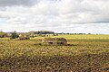
 A farm path - geograph.org.uk - 4651133.jpg 2 304 × 1 704; 1,65 MB
-

-
 Aircraft Dispersal Pens or Revetments - geograph.org.uk - 1811260.jpg 1 600 × 947; 369 KB
-
 An old house in Batheaston - geograph.org.uk - 2174155.jpg 2 000 × 1 399; 661 KB
-
 Back down the hill - geograph.org.uk - 4651129.jpg 1 704 × 2 304; 1,67 MB
-
 Banner Down Byway - geograph.org.uk - 3498500.jpg 2 592 × 1 944; 1,89 MB
-
 Bannerdown Common - geograph.org.uk - 329251.jpg 640 × 480; 46 KB
-
 Bannerdown Common - geograph.org.uk - 329260.jpg 640 × 427; 71 KB
-
 Barn near Rodney Farm - geograph.org.uk - 3750875.jpg 800 × 600; 329 KB
-
 Bath And North East Somerset , Aerial Scenery - geograph.org.uk - 5442117.jpg 6 000 × 4 000; 7,34 MB
-
 Bathampton Primary School - geograph.org.uk - 599565.jpg 640 × 480; 82 KB
-
 Batheaston Gardens flood - geograph.org.uk - 3789851.jpg 4 896 × 3 672; 7,21 MB
-
 Batheaston North End - geograph.org.uk - 5738861.jpg 1 676 × 2 046; 628 KB
-
 Batheaston Reservoir - geograph.org.uk - 1811311.jpg 2 186 × 1 438; 585 KB
-
 Batheaston toll bridge upstream view - geograph.org.uk - 99756.jpg 640 × 430; 77 KB
-
 Batheaston.jpg 640 × 525; 86 KB
-
 Boundary Marker On (Ngr St 7844 6721).jpg 3 024 × 4 032; 8,94 MB
-
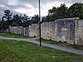
 Boundary Wall On North Side Of Batheaston Public Gardens.jpg 4 080 × 3 072; 3,84 MB
-
 Break pressure tank - geograph.org.uk - 4651121.jpg 2 304 × 1 704; 1,62 MB
-
 By Brook Footbridge.jpg 640 × 480; 124 KB
-
 Canal bridge, Batheaston - geograph.org.uk - 1753816.jpg 640 × 481; 143 KB
-
 Car park for The George - geograph.org.uk - 645030.jpg 640 × 480; 107 KB
-

-
 Chilcombe Bottom - panoramio.jpg 12 439 × 1 973; 5,51 MB
-
 Chilcombe Bottom from Upper Swainswick - geograph.org.uk - 4705589.jpg 3 128 × 2 346; 1,22 MB
-
 Cloud reflections in the River Avon - geograph.org.uk - 5210304.jpg 6 000 × 4 000; 7,19 MB
-
 Coalpit Road and Fosse Lane, Batheaston - geograph.org.uk - 821488.jpg 640 × 430; 103 KB
-
 Congregational Chapel, Batheaston - geograph.org.uk - 5227965.jpg 6 000 × 4 000; 3,72 MB
-
 Cows on Little Solsbury Hill - geograph.org.uk - 5229876.jpg 6 000 × 4 000; 5,01 MB
-
 Different duties - geograph.org.uk - 4655014.jpg 2 304 × 1 704; 1,78 MB
-
 Dispersed to nature - geograph.org.uk - 4652484.jpg 2 304 × 1 704; 1,67 MB
-
 Entrance to Little Solsbury Hill - geograph.org.uk - 4433485.jpg 734 × 516; 62 KB
-
 Farmland in Ramscombe Bottom - geograph.org.uk - 4705658.jpg 3 128 × 2 346; 1,4 MB
-
 Fiveway mini-roundabout in Batheaston - geograph.org.uk - 5210351.jpg 6 000 × 4 000; 4,05 MB
-
 Fiveways House.jpg 4 032 × 3 024; 2,08 MB
-
 Flying to the horizon - geograph.org.uk - 4652512.jpg 2 304 × 1 704; 1,65 MB
-
 For walkers old and new - geograph.org.uk - 4651136.jpg 1 704 × 2 304; 1,93 MB
-
 Former chapel, High Street, Batheaston - geograph.org.uk - 2173735.jpg 2 000 × 1 511; 564 KB
-
 Former telephone exchange, Fenthouse Hill, Batheaston - geograph.org.uk - 2173740.jpg 2 000 × 1 458; 491 KB
-
 Fosse Lane, Batheaston - geograph.org.uk - 2174153.jpg 2 000 × 1 389; 495 KB
-
 Fosse Lane, Batheaston - geograph.org.uk - 5210368.jpg 5 690 × 3 793; 3,23 MB
-
 Fosse Way on Bannerdown - geograph.org.uk - 3158995.jpg 640 × 480; 90 KB
-

-
 Garage, 15 Yards To East Of No 290, High Street.jpg 4 032 × 3 024; 2,63 MB
-
 Gateway and farm track onto Charmy Down airfield - geograph.org.uk - 4705577.jpg 3 128 × 2 346; 1,51 MB
-
 George And Dragon And White Lion Inns.jpg 4 080 × 3 072; 1,93 MB
-
 Growing a disguise - geograph.org.uk - 4655056.jpg 2 304 × 1 704; 1,7 MB
-
 Hillside above Lower Swainswick - geograph.org.uk - 5229885.jpg 6 000 × 4 000; 5,32 MB
-
 House Extension Construction - geograph.org.uk - 3157370.jpg 640 × 480; 76 KB
-
 Houses on the Fosse Way - geograph.org.uk - 3157328.jpg 640 × 480; 64 KB
-
 In the St Catherine's valley - geograph.org.uk - 5163998.jpg 2 304 × 1 704; 1,47 MB
-
 Lane drops towards Batheaston - geograph.org.uk - 1065982.jpg 640 × 480; 80 KB
-
 Little Solsbury Hill - geograph.org.uk - 4427066.jpg 3 072 × 2 304; 3,16 MB
-
 Little Solsbury Hill - geograph.org.uk - 5229026.jpg 6 000 × 4 000; 4,62 MB
-
 Little Solsbury Hill Fort - geograph.org.uk - 808930.jpg 3 888 × 2 592; 4,42 MB
-
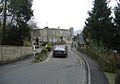
 London Road, approaching Batheaston - geograph.org.uk - 871611.jpg 640 × 445; 96 KB
-
 London Road, Batheaston - geograph.org.uk - 809088.jpg 640 × 453; 87 KB
-
 Looking down into the upper reaches of Ranscombe - geograph.org.uk - 4705616.jpg 3 128 × 2 346; 2,32 MB
-
 Looking downstream in the Ramscombe valley - geograph.org.uk - 4705645.jpg 3 128 × 2 346; 3 MB
-

-

-
 Looking upstream in the Ranscombe valley - geograph.org.uk - 4705635.jpg 2 346 × 3 128; 2,84 MB
-

-

-
 Minding how you go - geograph.org.uk - 4651165.jpg 2 304 × 1 704; 1,61 MB
-
 More for livestock to negotiate - geograph.org.uk - 4649907.jpg 1 704 × 2 304; 2,18 MB
-
 North West from Little Solsbury Hill - geograph.org.uk - 821331.jpg 640 × 427; 62 KB
-
 Northend - geograph.org.uk - 329199.jpg 640 × 427; 39 KB
-
 Northend - panoramio.jpg 4 170 × 2 138; 1,6 MB
-
 Northend to the Limestone Link - geograph.org.uk - 5163996.jpg 2 304 × 1 704; 1,47 MB
-
 Not today thank you. - geograph.org.uk - 818662.jpg 640 × 469; 137 KB
-
 Old Farm Buildings - geograph.org.uk - 3158937.jpg 640 × 480; 54 KB
-
 Old R.A.F. building - geograph.org.uk - 4655027.jpg 2 304 × 1 704; 1,72 MB
-

-
 Open to the air - geograph.org.uk - 4652504.jpg 2 304 × 1 704; 1,22 MB
-
 Open to the air - geograph.org.uk - 4654997.jpg 2 304 × 1 704; 1,24 MB
-
 OS Street View ST77SE.tif 5 000 × 5 000; 2,04 MB
-
 Path off Little Solsbury Hill - geograph.org.uk - 5229877.jpg 6 000 × 4 000; 6,54 MB
-
 Path to Upper Northend House - geograph.org.uk - 5163991.jpg 2 304 × 1 704; 1,62 MB
-
 Public Gardens, Batheaston - panoramio.jpg 3 072 × 2 304; 4,45 MB
-
 Pubs and shops in Batheaston - geograph.org.uk - 2174165.jpg 2 000 × 1 342; 442 KB
-
 Quarry - geograph.org.uk - 334339.jpg 640 × 432; 42 KB
-
 Ripening barley above Batheaston - geograph.org.uk - 5227970.jpg 6 000 × 4 000; 5,72 MB
-
 River Avon at Batheaston - geograph.org.uk - 2666565.jpg 1 024 × 680; 219 KB
-
 Road to St.Catherine - geograph.org.uk - 822681.jpg 640 × 536; 96 KB
-
 Rodney Farm outbuilding - geograph.org.uk - 690362.jpg 640 × 462; 143 KB
-
 Runway ironmongery - geograph.org.uk - 4652491.jpg 2 304 × 1 704; 1,78 MB
-
 Rural colour - geograph.org.uk - 4651142.jpg 1 704 × 2 304; 1,96 MB
-

-

-

-

-

-

-

-

-
-
 Signal tower - geograph.org.uk - 4655005.jpg 1 704 × 2 304; 1,15 MB
-
 Sinking into the landscape - geograph.org.uk - 4655063.jpg 2 304 × 1 704; 1,76 MB
-
 Solsbury Lane, west of Batheaston - geograph.org.uk - 4432635.jpg 756 × 523; 92 KB
-
 South east from Little Solsbury Hill - geograph.org.uk - 821354.jpg 640 × 433; 101 KB
-

-
 Steps down to the River Avon - geograph.org.uk - 5210326.jpg 6 000 × 4 000; 4,91 MB
-
 Stile and footpath at the edge of woodland - geograph.org.uk - 4705611.jpg 2 346 × 3 128; 2,06 MB
-
 Still a landing ground - geograph.org.uk - 4654992.jpg 2 304 × 1 704; 1,7 MB
-

-
 Teasels in the sun - geograph.org.uk - 4651125.jpg 2 304 × 1 704; 1,81 MB
-

-
 The edge of the plateau on Little Solsbury Hill - geograph.org.uk - 5229018.jpg 6 000 × 4 000; 5,02 MB
-
 The Fosse Way - geograph.org.uk - 3750869.jpg 800 × 600; 386 KB
-
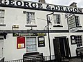 The George & Dragon.jpg 4 032 × 3 024; 2,85 MB
-
 The George Public House, Batheaston - geograph.org.uk - 1753806.jpg 640 × 480; 164 KB
-
 The Gloucester Road curves round - geograph.org.uk - 2421388.jpg 1 536 × 2 048; 991 KB
-
 The junction for Swainswick Lane - geograph.org.uk - 6407156.jpg 2 658 × 1 163; 939 KB
-
 The North East end of Banner Down Byway - geograph.org.uk - 3498489.jpg 2 592 × 1 944; 2,14 MB
-
 The north eastern side of Little Solsbury Hill - geograph.org.uk - 5229021.jpg 6 000 × 4 000; 5,86 MB
-
 The River Avon at Batheaston - geograph.org.uk - 6407149.jpg 2 525 × 932; 732 KB
-
 The side of Little Solsbury Hill - geograph.org.uk - 5229012.jpg 6 000 × 4 000; 5,79 MB
-
 The steep edge of Cherrywell Wood - geograph.org.uk - 2421363.jpg 1 200 × 1 600; 625 KB
-
 The Weir on the River Avon - geograph.org.uk - 1066006.jpg 640 × 480; 60 KB
-
 The western side of Little Solsbury Hill - geograph.org.uk - 5229879.jpg 6 000 × 4 000; 5,83 MB
-
 The White Lion 2.jpg 4 032 × 3 024; 2,41 MB
-
 The White Lion, Batheaston - geograph.org.uk - 821363.jpg 640 × 491; 86 KB
-
 Toll House, Batheaston - geograph.org.uk - 340481.jpg 640 × 480; 104 KB
-
 Tombstone of Arthur Philip - geograph.org.uk - 645079.jpg 640 × 480; 67 KB
-
 Trig point on Little Solsbury Hill - geograph.org.uk - 5229014.jpg 6 000 × 4 000; 5,78 MB
-
 Under cover - geograph.org.uk - 4649881.jpg 2 304 × 1 704; 1,76 MB
-
 Upper Bannerdown - geograph.org.uk - 5412232.jpg 3 264 × 2 448; 1,97 MB
-
 Upper Northend Farm - geograph.org.uk - 756813.jpg 640 × 427; 78 KB
-
 View from Bathford Hill - geograph.org.uk - 547691.jpg 640 × 426; 108 KB
-

-
 View over Lansdown from Little Solsbury Hill - geograph.org.uk - 818679.jpg 3 455 × 2 528; 4,28 MB
-
 View west from Little Solsbury Hill - geograph.org.uk - 821347.jpg 3 888 × 2 592; 5,46 MB
-
 Weir at Batheaston - geograph.org.uk - 340483.jpg 640 × 480; 60 KB
-
 Wending the way - geograph.org.uk - 4652509.jpg 2 304 × 1 704; 1,65 MB
-
 Wiltshire Border sign - geograph.org.uk - 700056.jpg 640 × 474; 162 KB
-
-

-

-

-

-

-

-

-

-

-

-

-

-

-

-
 Banner Down mast - geograph.org.uk - 57954.jpg 640 × 480; 55 KB
-
 Footpath at Holts Down - geograph.org.uk - 469361.jpg 640 × 480; 132 KB
-
 Houses in St. Catherine's Valley - geograph.org.uk - 755401.jpg 640 × 427; 92 KB
-
 Looking down road from The George - geograph.org.uk - 645044.jpg 640 × 480; 74 KB
-
 Northend - geograph.org.uk - 329182.jpg 640 × 427; 51 KB
-
 Northend - geograph.org.uk - 329277.jpg 640 × 427; 58 KB
-
 Rodney Farm - geograph.org.uk - 687811.jpg 640 × 480; 92 KB
-
 Rodney Farm, the farmhouse - geograph.org.uk - 690373.jpg 611 × 640; 129 KB
-
 Sandybank - geograph.org.uk - 316320.jpg 640 × 430; 62 KB
-
 The Fosse Way - geograph.org.uk - 700052.jpg 640 × 463; 126 KB
-
 Tollbooth at Batheaston - geograph.org.uk - 340477.jpg 640 × 449; 71 KB
-
 Workshops at Oakleigh - geograph.org.uk - 315815.jpg 628 × 442; 128 KB


.jpg)


_-_geograph.org.uk_-_5680031.jpg)
_-_geograph.org.uk_-_5680129.jpg)
_-_geograph.org.uk_-_5680142.jpg)
_-_geograph.org.uk_-_5680160.jpg)
_-_geograph.org.uk_-_5680071.jpg)
_-_geograph.org.uk_-_5680074.jpg)
_-_geograph.org.uk_-_5680036.jpg)
_-_geograph.org.uk_-_5680039.jpg)
_-_geograph.org.uk_-_5680044.jpg)
_-_geograph.org.uk_-_5680048.jpg)
_-_geograph.org.uk_-_5680058.jpg)
_-_geograph.org.uk_-_5680068.jpg)
_-_geograph.org.uk_-_5680150.jpg)
_-_geograph.org.uk_-_5680157.jpg)


