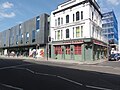
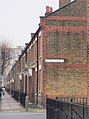
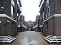
Category:Battersea
Vai alla navigazione
Vai alla ricerca
English: Battersea is a district of London and forms part of the London Borough of Wandsworth
- NOTE: Battersea may refer to many other subjects. See en:Battersea (disambiguation)
quartiere di Londra  | |||||
| Carica un file multimediale | |||||
| Istanza di | |||||
|---|---|---|---|---|---|
| Luogo |
| ||||
| Situato sul mare / lago / fiume | |||||
 | |||||
Sottocategorie
Questa categoria contiene le 46 sottocategorie indicate di seguito, su un totale di 46.
A
- Albion Riverside (16 F)
- Archer House, Battersea (3 F)
B
- Battersea Power Station Pier (7 F)
- Battersea Shield (7 F)
- Battersea Vicarage (3 F)
C
E
- Battersea enamel (52 F)
F
- Falcon Road (1 F)
G
- Battersea gas holders (43 F)
H
- Hotel Verta (5 F)
I
- In Town (Ravera), Battersea (34 F)
J
L
- Lavender Walk, Clapham (4 F)
- London Heliport (29 F)
M
- Maps of Battersea (13 F)
N
P
- Parkgate Road, Battersea (15 F)
Q
R
- Ransome's Dock (7 F)
S
Y
- York Road, Wandsworth (8 F)
File nella categoria "Battersea"
Questa categoria contiene 200 file, indicati di seguito, su un totale di 227.
(pagina precedente) (pagina successiva)-
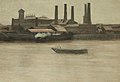
 Image taken from page 1076 of 'Old and New London, etc' (11191796304).jpg 1 719 × 1 326; 963 KB
-
 2 Westbridge Road.jpg 3 024 × 4 032; 4,21 MB
-
 2+4 Westbridge Road.jpg 3 024 × 4 032; 4,29 MB
-

-

-
 4 Westbridge Road.jpg 3 024 × 4 032; 4,41 MB
-
 7.7.16 London Sunrise 02 (27294035094).jpg 6 016 × 4 000; 4,6 MB
-
 7.7.16 London Sunrise 03 (27906544105).jpg 6 016 × 4 000; 4,44 MB
-
 7.7.16 London Sunrise 19 (27829841361).jpg 6 016 × 4 000; 6,35 MB
-
 Abercrombie Street, Battersea - geograph.org.uk - 4407468.jpg 2 272 × 1 704; 804 KB
-
 Afghan Road, Battersea - geograph.org.uk - 4407492.jpg 2 272 × 1 704; 899 KB
-
 Altura Tower Battersea (15127464531).jpg 1 280 × 853; 470 KB
-
 Ancient Celt with carnyx (Ancient Briton).jpg 2 220 × 1 788; 2,3 MB
-
 Arch 75 Queen's Circus Battersea Park.jpg 3 264 × 2 448; 2,58 MB
-
 Atherton Street, Battersea - geograph.org.uk - 4407459.jpg 2 272 × 1 704; 935 KB
-
 Batersea (19297045).jpeg 1 728 × 1 152; 644 KB
-
 Battersea and the Thames from the air - geograph.org.uk - 2646378.jpg 480 × 640; 146 KB
-
 Battersea boat.jpg 584 × 400; 137 KB
-
 Battersea bridge sign LBSC.jpg 3 024 × 4 032; 2,03 MB
-
 Battersea Church Road - geograph.org.uk - 2859385.jpg 472 × 640; 77 KB
-
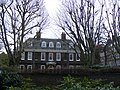
 Battersea General Hospital.jpg 478 × 307; 108 KB
-
 Battersea Power station 2024 2.jpg 5 472 × 3 648; 6,2 MB
-
 Battersea Power station 2024 7.jpg 5 472 × 3 648; 6,49 MB
-
 Battersea Reach (25790845363).jpg 2 665 × 1 614; 1,86 MB
-
 Battersea Reach Lawson.jpg 1 908 × 1 384; 2,4 MB
-
 Battersea Reach, River Thames - geograph.org.uk - 647289.jpg 640 × 480; 147 KB
-
 Battersea Square (geograph 4705633).jpg 6 000 × 4 000; 4,68 MB
-
 Battersea Square, Battersea - geograph.org.uk - 3200190.jpg 640 × 480; 154 KB
-
 Battersea sunset (6539004769).jpg 2 544 × 1 904; 1,13 MB
-
 Battersea, Cambridge Mansions - geograph.org.uk - 5085581.jpg 1 024 × 768; 196 KB
-
 Battersea, cement depot - geograph.org.uk - 1454045.jpg 640 × 480; 58 KB
-
 Battersea, converted school - geograph.org.uk - 1454095.jpg 640 × 480; 63 KB
-
 Battersea, Garrick Close - geograph.org.uk - 3434772.jpg 1 024 × 751; 149 KB
-
 Battersea, Joubert Street - geograph.org.uk - 5085548.jpg 1 024 × 768; 207 KB
-
 Battersea, Lombard Road and railway bridge - geograph.org.uk - 3484750.jpg 4 320 × 3 240; 6,18 MB
-
 Battersea, Robertson Street - geograph.org.uk - 1454155.jpg 640 × 480; 75 KB
-
 Battersea, stenchpipe - geograph.org.uk - 1454069.jpg 480 × 640; 82 KB
-
 Battersea, The Thames Path, south side - geograph.org.uk - 3484827.jpg 4 320 × 3 240; 7,14 MB
-
 Battsea freight.jpg 2 120 × 1 411; 1,05 MB
-
 Birds of a feather - geograph.org.uk - 692314.jpg 639 × 480; 42 KB
-
 Boudicca and Prasutagus (reenactors portraying).jpg 3 270 × 2 598; 3,61 MB
-
 Broughton Street, SW8 - geograph.org.uk - 224517.jpg 640 × 480; 136 KB
-
 Brynmaer Road, Battersea - geograph.org.uk - 4406823.jpg 2 272 × 1 704; 766 KB
-
 Bunga Bunga Bar.jpg 3 648 × 2 736; 2,17 MB
-
 Burns Road, Battersea - geograph.org.uk - 1703779.jpg 477 × 640; 86 KB
-
 Cabul Road, Battersea - geograph.org.uk - 4407484.jpg 2 272 × 1 704; 847 KB
-

-
 Cambridge Mansions, Cambridge Road - geograph.org.uk - 2641189.jpg 640 × 482; 103 KB
-
 Candahar and Cabul - non-PC Roads - geograph.org.uk - 1381898.jpg 640 × 480; 94 KB
-
 Candahar Road, Battersea - geograph.org.uk - 4407477.jpg 2 272 × 1 704; 852 KB
-
 Cement mixer trucks, Kirtling Street, London SW8.jpg 3 264 × 2 448; 872 KB
-
 Cemex cement plant, Cringle Street, London SW8.jpg 3 264 × 2 448; 821 KB
-
 Chelsea Reach - geograph.org.uk - 1440479.jpg 640 × 480; 78 KB
-
 Christchurch Gardens - geograph.org.uk - 1735470.jpg 640 × 480; 114 KB
-
 Cinnamon Row, Battersea SW11 - geograph.org.uk - 647290.jpg 640 × 480; 189 KB
-
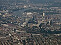 Clapham and Battersea from the air - geograph.org.uk - 6253991.jpg 1 024 × 768; 462 KB
-
 Clapham and Battersea from the air - geograph.org.uk - 6253995.jpg 1 024 × 768; 494 KB
-
 Cloisters Business Centre, London SW8.jpg 2 448 × 3 264; 1,37 MB
-
 Colestown Street, Battersea - geograph.org.uk - 4407393.jpg 2 272 × 1 704; 938 KB
-
 Cologne Road - geograph.org.uk - 3304057.jpg 1 600 × 1 062; 1 MB
-
 Comyn Road.jpg 3 024 × 4 032; 5,58 MB
-
 Coral Place Plantation Wharf - geograph.org.uk - 1261233.jpg 640 × 480; 81 KB
-
 Corner Houses - geograph.org.uk - 1381910.jpg 640 × 480; 87 KB
-
 Creative House, Battersea - geograph.org.uk - 617330.jpg 476 × 640; 74 KB
-
 Culvert Place, Battersea - geograph.org.uk - 325229.jpg 640 × 480; 39 KB
-
 Cupar Road, Battersea - geograph.org.uk - 4406768.jpg 2 272 × 1 704; 827 KB
-
 Dagnall Street, Battersea - geograph.org.uk - 2480851.jpg 640 × 480; 73 KB
-
 Decorated railway bridge in Battersea.jpg 3 024 × 4 032; 2,91 MB
-
 Decorative arch near Battersea Dogs Home.jpg 3 024 × 4 032; 3,64 MB
-
 Doddington and Rollo Estate - geograph.org.uk - 340761.jpg 640 × 480; 73 KB
-
 Early Melodians Steel Orchestra UK Members.png 835 × 405; 457 KB
-
 EAST YORKSHIRE DIPLOMAT - Flickr - secret coach park.jpg 1 719 × 1 176; 341 KB
-
 Eaton House School - geograph.org.uk - 1153166.jpg 640 × 480; 140 KB
-
 Edna St, Battersea - geograph.org.uk - 372212.jpg 640 × 480; 122 KB
-
 Edna Street - geograph.org.uk - 1381846.jpg 640 × 480; 105 KB
-
 Edward VII postbox in battersea.jpg 2 448 × 3 264; 2,78 MB
-
 Falcon Road, Battersea - geograph.org.uk - 4407504.jpg 2 272 × 1 704; 792 KB
-
 Falcon Wharf extension (15114162091).jpg 1 280 × 853; 606 KB
-
 Falcon Wharf turret (15119826162).jpg 862 × 1 280; 463 KB
-

-

-
 Footpath off Kirtling Street, London SW8.jpg 2 448 × 3 264; 657 KB
-
 Forfar Road - geograph.org.uk - 1259849.jpg 640 × 480; 93 KB
-
 Forfar Road - geograph.org.uk - 2324100.jpg 640 × 430; 134 KB
-
 Former Battersea Power Station seen from Ebury Bridge (1).jpg 4 000 × 3 000; 5,08 MB
-
 Former Battersea Power Station seen from Ebury Bridge (2).jpg 4 000 × 3 000; 5,45 MB
-
 Former Battersea Power Station seen seen from Vauxhall Bridge.jpg 4 000 × 2 248; 5,81 MB
-
 Fred Wells Gardens - geograph.org.uk - 1153097.jpg 545 × 640; 151 KB
-
 Frere Street, Battersea - geograph.org.uk - 3027058.jpg 3 872 × 2 592; 4,1 MB
-
 Geese, Battersea - geograph.org.uk - 4977106.jpg 1 686 × 1 152; 433 KB
-
 Geese, Battersea - geograph.org.uk - 4977138.jpg 1 757 × 1 121; 754 KB
-
 General Railway Pictures 2011 78.jpg 4 000 × 3 000; 4,54 MB
-
 Granfield Road, Battersea - geograph.org.uk - 3200181.jpg 640 × 480; 122 KB
-
 Green and white railway bridge.jpg 3 024 × 4 032; 2,15 MB
-
 Gwynne Road SW11 - geograph.org.uk - 168249.jpg 640 × 480; 128 KB
-
 Hamburger - Patty and Bun, London (1).jpg 3 346 × 2 232; 2,84 MB
-
 Hamburger - Patty and Bun, London.jpg 3 422 × 2 284; 3,04 MB
-
 Harbut Road SW11 - geograph.org.uk - 3668280.jpg 1 920 × 2 560; 631 KB
-
 Henning Street, Battersea - geograph.org.uk - 4408958.jpg 2 272 × 1 704; 870 KB
-
 Hervey Court Battersea - geograph.org.uk - 995628.jpg 640 × 450; 86 KB
-
 Hervey Court, Battersea, London - geograph.org.uk - 995627.jpg 640 × 428; 76 KB
-
 Holgate Avenue, Battersea, SW11 - geograph.org.uk - 648174.jpg 640 × 480; 86 KB
-

-
 Home Road, Battersea - geograph.org.uk - 4407473.jpg 2 272 × 1 704; 1 008 KB
-
 Homebase Superstore, Battersea - geograph.org.uk - 646368.jpg 640 × 480; 200 KB
-
 House on Louvaine Road - geograph.org.uk - 3583624.jpg 3 456 × 4 608; 6,1 MB
-
 Houses in Orbel Street, Battersea - geograph.org.uk - 2656082.jpg 4 000 × 3 000; 4,06 MB
-
 Houses on Poyntz Road - geograph.org.uk - 3461803.jpg 1 600 × 1 200; 331 KB
-
 ILN Vauxhall, Victoria & Battersea bridges.jpg 641 × 453; 101 KB
-
 Ingrave Street SW11 - geograph.org.uk - 168223.jpg 640 × 480; 111 KB
-
 Inworth Street, Battersea - geograph.org.uk - 4407465.jpg 2 272 × 1 704; 791 KB
-
 John Archer c.1913.jpg 808 × 808; 207 KB
-
 Kerrison Road - geograph.org.uk - 1381917.jpg 640 × 480; 87 KB
-
 Kerrison Road, Battersea - geograph.org.uk - 4407497.jpg 2 272 × 1 704; 768 KB
-
 Khyber Road, Battersea - geograph.org.uk - 4407488.jpg 2 272 × 1 704; 852 KB
-
 Latchmere Passage, Battersea - geograph.org.uk - 1703725.jpg 480 × 640; 101 KB
-
 Latchmere Street, Battersea - geograph.org.uk - 2480845.jpg 640 × 480; 87 KB
-
 Lindsay Court, Battersea.jpg 3 448 × 4 592; 7,7 MB
-
 Lombard Road - geograph.org.uk - 3304091.jpg 1 600 × 1 067; 857 KB
-
 Lombard Road, Battersea, SW11 - geograph.org.uk - 647455.jpg 640 × 480; 94 KB
-
 Lombard Wharf, Battersea (01).jpg 4 592 × 3 448; 7,97 MB
-
 London , Battersea - Lombard Road - geograph.org.uk - 2409531.jpg 4 286 × 2 844; 4,15 MB
-
 London - Battersea - Cinnamon kitchen restaurant, Tandoori Chicken Tikka.jpg 4 128 × 3 096; 3,67 MB
-
 London - Thames Clippers, Jupiter Clipper leaving Battersea Power Station stop.jpg 4 128 × 3 096; 4,18 MB
-
 London Buses route 137 Battersea.jpg 1 600 × 1 200; 501 KB
-
 London Buses route 344 Battersea.jpg 1 600 × 1 200; 624 KB
-
 London Buses route 345 Battersea.jpg 1 200 × 1 600; 361 KB
-
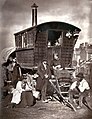 London Nomades.jpg 1 938 × 2 517; 1,76 MB
-
 London V2 Frissell2.jpg 983 × 1 030; 598 KB
-
 Longhedge works old OS.png 1 086 × 597; 1,54 MB
-
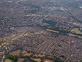 Looking across south Battersea, Wandsworth Common and Wandsworth Cemetery towards Wimbledon.jpg 1 898 × 1 424; 1 003 KB
-
 Louvaine Road - geograph.org.uk - 3583617.jpg 4 608 × 3 456; 6,33 MB
-
 Macduff Road, Battersea - geograph.org.uk - 4406789.jpg 2 272 × 1 704; 828 KB
-
 Maitland-Battersea.jpg 682 × 467; 47 KB
-
 Map of Winstanley Estate, Battersea.jpg 3 888 × 2 592; 4,04 MB
-
 Meath Street, Battersea - geograph.org.uk - 4406767.jpg 2 272 × 1 704; 697 KB
-
 Melodians BBC Virtual Orchestra 2016.jpg 214 × 290; 9 KB
-
 Molasses-House.jpg 554 × 368; 54 KB
-
 National School for Girls and Infants, Vicarage Crescent - geograph.org.uk - 2656065.jpg 4 000 × 3 000; 4,35 MB
-
 Nepaul Road, Battersea - geograph.org.uk - 4407490.jpg 2 272 × 1 704; 893 KB
-
 Network south east signage at Battersea.jpg 3 024 × 4 032; 2,07 MB
-

-
 Newcomen Road, Battersea - geograph.org.uk - 4407518.jpg 2 272 × 1 704; 1,13 MB
-
 Northcote Road Antiques Market.jpg 250 × 250; 35 KB
-
 Not really built of Lego...... - geograph.org.uk - 183398.jpg 640 × 480; 119 KB
-
 Odger Street, Battersea - geograph.org.uk - 1703794.jpg 640 × 480; 109 KB
-
 Open Space Doddington Estate - geograph.org.uk - 1259816.jpg 640 × 480; 119 KB
-
 Orbel Street, Battersea - geograph.org.uk - 4408955.jpg 2 272 × 1 704; 800 KB
-
 Orbis Wharf Battersea I (15102746361).jpg 853 × 1 280; 638 KB
-
 OSM Clapham Junction area transport layer.jpg 850 × 650; 505 KB
-
 OXFORD CITY LINK - Flickr - secret coach park.jpg 1 737 × 1 176; 306 KB
-
 Oyster Pier barges (15127691035).jpg 1 280 × 853; 590 KB
-
 Oyster Pier sign (15124619851).jpg 1 280 × 853; 325 KB
-

-
 Palmwood house 2.JPG 1 840 × 1 232; 1,3 MB
-
 Papine Jerk Centre on Winstanley Estate, Battersea.jpg 3 888 × 2 592; 5,22 MB
-
 Patty and Bun, London (7440739708).jpg 3 300 × 2 202; 3,79 MB
-

-
 Pillar box, York Road, Battersea - geograph.org.uk - 1734346.jpg 480 × 640; 67 KB
-
 Plough Rd - geograph.org.uk - 3465009.jpg 640 × 430; 50 KB
-
 Plough Road - geograph.org.uk - 3304041.jpg 1 600 × 1 067; 986 KB
-
 Plough Road, Battersea - geograph.org.uk - 2602973.jpg 1 000 × 667; 161 KB
-
 Plough Road, Battersea - geograph.org.uk - 3303984.jpg 1 600 × 1 067; 960 KB
-
 Plough Road, Battersea, London SW11 - geograph.org.uk - 647283.jpg 640 × 480; 180 KB
-
 Plough Road, Wandsworth - geograph.org.uk - 4381755.jpg 6 000 × 4 000; 6,75 MB
-
 Plough Terrace - geograph.org.uk - 4378134.jpg 466 × 640; 61 KB
-
 Polling station sign (London) (17195104557).jpg 2 048 × 980; 1,52 MB
-
 Poyntz Road, Battersea - geograph.org.uk - 325237.jpg 640 × 480; 45 KB
-
 Pym Battersea Bridge.jpg 1 920 × 1 360; 945 KB
-
 Railway bridge across River Thames - geograph.org.uk - 1153161.jpg 640 × 480; 53 KB
-
 Railway bridge over Winders Road - geograph.org.uk - 1735469.jpg 640 × 480; 85 KB
-
 Railway bridges, Battersea - geograph.org.uk - 1703683.jpg 480 × 640; 55 KB
-
 Railway lines and Chelsea Bridge Wharf apartments from Battersea Park Road, London SW8.jpg 3 264 × 2 448; 1,71 MB
-

-

-
 Riverside Radio.jpg 3 377 × 3 072; 3,14 MB
-
 Roads named after Afghanistan War in SW11 - geograph.org.uk - 5683738.jpg 576 × 1 024; 171 KB
-
 Rosenau Crescent - geograph.org.uk - 1380688.jpg 640 × 480; 92 KB
-
 Rowena Crescent, Battersea - geograph.org.uk - 4407479.jpg 2 272 × 1 704; 779 KB
-
 Selworthy House and Sparkford House, Battersea (01).jpg 4 096 × 3 116; 8,34 MB
-

-
 Shuttleworth Road, Battersea - geograph.org.uk - 4408951.jpg 2 272 × 1 704; 696 KB
-
 Shuttleworth Road, Battersea - geograph.org.uk - 4408961.jpg 2 272 × 1 704; 785 KB
-
 Simpson Street SW11 - geograph.org.uk - 168244.jpg 640 × 480; 118 KB
-
 Simpson Street, Battersea - geograph.org.uk - 4407525.jpg 2 272 × 1 704; 909 KB
-
 Somerset Estate, Battersea - geograph.org.uk - 237846.jpg 640 × 480; 133 KB
-
 Southolm Street, Battersea - geograph.org.uk - 4406756.jpg 2 272 × 1 704; 938 KB
-
 Sporle Court and Clarke Lawrence Court on Winstanley Estate, Battersea.jpg 3 888 × 2 592; 3,56 MB
-

-
 St Peter's Church Hall, Battersea - geograph.org.uk - 325253.jpg 640 × 480; 63 KB
-
 Stanmer Street, Battersea - geograph.org.uk - 4407461.jpg 2 272 × 1 704; 828 KB
-
 Stewarts Road, Battersea - geograph.org.uk - 4406742.jpg 2 272 × 1 704; 919 KB
-
 Stewarts Road, London SW8 - geograph.org.uk - 2674877.jpg 4 320 × 3 240; 4,16 MB
-
 Stewarts Road, London SW8 - geograph.org.uk - 2675826.jpg 4 320 × 3 240; 3,68 MB
-
 T & W Farmiloe Ltd, London SW8.jpg 2 448 × 3 264; 884 KB
-
 Thames Path approaching Battersea Bridge - geograph.org.uk - 2619669.jpg 1 024 × 680; 167 KB
-
 Thames Path at Battersea Reach - geograph.org.uk - 3778091.jpg 1 024 × 682; 101 KB
-
 Thames Path south of Battersea Bridge - geograph.org.uk - 3778111.jpg 1 024 × 682; 106 KB
-
 Thames Path, Battersea - geograph.org.uk - 2099542.jpg 640 × 430; 131 KB
-
 Thames Path, Battersea Reach - geograph.org.uk - 2100068.jpg 640 × 430; 134 KB
.jpg)


%27_(11121018444).jpg)
%27_(11120959185).jpg)

.jpg)
.jpg)
.jpg)


.jpg)
.jpg)


.jpeg)


.jpg)


.jpg)

.jpg)


.jpg)


.jpg)
.jpg)


.jpg)
.jpg)


.jpg)


.jpg)


.jpg)

.jpg)
.jpg)


.jpg)


_(17195104557).jpg)


.jpg)


