Category:Batu Pahat District
Vai alla navigazione
Vai alla ricerca
district in Johor, Malaysia   | |||||
| Carica un file multimediale | |||||
| Istanza di | |||||
|---|---|---|---|---|---|
| Luogo | Johor, Malaysia | ||||
| Superficie |
| ||||
| sito web ufficiale | |||||
 | |||||
Bahasa Melayu: Daerah Batu Pahat
Sottocategorie
Questa categoria contiene le 11 sottocategorie indicate di seguito, su un totale di 11.
B
- Batu Pahat River (14 F)
J
- Johor Botanical Garden (25 F)
M
P
- Parit Abdul Rahman (1 F)
- Parit Bakut (1 F)
- Parit Belemam (2 F)
- Parit Ju (1 F)
- Parit Penghulu (3 F)
S
- Simpang Kiri River (22 F)
File nella categoria "Batu Pahat District"
Questa categoria contiene 36 file, indicati di seguito, su un totale di 36.
-
 Aerial photographs of Tongkang Pechah and Panchor, Johor (230815) 01.jpg 3 000 × 4 000; 2,19 MB
-
 Aerial photographs of Tongkang Pechah and Panchor, Johor (230815) 02.jpg 3 000 × 4 000; 2,25 MB
-
 Aerial photographs of Tongkang Pechah and Panchor, Johor (230815) 03.jpg 3 000 × 4 000; 2,23 MB
-
 Batu Pahat at Dusk (3339677053).jpg 3 880 × 2 608; 7,07 MB
-
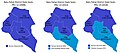
 Batu Pahat highlighted in Johor, Malaysia.svg 1 035 × 986; 78 KB
-
 Batu Pahat Parliamentary seats (2008, 2013, 2018).jpg 9 253 × 4 100; 2,13 MB
-
 Batu Pahat skyline dark-small.jpg 320 × 240; 14 KB
-
 Batu Pahat State seats (2008, 2013, 2018).jpg 9 742 × 4 476; 2,73 MB
-
 Bendera SKSD.png 1 200 × 600; 2,75 MB
-
 Daerah Batu Pahat, Johor - Mukim Bandar Pekan.svg 1 122 × 1 363; 358 KB
-
 Flag of Batu Pahat, Johor.svg 1 512 × 756; 2 KB
-
 Flag of Batu Pahat.svg 1 800 × 1 200; 2 KB
-
 GE14 Batu Pahat District Dun.svg 465 × 559; 46 KB
-
 GE14 Batu Pahat District Parliament.svg 465 × 566; 25 KB
-
 Intergrasi antara nanas dan kelapa sawit.JPG 2 205 × 1 408; 928 KB
-
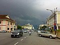
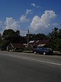
 Jalan Jenang.jpg 639 × 379; 45 KB
-
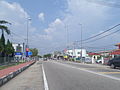
 Jalan Sultanah.jpg 639 × 366; 39 KB
-
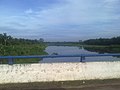 Kampung Sri Gading, Seri Gading, Johor, Malaysia - panoramio.jpg 2 048 × 1 536; 449 KB
-
 Local authorities of Batu Pahat District, Johor.svg 1 035 × 986; 59 KB
-
 Looking towards the Mimbar of Dato' Bentara Luar Mosque, Batu Pahat.jpg 1 280 × 960; 191 KB
-
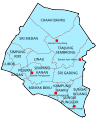 Map of Batu Pahat District, Johor.svg 477 × 590; 63 KB
-
 Msia- Johor Kampung.JPG 960 × 1 280; 529 KB
-
 Mukims of Batu Pahat District, Johor.svg 579 × 701; 44 KB
-
 Semerah.JPG 1 984 × 1 488; 1,1 MB
-
 Senggarang.JPG 1 984 × 1 488; 1,12 MB
-
 Seri Broleh Mosque.jpg 2 816 × 2 112; 2,52 MB
-
 SJK (C) Cheng Siu.jpg 1 350 × 759; 152 KB
-
 SJK (C) Chern Hwa.jpg 1 213 × 682; 88 KB
-
 SJK (C) Chong Hwa Rengit.jpg 1 638 × 922; 161 KB
-
 SJK (C) Chung Cheng.jpg 1 965 × 614; 143 KB
-
 Soga Perdana Recreational Forest.jpg 2 816 × 2 112; 3,23 MB
-
 Sri Gading.JPG 1 984 × 1 488; 1,13 MB
-
 Tanjong Laboh Jamek Mosque.jpg 1 984 × 1 488; 1,5 MB
-
 Temple White Horse Under Constructions.jpg 3 968 × 2 976; 3,58 MB
-
 The exterior of Dato' Bentara Luar Mosque, Batu Pahat.jpg 1 280 × 960; 240 KB
-
 The interior of Dato' Bentara Luar Mosque, Batu Pahat.jpg 1 280 × 960; 196 KB
_01.jpg)
_02.jpg)
_03.jpg)
.jpg)
.jpg)

.jpg)


_Cheng_Siu.jpg)
_Chern_Hwa.jpg)
_Chong_Hwa_Rengit.jpg)


_Chung_Cheng.jpg)