Category:Beal, North Yorkshire
Vai alla navigazione
Vai alla ricerca
parrocchia civile inglese  | |||||
| Carica un file multimediale | |||||
| Istanza di | |||||
|---|---|---|---|---|---|
| Luogo | Selby, North Yorkshire, Yorkshire e Humber, Inghilterra | ||||
| Popolazione |
| ||||
 | |||||
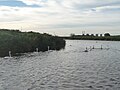
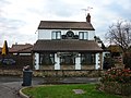
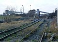
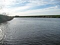
English: Beal is a village and civil parish in the Selby district of North Yorkshire, England. It is on the River Aire. According to the 2001 census it had a population of 720. The parish borders the City of Wakefield in West Yorkshire.
Sottocategorie
Questa categoria contiene un'unica sottocategoria, indicata di seguito.
K
File nella categoria "Beal, North Yorkshire"
Questa categoria contiene 200 file, indicati di seguito, su un totale di 209.
(pagina precedente) (pagina successiva)-
 A sharp bend on the River Aire near Birkin Holme - geograph.org.uk - 4729588.jpg 1 024 × 768; 144 KB
-

-
 A645 towards Knottingley - geograph.org.uk - 2476129.jpg 1 600 × 1 200; 405 KB
-
 Across the field to St Mary's church - geograph.org.uk - 1834511.jpg 3 264 × 2 448; 1,94 MB
-
 Aerial ropeway, north bank, River Aire, at Beal - geograph.org.uk - 4734609.jpg 1 024 × 683; 137 KB
-
 Aerial ropeway, south bank, River Aire, at Beal - geograph.org.uk - 4734612.jpg 1 024 × 768; 127 KB
-
 Anglers at Adam's Nook - geograph.org.uk - 4732528.jpg 1 024 × 615; 109 KB
-
 Bare field, west of Birkin - geograph.org.uk - 6001029.jpg 1 331 × 998; 331 KB
-
 Beal Bridge - geograph.org.uk - 3799140.jpg 1 280 × 960; 203 KB
-
 Beal Bridge - geograph.org.uk - 3799200.jpg 1 280 × 960; 363 KB
-
 Beal Bridge - geograph.org.uk - 4021959.jpg 4 608 × 3 456; 4,05 MB
-
 Beal Bridge on Intake Lane, Beal - geograph.org.uk - 4116852.jpg 1 600 × 1 064; 764 KB
-
 Beal Bridge over the River Aire - geograph.org.uk - 3173289.jpg 2 048 × 1 536; 586 KB
-
 Beal Bridge, looking upstream (locally west) - geograph.org.uk - 4734599.jpg 1 024 × 614; 119 KB
-
 Beal Dam on the River Aire - geograph.org.uk - 4734588.jpg 1 024 × 768; 175 KB
-
 Beal House Farm, Ings Lane, Beal - geograph.org.uk - 4116820.jpg 1 600 × 1 312; 771 KB
-
 Beal Lane - geograph.org.uk - 5774646.jpg 640 × 427; 223 KB
-
 Beal Lane towards Beal - geograph.org.uk - 2153517.jpg 800 × 600; 194 KB
-
 Beal Lane towards Beal - geograph.org.uk - 2475971.jpg 1 600 × 1 200; 339 KB
-
 Beal Lane, Beal - geograph.org.uk - 6227677.jpg 1 600 × 1 065; 509 KB
-
 Beal Lock - geograph.org.uk - 3799185.jpg 1 280 × 960; 446 KB
-
 Beal Lock - geograph.org.uk - 3799194.jpg 1 280 × 960; 238 KB
-
 Beal Lock - geograph.org.uk - 579884.jpg 640 × 463; 93 KB
-
 Beal Lock on the River Aire - geograph.org.uk - 4734594.jpg 1 024 × 768; 138 KB
-
 Beal Lock on the River Aire, Beal - geograph.org.uk - 4116866.jpg 1 600 × 1 064; 588 KB
-
 Beal Lock on the River Aire, Beal - geograph.org.uk - 4116870.jpg 1 064 × 1 600; 698 KB
-
 Beal Lock, River Aire - geograph.org.uk - 827641.jpg 640 × 407; 78 KB
-
 Beal Long Reach, River Aire - geograph.org.uk - 4734579.jpg 1 024 × 615; 111 KB
-
 Beal Short Reach, River Aire - geograph.org.uk - 4732544.jpg 1 024 × 768; 113 KB
-
 Beal village hall - geograph.org.uk - 2155419.jpg 800 × 600; 299 KB
-
 Beal Village Hall - geograph.org.uk - 2475978.jpg 1 600 × 1 200; 586 KB
-
 Beal Weir - geograph.org.uk - 3799199.jpg 1 280 × 960; 326 KB
-
 Beal weir and lock - geograph.org.uk - 4021971.jpg 4 034 × 2 923; 2,13 MB
-
 Beal, Leeds and Liverpool Canal, Leeds (27780514213).jpg 3 709 × 2 957; 7,82 MB
-
-
 Blocked field entrance, south of Birkin - geograph.org.uk - 6001019.jpg 1 600 × 1 200; 433 KB
-
 Broad Lane - geograph.org.uk - 5774637.jpg 640 × 427; 210 KB
-
 Canal at Stubbs Common towards Stubbs Bridge - geograph.org.uk - 5143761.jpg 1 600 × 1 200; 483 KB
-
 Cart Track. - geograph.org.uk - 244143.jpg 640 × 480; 107 KB
-
 Common Lane heading south towards the A645 - geograph.org.uk - 2475985.jpg 1 600 × 1 200; 440 KB
-
 Cormorants overlooking the River Aire - geograph.org.uk - 4118133.jpg 992 × 782; 153 KB
-
 Cormorants perching on power line - geograph.org.uk - 4021942.jpg 2 638 × 3 981; 1,92 MB
-
 Corner House on Main Street, Beal - geograph.org.uk - 4116890.jpg 1 600 × 1 064; 671 KB
-
 Downstream from Beal Bridge - geograph.org.uk - 5774634.jpg 640 × 427; 207 KB
-
 Drain and Pumping Station at Wood Holmes - geograph.org.uk - 4118035.jpg 1 600 × 1 064; 577 KB
-
 Drain in winter, east of Sudforth Lane - geograph.org.uk - 6001070.jpg 2 499 × 1 875; 1,25 MB
-
 Drain on the river bank, Birkin Holme - geograph.org.uk - 4729613.jpg 984 × 738; 100 KB
-
 Drain outlet and pumping station at Wood Holmes - geograph.org.uk - 4734905.jpg 1 024 × 768; 161 KB
-
 Drainage ditch, Birkin - geograph.org.uk - 1834526.jpg 2 448 × 3 264; 1,86 MB
-
 Eastern edge of Beal - geograph.org.uk - 5774638.jpg 640 × 427; 194 KB
-
 Eggborough Power Station - geograph.org.uk - 3737519.jpg 640 × 480; 62 KB
-
 Entering Kellingley - geograph.org.uk - 1265474.jpg 640 × 480; 69 KB
-
 Exit and entrance to the Oval - geograph.org.uk - 2477990.jpg 1 024 × 768; 119 KB
-
 Farm land at Wood Holmes - geograph.org.uk - 4118030.jpg 1 600 × 1 064; 474 KB
-
 Farm track leading to Beal - geograph.org.uk - 4116762.jpg 1 600 × 1 064; 694 KB
-
 Farmhouse at Manor Farm, Beal - geograph.org.uk - 4117118.jpg 1 600 × 1 064; 414 KB
-
 Farmland and drain, east of Intake Lane - geograph.org.uk - 6001024.jpg 2 560 × 1 920; 2,37 MB
-
 Farmland at Kellingley Ings - geograph.org.uk - 4118148.jpg 1 600 × 1 064; 530 KB
-
 Farmland beside Beal Lane - geograph.org.uk - 5774644.jpg 640 × 427; 226 KB
-
 Farmland east of Kellingley Colliery and Sudforth Lane - geograph.org.uk - 6001068.jpg 1 600 × 1 200; 460 KB
-
 Farmland east of Sudforth Lane - geograph.org.uk - 6001043.jpg 2 560 × 1 920; 2,28 MB
-

-
 Farmland near Beal - geograph.org.uk - 2475966.jpg 1 600 × 1 200; 329 KB
-
 Farmland north of Weeland Road, Kellingley - geograph.org.uk - 2476125.jpg 1 600 × 1 200; 530 KB
-
 Farmland off Sudforth Lane - geograph.org.uk - 2476119.jpg 1 600 × 1 200; 628 KB
-
 Farmland south of Beal - geograph.org.uk - 2475982.jpg 1 600 × 1 200; 452 KB
-
 Farmland west of Thornfield House - geograph.org.uk - 6003230.jpg 1 733 × 1 299; 728 KB
-
 Farmyard manure and Ferrybridge power station - geograph.org.uk - 4825512.jpg 1 024 × 768; 159 KB
-
 Ferrybridge power station - geograph.org.uk - 4021977.jpg 3 435 × 2 535; 1,64 MB
-
 Field boundary, west of Intake Lane - geograph.org.uk - 6001032.jpg 2 560 × 1 920; 2,29 MB
-
 Field off Beal Lane - geograph.org.uk - 5774645.jpg 640 × 427; 261 KB
-
 Fishing lake near Willow Garth - geograph.org.uk - 4118499.jpg 1 600 × 1 064; 406 KB
-
 Footpath at East Ings - geograph.org.uk - 3173277.jpg 2 048 × 1 536; 767 KB
-
 Green field, yellow field - geograph.org.uk - 2477935.jpg 1 024 × 768; 188 KB
-
 Houses on Broad Lane, Beal - geograph.org.uk - 4116836.jpg 1 600 × 1 064; 636 KB
-
 Houses on Ings Lane, Beal - geograph.org.uk - 4116793.jpg 1 600 × 1 064; 639 KB
-
 Houses on Weeland Road, Kellingley - geograph.org.uk - 2476122.jpg 1 600 × 1 331; 387 KB
-
 Ings Lane, Beal - geograph.org.uk - 4116791.jpg 1 600 × 1 064; 733 KB
-
 Intake Lane and its drain, looking south - geograph.org.uk - 6001015.jpg 2 560 × 1 920; 2,48 MB
-
 Kellingley Colliery - geograph.org.uk - 6299493.jpg 640 × 480; 95 KB
-
 Kellingley Solar Farm - geograph.org.uk - 6003733.jpg 1 280 × 960; 294 KB
-
 Land south of the A645, near Knottingley - geograph.org.uk - 2476131.jpg 1 600 × 1 200; 574 KB
-
 Lock Keepers Cottage, Beal - geograph.org.uk - 4116816.jpg 1 600 × 1 064; 820 KB
-
 Lock Keepers Cottage, Beal - geograph.org.uk - 4116881.jpg 1 600 × 1 064; 817 KB
-
 Lock landing above Beal Lock, on the River Aire - geograph.org.uk - 4734597.jpg 1 024 × 768; 172 KB
-
 Lock landing below Beal Lock, on the River Aire - geograph.org.uk - 4734586.jpg 1 024 × 768; 155 KB
-

-
 Lunn Lane at New Lane - geograph.org.uk - 6227670.jpg 1 600 × 1 067; 425 KB
-
 Manor Farm Beal - geograph.org.uk - 1265539.jpg 640 × 480; 50 KB
-
 Manor Farm, Beal - geograph.org.uk - 4734616.jpg 1 024 × 768; 122 KB
-
 Manor Farm, Beal - geograph.org.uk - 6003720.jpg 1 280 × 960; 358 KB
-
 Mobile Blacksmith, Farrier - geograph.org.uk - 4108463.jpg 1 600 × 1 064; 689 KB
-
 Mobile Blacksmith, Farrier - geograph.org.uk - 4108468.jpg 1 600 × 1 064; 742 KB
-
 Mobile Blacksmith, Farrier - geograph.org.uk - 4108469.jpg 1 600 × 1 064; 757 KB
-
 New Lane towards Beal - geograph.org.uk - 6227674.jpg 1 600 × 1 141; 719 KB
-

-
-
 Not too sure what this is for - geograph.org.uk - 2155429.jpg 800 × 600; 343 KB
-
 Off Weeland Road - geograph.org.uk - 5999371.jpg 1 280 × 955; 351 KB
-
 Old Eye pumping station - geograph.org.uk - 4732489.jpg 1 024 × 768; 118 KB
-
 Old Eye Pumping Station - geograph.org.uk - 685998.jpg 640 × 427; 64 KB
-
 Open field entrance, east of Sudforth Lane - geograph.org.uk - 2477977.jpg 1 024 × 768; 193 KB
-
 Path leading to Willow Garths - geograph.org.uk - 4118498.jpg 1 600 × 1 064; 752 KB
-
-
 Power lines over the River Aire - geograph.org.uk - 4118076.jpg 1 064 × 1 600; 432 KB
-
 Pro-Action on Main Street, Beal - geograph.org.uk - 4116934.jpg 1 600 × 1 064; 599 KB
-
 Pumping Station at Kellingley Crook - geograph.org.uk - 4118496.jpg 1 600 × 1 064; 753 KB
-
 Pylon and Power Station - geograph.org.uk - 3737497.jpg 480 × 640; 67 KB
-

-
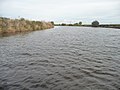
 River Aire - geograph.org.uk - 1612466.jpg 640 × 426; 45 KB
-
 River Aire - geograph.org.uk - 1612469.jpg 640 × 426; 30 KB
-
 River Aire - geograph.org.uk - 686443.jpg 640 × 427; 85 KB
-
 River Aire at Beal - geograph.org.uk - 3799151.jpg 1 280 × 960; 311 KB
-
 River Aire near Beal - geograph.org.uk - 6003717.jpg 1 280 × 960; 337 KB
-
 River Aire near Wood Holmes - geograph.org.uk - 4734624.jpg 1 024 × 615; 123 KB
-
 River Aire, Beal.jpg 640 × 460; 97 KB
-
 River Aire, between Beal Short and Long Reaches - geograph.org.uk - 4734575.jpg 1 024 × 768; 112 KB
-
 River Aire, looking upstream by Wood Holmes - geograph.org.uk - 4734887.jpg 1 024 × 614; 127 KB
-
 River Aire, west of Beal Bridge - geograph.org.uk - 4734604.jpg 1 024 × 768; 106 KB
-
 Rix Tanker at Manor Farm - geograph.org.uk - 4117058.jpg 1 600 × 1 064; 519 KB
-
 Royal Mail postbox on Main Street, Beal - geograph.org.uk - 4116954.jpg 1 064 × 1 600; 904 KB
-
 Sheep on the north bank of the River Aire, Beal - geograph.org.uk - 4734583.jpg 1 024 × 768; 113 KB
-
 Sluice Gates on the River Aire - geograph.org.uk - 4118073.jpg 1 600 × 1 064; 547 KB
-

-
 South bank of the River Aire at Humble Holme - geograph.org.uk - 4732510.jpg 1 024 × 768; 162 KB
-
 South bank of the River Aire at Kellingley Scalp - geograph.org.uk - 4734931.jpg 1 024 × 768; 129 KB
-
-
 South bank, Beal Long Reach, River Aire - geograph.org.uk - 4734577.jpg 1 024 × 768; 156 KB
-
 South bank, Beal Short Reach, River Aire - geograph.org.uk - 4734570.jpg 1 024 × 768; 137 KB
-
-
 Starlings on the power lines, Birkin Holme - geograph.org.uk - 4729620.jpg 1 024 × 768; 116 KB
-
 Stile at Beal Lock on the River Aire - geograph.org.uk - 4116855.jpg 1 600 × 1 064; 896 KB
-
 Stile at East Ings near Beal - geograph.org.uk - 4116781.jpg 1 600 × 1 064; 850 KB
-
 Stone Trough at East Ings - geograph.org.uk - 4116724.jpg 1 600 × 1 064; 803 KB
-
 Straw bales at Manor Farm, Beal - geograph.org.uk - 4118027.jpg 1 600 × 1 064; 508 KB
-
 Sudforth Lane - geograph.org.uk - 6001039.jpg 1 600 × 1 200; 434 KB
-
 Sudforth Lane heading south - geograph.org.uk - 2476120.jpg 1 600 × 1 200; 467 KB
-
 Sudforth Lane Junction - geograph.org.uk - 1265525.jpg 640 × 480; 62 KB
-
 Sudforth Lane junction - geograph.org.uk - 3799445.jpg 1 280 × 960; 478 KB
-
 Sudforth Lane junction - geograph.org.uk - 6003730.jpg 1 280 × 960; 398 KB
-
 Sudforth Lane junction with the A645 - geograph.org.uk - 6003722.jpg 1 280 × 960; 352 KB
-
 Sunset over Kellingley Colliery - geograph.org.uk - 5595084.jpg 640 × 480; 33 KB
-
 Swans and cygnets on the River Aire - geograph.org.uk - 4734893.jpg 1 024 × 768; 129 KB
-

-
 The Cottage on Ings Lane, Beal - geograph.org.uk - 4116832.jpg 1 600 × 1 064; 437 KB
-
 The entrance to Beal House Farm, Beal - geograph.org.uk - 2155411.jpg 800 × 600; 293 KB
-
 The Hungry Fox Inn at Beal - geograph.org.uk - 2155424.jpg 800 × 600; 279 KB
-
 The Jenny Wren Public House - geograph.org.uk - 4116996.jpg 1 600 × 1 064; 395 KB
-
 The Jenny Wren Public House - geograph.org.uk - 4116999.jpg 1 064 × 1 600; 556 KB
-
 The Jenny Wren public house at Beal - geograph.org.uk - 3173283.jpg 2 048 × 1 536; 656 KB
-
 The Jenny Wren Public House, Beal - geograph.org.uk - 225086.jpg 640 × 423; 56 KB
-
 The Kings Arms, Beal - geograph.org.uk - 6228967.jpg 1 600 × 1 065; 529 KB
-
 The Kings Arms, Beal - geograph.org.uk - 6228970.jpg 1 600 × 1 002; 447 KB
-
 The Kings Arms, Beal - geograph.org.uk - 6228971.jpg 1 600 × 978; 347 KB
-

-
 The Old School, Beal - geograph.org.uk - 2153526.jpg 800 × 600; 258 KB
-
 The Oval housing styles - geograph.org.uk - 2478002.jpg 1 024 × 768; 129 KB
-
 The Oval, north-west corner - geograph.org.uk - 2477985.jpg 1 024 × 768; 161 KB
-
 The Oval, northern corner - geograph.org.uk - 2477988.jpg 1 024 × 768; 100 KB
-
 The Oval, south side - geograph.org.uk - 2477996.jpg 1 024 × 768; 111 KB
-
 The Oval, south-east corner - geograph.org.uk - 2477992.jpg 1 024 × 768; 113 KB
-
 The Oval, west side - geograph.org.uk - 2477983.jpg 1 024 × 768; 137 KB
-
 The railway into Kellingley Colliery - geograph.org.uk - 3799447.jpg 1 280 × 925; 373 KB
-
 The railway into Kellingley Colliery - geograph.org.uk - 6003725.jpg 1 280 × 862; 345 KB
-
 The River Aire at Beal (2) - geograph.org.uk - 2748645.jpg 1 024 × 768; 192 KB
-
 The River Aire at Beal - geograph.org.uk - 1265548.jpg 640 × 480; 50 KB
-
 The River Aire at Beal - geograph.org.uk - 2748642.jpg 1 024 × 768; 180 KB
-
 The River Aire at Beal Lock, Beal - geograph.org.uk - 4116862.jpg 1 600 × 1 064; 558 KB
-
 The River Aire at Birkin Holme - geograph.org.uk - 4729604.jpg 1 024 × 768; 110 KB
-
 The River Aire at East Ings - geograph.org.uk - 4116609.jpg 1 600 × 1 064; 648 KB
-
 The River Aire at Kellingley Crook - geograph.org.uk - 4734947.jpg 1 024 × 768; 151 KB
-
 The River Aire below Beal Lock and Beal Dam - geograph.org.uk - 4734581.jpg 1 024 × 768; 103 KB
-

-
 The River Aire heading upstream (westwards) - geograph.org.uk - 4732534.jpg 1 024 × 768; 153 KB
-
 The River Aire rounding Kellingley Crook - geograph.org.uk - 4734934.jpg 1 024 × 615; 127 KB
-
 The River Aire rounding the tip of Humble Holme - geograph.org.uk - 4732503.jpg 1 024 × 768; 164 KB
-
 The River Aire upstream of Allum Pit - geograph.org.uk - 4729355.jpg 1 024 × 614; 118 KB
-
 The River Aire, west of Kellingley Crook - geograph.org.uk - 4735121.jpg 1 024 × 768; 114 KB
-
 The riverside path at East Ings - geograph.org.uk - 4116718.jpg 1 600 × 1 064; 707 KB
-
 The riverside path towards Beal Bridge, Beal - geograph.org.uk - 4116884.jpg 1 600 × 1 064; 774 KB
-
 The southern tip of Kellingley Crook - geograph.org.uk - 4734938.jpg 1 024 × 768; 114 KB
-
 The Village Hall, Beal - geograph.org.uk - 4116889.jpg 1 600 × 1 064; 700 KB
-
 The Weir on the River Aire at Beal - geograph.org.uk - 4116874.jpg 1 600 × 1 064; 776 KB
-
 Tidemark of rubbish along the River Aire - geograph.org.uk - 3173313.jpg 2 048 × 1 536; 745 KB
-
 Track leading to Beal - geograph.org.uk - 4116757.jpg 1 600 × 1 064; 759 KB
-
 Track leading to Ings Lane, Beal - geograph.org.uk - 4116785.jpg 1 600 × 1 064; 601 KB
-
 Track leading to Ings Lane, Beal - geograph.org.uk - 4116787.jpg 1 600 × 1 064; 646 KB
-
 Track leading to Willow Garths - geograph.org.uk - 4118234.jpg 1 600 × 1 064; 604 KB
-
 Track leading to Wood Holmes - geograph.org.uk - 4118028.jpg 1 600 × 1 064; 533 KB
-
 Track to Beal House Farm - geograph.org.uk - 2475975.jpg 1 600 × 1 200; 501 KB
-
 Track towards Kellingley Farm (footpath) - geograph.org.uk - 2476133.jpg 1 600 × 1 200; 579 KB
-
-
 Uncultivated field - geograph.org.uk - 5217767.jpg 1 024 × 768; 117 KB
-
 Unknown business premises, off Weeland Road (A645) - geograph.org.uk - 6001049.jpg 2 560 × 1 920; 2,4 MB
-
 Upstream from Beal Bridge - geograph.org.uk - 5774635.jpg 640 × 427; 216 KB
-
 View from Beal Lane - geograph.org.uk - 5999372.jpg 1 280 × 960; 410 KB
-
 View from Beal Lane - geograph.org.uk - 5999373.jpg 1 280 × 819; 308 KB
-

-
 View towards warehouses off Weeland Road - geograph.org.uk - 5217800.jpg 1 024 × 768; 129 KB
-
 War Memorial at Beal - geograph.org.uk - 4116896.jpg 1 600 × 1 064; 731 KB


_-_geograph.org.uk_-_4734599.jpg)


.jpg)


_-_geograph.org.uk_-_2748645.jpg)


_-_geograph.org.uk_-_4732534.jpg)


_-_geograph.org.uk_-_2476133.jpg)


_-_geograph.org.uk_-_6001049.jpg)


