Category:Beausale
Aller à la navigation
Aller à la recherche
village britannique  | |||||
| Téléverser des médias | |||||
| Nature de l’élément |
| ||||
|---|---|---|---|---|---|
| Lieu | Beausale, Haseley, Honiley and Wroxall, Warwick, Warwickshire, Midlands de l'Ouest, Angleterre | ||||
 | |||||
English: Beausale is a village in the Warwick district of Warwickshire, England, north-west of Warwick. According to the 2001 census it had a population of 202. It lies within the civil parish of Beausale, Haseley, Honiley and Wroxall.
Média dans la catégorie « Beausale »
Cette catégorie comprend 59 fichiers, dont les 59 ci-dessous.
-
 20th century houses, Haseley Green - geograph.org.uk - 1777540.jpg 640 × 480 ; 337 kio
-
 Approaching Rouncil Lane - geograph.org.uk - 1614992.jpg 640 × 480 ; 124 kio
-
 Beausale - Firs Farm - geograph.org.uk - 14278.jpg 640 × 480 ; 79 kio
-
 Beausale - geograph.org.uk - 14277.jpg 640 × 480 ; 75 kio
-
 Beausale - geograph.org.uk - 50476.jpg 640 × 467 ; 114 kio
-
 Beausale Club - geograph.org.uk - 4861378.jpg 1 600 × 1 361 ; 371 kio
-
 Beausale Cottage - geograph.org.uk - 14111.jpg 640 × 480 ; 112 kio
-
 Beausale House - geograph.org.uk - 2171065.jpg 640 × 480 ; 74 kio
-
 Beausale House from the northwest with lambs - geograph.org.uk - 1768127.jpg 640 × 480 ; 388 kio
-
 Beausale House from the southeast - geograph.org.uk - 1768189.jpg 640 × 480 ; 379 kio
-
 Beausale main street - geograph.org.uk - 1769607.jpg 640 × 480 ; 400 kio
-
 Beausale Village Club - geograph.org.uk - 50477.jpg 640 × 480 ; 93 kio
-
 Brook Cottages - geograph.org.uk - 1615015.jpg 640 × 480 ; 65 kio
-
 Bulloak Farm, Beausale - geograph.org.uk - 3149956.jpg 640 × 480 ; 66 kio
-
 Bulloak Farm, Beausale - geograph.org.uk - 3149965.jpg 640 × 480 ; 88 kio
-
 Bus shelter, Heath Terrace, Beausale - geograph.org.uk - 1769525.jpg 640 × 480 ; 393 kio
-
 Camphill Farm, Beausale (1) - geograph.org.uk - 1769618.jpg 640 × 462 ; 357 kio
-
 Camphill Farm, Beausale (2) - geograph.org.uk - 1769621.jpg 640 × 480 ; 365 kio
-
 Cattle, Ley End Farm, Beausale - geograph.org.uk - 1765678.jpg 640 × 480 ; 412 kio
-
 Clearing trees, Hill Farm, Beausale - geograph.org.uk - 1769563.jpg 640 × 480 ; 589 kio
-
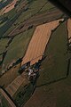
 East of Beausale, aerial 2018 - geograph.org.uk - 5845883.jpg 533 × 800 ; 113 kio
-
 Elmwood Farm, Beausale - geograph.org.uk - 1769584.jpg 640 × 480 ; 488 kio
-
 Farmland east of Beausale, aerial 2018 - geograph.org.uk - 5845904.jpg 533 × 800 ; 95 kio
-
 Farmland, Beausale - geograph.org.uk - 3167081.jpg 640 × 480 ; 114 kio
-
 Fields east of Beausale House - geograph.org.uk - 1768152.jpg 640 × 480 ; 514 kio
-
 Fields east of Hill Farm, Beausale - geograph.org.uk - 1769568.jpg 640 × 480 ; 411 kio
-
 Firs Lane at Haseley Green - geograph.org.uk - 1777552.jpg 640 × 480 ; 520 kio
-
 Firs Lane by Firs Farm - geograph.org.uk - 1777560.jpg 640 × 480 ; 450 kio
-
 Firs Lane crosses Inchford Brook (2) - geograph.org.uk - 1777638.jpg 640 × 480 ; 604 kio
-
 Flytipping by Inchford Brook east of Beausale - geograph.org.uk - 1765657.jpg 640 × 480 ; 527 kio
-
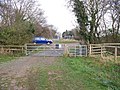
 Ford at Beausale - geograph.org.uk - 2980299.jpg 3 872 × 2 592 ; 2,4 Mio
-
 Grazing near Beausale - geograph.org.uk - 3167073.jpg 640 × 480 ; 75 kio
-
 Hawkes Barn, Beausale - geograph.org.uk - 1768171.jpg 640 × 480 ; 398 kio
-
 Heath Terrace, Beausale - geograph.org.uk - 1769544.jpg 640 × 480 ; 391 kio
-
 Hedgerow oaks and farm buildings, Beausale - geograph.org.uk - 6063786.jpg 1 024 × 615 ; 1,32 Mio
-
 Hill Farm Beausale - geograph.org.uk - 2649175.jpg 640 × 480 ; 89 kio
-
 Hill Farm from Rouncil Lane, Beausale - geograph.org.uk - 1769581.jpg 512 × 640 ; 419 kio
-
 Holly Farm, Beausale - geograph.org.uk - 1769598.jpg 640 × 480 ; 461 kio
-
 Honiley Road, Beausale - geograph.org.uk - 1769552.jpg 640 × 480 ; 517 kio
-
 Inchford Brook approaches Firs Lane - geograph.org.uk - 1777640.jpg 640 × 480 ; 464 kio
-
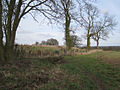 Iron Age earthwork, Beausale - geograph.org.uk - 1769623.jpg 640 × 480 ; 475 kio
-
 Lion Farm, Beausale - geograph.org.uk - 49946.jpg 640 × 480 ; 124 kio
-
 Makeover Cottage, Beausale - geograph.org.uk - 1769605.jpg 640 × 480 ; 546 kio
-
 Meadow south of Beausale - geograph.org.uk - 1769600.jpg 640 × 480 ; 532 kio
-
 New footbridge - geograph.org.uk - 1613478.jpg 640 × 480 ; 145 kio
-
 Oak Farm Stables, Beausale - geograph.org.uk - 1769611.jpg 640 × 480 ; 397 kio
-
 Old Sluice Gate - geograph.org.uk - 759278.jpg 427 × 640 ; 204 kio
-
 Paddocks near Lion Farm, Beausale - geograph.org.uk - 1769590.jpg 640 × 480 ; 418 kio
-
 Parish boundary hedge north of Deer Park Farm - geograph.org.uk - 1589314.jpg 640 × 427 ; 422 kio
-
 Road heading north towards Beausale - geograph.org.uk - 3167078.jpg 640 × 480 ; 105 kio
-
 Roadside gardening, Beausale Lane, Waste Green - geograph.org.uk - 1768195.jpg 640 × 480 ; 547 kio
-
 Rouncil Lane near Beausale - geograph.org.uk - 1769578.jpg 640 × 480 ; 522 kio
-
 The Blacksmiths cottage, Beausale, Warwickshire, picture taken in the 1980s 1.jpg 2 395 × 2 370 ; 831 kio
-
 The Blacksmiths cottage, Beausale, Warwickshire, picture taken in the 1980s 2.jpg 2 539 × 2 457 ; 882 kio
-
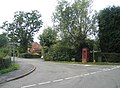
 The phone kiosk in Beausale - geograph.org.uk - 1802349.jpg 640 × 480 ; 154 kio
-
 Walker's bridge in Beausale - geograph.org.uk - 759518.jpg 640 × 466 ; 177 kio
-
 Waterlogged farmland north of Beausale - geograph.org.uk - 3167092.jpg 640 × 480 ; 76 kio
-
 Waterlogged field, Beausale - geograph.org.uk - 1769593.jpg 640 × 480 ; 429 kio
-
 Wooden house - geograph.org.uk - 1614660.jpg 640 × 480 ; 62 kio


_-_geograph.org.uk_-_1769618.jpg)
_-_geograph.org.uk_-_1769621.jpg)


_-_geograph.org.uk_-_1777638.jpg)


