Category:Beaworthy
Aller à la navigation
Aller à la recherche
English: Beaworthy is a village and civil parish in the West Devon district of Devon, England. According to the 2001 census it had a population of 236.
village britannique  | |||||
| Téléverser des médias | |||||
| Nature de l’élément | |||||
|---|---|---|---|---|---|
| Lieu | West Devon, Devon, Angleterre du Sud-Ouest, Angleterre | ||||
| Réputé identique à | Beaworthy (page en doublon, paroisse civile) | ||||
 | |||||
Sous-catégories
Cette catégorie comprend seulement la sous-catégorie ci-dessous.
S
- St Alban's Church, Beaworthy (3 F)
Média dans la catégorie « Beaworthy »
Cette catégorie comprend 89 fichiers, dont les 89 ci-dessous.
-
 A3079 approaching crossroads - geograph.org.uk - 3664458.jpg 800 × 507 ; 56 kio
-
 A3079 at Hole Ball Cross - geograph.org.uk - 3631259.jpg 1 770 × 1 111 ; 1,04 Mio
-
 A3079 Metherell Cross - geograph.org.uk - 3664467.jpg 800 × 544 ; 78 kio
-
 A3079 near Patchacott Cross - geograph.org.uk - 4865535.jpg 1 920 × 1 280 ; 818 kio
-
 A3079 south of Halwill Junction - geograph.org.uk - 3631241.jpg 1 669 × 1 047 ; 838 kio
-
 Accommodation bridge over disused railway trackbed - geograph.org.uk - 6202786.jpg 1 600 × 1 067 ; 794 kio
-
 Ashbury, above Melbury - geograph.org.uk - 88268.jpg 640 × 435 ; 126 kio
-
 Ashbury, Wadland Down Plantations - geograph.org.uk - 203186.jpg 640 × 427 ; 227 kio
-
 Beaworthy Bridleway 53 and dismantled railway - geograph.org.uk - 360989.jpg 640 × 480 ; 161 kio
-
 Beaworthy Byway 9 - geograph.org.uk - 486888.jpg 640 × 480 ; 128 kio
-
 Beaworthy, by the A3079 road - geograph.org.uk - 198446.jpg 640 × 427 ; 187 kio
-
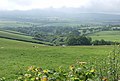
 Beaworthy, east from Venn - geograph.org.uk - 198468.jpg 640 × 427 ; 162 kio
-
 Beaworthy, lane on Venn Down - geograph.org.uk - 88270.jpg 640 × 435 ; 98 kio
-
 Beaworthy, on Venn Down - geograph.org.uk - 198460.jpg 640 × 427 ; 203 kio
-
 Beaworthy, the A3079 road - geograph.org.uk - 198449.jpg 640 × 427 ; 146 kio
-
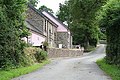 Beaworthy, The Mill House and Wigdon Corn Mill - geograph.org.uk - 198463.jpg 640 × 427 ; 234 kio
-
 Beaworthy, towards Stoney - geograph.org.uk - 198464.jpg 640 × 427 ; 141 kio
-
 Bennys. - panoramio.jpg 4 000 × 2 248 ; 4 Mio
-
 Blocked bridge - geograph.org.uk - 4947851.jpg 1 600 × 1 067 ; 837 kio
-
 Bridge on dismantled railway - geograph.org.uk - 4940200.jpg 1 600 × 1 067 ; 1 007 kio
-
 Bridge over dismantled railway - geograph.org.uk - 4948251.jpg 1 600 × 1 067 ; 753 kio
-

-
 Bridleway to Venn Down Gate - geograph.org.uk - 4939642.jpg 1 600 × 1 067 ; 585 kio
-
 Bridleway to Venn Down Gate - geograph.org.uk - 4939651.jpg 1 600 × 1 067 ; 790 kio
-
 Bridleway to Venn Down Gate - geograph.org.uk - 4939663.jpg 1 600 × 1 067 ; 798 kio
-
 Bridleway to Venn Down Gate - geograph.org.uk - 4940209.jpg 1 600 × 1 067 ; 936 kio
-
 Bridleway, Wadland Down Plantations - geograph.org.uk - 2778454.jpg 640 × 480 ; 123 kio
-
 By the A3079 - geograph.org.uk - 2778035.jpg 640 × 398 ; 84 kio
-
 Byway to Beamsworthy - geograph.org.uk - 5541717.jpg 1 024 × 768 ; 322 kio
-
 Byway to Patchacott - geograph.org.uk - 4947906.jpg 1 600 × 1 067 ; 1 Mio
-
 Cemetery at Madworthy Methodist Church - geograph.org.uk - 5660802.jpg 1 024 × 768 ; 208 kio
-
 Communications mast at Castle Cross - geograph.org.uk - 5560124.jpg 800 × 537 ; 71 kio
-
 Converted railway house by dismantled railway - geograph.org.uk - 4948225.jpg 1 600 × 1 067 ; 837 kio
-
 Crossroad at Venndown Gates - geograph.org.uk - 5020016.jpg 1 600 × 1 201 ; 825 kio
-
 Disused railway bridge - geograph.org.uk - 4947945.jpg 1 600 × 1 067 ; 1 021 kio
-
 Disused railway bridge - geograph.org.uk - 4947961.jpg 1 600 × 1 067 ; 1 014 kio
-
 Disused Railway Bridge - geograph.org.uk - 6202753.jpg 1 600 × 1 067 ; 874 kio
-
 Entrance to Moorside Farm - geograph.org.uk - 5018163.jpg 1 600 × 1 198 ; 687 kio
-
 Farm building, Beaworthy - geograph.org.uk - 491528.jpg 640 × 480 ; 116 kio
-
 Farm track at Patchacott - geograph.org.uk - 5660805.jpg 1 024 × 768 ; 183 kio
-
 Farm track to Venn Barton - geograph.org.uk - 2778956.jpg 640 × 480 ; 117 kio
-
 Field Edge view at Castle Field Triangulation Pillar - geograph.org.uk - 4723909.jpg 4 000 × 3 000 ; 4,81 Mio
-
 Field west of Beaworthy - geograph.org.uk - 486982.jpg 640 × 480 ; 117 kio
-
 Field, lane and wood, Venn Down - geograph.org.uk - 2778909.jpg 640 × 480 ; 86 kio
-
 Fields near Wigdon Mill - geograph.org.uk - 2778867.jpg 640 × 453 ; 76 kio
-
 Gate on a road to Beaworthy - geograph.org.uk - 5541670.jpg 1 024 × 768 ; 140 kio
-
 Grass field next to Madworthy Methodist Church - geograph.org.uk - 5541695.jpg 1 024 × 768 ; 178 kio
-
 Lane east of Halwill Junction - 487960.jpg 640 × 480 ; 142 kio
-
 Lay-by and woodland by A3079 near Patchacott Cross - geograph.org.uk - 5018142.jpg 1 600 × 1 199 ; 702 kio
-
 Lay-by at Hole Ball Cross by A3079 - geograph.org.uk - 5753004.jpg 1 600 × 1 200 ; 802 kio
-
 Maddaford Moor Halt - geograph.org.uk - 4939632.jpg 1 600 × 1 067 ; 891 kio
-
 Maddaford Moor Halt - geograph.org.uk - 4940182.jpg 1 600 × 1 067 ; 942 kio
-
 Madworthy Methodist Church - geograph.org.uk - 486986.jpg 640 × 480 ; 127 kio
-
 Madworthy Methodist Church - geograph.org.uk - 4947955.jpg 1 600 × 1 067 ; 624 kio
-
 Metherell Cross - geograph.org.uk - 487054.jpg 640 × 480 ; 118 kio
-
 Old Rectory - geograph.org.uk - 487052.jpg 640 × 480 ; 109 kio
-
 Out Patchacott way. - panoramio.jpg 2 464 × 864 ; 1,02 Mio
-
 Patchacott - geograph.org.uk - 486892.jpg 640 × 480 ; 125 kio
-
 Patchacott Cross and bus stop - geograph.org.uk - 5018133.jpg 1 600 × 1 199 ; 724 kio
-
 Patchacott Cross on A3079 - geograph.org.uk - 5753001.jpg 1 600 × 1 201 ; 744 kio
-
 Pegasus Trail - geograph.org.uk - 6202738.jpg 1 600 × 1 067 ; 651 kio
-
 Pegasus Trail - geograph.org.uk - 6202801.jpg 1 600 × 1 067 ; 646 kio
-
 Pegasus Trail - geograph.org.uk - 6202821.jpg 1 600 × 1 067 ; 655 kio
-
 Pegasus Trail - geograph.org.uk - 6210255.jpg 1 600 × 1 067 ; 665 kio
-
 Pegasus Trail - geograph.org.uk - 6210260.jpg 1 600 × 1 067 ; 757 kio
-
 Public Byway to the lane to Beamsworthy - geograph.org.uk - 4948258.jpg 1 600 × 1 067 ; 1,01 Mio
-
 Remains of railway bridge - geograph.org.uk - 4948272.jpg 1 600 × 1 067 ; 856 kio
-
 Road to Patchacott - geograph.org.uk - 4947932.jpg 1 600 × 1 067 ; 553 kio
-
 Road to Patchacott Cross - geograph.org.uk - 5541723.jpg 1 024 × 768 ; 158 kio
-
 Rough grazing by the Old Rectory - geograph.org.uk - 5541706.jpg 1 024 × 768 ; 163 kio
-
 Rough grazing near Beaworthy - geograph.org.uk - 5541637.jpg 1 024 × 789 ; 153 kio
-
 Rushy pasture, Venn Down - geograph.org.uk - 2778958.jpg 640 × 415 ; 74 kio
-
 Sedgy field - geograph.org.uk - 487993.jpg 640 × 480 ; 111 kio
-
 Start of Bridleway to Thorndon Cross - geograph.org.uk - 4940220.jpg 1 600 × 1 067 ; 715 kio
-
 T-Mobile Mast, Castle Cross - geograph.org.uk - 374102.jpg 640 × 480 ; 87 kio
-
 The A3079 crosses Sixty Acre Moor - geograph.org.uk - 1829320.jpg 640 × 480 ; 84 kio
-
 The Village Hall, Patchacott - geograph.org.uk - 5541714.jpg 1 024 × 768 ; 154 kio
-
 Thorndon downs ahead - geograph.org.uk - 1824396.jpg 640 × 415 ; 75 kio
-
 Town Farm farmhouse - geograph.org.uk - 5660791.jpg 1 024 × 768 ; 152 kio
-
 Track to Higher Melbury - geograph.org.uk - 4947871.jpg 1 600 × 1 067 ; 523 kio
-
 Trackbed of the dismantled railway to Holsworthy - geograph.org.uk - 4939671.jpg 1 600 × 1 067 ; 871 kio
-
 Valley below Beamsworthy - geograph.org.uk - 468319.jpg 640 × 480 ; 135 kio
-
 Valley near Wigdon Mill - geograph.org.uk - 2778834.jpg 640 × 445 ; 78 kio
-
 Valleys near Burden Farm - geograph.org.uk - 468262.jpg 640 × 432 ; 73 kio
-
 Victorian postbox at Beaworthy - geograph.org.uk - 5660789.jpg 768 × 1 024 ; 253 kio
-
 View - geograph.org.uk - 471394.jpg 640 × 480 ; 110 kio
-
 View from Pegasus Trail - geograph.org.uk - 6210272.jpg 1 600 × 1 067 ; 425 kio
-
 Water treatment works at Northcombe - geograph.org.uk - 5018158.jpg 1 600 × 1 067 ; 747 kio
-
 Wind turbine at Metherell Cross - geograph.org.uk - 5018106.jpg 1 600 × 1 194 ; 754 kio


