Category:Bedford Park, London
Zur Navigation springen
Zur Suche springen
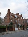
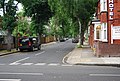
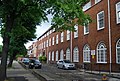
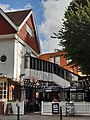
English: Bedford Park is a suburban development in west London, England. It forms a conservation area that is mostly within the London Borough of Ealing, with a small part to the east within the London Borough of Hounslow. The nearest underground station is Turnham Green (District Line).
Stadtteil von London, England  | |||||
| Medium hochladen | |||||
| Ist ein(e) |
| ||||
|---|---|---|---|---|---|
| Ist Teil von | |||||
| Ort |
| ||||
| Architekt | |||||
 | |||||
Unterkategorien
Es werden 11 von insgesamt 11 Unterkategorien in dieser Kategorie angezeigt:
In Klammern die Anzahl der enthaltenen Kategorien (K), Seiten (S), Dateien (D)
B
- Bedford Park Stores (5 D)
C
- Jonathan Carr (3 D)
H
L
- London Buddhist Vihara (4 D)
S
- 14 South Parade, London W4 (6 D)
T
- Tabard Inn, Bedford Park (18 D)
V
- The Vicarage, Bedford Park (3 D)
Medien in der Kategorie „Bedford Park, London“
Folgende 142 Dateien sind in dieser Kategorie, von 142 insgesamt.
-

-
 1 and 2 Rupert Gardens, Bedford Park - geograph.org.uk - 2768553.jpg 960 × 1.280; 308 KB
-
 1 Priory Gardens.jpg 3.264 × 2.448; 2,66 MB
-
 1, Priory Gardens, Bedford Park - geograph.org.uk - 2768617.jpg 1.280 × 960; 321 KB
-
 1, Woodstock Road, Bedford Park - geograph.org.uk - 2768469.jpg 960 × 1.280; 606 KB
-
 23 and 25 Woodstock Road, Bedford Park - geograph.org.uk - 2768446.jpg 1.280 × 975; 581 KB
-
 38 Bath Road - geograph.org.uk - 2768569.jpg 1.280 × 981; 321 KB
-
 39 and 41 Bath Road - geograph.org.uk - 2768581.jpg 1.280 × 960; 279 KB
-
 4, The Orchard - geograph.org.uk - 2768905.jpg 960 × 1.280; 212 KB
-
 51 Woodstock Road - geograph.org.uk - 2768211.jpg 1.280 × 960; 716 KB
-
 6,5,4 and 3 South Parade - geograph.org.uk - 2768897.jpg 1.280 × 960; 311 KB
-
 7 Queen Anne's Gardens for T. M. Rooke artist, prob by Henry Wilson, 1878.jpg 4.608 × 3.456; 2,27 MB
-
 Abinger Rd - geograph.org.uk - 4070863.jpg 640 × 430; 91 KB
-
 Adams detailing on 12 Newton Grove.jpg 3.456 × 4.608; 3,17 MB
-
 Angled Oriel, Bedford Park.jpg 3.456 × 4.608; 2,37 MB
-
 Arts Educational School - geograph.org.uk - 4070847.jpg 640 × 430; 106 KB
-
 Arts Educational School - geograph.org.uk - 4070848.jpg 430 × 640; 69 KB
-
 Arts Educational School - geograph.org.uk - 4070852.jpg 640 × 499; 127 KB
-
 Bath Rd - geograph.org.uk - 4070837.jpg 640 × 430; 92 KB
-
 Bath Road ^ Lonsdale Road postbox (ref. W4 40) - geograph.org.uk - 2768574.jpg 1.280 × 960; 363 KB
-
 Bay windows, wooden balconies of 'Queen Anne' style.jpg 1.501 × 1.305; 518 KB
-
 Bedford Corner - geograph.org.uk - 2768892.jpg 1.280 × 949; 272 KB
-
 Bedford Park Mansions - geograph.org.uk - 2768902.jpg 960 × 1.280; 334 KB
-
 Bedford Park Mansions, The Orchard.jpg 4.177 × 2.836; 2,02 MB
-
 Bedford Park railings - geograph.org.uk - 2768220.jpg 1.280 × 950; 682 KB
-
 Bedford Park, London in 2005.jpg 640 × 480; 240 KB
-
 Bedford Park, Priory Avenue - geograph.org.uk - 2718636.jpg 640 × 480; 126 KB
-
 Bedford Road, W4 - geograph.org.uk - 889345.jpg 640 × 480; 117 KB
-
 Blandford Road - geograph.org.uk - 2768212.jpg 1.280 × 950; 602 KB
-
 Blenheim Road, Bedford Park - geograph.org.uk - 2768226.jpg 1.280 × 960; 737 KB
-
 Chiswick Playhouse (at The Tabard).jpg 3.456 × 4.608; 2 MB
-
 Complex Bay Window, Priory House, Bedford Park.jpg 3.456 × 4.608; 2,63 MB
-
 Doorway hooded porch Priory Gardens by E. J. May 1880.jpg 3.456 × 4.608; 2,28 MB
-
 Dutch Gable, Tazza Motif, Bedford Park.jpg 3.456 × 4.608; 1,19 MB
-
 Dutch gable, terracotta roundels and sculptures, Bedford Park.jpg 3.456 × 4.608; 1,04 MB
-
 Dutch gable.jpg 1.849 × 1.967; 627 KB
-
 Esmond Rd - geograph.org.uk - 4062879.jpg 640 × 430; 85 KB
-
 Esmond Road, W4 - geograph.org.uk - 3828833.jpg 640 × 480; 139 KB
-
 Fairytale Tile decoration, Bedford Park (cropped).jpg 3.296 × 907; 521 KB
-
 Fairytale Tile decoration, Bedford Park.jpg 3.780 × 1.815; 1 MB
-
 Fancy Oriel window in Queen Anne Revival style.jpg 967 × 1.245; 498 KB
-
 First houses of Bedford Park, The Avenue by Coe & Robinson paired gables 1876.jpg 4.608 × 3.456; 3,16 MB
-
 Flanders Mansions, Flanders Road.jpg 4.608 × 3.456; 2,86 MB
-
 Flanders Rd - geograph.org.uk - 4070834.jpg 640 × 430; 88 KB
-
 Flats on Ramillies Road - geograph.org.uk - 2768912.jpg 1.280 × 988; 291 KB
-
 Focus of Bedford Park Garden Suburb.png 627 × 480; 97 KB
-
 Focus of Bedford Park Garden Suburb.svg 626 × 480; 5 KB
-
 Front Door, Segmental Pediment, Bedford Park.jpg 3.456 × 4.608; 1,92 MB
-
 Gainsborough Rd - geograph.org.uk - 4070868.jpg 640 × 430; 79 KB
-
 House in Bedford Park, London W4 - geograph.org.uk - 4577595.jpg 1.569 × 2.132; 1,14 MB
-
 House on The Avenue, anchor brick motif, broken pediment over round-arched doorway.jpg 3.456 × 4.608; 2,35 MB
-
 Houses in Priory Road, Bedford Park - geograph.org.uk - 2401545.jpg 1.280 × 960; 656 KB
-
 Houses on Priory Avenue, Bedford Park - geograph.org.uk - 2768491.jpg 1.280 × 960; 856 KB
-
 Houses on Priory Avenue, Bedford Park - geograph.org.uk - 2768518.jpg 1.280 × 952; 732 KB
-
 Houses on South Parade, Acton Green - geograph.org.uk - 3382569.jpg 640 × 446; 83 KB
-
 Houses, Bedford Park - geograph.org.uk - 4577618.jpg 1.617 × 2.365; 1,38 MB
-
 Housing in Bedford Park - geograph.org.uk - 6151662.jpg 4.814 × 3.701; 2,77 MB
-
 Joseph Nash studio detail Blenheim Road 1879.jpg 4.608 × 3.456; 1,12 MB
-
 Joseph Nash's studio with 1879 cartouche Blenheim Road on Norman Shaw corner house.jpg 3.502 × 2.469; 1,06 MB
-
 K6 telephone kiosk, Bedford Park - geograph.org.uk - 2768889.jpg 960 × 1.280; 357 KB
-
 Leafy Bedford Road.jpg 4.608 × 2.745; 3,24 MB
-
 London Chiswick Bath Road Halt site geograph-3257423-by-Ben-Brooksbank.jpg 2.350 × 1.382; 3,82 MB
-
 Lonsdale Rd - geograph.org.uk - 4070858.jpg 640 × 430; 98 KB
-
 Marlborough Crescent, Bedford - geograph.org.uk - 2768906.jpg 1.280 × 960; 324 KB
-
 Maurice B. Adams map of Bedford Park 1897.jpg 1.127 × 1.074; 498 KB
-
 Maurice Bingham Adams houses on Newton Grove for JC Dollman 1880.jpg 4.608 × 3.456; 5,32 MB
-
 Melbourne House, South Parade.jpg 2.432 × 3.879; 2,61 MB
-
 Newton Grove - geograph.org.uk - 4062886.jpg 640 × 430; 88 KB
-
 No 2 South Parade by Fritz Ruhemann and Michael Dugdale 1938-9.jpg 3.713 × 2.006; 2,43 MB
-
 No 2 South Parade entrance and roof terrace.jpg 2.639 × 1.848; 1,64 MB
-
 No 2 The Avenue by Godwin 1876.jpg 3.456 × 4.608; 2,24 MB
-
 No 3 Newton Grove.jpg 4.608 × 3.456; 4,74 MB
-
 No 9 Queen Anne's Gardens 1880 off road in large garden prob by Henry Wilson.jpg 3.456 × 4.608; 2,23 MB
-
 No. 1 Newton Grove by E. J. May 1880s.jpg 4.608 × 3.456; 3,27 MB
-
 No. 1 The Orchard crow-stepped gables poss by Shaw detail.jpg 3.456 × 4.608; 6,69 MB
-
 No. 1 The Orchard crow-stepped gables possibly by Shaw.jpg 4.608 × 3.456; 7,39 MB
-
 Norman Shaw Semis, Woodstock Road, wide bay windows, wooden balconies, 1879.jpg 4.608 × 3.456; 2,89 MB
-
 Norman Shaw sunflower panel on his first semis 1877.jpg 2.550 × 3.914; 1,33 MB
-
 Norman Shaw tile-hung detached house Rupert Road 1879.jpg 4.076 × 3.164; 2,44 MB
-
 Norman Shaw's Bedford Park Club, now London Buddhist Vihara, The Avenue, 1878.jpg 4.400 × 3.341; 2,28 MB
-
 Norman Shaw's first semis detail, sunflower panel, corbelled bay window The Avenue 1878.jpg 4.608 × 3.456; 1,81 MB
-

-
 Norman Shaw's first semis, The Avenue 1877 with sunflower panel.jpg 3.456 × 4.608; 2,81 MB
-
 Norman Shaw's first terrace Woodstock Road tiny dormer, segmental hood over doorway.jpg 3.456 × 4.608; 2,54 MB
-
 Norman Shaw's first terrace, Woodstock Road, 1878 overhanging gabled bay windows.jpg 3.456 × 4.608; 2,6 MB
-
 Norman Shaw's first terrace, Woodstock Road, 1878.jpg 4.231 × 3.312; 2,54 MB
-
 Old street sign, Bedford Park - geograph.org.uk - 4574070.jpg 2.415 × 1.439; 592 KB
-
 One of the few Bedford Park houses by Henry Wilson, Blenheim Road.jpg 4.608 × 3.456; 4,1 MB
-
 Ornamented house, South Parade.jpg 4.608 × 3.456; 7,39 MB
-

-
Peter Murray on Bedford Park.oga 9 min 32 s; 5,35 MB
-
 Plans for Bedford Park Club by Norman Shaw 1878.jpg 640 × 459; 45 KB
-

-
 Porch of 28 Bath Road - geograph.org.uk - 2768566.jpg 960 × 1.280; 311 KB
-
 Priory Avenue - geograph.org.uk - 4070835.jpg 640 × 430; 105 KB
-
-
 Priory gardens 2021.jpg 1.440 × 1.440; 483 KB
-
 Priory Gardens, 1880 - geograph.org.uk - 2768545.jpg 1.280 × 944; 342 KB
-
 Priory House '1882' cartouche.jpg 2.073 × 2.507; 744 KB
-
 Priory House, Priory Gardens by E. J. May 1882.jpg 3.837 × 3.163; 1,95 MB
-
 Priory Road, Bedford Park - geograph.org.uk - 2438477.jpg 960 × 1.280; 582 KB
-
 Queen Anne tile-hung wall, Bedford Park.jpg 4.608 × 3.456; 2,58 MB
-
 Queen Anne-style tile-hung detail.jpg 1.552 × 829; 245 KB
-
 Ramillies Road - geograph.org.uk - 2768909.jpg 1.280 × 960; 260 KB
-
 Ramillies Road - geograph.org.uk - 2768915.jpg 1.280 × 960; 314 KB
-
 Red brick terrace, Priory Gardens by E. J. May, 1880.jpg 4.608 × 3.456; 2,63 MB
-
 Roman Rd - geograph.org.uk - 4070856.jpg 640 × 430; 96 KB
-
 Rupert Rd - geograph.org.uk - 4070854.jpg 640 × 430; 97 KB
-
 Rusthall Avenue, Chiswick - geograph.org.uk - 1188411.jpg 640 × 521; 104 KB
-
 Rusthall Avenue, Chiswick, W4 - geograph.org.uk - 822932.jpg 640 × 480; 81 KB
-
 Semi in Marlborough Crescent.jpg 4.608 × 3.456; 5,11 MB
-
 Shell Porch, 4 Priory Gardens - geograph.org.uk - 2768537.jpg 653 × 1.280; 170 KB
-
 Sketch of The Club, Bedford Park, 1880.jpg 716 × 480; 161 KB
-
 Small narrow Oriels at Street Level, Priory Gardens.jpg 3.456 × 4.608; 2,17 MB
-
 Small Oriel in Gable, Bedford Park.jpg 2.767 × 3.884; 1,13 MB
-
 Small Oriel Windows under eaves, Priory House, Bedford Park.jpg 3.456 × 4.608; 1,43 MB
-
 Smaller Bedford Park cottages, Marlborough Crescent.jpg 4.608 × 3.456; 5,55 MB
-
 St Michael & All Angels Church during the 2019 Chiswick Book Festival (48781671678).jpg 7.226 × 3.269; 21,64 MB
-

-
 Tabard and neighbour front.jpg 4.608 × 3.456; 3,14 MB
-
 Tabard Inn and St Michael and All Angels Church by TM Rooke.jpg 690 × 434; 246 KB
-
 Telephone box on South Parade, Turnham Green - geograph.org.uk - 2720747.jpg 1.600 × 1.200; 556 KB
-
 Terrace by E. J. May shaped gables Marlborough Crescent 1880s.jpg 4.608 × 3.456; 5,24 MB
-
 Terrace by E. J. May shaped gables Marlborough Crescent oblique view.jpg 3.456 × 4.608; 2,61 MB
-
 Terracotta 'Priory Gardens 1880', Bedford Park.jpg 3.456 × 4.608; 1,42 MB
-
 The Arts Educational Schools - geograph.org.uk - 2768559.jpg 1.280 × 960; 387 KB
-

-
 The Avenue first Bedford Park houses tiled gable over bay window by E. W. Godwin 1876.jpg 4.608 × 3.456; 3,34 MB
-
 The Orchard - Bedford Road, W4 - geograph.org.uk - 889340.jpg 640 × 480; 94 KB
-
 The Orchard - geograph.org.uk - 4062882.jpg 640 × 430; 95 KB
-
 The Orchard, W4 - geograph.org.uk - 889341.jpg 640 × 480; 125 KB
-
 Turnham Green Terrace - geograph.org.uk - 2768654.jpg 1.280 × 960; 236 KB
-
 Varied gables, Bedford Park.jpg 4.608 × 3.456; 2,62 MB
-
 Varied Gables, Sash Windows, Shell Doorhoods, Priory Gardens.jpg 4.608 × 3.456; 5,44 MB
-
 Wadhurst Road, Bedford Park - geograph.org.uk - 2438480.jpg 1.280 × 960; 635 KB
-
 White wooden porch, Bedford Park.jpg 3.456 × 4.608; 2,08 MB
-
 Wooden porch, leaded stained glass window, Bedford Park.jpg 3.094 × 4.500; 1,56 MB
-
 Woodstock House, Woodstock Road.jpg 4.608 × 3.456; 2,98 MB
-
 Woodstock Road - geograph.org.uk - 2768207.jpg 1.280 × 960; 696 KB
-
 Yeats house 3 Blenheim Road London W4.JPG 3.672 × 4.896; 2,67 MB
-
 Yeats lived here 3 Blenheim Road London W4.JPG 3.065 × 3.076; 2,15 MB
-
 Zigzag in Queen Anne's Gardens, Bedford Park.jpg 3.456 × 4.608; 3,05 MB


_-_geograph.org.uk_-_2768574.jpg)


.jpg)


_-_geograph.org.uk_-_2768525.jpg)


.jpg)


.jpg)