Category:Beinn Eighe
Zur Navigation springen
Zur Suche springen
Deutsch: Der Beinn Eighe ist eine von der UNESCO als Biosphärenreservat eingestufte Hügel/Bergkette in Schottland.
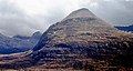
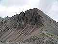
English: Beinn Eighe is a mountain/hill and a UNESCO biosphere reserve.
Berg in Schottland  | |||||
| Medium hochladen | |||||
| Ist ein(e) | |||||
|---|---|---|---|---|---|
| Ort | Wester Ross, Ross and Cromarty, Highland, Highlands, Schottland | ||||
| Besteht aus |
| ||||
| Schartenhöhe |
| ||||
| Höhe über dem Meeresspiegel |
| ||||
| Bezugsberg | |||||
 | |||||
Unterkategorien
Diese Kategorie enthält folgende Unterkategorie:
In Klammern die Anzahl der enthaltenen Kategorien (K), Seiten (S), Dateien (D)
L
Medien in der Kategorie „Beinn Eighe“
Folgende 78 Dateien sind in dieser Kategorie, von 78 insgesamt.
-
 Autumn Colours - panoramio (2).jpg 4.320 × 3.240; 5,69 MB
-
 Bein Eighe from Allt 'a' Chuirn - geograph.org.uk - 165965.jpg 269 × 194; 19 KB
-
 Beinn Eighe - geograph.org.uk - 2292448.jpg 640 × 480; 33 KB
-
 Beinn Eighe - geograph.org.uk - 2674258.jpg 1.567 × 461; 705 KB
-
 Beinn Eighe - panoramio.jpg 5.616 × 3.744; 3,66 MB
-
 Beinn Eighe Coire Dubh Mor.jpg 2.304 × 3.456; 3,68 MB
-
 Beinn Eighe first autumn snow - geograph.org.uk - 1476756.jpg 640 × 479; 133 KB
-
 Beinn Eighe from Abhainn Bruachaig (geograph 5683566).jpg 3.264 × 2.448; 3,17 MB
-
 Beinn Eighe from Loch Clair - geograph.org.uk - 379562.jpg 640 × 480; 112 KB
-

-
 Beinn Eighe panorama - geograph.org.uk - 2147348.jpg 526 × 343; 178 KB
-
 Beinn Eighe Pinus sylvestris 1.jpg 1.600 × 1.200; 1,08 MB
-
 Beinn Eighe Pinus sylvestris 2.jpg 1.478 × 1.152; 872 KB
-
 Beinn Eighe Pinus sylvestris 3.jpg 1.600 × 1.200; 780 KB
-
 Beinn Eighe Pinus sylvestris 4.jpg 1.600 × 1.200; 1,16 MB
-
 Beinn Eighe Pinus sylvestris 5.jpg 1.200 × 1.600; 1,86 MB
-
 Beinn Eighe Pinus sylvestris 6.jpg 1.200 × 1.600; 1,38 MB
-
 Beinn Eighe ridge walking - panoramio.jpg 5.616 × 3.744; 3,8 MB
-
 Beinn Eighe Ruadh-stac Mor.jpg 3.347 × 2.231; 2,15 MB
-
 Beinn Eighe Sail Mhor.jpg 3.456 × 2.304; 1,69 MB
-
-
 Beinn Eighe visitor centre - geograph.org.uk - 3078336.jpg 800 × 600; 118 KB
-
 Beinn Eighe Visitor Centre - geograph.org.uk - 3114816.jpg 2.272 × 1.704; 1,61 MB
-
 Beinn Eighe's ridge south west from Creag Dhubh - geograph.org.uk - 860312.jpg 1.024 × 713; 781 KB
-
 Beinn eighe.jpg 501 × 376; 77 KB
-
 Beinn Eighe.jpg 3.456 × 2.304; 3,07 MB
-
 Ben Eighe from the A896 - geograph.org.uk - 3533008.jpg 1.100 × 831; 591 KB
-
 Ben Eighe's Ridge - geograph.org.uk - 68464.jpg 640 × 480; 114 KB
-
 Ben Eighe's Ridge and Coinneach Mhor - geograph.org.uk - 68467.jpg 640 × 480; 103 KB
-
 Benn Eighe - panoramio.jpg 4.320 × 3.240; 5,51 MB
-

-

-
 Coire an Laoigh - geograph.org.uk - 44481.jpg 640 × 480; 286 KB
-

-
 Eastern tops of Beinn Eighe - geograph.org.uk - 2255926.jpg 1.500 × 981; 495 KB
-
 Gairloch , Looking towards Beinn Eighe from Kinlochewe - geograph.org.uk - 2247339.jpg 2.000 × 3.008; 740 KB
-
 Hard geographing - geograph.org.uk - 226107.jpg 640 × 480; 90 KB
-
 Kinlochewe.jpg 1.489 × 896; 178 KB
-
 North side of Beinn Eighe - geograph.org.uk - 14131.jpg 600 × 450; 30 KB
-
 North side of Ben Eighe - geograph.org.uk - 288501.jpg 640 × 410; 57 KB
-
 Patterns on a mountainside, Beinn Eighe - geograph.org.uk - 1510636.jpg 640 × 424; 139 KB
-
 Purple Saxifrage on Sgurr Ban - geograph.org.uk - 68475.jpg 640 × 480; 148 KB
-
 Rough country below Ruadh-stac Beag - geograph.org.uk - 62621.jpg 640 × 480; 90 KB
-
 Ruadh stac Mor - geograph.org.uk - 288505.jpg 640 × 422; 68 KB
-
 Ruadh-stac Mor - geograph.org.uk - 44490.jpg 480 × 640; 234 KB
-

-
-
 Ruadh-stac Mor from Beinn a Chearcaill geograph-5477308-by-Alan-Reid.jpg 1.024 × 751; 127 KB
-
 Ruadh-stac Mor of Beinn Eighe - geograph.org.uk - 2346433.jpg 640 × 480; 65 KB
-
 Ruard-stac Mor - geograph.org.uk - 44487.jpg 480 × 640; 242 KB
-
 Ruardh-stac Beag - geograph.org.uk - 44495.jpg 640 × 480; 236 KB
-
 Sail Mhor, Beinn Eighe - geograph.org.uk - 85643.jpg 640 × 480; 124 KB
-
 Sail Mor - geograph.org.uk - 958981.jpg 500 × 375; 96 KB
-
 Scotland Torridon.jpg 2.048 × 1.536; 460 KB
-
 Sgurr nan Fhir Duibhe - geograph.org.uk - 44502.jpg 640 × 480; 228 KB
-
 South side of Beinn Eighe - geograph.org.uk - 554198.jpg 640 × 480; 102 KB
-
 Southern slopes of Sgùrr Ban - geograph.org.uk - 724987.jpg 1.000 × 665; 283 KB
-

-

-
 Sunset over lower part of Slioch and Loch Maree.jpg 3.024 × 3.046; 5,64 MB
-
 Sunset over Slioch and Loch Maree.jpg 3.024 × 2.121; 1,77 MB
-

-

-
 The Triple Buttress - geograph.org.uk - 1531043.jpg 1.000 × 670; 331 KB
-
 Triple Buttress Beinn Eighe - geograph.org.uk - 13524.jpg 640 × 419; 120 KB
-
 Triple buttress corrie.jpg 438 × 443; 61 KB
-

-
 View east from Sgùrr Mòr - geograph.org.uk - 861725.jpg 1.000 × 664; 1,04 MB
-
 View of Beinn Eighe - geograph.org.uk - 315608.jpg 470 × 640; 64 KB
-
 View to Beinn Eighe - geograph.org.uk - 2292356.jpg 640 × 409; 29 KB
-

-
 View west from Fionn Bheinn - geograph.org.uk - 1013263.jpg 640 × 480; 62 KB
-
 West of the Torridon road - geograph.org.uk - 588691.jpg 800 × 600; 161 KB
-
 Beinn Eighe - geograph.org.uk - 7587.jpg 448 × 640; 186 KB
-
 Beinn Eighe from Loch Clair - geograph.org.uk - 7601.jpg 640 × 375; 127 KB
-
 Gully, Sgurr Ban - geograph.org.uk - 44493.jpg 480 × 640; 315 KB
-
 The ridge east of Spidean Coire nan Clach - geograph.org.uk - 630865.jpg 800 × 600; 185 KB
-
 Бэн Эй.jpg 3.648 × 2.736; 3,93 MB
.jpg)


.jpg)


.jpg)


_-_geograph.org.uk_-_4066179.jpg)


Kategorien:
- Mountains and hills of the Northwest Highlands
- Marilyns of Scotland
- Sites of Special Scientific Interest in Highland council area
- National Nature Reserves in Scotland
- Torridon Hills
- Biosphere reserves of the United Kingdom
- Fucoid Beds
- Lewisian Gneiss
- Torridonian Sandstone
- Cambrian quartzite in the United Kingdom