Category:Belaugh
Zur Navigation springen
Zur Suche springen
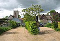
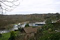
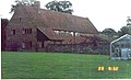
English: Belaugh is a small village (population 105) that occupies a bend in the River Bure in Norfolk, England - within The Broads National Park. It is accessible only via the road between Hoveton and Coltishall. It contains no pubs, bars or shops. The main civic features are the church of St Peter Belaugh and the Old School, which also belongs to the church and is used for parish council meetings and for celebrating the harvest festival. The local broad is Belaugh Broad. Most of the land around Belaugh - around 850 acres - is owned by the Trafford family, who are Lords of the Manor.
Ort in der englischen Grafschaft Norfolk | |||||
| Medium hochladen | |||||
| Ist ein(e) | |||||
|---|---|---|---|---|---|
| Ort | Broadland, Norfolk, East of England, England | ||||
| Fläche |
| ||||
 | |||||
Unterkategorien
Diese Kategorie enthält folgende Unterkategorie:
In Klammern die Anzahl der enthaltenen Kategorien (K), Seiten (S), Dateien (D)
P
Medien in der Kategorie „Belaugh“
Folgende 105 Dateien sind in dieser Kategorie, von 105 insgesamt.
-
 'Sunny Haigh' Belaugh - geograph.org.uk - 402386.jpg 640 × 480; 55 KB
-
 A big puddle on Belaugh Green Lane - geograph.org.uk - 1059338.jpg 480 × 640; 102 KB
-
 Across the Field - geograph.org.uk - 4174628.jpg 4.240 × 2.832; 5,6 MB
-
 Across the Field - geograph.org.uk - 4174630.jpg 4.240 × 2.832; 5,93 MB
-
 Approaching Belaugh Green level crossing - geograph.org.uk - 2458277.jpg 3.888 × 2.592; 4,2 MB
-
 Barn at Belaugh Green Farm - geograph.org.uk - 1059356.jpg 640 × 459; 113 KB
-
 Belaugh From The River Bure - geograph.org.uk - 5685736.jpg 3.600 × 2.399; 930 KB
-
 Belaugh Green Lane becomes Hand Lane - geograph.org.uk - 1059360.jpg 480 × 640; 90 KB
-
 Belaugh Green level crossing - geograph.org.uk - 2453616.jpg 3.888 × 2.592; 4,06 MB
-
 Belaugh Green level crossing - geograph.org.uk - 2458378.jpg 3.888 × 2.592; 4,35 MB
-
 Belaugh Green level crossing - geograph.org.uk - 2458392.jpg 3.888 × 2.592; 4,14 MB
-
 Belaugh Green level crossing - geograph.org.uk - 2458408.jpg 2.592 × 3.888; 3,09 MB
-
 Belaugh Green level crossing - geograph.org.uk - 2461558.jpg 3.888 × 2.592; 3,86 MB
-
 Belaugh Green level crossing - geograph.org.uk - 2461574.jpg 2.592 × 3.888; 3,27 MB
-
 Belaugh Green level crossing - geograph.org.uk - 2462482.jpg 2.592 × 3.888; 4,35 MB
-
 Belaugh Lane - geograph.org.uk - 2461548.jpg 3.888 × 2.592; 4,58 MB
-
 Belaugh Lane - leading to Belaugh Green - geograph.org.uk - 1059160.jpg 480 × 640; 110 KB
-
 Belaugh Lane Railway Crossing - geograph.org.uk - 6264156.jpg 4.608 × 3.456; 7,66 MB
-
 Belaugh Road (B1354) - geograph.org.uk - 5014900.jpg 4.518 × 3.332; 5,91 MB
-
 Belaugh St Peter's church - geograph.org.uk - 2207511.jpg 800 × 600; 152 KB
-
 Belaugh Staithe - geograph.org.uk - 960664.jpg 640 × 480; 131 KB
-
 Belaugh Staithe - geograph.org.uk - 960666.jpg 640 × 480; 120 KB
-
 Belaugh War Memorial - geograph.org.uk - 4791693.jpg 3.456 × 2.592; 3,79 MB
-
 Bend in Belaugh Road (B1354) - geograph.org.uk - 5014922.jpg 4.608 × 3.456; 6,45 MB
-
 Bittern Line Train - geograph.org.uk - 2424289.jpg 3.888 × 2.592; 3,88 MB
-
 Bridge 1293 - detail - geograph.org.uk - 2462489.jpg 3.888 × 2.592; 5,58 MB
-
 Bridge 1293 - geograph.org.uk - 1059216.jpg 464 × 640; 98 KB
-
 Bridge 1293 - geograph.org.uk - 2462484.jpg 3.888 × 2.592; 4,18 MB
-
 Bridge 1293 - geograph.org.uk - 2462486.jpg 3.888 × 2.592; 5,43 MB
-
 Bridge 1293 - geograph.org.uk - 2462491.jpg 2.592 × 3.888; 5,77 MB
-
 Bure Valley Path - geograph.org.uk - 2424272.jpg 3.888 × 2.592; 4,73 MB
-
 Bure Valley Path and Railway - geograph.org.uk - 2424300.jpg 3.888 × 2.592; 4,8 MB
-
 Bure Valley Railway - geograph.org.uk - 4174639.jpg 4.240 × 2.832; 5,39 MB
-
 Bure Valley Railway - geograph.org.uk - 4174644.jpg 4.240 × 2.832; 5,2 MB
-
 Bure Valley Railway - geograph.org.uk - 4174649.jpg 4.240 × 2.832; 6,3 MB
-
 Bure Valley Railway - geograph.org.uk - 4174658.jpg 4.000 × 2.671; 7,19 MB
-
 Bure Valley Railway - warning sign and level crossing gate - geograph.org.uk - 2457365.jpg 3.888 × 2.592; 4,13 MB
-
 Bure Valley Railway and Bure Valley Path - geograph.org.uk - 2457364.jpg 3.888 × 2.592; 5,13 MB
-
 Bure Valley Railway and Bure Valley Path - geograph.org.uk - 2457369.jpg 3.888 × 2.592; 6,6 MB
-
 Bure Valley Railway and Bure Valley Path - geograph.org.uk - 2457653.jpg 3.888 × 2.592; 6,46 MB
-
 Bure Valley Railway and Bure Valley Path - geograph.org.uk - 2457661.jpg 3.888 × 2.592; 5,54 MB
-
 Bure Valley Railway and Bure Valley Path - geograph.org.uk - 2462496.jpg 2.592 × 3.888; 6 MB
-

-

-
 Bure Valley Railway view - geograph.org.uk - 2457370.jpg 3.888 × 2.592; 5,15 MB
-
 Bure Valley Railway warning sign - geograph.org.uk - 2458266.jpg 2.592 × 3.888; 5,05 MB
-
 Bure Valley Railway warning sign - geograph.org.uk - 2458301.jpg 2.592 × 3.888; 4,71 MB
-
 Cereal crop and cow parsley - geograph.org.uk - 3966703.jpg 640 × 434; 181 KB
-
 Cereal crop beside Top Road - geograph.org.uk - 3966702.jpg 640 × 445; 120 KB
-
 Cow parsley beside Top Road - geograph.org.uk - 3966696.jpg 640 × 480; 206 KB
-
 Crop field near Belaugh Green - geograph.org.uk - 4962515.jpg 640 × 452; 59 KB
-
 Eggs, 30p Doz. - geograph.org.uk - 5685746.jpg 3.599 × 2.399; 1,1 MB
-
 Farm shed - geograph.org.uk - 1059353.jpg 640 × 461; 59 KB
-
 Field adjoining Belaugh Green Lane - geograph.org.uk - 1059347.jpg 640 × 480; 80 KB
-
 Field beside the Bure Valley Railway - geograph.org.uk - 2457366.jpg 3.888 × 2.592; 3,94 MB
-
 Field beside the Bure Valley Railway - geograph.org.uk - 2462498.jpg 3.888 × 2.592; 4,3 MB
-
 Field near Belaugh Green Farm - geograph.org.uk - 2462483.jpg 2.592 × 3.888; 4,59 MB
-
 Field near Belaugh Green Farm - geograph.org.uk - 2462494.jpg 2.592 × 3.888; 6,87 MB
-
 Field near Grange Farm - geograph.org.uk - 2458327.jpg 3.888 × 2.592; 5,31 MB
-
 Fields by Belaugh - geograph.org.uk - 3966701.jpg 640 × 480; 165 KB
-
 Fields by Belaugh Hole - geograph.org.uk - 3966674.jpg 640 × 480; 184 KB
-
 Fields by Belaugh Hole - geograph.org.uk - 3966679.jpg 640 × 480; 160 KB
-
 Fieldside Power - geograph.org.uk - 6264150.jpg 3.456 × 4.608; 6,72 MB
-
 Footpath along edge of wheat field - geograph.org.uk - 5012343.jpg 4.608 × 3.456; 7,23 MB
-
 Footpath connection from the Bure Valley Path - geograph.org.uk - 2458211.jpg 3.888 × 2.592; 6,93 MB
-
 Footpath to Belaugh Green Farm - geograph.org.uk - 5012327.jpg 4.600 × 3.446; 6,06 MB
-
 Greylag Geese on the River Bure - geograph.org.uk - 449696.jpg 640 × 609; 93 KB
-
 Hand Lane - leading to Belaugh Green - geograph.org.uk - 1059188.jpg 480 × 640; 121 KB
-
 Houses in Top Road - geograph.org.uk - 3966698.jpg 640 × 440; 177 KB
-
 K6 telephone box in The Street - geograph.org.uk - 3966689.jpg 640 × 544; 307 KB
-
 Level crossing on Belaugh Lane - geograph.org.uk - 1059151.jpg 640 × 480; 98 KB
-
 Level Crossing on the Bure Valley Railway - geograph.org.uk - 2424324.jpg 3.888 × 2.592; 5,17 MB
-
 Level Crossing on the Bure Valley Railway - geograph.org.uk - 2424332.jpg 3.888 × 2.592; 5,02 MB
-
 Minor road to Coltishall - geograph.org.uk - 2458402.jpg 2.592 × 3.888; 5,93 MB
-
 Right down the Line - geograph.org.uk - 6264142.jpg 4.608 × 3.456; 6,96 MB
-
 Ripening wheat - geograph.org.uk - 4557794.jpg 1.024 × 768; 382 KB
-
 River Bure close to Belaugh - geograph.org.uk - 380299.jpg 640 × 480; 68 KB
-
 River Bure from Belaugh Church - geograph.org.uk - 701565.jpg 640 × 425; 68 KB
-
 St Peter's church in Belaugh - geograph.org.uk - 2208101.jpg 640 × 480; 100 KB
-
 St. Peter's Church, Belaugh - geograph.org.uk - 5685740.jpg 3.565 × 2.364; 1,32 MB
-
 The River Bure west of Wroxham in Norfolk - geograph.org.uk - 5811317.jpg 4.032 × 3.024; 3,73 MB
-
 The Train to Aylsham - geograph.org.uk - 6264146.jpg 4.608 × 3.456; 7,61 MB
-
 This way to Norwich - geograph.org.uk - 1059156.jpg 640 × 480; 74 KB
-
 Top Road junction with Coltishall Road - geograph.org.uk - 4557801.jpg 1.024 × 768; 282 KB
-
 Under the Bridge - geograph.org.uk - 4174626.jpg 3.973 × 2.653; 7,22 MB
-
 View across sugar beet crop - geograph.org.uk - 1059161.jpg 640 × 480; 67 KB
-
 View along Back Lane - geograph.org.uk - 3966673.jpg 640 × 480; 218 KB
-
 View along Belaugh Lane - geograph.org.uk - 1059162.jpg 640 × 480; 121 KB
-
 View along The Street - geograph.org.uk - 3966692.jpg 640 × 480; 262 KB
-
 View east along Hand Lane - geograph.org.uk - 1059177.jpg 480 × 640; 102 KB
-
 View on the river Belaugh England.jpg 1.068 × 840; 162 KB
-
 View on the river, Belaugh, England-LCCN2002696380.jpg 3.670 × 2.759; 2,96 MB
-
 View on the river, Belaugh, England-LCCN2002696380.tif 3.670 × 2.759; 28,97 MB
-
 View towards St Peter's church - geograph.org.uk - 3966699.jpg 640 × 551; 255 KB
-

-
 Wherry Hathor at Belaugh - geograph.org.uk - 288238.jpg 640 × 480; 112 KB
-
 Wild chamomile in potato field - geograph.org.uk - 548689.jpg 640 × 480; 112 KB
-
 Wroxham church tower from the River Bure - geograph.org.uk - 3616910.jpg 1.600 × 1.200; 361 KB
-
 Young crops - geograph.org.uk - 5014914.jpg 4.556 × 3.384; 5,77 MB
-
 Church Lane, Belaugh - geograph.org.uk - 402423.jpg 640 × 480; 176 KB
-
 Footpath between the houses - geograph.org.uk - 402375.jpg 480 × 640; 56 KB
-
 Sevenstead, Belaugh - geograph.org.uk - 261885 (cropped).jpg 539 × 329; 69 KB
-
 Sevenstead, Belaugh - geograph.org.uk - 261885.jpg 640 × 391; 93 KB
-
 View of the River Bure - geograph.org.uk - 402448.jpg 640 × 480; 137 KB
-


_-_geograph.org.uk_-_5014900.jpg)


_-_geograph.org.uk_-_5014922.jpg)


.jpg)


