Category:Belstead
Zur Navigation springen
Zur Suche springen
English: Belstead is a village and civil parish in the Babergh district of Suffolk, England. Located around south-west of Ipswich town centre, in 2005 it had a population of 190.
Gemeinde in der englischen Grafschaft Suffolk  | |||||
| Medium hochladen | |||||
| Ist ein(e) | |||||
|---|---|---|---|---|---|
| Ort | Babergh, Suffolk, East of England, England | ||||
 | |||||
Unterkategorien
Es werden 6 von insgesamt 6 Unterkategorien in dieser Kategorie angezeigt:
In Klammern die Anzahl der enthaltenen Kategorien (K), Seiten (S), Dateien (D)
B
- Belstead War Memorial (3 D)
E
- Environs of Belstead (1 D)
H
- Belstead Hall, Suffolk (1 D)
M
- St Mary the Virgin, Belstead (21 D)
S
- Spring Wood, Belstead (7 D)
V
- Belstead Village Sign (6 D)
Medien in der Kategorie „Belstead“
Folgende 112 Dateien sind in dieser Kategorie, von 112 insgesamt.
-

-
 A stretch of Alton Water - geograph.org.uk - 589064.jpg 640 × 511; 113 KB
-

-
 A12 Northbound - geograph.org.uk - 3515869.jpg 3.072 × 2.304; 1,21 MB
-
 A12 Southbound - geograph.org.uk - 3515859.jpg 3.072 × 2.304; 1,22 MB
-
 A12, 1 mile south of Junction 33 - geograph.org.uk - 3261376.jpg 640 × 398; 41 KB
-
 A12, eastbound - geograph.org.uk - 3885653.jpg 640 × 284; 33 KB
-
 A12, South of the Copdock Interchange - geograph.org.uk - 3846278.jpg 640 × 480; 220 KB
-
 A14 - A12 interchange - geograph.org.uk - 4790794.jpg 640 × 426; 45 KB
-
 A14 - A12 interchange overbridge - geograph.org.uk - 4790798.jpg 640 × 426; 42 KB
-
 A14 - A12 interchange overbridge - geograph.org.uk - 4790804.jpg 640 × 426; 45 KB
-
 A14 westbound - geograph.org.uk - 3885593.jpg 640 × 480; 41 KB
-
 A14 westbound - geograph.org.uk - 4212211.jpg 640 × 480; 48 KB
-
 A14 westbound - geograph.org.uk - 4212225.jpg 640 × 480; 54 KB
-
 A14, Ipswich bypass - geograph.org.uk - 4790780.jpg 640 × 398; 53 KB
-
 A14, westbound - geograph.org.uk - 4790693.jpg 640 × 426; 43 KB
-
 A14, westbound - geograph.org.uk - 4790786.jpg 640 × 426; 42 KB
-
 A14, westbound, - geograph.org.uk - 4121009.jpg 640 × 430; 56 KB
-
 Abandoned chapel. Belstead - geograph.org.uk - 1294539.jpg 640 × 480; 81 KB
-

-
 Belstead Brook Park - geograph.org.uk - 1118814.jpg 640 × 480; 93 KB
-
 Belstead Brook Park Car Park - geograph.org.uk - 1118817.jpg 640 × 480; 101 KB
-

-
 Belstead historic map.png 325 × 240; 147 KB
-
 Belstead Map 1946.png 573 × 443; 464 KB
-
 Belstead sign on The Street - geograph.org.uk - 3484556.jpg 2.749 × 2.068; 1,68 MB
-

-
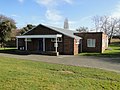
 Belstead village hall - geograph.org.uk - 1002158.jpg 640 × 479; 91 KB
-
 Belstead Village Hall - geograph.org.uk - 3484715.jpg 3.072 × 2.304; 1,24 MB
-
 Belstead village hall - geograph.org.uk - 4378529.jpg 1.024 × 768; 390 KB
-
 Belstead Village Name sign on Grove Hill - geograph.org.uk - 4132488.jpg 2.304 × 3.072; 1,83 MB
-
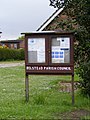 Belstead Village Notice Board - geograph.org.uk - 3484608.jpg 2.189 × 2.922; 1,52 MB
-
 Belstead village sign near the village hall - geograph.org.uk - 4378525.jpg 1.024 × 768; 352 KB
-
 Bentley Lane - geograph.org.uk - 1309517.jpg 640 × 480; 109 KB
-
 Bentley lane - geograph.org.uk - 1309521.jpg 640 × 480; 59 KB
-

-
 Bentley Manor - geograph.org.uk - 387908.jpg 640 × 480; 122 KB
-
 Bridge Number sign - geograph.org.uk - 4132078.jpg 2.965 × 2.227; 714 KB
-
 Buck's Horns Lane, Belstead - geograph.org.uk - 3484689.jpg 3.072 × 2.304; 1,05 MB
-
 Bucks Horn Place sign - geograph.org.uk - 3484726.jpg 2.930 × 2.201; 1,6 MB
-
 Carpet of Bluebells - geograph.org.uk - 240606.jpg 640 × 480; 171 KB
-
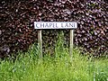 Chapel Lane sign - geograph.org.uk - 3484594.jpg 3.072 × 2.304; 1,64 MB
-
 Chapel Lane sign - geograph.org.uk - 4132515.jpg 3.072 × 2.304; 1,91 MB
-
 Chapel Lane, Belsead - geograph.org.uk - 3484595.jpg 3.072 × 2.304; 1,28 MB
-
 Chapel Lane, Belstead - geograph.org.uk - 1294543.jpg 640 × 480; 71 KB
-
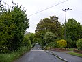
 Church Lane - geograph.org.uk - 1309482.jpg 640 × 480; 75 KB
-
 Church Lane bridge over the A12 - geograph.org.uk - 3515850.jpg 3.072 × 2.304; 1,25 MB
-
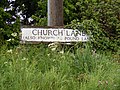 Church Lane sign - geograph.org.uk - 3484678.jpg 3.072 × 2.304; 1,53 MB
-
 Copdock Interchange Roundabout - geograph.org.uk - 3073779.jpg 3.072 × 2.304; 1,35 MB
-
 Copdock Interchange, A14 - geograph.org.uk - 4121011.jpg 640 × 430; 58 KB
-
 Cottages on The Street - geograph.org.uk - 2511572.jpg 2.792 × 1.745; 1,89 MB
-
 Entering Belstead on Grove Hill - geograph.org.uk - 4132086.jpg 3.072 × 2.090; 1,06 MB
-
 Entering Belstead on The Street - geograph.org.uk - 3484541.jpg 3.072 × 2.304; 1,47 MB
-
 Entrance to Belstead Hall - geograph.org.uk - 3484683.jpg 3.072 × 2.304; 1,55 MB
-
 Field near Charity Farm - geograph.org.uk - 3402551.jpg 3.648 × 2.736; 2,06 MB
-

-

-

-
 Grove Hill sign - geograph.org.uk - 3484633.jpg 3.011 × 2.262; 1,85 MB
-
 Grove Hill sign - geograph.org.uk - 4132511.jpg 2.251 × 3.005; 2,47 MB
-
 Grove Hill ^ Grove Hill Bridge - geograph.org.uk - 4132493.jpg 3.072 × 2.304; 1,06 MB
-
 Grove Hill, Belstead - geograph.org.uk - 3484589.jpg 3.072 × 2.304; 1,28 MB
-
 Grove Hill, Belstead - geograph.org.uk - 3484627.jpg 3.072 × 2.304; 1,35 MB
-
 Grove Hill, Belstead - geograph.org.uk - 3484644.jpg 3.072 × 2.304; 1,27 MB
-
 Grove Hill, Belstead - geograph.org.uk - 3484734.jpg 3.072 × 2.304; 1,27 MB
-
 Grove Hill, Belstead - geograph.org.uk - 4132513.jpg 3.072 × 2.304; 1,77 MB
-
 Holly Lane - geograph.org.uk - 2510721.jpg 3.648 × 2.736; 3,78 MB
-
 Junction 32 of the A12 southbound - geograph.org.uk - 3478051.jpg 3.072 × 2.304; 1,27 MB
-
 Lane towards Belstead from Copdock - geograph.org.uk - 1002166.jpg 640 × 480; 94 KB
-
 London bound slow train passing Old Hall Wood - geograph.org.uk - 5237307.jpg 4.592 × 3.056; 3,38 MB
-
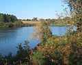
 Looking across Alton Water in autumn - geograph.org.uk - 589063.jpg 640 × 459; 106 KB
-
 New houses, Belstead - geograph.org.uk - 1309512.jpg 640 × 480; 82 KB
-
 Old Blacksmiths, Bentley Lane - geograph.org.uk - 1294530.jpg 640 × 480; 82 KB
-

-
 Old Hall Wood, Belstead - geograph.org.uk - 2747411.jpg 640 × 480; 313 KB
-
 Ordnance Survey Cut Mark with Bolt - geograph.org.uk - 4565923.jpg 4.000 × 3.000; 3,95 MB
-

-
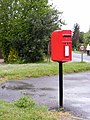
 Poultry Farm Postbox - geograph.org.uk - 3484612.jpg 2.304 × 3.072; 1,44 MB
-
 Poultry Farm Postbox - geograph.org.uk - 3484615.jpg 2.304 × 3.072; 1,46 MB
-
 Poultry Farm Postbox - geograph.org.uk - 3484618.jpg 2.304 × 3.072; 1,66 MB
-
 Poultry Farm Postbox - geograph.org.uk - 3484619.jpg 2.304 × 3.072; 1,45 MB
-
 Shallow lay-by on A12 southbound near Belstead - geograph.org.uk - 4057629.jpg 1.536 × 1.152; 815 KB
-
 Slip road off A14 - geograph.org.uk - 4212229.jpg 640 × 480; 69 KB
-
 St Mary's the Virgin Church, Belstead - geograph.org.uk - 5073432.jpg 3.648 × 3.698; 4,82 MB
-
 Street Farm field with horses - geograph.org.uk - 2510712.jpg 3.648 × 2.736; 3,27 MB
-
 Tesco Extra Copdock ^ Copdock Interchange - geograph.org.uk - 3515873.jpg 3.072 × 2.304; 1,32 MB
-
 The A12 meets the A14 - geograph.org.uk - 5378374.jpg 2.238 × 1.636; 963 KB
-
 The A12, Belstead - geograph.org.uk - 6229583.jpg 1.836 × 1.138; 996 KB
-
 The A12, Belstead - geograph.org.uk - 6229584.jpg 1.920 × 1.280; 1,03 MB
-
 The A12, Copdock - geograph.org.uk - 5395542.jpg 2.304 × 1.728; 931 KB
-
 The A14-A12 sliproad, Copdock - geograph.org.uk - 5395544.jpg 2.304 × 1.728; 946 KB
-

-
 The London to Norwich line - geograph.org.uk - 3402544.jpg 3.648 × 2.736; 3,41 MB
-
 The road to Belstead Hall - geograph.org.uk - 1309489.jpg 640 × 480; 131 KB
-

-

-
 Track in Old Hall Woods - geograph.org.uk - 3402563.jpg 2.736 × 3.648; 5,33 MB
-
 Track to Charity Farm - geograph.org.uk - 2510679.jpg 3.648 × 2.736; 2,33 MB
-
 Under the A14 Felixstowe Road on Grove Hill - geograph.org.uk - 4132499.jpg 2.841 × 2.134; 756 KB
-

-
 View north along Bentley Lane, Belstead - geograph.org.uk - 2747387.jpg 640 × 480; 181 KB
-
 Village street, Belstead - geograph.org.uk - 1001500.jpg 640 × 431; 103 KB
-
 West Ipswich from the air - geograph.org.uk - 3367272.jpg 640 × 410; 110 KB
-
 Westbound slip road from A14 to A12 - geograph.org.uk - 4057609.jpg 1.536 × 1.152; 786 KB
-

-
 A variety of trees near Belstead - geograph.org.uk - 1002144.jpg 640 × 452; 105 KB
-
 Clearly Marked Footpath - geograph.org.uk - 370863.jpg 480 × 640; 112 KB
-
 Cottage by the lane to Alton Water - geograph.org.uk - 589055.jpg 640 × 455; 73 KB
-
 Crossing fields towards Alton Water - geograph.org.uk - 589057.jpg 640 × 469; 100 KB
-
 Four Trees - geograph.org.uk - 387884.jpg 640 × 480; 101 KB
-
 Road Junction - geograph.org.uk - 370867.jpg 640 × 480; 114 KB
-
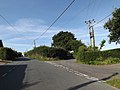
 Road junction at Belstead, Suffolk - geograph.org.uk - 282429.jpg 640 × 404; 60 KB


_-_geograph.org.uk_-_3846283.jpg)


