Category:Belton with Browston
Vai alla navigazione
Vai alla ricerca
English: Belton with Browston is a civil parish in the English county of Norfolk. The parish consists of the villages of Belton and Browston Green, and is situated some 8 km south-west of the town of Great Yarmouth and 10 km north-west of the Suffolk town of Lowestoft.
civil parish in Great Yarmouth, Norfolk, England | |||||
| Carica un file multimediale | |||||
| Istanza di | |||||
|---|---|---|---|---|---|
| Luogo | Great Yarmouth, Norfolk, Est dell'Inghilterra, Inghilterra | ||||
| Superficie |
| ||||
 | |||||
Sottocategorie
Questa categoria contiene le 2 sottocategorie indicate di seguito, su un totale di 2.
B
File nella categoria "Belton with Browston"
Questa categoria contiene 200 file, indicati di seguito, su un totale di 245.
(pagina precedente) (pagina successiva)-
 A143 Beccles Road towards Bradwell - geograph.org.uk - 6154344.jpg 1 600 × 1 065; 621 KB
-
 A143 Beccles Road towards Fritton - geograph.org.uk - 6154341.jpg 1 600 × 1 065; 862 KB
-
 Aircraft crash memorial on Belton Tavern - geograph.org.uk - 5625653.jpg 3 456 × 2 592; 3,53 MB
-
 All Saints Church Notice Board - geograph.org.uk - 5776194.jpg 4 608 × 3 072; 1,92 MB
-
 All Saints Church, Belton - geograph.org.uk - 5544903.jpg 4 032 × 3 024; 3,71 MB
-
 All Saints Church, Belton - geograph.org.uk - 5775821.jpg 3 797 × 2 528; 3,76 MB
-
 All Saints Church, Belton - geograph.org.uk - 5775823.jpg 4 608 × 3 072; 1,85 MB
-
 All Saints Church, Belton - geograph.org.uk - 5778137.jpg 4 608 × 3 072; 1,82 MB
-
 All Saints Church, Belton - geograph.org.uk - 6154136.jpg 1 600 × 1 065; 895 KB
-
 All Saints Church, Belton - geograph.org.uk - 6154141.jpg 1 600 × 1 065; 756 KB
-
 All Saints Churchyard - geograph.org.uk - 5776908.jpg 4 608 × 3 072; 1,89 MB
-
 All Saints Churchyard - geograph.org.uk - 5776914.jpg 4 608 × 3 072; 2,05 MB
-
 All Saints Churchyard - geograph.org.uk - 5776917.jpg 4 608 × 3 072; 1,91 MB
-
 Angles Way footpath alongside Belton Common - geograph.org.uk - 2807021.jpg 2 448 × 3 264; 2,7 MB
-
 Angles Way towards Fritton - geograph.org.uk - 6154243.jpg 1 600 × 1 065; 1,21 MB
-
 Approaching Browston Green on Lound Road - geograph.org.uk - 3282746.jpg 640 × 480; 219 KB
-
 Back Lane - geograph.org.uk - 4488234.jpg 1 024 × 768; 292 KB
-
 Back Lane joins Beccles Road - geograph.org.uk - 6154335.jpg 1 600 × 1 065; 990 KB
-
 Back Lane towards Beccles Road - geograph.org.uk - 6154318.jpg 1 600 × 1 065; 956 KB
-
 Back Lane towards Beccles Road - geograph.org.uk - 6154333.jpg 1 600 × 1 065; 882 KB
-
 Back Lane, Belton - geograph.org.uk - 2807024.jpg 2 448 × 3 264; 2,69 MB
-

-
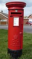
 Belton Post Office - geograph.org.uk - 5625667.jpg 3 456 × 2 592; 3,87 MB
-
 Belton pumping station - geograph.org.uk - 3140770.jpg 480 × 640; 163 KB
-
 Belton Village Name sign on New Road - geograph.org.uk - 5774519.jpg 2 667 × 4 000; 6,33 MB
-
 Belton Village Name sign on New Road - geograph.org.uk - 5778141.jpg 4 608 × 3 072; 1,82 MB
-
 Belton village sign - geograph.org.uk - 4291300.jpg 480 × 640; 231 KB
-

-
 Black drainage windpump - geograph.org.uk - 4606147.jpg 524 × 640; 397 KB
-
 Black drainage windpump - geograph.org.uk - 4606150.jpg 617 × 640; 605 KB
-
 Blocked path along the River Waveney - geograph.org.uk - 3140762.jpg 640 × 480; 167 KB
-
 Bracon Road, Belton - geograph.org.uk - 4947639.jpg 640 × 480; 68 KB
-
 Bramble Gardens, Belton - geograph.org.uk - 4947634.jpg 640 × 480; 73 KB
-
 Bridge on Stepshort - geograph.org.uk - 5670522.jpg 640 × 480; 339 KB
-
 Bridge over Lound Run - geograph.org.uk - 3282683.jpg 640 × 433; 197 KB
-
 Browston Green sign - geograph.org.uk - 5756883.jpg 1 532 × 2 150; 2,79 MB
-
 Browston Hall sign - geograph.org.uk - 5756825.jpg 3 946 × 2 628; 6,66 MB
-
 Browston Lane - geograph.org.uk - 4947541.jpg 640 × 480; 93 KB
-
 Browston Lane - geograph.org.uk - 4947566.jpg 640 × 480; 69 KB
-
 Browston Lane sign - geograph.org.uk - 5756072.jpg 3 774 × 2 513; 3,68 MB
-
 Browston Lane sign - geograph.org.uk - 5756915.jpg 1 702 × 2 149; 1,87 MB
-
 Browston Lane towards Yarmouth Road - geograph.org.uk - 6154762.jpg 1 600 × 1 065; 930 KB
-
 Browston Lane, Bradwell - geograph.org.uk - 5755941.jpg 4 608 × 3 072; 1,96 MB
-
 Browston Lane, Bradwell - geograph.org.uk - 5756840.jpg 4 608 × 3 072; 1,84 MB
-
 Browston Lane, Browston - geograph.org.uk - 5755961.jpg 4 608 × 3 072; 1,88 MB
-
 Browston Lane, Browston - geograph.org.uk - 5756002.jpg 4 608 × 3 072; 1,9 MB
-
 Browston Lane, Browston - geograph.org.uk - 5756064.jpg 4 000 × 2 667; 3,61 MB
-
 Browston Lane, Browston - geograph.org.uk - 5756199.jpg 4 608 × 3 072; 1,89 MB
-
 Browston Lane, Browston - geograph.org.uk - 5756218.jpg 4 608 × 3 072; 1,93 MB
-
 Browston Lane, Browston - geograph.org.uk - 5756812.jpg 4 608 × 3 072; 1,97 MB
-
 Browston Lane, Browston - geograph.org.uk - 5756849.jpg 4 608 × 3 072; 1,82 MB
-
 Browston Lane, Lound - geograph.org.uk - 5757151.jpg 1 600 × 1 067; 404 KB
-
 Browston Village Name sign on Browston Lane - geograph.org.uk - 5755998.jpg 2 667 × 4 000; 2,97 MB
-
 Browston Village Name sign on Browston Lane - geograph.org.uk - 5756911.jpg 4 608 × 3 072; 1,85 MB
-
 Browston Village Notice Boards - geograph.org.uk - 5756890.jpg 1 707 × 2 478; 2,45 MB
-
 Browston Village Notice Boards ^ Browston Green sign - geograph.org.uk - 5756203.jpg 4 000 × 2 667; 7,17 MB
-

-

-
 Bus stop on New Road - geograph.org.uk - 4947614.jpg 640 × 480; 59 KB
-

-
 Caldecott Hall - car park 1 - geograph.org.uk - 1538067.jpg 640 × 461; 98 KB
-

-
 Caldecott Hall - golf course - geograph.org.uk - 1538082.jpg 640 × 480; 80 KB
-
 Caldecott Hall - Reception and golf shop - geograph.org.uk - 1538059.jpg 640 × 455; 106 KB
-
 Caldecott Hall - the golf course - geograph.org.uk - 1538069.jpg 640 × 452; 82 KB
-
 Cherry Lane sign - geograph.org.uk - 5756067.jpg 4 608 × 3 072; 1,78 MB
-
 Cherry Lane, Browston - geograph.org.uk - 5756031.jpg 4 608 × 3 072; 1,84 MB
-
 Church Lane towards Beccles Road - geograph.org.uk - 6154152.jpg 1 600 × 1 065; 880 KB
-
 Church Lane, Belton - geograph.org.uk - 2935428.jpg 1 600 × 893; 363 KB
-
 Church Lane, Belton - geograph.org.uk - 5774527.jpg 4 608 × 3 072; 1,91 MB
-
 Church Lane, Belton - geograph.org.uk - 5774532.jpg 4 608 × 3 072; 1,87 MB
-
 Church Lane, Belton - geograph.org.uk - 5776203.jpg 4 608 × 3 072; 1,78 MB
-
 Church Lane, Belton - geograph.org.uk - 5776209.jpg 4 608 × 3 072; 1,97 MB
-
 Church Lane, Belton - geograph.org.uk - 5776213.jpg 4 608 × 3 072; 1,82 MB
-
 Church Lane, Belton - geograph.org.uk - 5776226.jpg 4 608 × 3 072; 1,81 MB
-
 Church Lane, Belton - geograph.org.uk - 6154116.jpg 1 600 × 1 065; 692 KB
-
 Church Lane, Belton - geograph.org.uk - 6154118.jpg 1 600 × 1 065; 572 KB
-
 Church Lane, Belton - geograph.org.uk - 6154119.jpg 1 600 × 1 065; 498 KB
-
 Clearing in Belton Wood - geograph.org.uk - 3282750.jpg 640 × 480; 251 KB
-

-

-
 Communications Mast off Back Lane - geograph.org.uk - 6154326.jpg 1 065 × 1 600; 860 KB
-

-

-
 Crop field and pylons - geograph.org.uk - 4947573.jpg 640 × 480; 56 KB
-
 Crop field and woodland - geograph.org.uk - 4947569.jpg 640 × 480; 75 KB
-

-
 Deben Drive sign - geograph.org.uk - 5777642.jpg 4 608 × 3 072; 1,89 MB
-
 Deben Drive, Belton - geograph.org.uk - 5777636.jpg 4 608 × 3 072; 2,06 MB
-
 Dog litter bin in River Way - geograph.org.uk - 3140715.jpg 480 × 640; 207 KB
-
 Drain off Sandy Lane, Belton - geograph.org.uk - 6154219.jpg 1 600 × 1 065; 1,01 MB
-
 Drainage ditch in Belton Fen - geograph.org.uk - 5670523.jpg 480 × 640; 378 KB
-

-
 Ducks on the Dyke, Belton - geograph.org.uk - 3510467.jpg 3 648 × 2 736; 2,17 MB
-
 Electricity Pylon off Browston Lane - geograph.org.uk - 5755935.jpg 2 667 × 4 000; 3,78 MB
-
 Electricity pylons cross Beccles Road - geograph.org.uk - 3203877.jpg 2 203 × 1 514; 435 KB
-

-

-
 Electricity pylons stride across Belton Common - geograph.org.uk - 2807016.jpg 3 264 × 2 448; 2,2 MB
-
 Electricity pylons stride across farmland near Hobland Hall - geograph.org.uk - 3203874.jpg 3 264 × 2 448; 2,07 MB
-
 Elizabeth II postbox and bench on Rainworth Close, Belton - geograph.org.uk - 4949258.jpg 2 543 × 2 248; 1,36 MB
-
 Elizabeth II postbox on Rainworth Close, Belton - geograph.org.uk - 4949257.jpg 1 499 × 2 735; 825 KB
-
 Elizabeth II postbox on Station Road North, Belton - geograph.org.uk - 4949269.jpg 2 116 × 2 070; 1,13 MB
-
 End of the water ski area - geograph.org.uk - 4606142.jpg 640 × 360; 254 KB
-
 Entering Belton on New Road - geograph.org.uk - 5774516.jpg 4 608 × 3 072; 1,85 MB
-
 Entering Belton on Stepshort - geograph.org.uk - 5670508.jpg 640 × 480; 282 KB
-
 Entering Browston - geograph.org.uk - 4947534.jpg 640 × 480; 108 KB
-
 Entering Browston on Browston Lane - geograph.org.uk - 5755992.jpg 4 608 × 3 072; 1,92 MB
-
 Entering Browston on Browston Lane - geograph.org.uk - 6007424.jpg 4 608 × 3 456; 3,8 MB
-
 Entrance of New Road Sports ^ Leisure Centre - geograph.org.uk - 5772373.jpg 4 000 × 2 618; 4,12 MB
-
 Entrance to Decoy Farm on Browston Lane - geograph.org.uk - 4283049.jpg 640 × 480; 146 KB
-
 Farm building on Browston Lane - geograph.org.uk - 4947538.jpg 640 × 480; 93 KB
-
 Farm track to the River Waveney - geograph.org.uk - 3140730.jpg 640 × 480; 278 KB
-
 Farman Close, Belton - geograph.org.uk - 5776929.jpg 3 717 × 2 400; 3,01 MB
-
 Farman Close, Belton - geograph.org.uk - 6154109.jpg 1 600 × 1 065; 539 KB
-
 Farmland off Browston Lane - geograph.org.uk - 5755932.jpg 4 608 × 3 072; 1,83 MB
-
 Farmland off Browston Lane - geograph.org.uk - 5756010.jpg 4 608 × 3 072; 2,1 MB
-
 Farmland off Browston Lane - geograph.org.uk - 5756037.jpg 3 855 × 2 668; 2,47 MB
-

-
 Field near Decoy Farm - geograph.org.uk - 4947536.jpg 640 × 480; 71 KB
-
 Fingerpost on Sandy Lane, Belton - geograph.org.uk - 6154236.jpg 1 600 × 1 065; 1,07 MB
-
 Footbridge over New Road, Belton - geograph.org.uk - 4947625.jpg 640 × 480; 87 KB
-
 Footpath - geograph.org.uk - 4488270.jpg 1 024 × 768; 384 KB
-
 Footpath to Belton - geograph.org.uk - 3140765.jpg 640 × 480; 193 KB
-

-
 Gate and footpath off Hobland Road - geograph.org.uk - 4283069.jpg 640 × 480; 117 KB
-

-
 Gate into pasture north of Lound Road - geograph.org.uk - 3282737.jpg 640 × 480; 194 KB
-
 Gold Postbox on Station Road South - geograph.org.uk - 6154180.jpg 1 065 × 1 600; 837 KB
-
 Gold Postbox on Station Road South - geograph.org.uk - 6154181.jpg 1 600 × 1 299; 817 KB
-
 Golden postbox in Belton - geograph.org.uk - 3140704.jpg 480 × 640; 138 KB
-
 Golf course at Caldecott Hall - geograph.org.uk - 1538049.jpg 640 × 453; 82 KB
-
 Graveyard at All Saints Church, Belton - geograph.org.uk - 6154140.jpg 1 600 × 1 065; 742 KB
-
 Graveyard at All Saints Church, Belton - geograph.org.uk - 6154144.jpg 1 600 × 1 065; 1 MB
-
 Green on Station Road South, Belton - geograph.org.uk - 6154162.jpg 1 600 × 1 065; 829 KB
-
 Greenhouses at Cherry Lane Garden Centre - geograph.org.uk - 1537942.jpg 640 × 447; 100 KB
-
 Hobland House, Bradwell - geograph.org.uk - 2280553.jpg 640 × 480; 118 KB
-
 Hobland Road - geograph.org.uk - 4947548.jpg 640 × 480; 66 KB
-

-
 Hobland Road sign - geograph.org.uk - 5756880.jpg 3 797 × 2 528; 7,72 MB
-
 Hobland Road, Browston - geograph.org.uk - 5756872.jpg 4 608 × 3 072; 1,84 MB
-
 House in the grounds of Caldecott Hall - geograph.org.uk - 1538027.jpg 640 × 468; 110 KB
-
 House on Beccles Road - geograph.org.uk - 6154337.jpg 1 600 × 1 065; 731 KB
-
 House on New Road, Belton - geograph.org.uk - 4947624.jpg 640 × 480; 58 KB
-
 Houses on Bramble Gardens, Belton - geograph.org.uk - 4947638.jpg 640 × 480; 55 KB
-
 Houses on Lound Road, Bradwell - geograph.org.uk - 6154368.jpg 1 600 × 1 065; 725 KB
-
 Houses on Station Road North, Belton - geograph.org.uk - 4947641.jpg 640 × 480; 63 KB
-
 John Green Institute, Station Road South, Belton - geograph.org.uk - 6154184.jpg 1 600 × 1 065; 593 KB
-
 Junction of Browston Lane and Hobland Road - geograph.org.uk - 3203876.jpg 3 264 × 2 448; 2,47 MB
-

-

-
 Kings Head Public House sign - geograph.org.uk - 5776939.jpg 2 592 × 3 901; 3,35 MB
-
 Kings Head Public House, Belton - geograph.org.uk - 5776947.jpg 4 608 × 3 072; 1,78 MB
-
 Lane descending to the Carr - geograph.org.uk - 1538091.jpg 640 × 480; 111 KB
-
 Lound Road at Cherry Lane, Browston - geograph.org.uk - 6154351.jpg 1 600 × 1 065; 880 KB
-
 Lound Road joins Browston Lane - geograph.org.uk - 6154759.jpg 1 600 × 1 065; 846 KB
-
 Lound Road past Belton Wood - geograph.org.uk - 3282741.jpg 640 × 480; 197 KB
-
 Lound Road towards Browston Lane - geograph.org.uk - 6154757.jpg 1 600 × 1 065; 690 KB
-
 Lound Road, Browston - geograph.org.uk - 6154347.jpg 1 600 × 1 065; 756 KB
-
 Lound Road, Browston - geograph.org.uk - 6154364.jpg 1 600 × 1 065; 788 KB
-
 Lound Road, Lound - geograph.org.uk - 5757156.jpg 3 591 × 2 391; 4,44 MB
-

-

-
 Mini roundabout on New Road, Belton - geograph.org.uk - 6154111.jpg 1 600 × 1 065; 578 KB
-
 New Road Sport And Leisure Centre - geograph.org.uk - 4947617.jpg 640 × 480; 51 KB
-
 New Road Sports ^ Leisure Centre sign - geograph.org.uk - 5772289.jpg 2 546 × 3 839; 3,91 MB
-
 New Road towards Bradwell - geograph.org.uk - 6154112.jpg 1 600 × 1 065; 610 KB
-
 New Road towards Bradwell - geograph.org.uk - 6154113.jpg 1 600 × 1 065; 569 KB
-
 New Road, Belton - geograph.org.uk - 4947627.jpg 640 × 480; 121 KB
-
 New Road, Belton - geograph.org.uk - 5774521.jpg 3 877 × 2 491; 3,7 MB
-
 New Road, Belton - geograph.org.uk - 5774525.jpg 4 608 × 3 072; 1,79 MB
-
 New Road, Belton - geograph.org.uk - 5776922.jpg 4 608 × 3 072; 1,81 MB
-
 New Road, Belton - geograph.org.uk - 5776925.jpg 4 608 × 3 072; 2,06 MB
-
 New Road, Belton - geograph.org.uk - 5776997.jpg 4 608 × 3 072; 1,76 MB
-
 New Road, Belton - geograph.org.uk - 5777630.jpg 4 608 × 3 072; 1,81 MB
-
 New Road, Belton - geograph.org.uk - 5778126.jpg 4 608 × 3 072; 1,82 MB
-
 New Road, Belton - geograph.org.uk - 5778129.jpg 4 608 × 3 072; 1,82 MB
-
 New Road, Bradwell - geograph.org.uk - 5772298.jpg 4 608 × 3 072; 1,9 MB
-
 Ordnance Survey Cut Mark - geograph.org.uk - 4215535.jpg 480 × 640; 122 KB
-
 Padlocked gate into Belton Wood - geograph.org.uk - 3282757.jpg 640 × 480; 219 KB
-
 Part Of The Angles Way - geograph.org.uk - 4488227.jpg 1 024 × 768; 311 KB
-
 Pastures by Willow Farm - geograph.org.uk - 3140724.jpg 640 × 480; 213 KB
-
 Path leading to Hobland Road - geograph.org.uk - 6154811.jpg 1 600 × 1 065; 658 KB
-
 Path to St John's Road, Belton - geograph.org.uk - 3140751.jpg 640 × 480; 230 KB
-
 Pigeon Post^ - geograph.org.uk - 5625654.jpg 2 592 × 3 456; 3,21 MB
-
 Pipeline in Belton Fen - geograph.org.uk - 5670520.jpg 640 × 480; 408 KB
-
 Postbox On Short Road - geograph.org.uk - 4488264.jpg 1 024 × 768; 316 KB
-
 Postbox on Short Road, Browston - geograph.org.uk - 6154358.jpg 1 600 × 1 065; 1,13 MB
-
 Postbox, The Manor House, Browston - geograph.org.uk - 4947554.jpg 640 × 480; 96 KB
-
 Power lines cross the A143 near Belton - geograph.org.uk - 3606863.jpg 4 320 × 3 240; 4,05 MB
-
 Properties along River Way, Belton - geograph.org.uk - 3140720.jpg 640 × 451; 160 KB
-
 Pylons crossing fields at Browston - geograph.org.uk - 4283072.jpg 640 × 480; 66 KB
-
 Ranworth Close Postbox - geograph.org.uk - 5777571.jpg 3 739 × 2 490; 4,53 MB
-
 Ranworth Close Postbox - geograph.org.uk - 5777580.jpg 2 578 × 3 880; 3,92 MB
-
 Ranworth Close sign - geograph.org.uk - 5777002.jpg 3 882 × 2 585; 6,11 MB
-
 Ranworth Close, Belton - geograph.org.uk - 5776989.jpg 4 608 × 3 072; 1,82 MB
-
 Ranworth Close, Belton - geograph.org.uk - 5777649.jpg 4 608 × 3 072; 1,78 MB
-
-
 Redwings Horse Sanctuary - sign - geograph.org.uk - 1538036.jpg 640 × 471; 85 KB
-
 Reedbeds beside the River Waveney - geograph.org.uk - 4606052.jpg 640 × 360; 203 KB


_-_geograph.org.uk_-_1537963.jpg)


