Category:Benbecula
Vai alla navigazione
Vai alla ricerca

island of the Outer Hebrides, Scotland, UK   | |||||
| Carica un file multimediale | |||||
| Istanza di | |||||
|---|---|---|---|---|---|
| Parte di | |||||
| Luogo |
| ||||
| Situato sul mare / lago / fiume |
| ||||
| Capitale | |||||
| Punto più alto |
| ||||
| Popolazione |
| ||||
| Superficie |
| ||||
| Altezza sul mare |
| ||||
 | |||||
Sottocategorie
Questa categoria contiene le 12 sottocategorie indicate di seguito, su un totale di 12.
B
- Bail' Iochdrach (5 F)
- Baile Glas (9 F)
- Baile nan Cailleach (17 F)
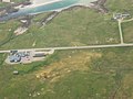
- Benbecula Airport (17 F)
- Borve Castle (14 F)
- Bàgh nam Faoileann (7 F)
N
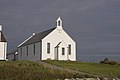
- Nunton Church (7 F)
R
- RAF Benbecula (7 F)
- Ruabhal (15 F)
U
- Uachdar (4 F)
File nella categoria "Benbecula"
Questa categoria contiene 200 file, indicati di seguito, su un totale di 220.
(pagina precedente) (pagina successiva)-

-
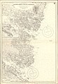 Admiralty Chart No 3168 Eigneig More to Black Leversay, Published 1902.jpg 8 486 × 12 302; 35,79 MB
-
 Aird - geograph.org.uk - 1382595.jpg 640 × 480; 61 KB
-
 Baile a' Mhanaich - geograph.org.uk - 1382623.jpg 640 × 480; 64 KB
-
 Baile a' Mhanaich from the air - geograph.org.uk - 1382621.jpg 640 × 480; 79 KB
-
 Beach near Benbecula Western Isles - geograph.org.uk - 10444.jpg 640 × 480; 82 KB
-
 Benbecula A 865 B 892.jpg 640 × 480; 51 KB
-
 Benbecula Balivanich Aerial View.jpg 640 × 552; 59 KB
-
 Benbecula beach - geograph.org.uk - 2017630.jpg 3 024 × 2 016; 955 KB
-
 Benbecula Beach 1.jpg 640 × 480; 31 KB
-
 Benbecula Beach 2.jpg 640 × 427; 44 KB
-
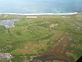
 Benbecula Beach Airport.jpg 640 × 426; 136 KB
-
 Benbecula Beach.jpg 640 × 416; 59 KB
-
 Benbecula Borve Castle.jpg 640 × 471; 99 KB
-
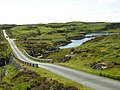
 Benbecula Bridge.jpg 640 × 480; 92 KB
-
 Benbecula by Sentinel-2.jpg 2 036 × 1 334; 2,4 MB
-
 Benbecula Causeway Griomasaigh Eilean na Chille.jpg 640 × 480; 86 KB
-
 Benbecula Creagastrom 1.jpg 640 × 480; 80 KB
-
 Benbecula Creagastrom 2.jpg 640 × 480; 79 KB
-
 Benbecula Creagory Hotel.jpg 640 × 480; 56 KB
-
 Benbecula Croft.jpg 640 × 480; 83 KB
-
 Benbecula Croftland Torlum.jpg 640 × 480; 65 KB
-
 Benbecula Deserted Buiding 1.jpg 640 × 480; 72 KB
-
 Benbecula Deserted Buiding 3.jpg 640 × 480; 80 KB
-
 Benbecula Eriophorum.jpg 640 × 480; 125 KB
-
 Benbecula Fish Cages.jpg 640 × 480; 80 KB
-
 Benbecula Golf club - geograph.org.uk - 483072.jpg 640 × 404; 114 KB
-
 Benbecula Griminis.jpg 640 × 483; 83 KB
-
 Benbecula House Gramasdail.jpg 640 × 480; 63 KB
-
 Benbecula Landscape 1.jpg 640 × 427; 56 KB
-
 Benbecula Landscape 2.jpg 640 × 480; 65 KB
-
 Benbecula Landscape 3.jpg 640 × 480; 82 KB
-
 Benbecula Oban nan Crothintin.jpg 640 × 480; 92 KB
-
 Benbecula Oban Uaine.jpg 640 × 480; 103 KB
-
 Benbecula OH.svg 1 083 × 1 424; 2,36 MB
-
 Benbecula Peat.jpg 640 × 480; 76 KB
-
 Benbecula Road Telephone Box.jpg 640 × 480; 58 KB
-
 Benbecula Ruabhal Eilean na Cille.jpg 640 × 480; 86 KB
-
 Benbecula Ruabhal View.jpg 640 × 429; 51 KB
-
 Benbecula Sheep Fanks.jpg 640 × 480; 91 KB
-
 Benbecula South Uist Causeway 1.jpg 640 × 480; 80 KB
-
 Benbecula South Uist Causeway 2.jpg 640 × 480; 92 KB
-
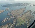
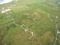
 Benbecula Torlum Aerial.jpg 640 × 480; 62 KB
-
 Benbecula Track.jpg 640 × 480; 72 KB
-
 Benbecula Uisgeabhagh.jpg 640 × 480; 67 KB
-
 Benbecula.jpg 640 × 480; 141 KB
-
 Benbecula01LB.jpg 4 608 × 3 456; 6 MB
-
 Beul an Toim - geograph.org.uk - 917257.jpg 640 × 480; 54 KB
-
 Beul an Toim.jpg 640 × 480; 52 KB
-
 Building remains at Sgaraileòd - geograph.org.uk - 1466940.jpg 640 × 427; 120 KB
-
 Burn, Haca - geograph.org.uk - 1527340.jpg 450 × 600; 326 KB
-
 Burn, Haca - geograph.org.uk - 1527354.jpg 450 × 600; 272 KB
-
 Busy Benbecula beach - geograph.org.uk - 1470843.jpg 640 × 427; 81 KB
-
 Cairn on summit of Ruabhal - geograph.org.uk - 1523277.jpg 640 × 426; 260 KB
-
 Caolas Fhlodaigh - geograph.org.uk - 855812.jpg 640 × 480; 108 KB
-
 Caolas Fhlodaigh - geograph.org.uk - 855819.jpg 640 × 480; 73 KB
-
 Caolas Fhlodaigh - geograph.org.uk - 855826.jpg 640 × 480; 98 KB
-
 Caolas Fhlodaigh - geograph.org.uk - 855827.jpg 480 × 640; 59 KB
-
 Caolas Fhlodaigh - geograph.org.uk - 858018.jpg 640 × 480; 106 KB
-
 Causeway Benbecula Eilean na Cille.jpg 640 × 480; 87 KB
-
 Cb cap inc bei den Äußeren Hebriden.jpg 5 043 × 3 248; 7,01 MB
-
 Cb, Cu, Ac über dem Atlantik.jpg 5 184 × 3 456; 4,88 MB
-
 Church Griminis - geograph.org.uk - 1523252.jpg 640 × 426; 177 KB
-
 Cnoc and lochan territory - geograph.org.uk - 1471045.jpg 640 × 427; 100 KB
-
 Communications - geograph.org.uk - 855773.jpg 640 × 480; 82 KB
-
 Creag Ghoraidh Co-op Store - geograph.org.uk - 448511.jpg 640 × 480; 60 KB
-
 Creag Ghoraidh Hotel - geograph.org.uk - 1381053.jpg 640 × 480; 59 KB
-

-
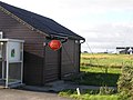 Creagorry Post Office - geograph.org.uk - 642117.jpg 640 × 480; 62 KB
-
 Crowded beach, Benbecula - geograph.org.uk - 2045307.jpg 3 189 × 2 023; 1,26 MB
-
 Culla Beach - geograph.org.uk - 1382544.jpg 640 × 480; 46 KB
-
 Culla beach - geograph.org.uk - 1516733.jpg 640 × 480; 102 KB
-

-
 Defence Imagery - Missiles 17.jpg 2 700 × 1 812; 3,22 MB
-
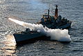 Defence Imagery - Missiles 18.jpg 2 686 × 1 822; 3,14 MB
-
 Deserted Croft at Sidhean Rossinish - geograph.org.uk - 1468420.jpg 640 × 480; 93 KB
-
 Driftwood on the beach - geograph.org.uk - 1470994.jpg 640 × 480; 125 KB
-
 Dubh Loch Sgaraileòd - geograph.org.uk - 1466933.jpg 640 × 427; 141 KB
-
 Dubh Loch Sgaraileòd - geograph.org.uk - 1466937.jpg 640 × 427; 120 KB
-
 Due West from above Loch Fada - geograph.org.uk - 1382394.jpg 640 × 480; 57 KB
-
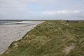 Dune backed beach - geograph.org.uk - 1470837.jpg 640 × 427; 88 KB
-
 East coast of Benbecula - geograph.org.uk - 1466895.jpg 640 × 427; 97 KB
-
 East of Lionacleit - geograph.org.uk - 1381057.jpg 640 × 480; 75 KB
-
 Eastern end of Rairnis - geograph.org.uk - 4974573.jpg 640 × 372; 50 KB
-

-
 Eilean na Cille.jpg 1 077 × 867; 653 KB
-
 Eileanan Chearabhaigh.jpg 4 000 × 3 000; 632 KB
-
 Faodhail a Tuath - geograph.org.uk - 1341727.jpg 640 × 383; 175 KB
-
 Fishing Boat - geograph.org.uk - 1526973.jpg 640 × 480; 347 KB
-
 Fishing Boats by the Jetty - geograph.org.uk - 26358.jpg 640 × 427; 58 KB
-
 From Loch na Liana Moire to Culla - geograph.org.uk - 1382484.jpg 640 × 480; 49 KB
-
 Fuidheigh Beag from Roisinis - geograph.org.uk - 1468405.jpg 640 × 480; 83 KB
-
 Gearraidh a Siar - geograph.org.uk - 1351452.jpg 640 × 427; 274 KB
-
 Gneiss, Mafic and Pegmatite - geograph.org.uk - 1351460.jpg 640 × 458; 310 KB
-
 Gramsdale, Welcome to Benbecula - geograph.org.uk - 3271497.jpg 640 × 480; 87 KB
-
 Greanamul Deas - geograph.org.uk - 4974569.jpg 640 × 371; 55 KB
-
 Haca - geograph.org.uk - 790482.jpg 640 × 480; 87 KB
-
 Hunger Road on Benbecula - geograph.org.uk - 1516719.jpg 640 × 480; 110 KB
-
 Jetty near Cuinabunag - geograph.org.uk - 1523025.jpg 640 × 426; 239 KB
-
 Jetty near Nunton - geograph.org.uk - 1479340.jpg 640 × 480; 87 KB
-
 Kirk and Cottages - geograph.org.uk - 1341708.jpg 640 × 387; 194 KB
-
 Klimadiagramm-deutsch-Benbecula (Hebriden)-Großbritannien.png 1 024 × 710; 131 KB
-
 Lews Castle College, Benbecula Campus - geograph.org.uk - 1523056.jpg 640 × 426; 179 KB
-
 Littering the beach - geograph.org.uk - 1470809.jpg 640 × 427; 168 KB
-
 Loch in der Entwässerungsrinne ermöglich Zugang für Vögel.jpg 5 184 × 3 456; 11,67 MB
-
 Loch Portain - geograph.org.uk - 443482.jpg 640 × 480; 76 KB
-
 Loch Uisgeabhagh - geograph.org.uk - 1466846.jpg 640 × 427; 147 KB
-
 LochOlabhat01LB.jpg 4 608 × 3 456; 5,22 MB
-
 Looking north east up Oban Uaine - geograph.org.uk - 1468394.jpg 640 × 480; 83 KB
-
 Luib Bhan - geograph.org.uk - 1381058.jpg 640 × 480; 61 KB
-
 MacGillivray's - geograph.org.uk - 1512788.jpg 640 × 480; 65 KB
-
 Machair meets beach - geograph.org.uk - 1470800.jpg 640 × 427; 110 KB
-
 Maithidh Riabhach from Benbecula - geograph.org.uk - 3061650.jpg 3 203 × 1 579; 827 KB
-
 Maragaidh Beag - geograph.org.uk - 4974546.jpg 640 × 484; 133 KB
-
 Maragaidh Beag - geograph.org.uk - 4974552.jpg 640 × 484; 121 KB
-
 Marsch und Watt im Süden von Benbecula II.jpg 5 043 × 3 248; 9,43 MB
-
 Marsch und Watt im Süden von Benbecula.jpg 5 142 × 3 394; 10,02 MB
-
 Marshland at Liniclate - geograph.org.uk - 1326554.jpg 640 × 480; 56 KB
-
 Minor road near Creagastrom - geograph.org.uk - 855863.jpg 640 × 480; 80 KB
-
 Minor road near Creagastrom - geograph.org.uk - 855878.jpg 640 × 480; 88 KB
-
 Minor roads north from Luib Bhan - geograph.org.uk - 1382360.jpg 640 × 480; 69 KB
-
 Moorland track to Roisinis - geograph.org.uk - 1523266.jpg 640 × 426; 283 KB
-
 Moorland track to Ruabhal - geograph.org.uk - 843008.jpg 640 × 480; 73 KB
-
 Muddy Inlet - geograph.org.uk - 1526964.jpg 640 × 427; 350 KB
-
 Màithidh Riabhach - geograph.org.uk - 4974563.jpg 640 × 409; 50 KB
-
 Near Cuinabunag - geograph.org.uk - 200634.jpg 640 × 312; 187 KB
-
 North Ford and Eaval - geograph.org.uk - 200831.jpg 640 × 396; 183 KB
-
 North Ford Causeway - geograph.org.uk - 1341743.jpg 640 × 427; 215 KB
-
-
 Oban Thaca - geograph.org.uk - 790481.jpg 640 × 480; 95 KB
-
 Oitir Mhor.jpg 1 275 × 826; 865 KB
-
 Oitir Mhòr - geograph.org.uk - 1341735.jpg 640 × 384; 172 KB
-
 Oitir Mhòr - geograph.org.uk - 5520916.jpg 640 × 427; 92 KB
-
 Old pier at Bàgh Sgaraileòd - geograph.org.uk - 1466876.jpg 640 × 427; 117 KB
-
 Old walls - geograph.org.uk - 1466881.jpg 640 × 427; 109 KB
-
 On road to Peter's Port - geograph.org.uk - 2986218.jpg 640 × 427; 63 KB
-
 On The Path To Rossinish - geograph.org.uk - 1526995.jpg 640 × 480; 354 KB
-
 On The Way To Rossinish - geograph.org.uk - 1527034.jpg 640 × 480; 379 KB
-
 Ordnance Survey One-Inch Sheet 23 Benbecula, Published 1948.jpg 12 228 × 9 282; 36,84 MB
-
 Ordnance Survey One-Inch Sheet 23 South Uist, Published 1959.jpg 8 296 × 9 841; 6,59 MB
-
 Ordnance Survey Quarter-inch sheet 4 Western Highlands, published 1967.jpg 9 627 × 8 869; 8,85 MB
-
 Otter Warning Sign - geograph.org.uk - 26355.jpg 640 × 427; 36 KB
-
 Otters Crossing sign at Benbecula.jpg 1 152 × 768; 799 KB
-

-
 Parting of the ways - geograph.org.uk - 1467155.jpg 640 × 427; 102 KB
-
 Patterned sand - geograph.org.uk - 1470859.jpg 640 × 427; 63 KB
-
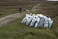
 Peat cutting - geograph.org.uk - 1467084.jpg 640 × 480; 133 KB
-
 Peat cuttings, Ruabhal - geograph.org.uk - 842991.jpg 640 × 360; 60 KB
-
 Peighinn a Bhaile - geograph.org.uk - 1382450.jpg 640 × 480; 43 KB
-
 Peter's Port Jetty - geograph.org.uk - 2986198.jpg 4 608 × 3 072; 1,99 MB
-
 Picnic site on the road to Port Pheadair - geograph.org.uk - 1523323.jpg 640 × 426; 268 KB
-
 Port Pheadair, Peter's Port - geograph.org.uk - 2902421.jpg 4 000 × 3 000; 1,68 MB
-
 Post Box near Creagastrom - geograph.org.uk - 855874.jpg 640 × 480; 84 KB
-
 Post Box on Flodaigh - geograph.org.uk - 855860.jpg 640 × 480; 88 KB
-
 Restored Black House - geograph.org.uk - 1341715.jpg 640 × 379; 196 KB
-
 Road and Causeway to Port Pheadair - geograph.org.uk - 1523292.jpg 640 × 426; 277 KB
-
 Road to Port Pheadair - geograph.org.uk - 4225496.jpg 1 600 × 1 200; 626 KB
-
 Ruabhal - geograph.org.uk - 858022.jpg 640 × 480; 73 KB
-

-
 Rueval Landfill - geograph.org.uk - 1467007.jpg 640 × 480; 82 KB
-
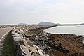
 Sand and pebble beach - geograph.org.uk - 1470822.jpg 640 × 427; 104 KB
-

-
 Screen machine at Dark Island Hotel - geograph.org.uk - 1469671.jpg 640 × 480; 101 KB
-
 Seaweed Collection - geograph.org.uk - 3289362.jpg 800 × 527; 448 KB
-
-
 Sgaraileòd - geograph.org.uk - 1466893.jpg 640 × 427; 124 KB
-
 Sgaraileòd - geograph.org.uk - 1466908.jpg 640 × 427; 120 KB
-
 Sgaraileòd - geograph.org.uk - 1466926.jpg 640 × 427; 110 KB
-
 Sidhean Rossinish - geograph.org.uk - 2069760.jpg 3 089 × 2 000; 953 KB
-
 Small inlet - geograph.org.uk - 1466853.jpg 640 × 427; 103 KB
-
 South-west from above Griminis - geograph.org.uk - 1382379.jpg 640 × 480; 51 KB
-
 Stinky Bay, Benbecula - geograph.org.uk - 3163204.jpg 1 600 × 1 200; 523 KB
-
 Strome Shunamal Anderson 1881b Fig 47 scotlandinearlyc00anderich 0106.jpg 681 × 1 045; 141 KB
-
 Sunamul - geograph.org.uk - 917252.jpg 640 × 480; 64 KB
-
 Target practise on Benbecula.JPEG 3 008 × 1 960; 826 KB
-
 Teampull Cholumchille Anderson 1881 Fig 20 scotlandinearlyc00ande 0089.jpg 1 129 × 2 807; 703 KB
-
 Thatched cottage near Gramasdal - geograph.org.uk - 1523282.jpg 426 × 640; 266 KB
-
 The Beach At Sidhean Rossinish - geograph.org.uk - 1527052.jpg 640 × 427; 335 KB
-

-
 The tide goes out on Benbecula beach - geograph.org.uk - 2017637.jpg 2 304 × 3 072; 1,25 MB
-
-
 Tidal channel at the south of Benbecula - geograph.org.uk - 3559019.jpg 1 024 × 676; 152 KB
-
 Tidal Inlet - geograph.org.uk - 1526947.jpg 640 × 473; 380 KB
-
 Tidal Inlet - geograph.org.uk - 1527000.jpg 640 × 438; 366 KB
-
 Tidal rocks west of Greanamul - geograph.org.uk - 4974562.jpg 640 × 457; 65 KB
-
 Tidal Sands - geograph.org.uk - 855775.jpg 640 × 480; 84 KB
-

-
 Towards Geodha Ban - geograph.org.uk - 1382615.jpg 640 × 480; 59 KB
-
 Towards Gramasdail - geograph.org.uk - 855804.jpg 640 × 480; 89 KB
-
 Track from Ruabhal - geograph.org.uk - 1467002.jpg 640 × 480; 89 KB
-
 Track from Sgaraileòd - geograph.org.uk - 1471051.jpg 640 × 427; 115 KB
-
 Track past Loch Bà Una - geograph.org.uk - 1467031.jpg 640 × 480; 117 KB
-
 Track to Roisinis and Loch Theirmeadail - geograph.org.uk - 1523273.jpg 640 × 426; 260 KB
-
 Track to Ruabhal - geograph.org.uk - 1467019.jpg 640 × 480; 125 KB
-
 Track to Ruabhal - geograph.org.uk - 842980.jpg 640 × 480; 38 KB
-
 Triangulation pillar, Aird - geograph.org.uk - 934940.jpg 640 × 480; 72 KB
-
 Turning circle on Flodaigh - geograph.org.uk - 1523325.jpg 640 × 426; 245 KB
-
 UK Benbecula.PNG 648 × 584; 19 KB
-
 View from Flodaigh - geograph.org.uk - 858028.jpg 640 × 490; 91 KB
-
 View of the Causeway - geograph.org.uk - 857950.jpg 640 × 469; 82 KB


-Gro%C3%9Fbritannien.png)


