Category:Bentham, North Yorkshire
Vai alla navigazione
Vai alla ricerca
civil parish in North Yorkshire, England, UK  | |||||
| Carica un file multimediale | |||||
| Istanza di | |||||
|---|---|---|---|---|---|
| Luogo | Craven, North Yorkshire, Yorkshire e Humber, Inghilterra | ||||
| Popolazione |
| ||||
 | |||||
English: Bentham is a civil parish in the Craven district of North Yorkshire, England, with a population of around 3,000 people. The town council is known as Bentham Town Council, and covers High Bentham and Low Bentham.
Polski: Bentham - civil parish w Wielkiej Brytanii, w Anglii, w regionie Yorkshire and the Humber, w hrabstwie North Yorkshire. W 2001r. civil parish to zamieszkiwało 3 000 osób.
Sottocategorie
Questa categoria contiene le 6 sottocategorie indicate di seguito, su un totale di 6.
C
- Church Bridge, Bentham (4 F)
G
- Great Stone of Fourstones (9 F)
H
L
M
- Mewith Head Hall (4 F)
R
- The Ridding, North Yorkshire (3 F)
File nella categoria "Bentham, North Yorkshire"
Questa categoria contiene 200 file, indicati di seguito, su un totale di 374.
(pagina precedente) (pagina successiva)-
 144 metre spot height on the road to Tatterthorn - geograph.org.uk - 5689882.jpg 1 024 × 768; 180 KB
-

-
 A view of Ingleborough from the Great Stone of Fourstones - geograph.org.uk - 5962063.jpg 5 184 × 3 456; 7,58 MB
-
 Access Lane from West Borronhead - geograph.org.uk - 5226983.jpg 1 600 × 1 067; 278 KB
-
 Access track at Mewith Head - geograph.org.uk - 3665111.jpg 640 × 425; 305 KB
-
 Approaching Black Wood - geograph.org.uk - 1908066.jpg 2 816 × 2 112; 1,89 MB
-
 Approaching Crow Trees - geograph.org.uk - 2361019.jpg 640 × 480; 87 KB
-
 Approaching Laneside Barn - geograph.org.uk - 4261051.jpg 4 320 × 3 240; 4,68 MB
-
 Approaching Stonegrove - geograph.org.uk - 3725056.jpg 4 320 × 3 240; 4,54 MB
-
 Around Keasden, aerila 2018 - geograph.org.uk - 5895493.jpg 800 × 533; 95 KB
-
 Art Deco factory - geograph.org.uk - 3724877.jpg 4 320 × 3 240; 4,78 MB
-
 B6480 towards Clapham - geograph.org.uk - 5927514.jpg 640 × 480; 96 KB
-
 B6480 towards Clapham - geograph.org.uk - 5927529.jpg 640 × 480; 67 KB
-
 B6480, Cross Green - geograph.org.uk - 5927518.jpg 640 × 480; 107 KB
-
 B6480, Low Bentham - geograph.org.uk - 4469848.jpg 640 × 433; 142 KB
-
 Back Lane approaching Low Bentham Solar Farm - geograph.org.uk - 6307568.jpg 4 000 × 3 000; 4,33 MB
-
 Back Lane beside Black Wood - geograph.org.uk - 6307563.jpg 4 000 × 3 000; 5,11 MB
-
 Back Lane crossing the border at Old Wennington - geograph.org.uk - 6307560.jpg 4 000 × 3 000; 5,16 MB
-
 Barn above the Wenning - geograph.org.uk - 2362819.jpg 800 × 557; 104 KB
-
 Barns, Ridding Lane - geograph.org.uk - 5926474.jpg 640 × 405; 47 KB
-
 Battersby Farm - geograph.org.uk - 1931423.jpg 1 500 × 666; 1,06 MB
-
 Beck running south towards Bentham Bridge - geograph.org.uk - 5689097.jpg 768 × 1 024; 274 KB
-
 Bench and stile on the Bentham Heritage Trail - geograph.org.uk - 5689219.jpg 1 024 × 768; 230 KB
-
 Bench mark on Butterbur Cottage, High Bentham - geograph.org.uk - 6034847.jpg 1 200 × 1 600; 578 KB
-
 Bench mark on gate post - geograph.org.uk - 2287411.jpg 480 × 640; 122 KB
-
 Bench mark on gate post, Toll House - geograph.org.uk - 2287467.jpg 480 × 640; 84 KB
-
 Bench mark on High Bentham Gallery - geograph.org.uk - 4913281.jpg 2 203 × 2 941; 1,87 MB
-
 Bench mark on High Bentham railway bridge - geograph.org.uk - 5291984.jpg 1 024 × 768; 320 KB
-

-

-
 Bench mark, Lane House, Mewith Lane - geograph.org.uk - 2297388.jpg 480 × 640; 156 KB
-

-
 Bench mark, railway bridge near Holmes - geograph.org.uk - 2287462.jpg 480 × 640; 144 KB
-

-
 Bend in the River Wenning - geograph.org.uk - 817489.jpg 640 × 480; 127 KB
-
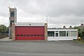 Bentham fire station - geograph.org.uk - 2022767.jpg 640 × 427; 168 KB
-
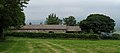
 Bentham parish church is now in Low Bentham - geograph.org.uk - 5689091.jpg 1 024 × 768; 236 KB
-
 Bentham to Burton path - geograph.org.uk - 2287391.jpg 640 × 480; 95 KB
-
 Black Wood from the East - geograph.org.uk - 1908071.jpg 2 816 × 2 112; 1,99 MB
-
 Bowtham Wood - geograph.org.uk - 817506.jpg 640 × 480; 73 KB
-
 Bridge over Lairgill Beck and a rivet bench mark - geograph.org.uk - 5291420.jpg 1 024 × 768; 427 KB
-
 Bridge over the Greta - geograph.org.uk - 4190011.jpg 1 280 × 960; 1,36 MB
-
 Bridleway beside Bentham Golf Course - geograph.org.uk - 4289381.jpg 5 184 × 3 456; 7,46 MB
-
 Bridleway heading west to High Bentham - geograph.org.uk - 5689910.jpg 1 024 × 768; 274 KB
-
 Bridleway leading away from Tatterthorn Road - geograph.org.uk - 4288324.jpg 5 179 × 3 451; 7,29 MB
-

-
 Bridleway sign on the road to Tatterthorn - geograph.org.uk - 5689906.jpg 1 024 × 768; 203 KB
-
 BT building on Low Bentham Road - geograph.org.uk - 5927480.jpg 640 × 480; 99 KB
-
 Builders Merchants, Low Bentham - geograph.org.uk - 5926658.jpg 640 × 394; 45 KB
-
 Buildings in the centre of High Bentham - geograph.org.uk - 6234591.jpg 2 000 × 1 375; 547 KB
-
 Burn Moor Fell Trig - geograph.org.uk - 3544279.jpg 2 560 × 1 920; 3,35 MB
-
-

-
 Burton in Lonsdale - geograph.org.uk - 5413322.jpg 5 174 × 2 605; 1,64 MB
-
 Businesses on High Bentham's Main Street - geograph.org.uk - 5690337.jpg 1 024 × 768; 161 KB
-
 Buttercups by the Wenning, Staggarth - geograph.org.uk - 3989172.jpg 800 × 600; 206 KB
-
 Carved stone, Staggarth - geograph.org.uk - 2297401.jpg 480 × 640; 110 KB
-
 Cattle grazing by Greystonegill Lane - geograph.org.uk - 2520951.jpg 640 × 480; 79 KB
-
 Cattle near High Barn - geograph.org.uk - 5927525.jpg 640 × 480; 79 KB
-
 Cereal crop near Holmes - geograph.org.uk - 5926622.jpg 640 × 480; 97 KB
-
 Chesters - geograph.org.uk - 4320596.jpg 5 184 × 3 456; 5,85 MB
-
 Chesters Lane - geograph.org.uk - 4320291.jpg 5 157 × 3 429; 5,24 MB
-
 Clifford Hall - geograph.org.uk - 1910456.jpg 640 × 480; 106 KB
-
 Close up, Edward VII postbox on the B6480, Low Bentham - geograph.org.uk - 5933972.jpg 1 569 × 2 956; 1,06 MB
-
 Communications mast, Linghaw Cross - geograph.org.uk - 5927523.jpg 640 × 480; 66 KB
-
 Cottages on the north side of Main Street - geograph.org.uk - 5690347.jpg 1 024 × 768; 155 KB
-
 Country West of Mewith Head Hall - geograph.org.uk - 5226998.jpg 1 600 × 1 067; 727 KB
-
 Crossroads by the River Greta - geograph.org.uk - 2048532.jpg 3 872 × 2 592; 3,63 MB
-
 Crossroads Mewith Lane - geograph.org.uk - 3665063.jpg 640 × 425; 237 KB
-
 Crow Trees - geograph.org.uk - 3725091.jpg 4 320 × 3 240; 4,74 MB
-
 Crow Trees farmhouse - geograph.org.uk - 2361023.jpg 640 × 480; 127 KB
-
 Cyclist on Mewith Lane - geograph.org.uk - 5481121.jpg 1 024 × 768; 697 KB
-

-
 Date-stone on barn, Staggarth - geograph.org.uk - 4193659.jpg 634 × 640; 251 KB
-
 Dawson Close - geograph.org.uk - 4193666.jpg 640 × 425; 193 KB
-
 Dead Tree, Live Tree - geograph.org.uk - 817520.jpg 640 × 480; 51 KB
-
 Destroyed weir on the Greta - geograph.org.uk - 1910479.jpg 640 × 480; 160 KB
-
 Dragon's Wood, south-east of High Bentham - geograph.org.uk - 5689198.jpg 768 × 1 024; 232 KB
-
 Driveway to Wildman's Barn, Clapham - geograph.org.uk - 6241545.jpg 2 000 × 1 500; 968 KB
-

-
 Easter Island comes to Bentham - geograph.org.uk - 5353493.jpg 720 × 540; 175 KB
-
 Edward VII postbox on the B6480, Low Bentham - geograph.org.uk - 5933974.jpg 3 648 × 2 736; 2,46 MB
-
 Eight houses on the west side of Lakeber Avenue - geograph.org.uk - 5690309.jpg 1 024 × 614; 134 KB
-
 Elizabeth II postbox on Main Street, High Bentham - geograph.org.uk - 5933977.jpg 1 457 × 2 656; 630 KB
-
 Eller Gill - geograph.org.uk - 2287367.jpg 640 × 480; 93 KB
-
 Eller Gill - geograph.org.uk - 2287377.jpg 800 × 600; 112 KB
-
 Eller Gill - geograph.org.uk - 4290856.jpg 5 179 × 3 451; 6,43 MB
-
 Entrance to Linghaw Lane - geograph.org.uk - 4320271.jpg 5 184 × 3 456; 7,47 MB
-
 Ewes and lambs near Mewith Head - geograph.org.uk - 2362828.jpg 800 × 568; 124 KB
-
 Fairway for Hole 2, Bentham Golf Course - geograph.org.uk - 4289386.jpg 5 184 × 3 456; 7,26 MB
-
 Farm track to Kirkbeck - geograph.org.uk - 2908534.jpg 2 592 × 1 944; 1,53 MB
-
 Farmland at Greystonegill - geograph.org.uk - 4670991.jpg 1 024 × 768; 720 KB
-
 Farmland near Greystonegill Lane - geograph.org.uk - 4193672.jpg 640 × 425; 179 KB
-
 Farmland near Mewith Head - geograph.org.uk - 2464223.jpg 1 600 × 1 200; 492 KB
-
 Farmland off Mewith Lane - geograph.org.uk - 2464183.jpg 1 600 × 1 200; 582 KB
-
 Farmland off Mewith Lane - geograph.org.uk - 2464210.jpg 1 600 × 1 200; 679 KB
-
 Farmland, Ridding Lane - geograph.org.uk - 5926470.jpg 640 × 401; 53 KB
-
 Fence and Gate Burn Moor - geograph.org.uk - 4152491.jpg 640 × 425; 312 KB
-
 Field alongside Station Road, High Bentham - geograph.org.uk - 5810330.jpg 1 010 × 768; 81 KB
-
 Field boundaries west of Pemberton Farm - geograph.org.uk - 5689915.jpg 1 024 × 768; 144 KB
-
 Fields in the snow by the B6480 - geograph.org.uk - 6398172.jpg 3 136 × 976; 1,01 MB
-
 Finger-post, Four Lane Ends - geograph.org.uk - 5805149.jpg 1 180 × 1 180; 634 KB
-
 Flood under the Railway Bridge near Holmes - geograph.org.uk - 6398817.jpg 4 032 × 1 816; 1,54 MB
-
 Footbridge over Ellergill Beck - geograph.org.uk - 5330254.jpg 640 × 480; 132 KB
-
 Footpath above Ellergill Beck - geograph.org.uk - 5353477.jpg 720 × 540; 88 KB
-
 Footpath by Bracken Hill Farm - geograph.org.uk - 5353483.jpg 720 × 540; 179 KB
-
 Footpath by Branstone Beck - geograph.org.uk - 2297396.jpg 640 × 480; 165 KB
-

-
 Footpath eastwards from Cinder Hill, Clapham - geograph.org.uk - 6241540.jpg 2 000 × 1 476; 1,07 MB
-
 Footpath gate on Cowslip Hill - geograph.org.uk - 5689395.jpg 1 024 × 768; 275 KB
-
 Footpath leading to Goodenbergh Farm - geograph.org.uk - 4307187.jpg 5 184 × 3 456; 7,66 MB
-
 Footpath north of Low Bentham - geograph.org.uk - 5330261.jpg 640 × 480; 101 KB
-
 Footpath to High Bentham - geograph.org.uk - 3724968.jpg 4 320 × 3 240; 4,77 MB
-
 Footpath, Greta Wood - geograph.org.uk - 1910515.jpg 480 × 640; 164 KB
-
 Former Post Office on Main Street, High Bentham - geograph.org.uk - 5933978.jpg 3 648 × 2 736; 1,56 MB
-
 Four Lane Ends - geograph.org.uk - 4306578.jpg 5 184 × 3 456; 6,81 MB
-
 Four Lane Ends - geograph.org.uk - 5413324.jpg 5 184 × 2 548; 1,55 MB
-
 Four Lane Ends - geograph.org.uk - 5805148.jpg 1 280 × 850; 595 KB
-
 Fourlands Hill - geograph.org.uk - 4290867.jpg 5 184 × 3 456; 5,99 MB
-
 Fowgill Beck - geograph.org.uk - 5689408.jpg 1 024 × 768; 397 KB
-
 Gate on Burn Moor - geograph.org.uk - 5962659.jpg 5 184 × 3 456; 7,26 MB
-
 Gate on the bridleway to High Bentham - geograph.org.uk - 5689932.jpg 1 024 × 768; 192 KB
-
 Gate, Burn Moor - geograph.org.uk - 6254006.jpg 1 280 × 720; 431 KB
-
 Gate, Mewith Head Hall - geograph.org.uk - 2361051.jpg 640 × 480; 165 KB
-
 Gill Head Farm - geograph.org.uk - 4289413.jpg 5 179 × 3 451; 7,32 MB
-
 Gill Head Farm, north of High Bentham - geograph.org.uk - 5690280.jpg 1 024 × 768; 175 KB
-
 Grassland near Mewith Head - geograph.org.uk - 4189837.jpg 4 000 × 3 000; 5,26 MB
-
 Grassland, Belle Bank - geograph.org.uk - 5927509.jpg 640 × 480; 78 KB
-
 Grassland, Bentham - geograph.org.uk - 5927487.jpg 640 × 480; 100 KB
-

-
 Grazing fields, Burton in Lonsdale - geograph.org.uk - 1610514.jpg 480 × 640; 87 KB
-
 Grazing land off West Hill Lane - geograph.org.uk - 2464190.jpg 1 600 × 1 200; 576 KB
-
 Grazing near Lowther Hill - geograph.org.uk - 5927528.jpg 640 × 480; 59 KB
-
 Grazing off the B6480 - geograph.org.uk - 5927517.jpg 640 × 480; 75 KB
-
 Green Lane leading to Low Bentham - geograph.org.uk - 1908105.jpg 2 816 × 2 112; 2,36 MB
-
 Greeta House, Burton in Lonsdale - geograph.org.uk - 1910508.jpg 480 × 640; 111 KB
-
 Greystonegill Bridge - geograph.org.uk - 4193676.jpg 640 × 445; 287 KB
-
 Greystonegill Lane - geograph.org.uk - 5927526.jpg 640 × 480; 64 KB
-
 Grouse Moor on NW. Slope of Burn Moor - geograph.org.uk - 1931505.jpg 1 499 × 842; 1,32 MB
-

-

-

-
 Haybers - geograph.org.uk - 2285580.jpg 640 × 480; 64 KB
-
 Heading towards Bentham... - geograph.org.uk - 3724860.jpg 4 320 × 3 240; 4,87 MB
-
 Hedged fields, near Gill Head Farm - geograph.org.uk - 5690134.jpg 1 024 × 768; 173 KB
-
 Hello^ - geograph.org.uk - 2361299.jpg 640 × 480; 144 KB
-
 Here be tigers - geograph.org.uk - 2285556.jpg 640 × 480; 186 KB
-
 Here since 1676 - geograph.org.uk - 2907837.jpg 2 592 × 1 944; 1,24 MB
-
 Hidden in the trees - geograph.org.uk - 3725631.jpg 4 320 × 3 240; 4,86 MB
-
 High Bentham - geograph.org.uk - 3663965.jpg 4 320 × 3 240; 2,95 MB
-
 High Bentham - geograph.org.uk - 5906007.jpg 1 024 × 615; 145 KB
-
 High Bentham Auction Mart - geograph.org.uk - 4441217.jpg 4 000 × 3 000; 5,66 MB
-
 High Bentham in 1965 - geograph.org.uk - 5251485.jpg 1 024 × 683; 133 KB
-
 Hillside grazing, Ridding Lane - geograph.org.uk - 5926480.jpg 640 × 388; 61 KB
-
 House near New Butt Farm - geograph.org.uk - 5927535.jpg 640 × 480; 87 KB
-
 House near the railway, Low Bentham - geograph.org.uk - 5926639.jpg 640 × 480; 82 KB
-

-
 Houses on Main Street, Low Bentham - geograph.org.uk - 5926653.jpg 640 × 480; 56 KB
-
 Houses stepping up Lakeber Avenue, High Bentham - geograph.org.uk - 5690305.jpg 1 024 × 768; 232 KB
-
-
 Information panel no. 2, Bentham Heritage Trail - geograph.org.uk - 5689403.jpg 1 024 × 768; 216 KB
-
 Ingleborough in the cloud - geograph.org.uk - 5049736.jpg 1 280 × 960; 853 KB
-
 Jubilee boundary stone, Bloe Beck Bridge - geograph.org.uk - 3989607.jpg 480 × 640; 191 KB
-
 King Street, High Bentham - geograph.org.uk - 3147253.jpg 480 × 640; 92 KB
-
 Lancaster to Leeds railway at Low Bentham - geograph.org.uk - 2907699.jpg 2 592 × 1 944; 1,56 MB
-
 Lane - geograph.org.uk - 5413331.jpg 3 456 × 3 590; 1,91 MB
-
 Lane heading towards Mewith Head - geograph.org.uk - 5228585.jpg 1 600 × 1 067; 545 KB
-
 Lane House Cottage - geograph.org.uk - 2297290.jpg 640 × 480; 107 KB
-
 Laneside Barn, Mewith Head - geograph.org.uk - 2361053.jpg 640 × 480; 99 KB
-

-

-
 Leaning Road Sign and Seat - geograph.org.uk - 127361.jpg 640 × 480; 171 KB
-
 Line of Grouse Butts from Butt No. 10 - geograph.org.uk - 1931486.jpg 1 499 × 842; 1,3 MB
-
 Linghaw Farm - geograph.org.uk - 2366364.jpg 640 × 480; 72 KB
-
 Logo on old biscuit van - geograph.org.uk - 3989633.jpg 480 × 640; 56 KB
-
 Lone tree in a sheep field - geograph.org.uk - 5689923.jpg 1 024 × 768; 271 KB
-
 Looking across a little valley on Cinder Hill, Clapham - geograph.org.uk - 6241530.jpg 2 000 × 1 500; 1,06 MB
-
 Looking towards Ingleborough - geograph.org.uk - 2361031.jpg 800 × 588; 116 KB
-
 Low Bentham - geograph.org.uk - 5413205.jpg 5 184 × 2 712; 1,98 MB
-
 Low Bentham and Ingleborough - geograph.org.uk - 4664332.jpg 800 × 600; 100 KB
-
 Low Bentham road into High Bentham - geograph.org.uk - 5927484.jpg 640 × 480; 76 KB
-
 Low Bottom - geograph.org.uk - 2297409.jpg 640 × 480; 79 KB
-
 Low water levels in the Wenning - geograph.org.uk - 5398154.jpg 800 × 600; 208 KB
-
 Main Street, Bentham - geograph.org.uk - 1255456.jpg 640 × 480; 66 KB
-
 Main Street, Low Bentham - geograph.org.uk - 5926655.jpg 640 × 480; 59 KB
-
 Mainly for farmers^ - geograph.org.uk - 3725220.jpg 3 743 × 2 761; 3,79 MB
-
 Market Gardening Operation on Bentham Moor - geograph.org.uk - 4290864.jpg 5 184 × 3 456; 7,1 MB
-
 Mast and track - geograph.org.uk - 4670993.jpg 759 × 1 024; 622 KB
-
 Meregill at sunset - geograph.org.uk - 3990165.jpg 640 × 480; 110 KB
-
 Mewith Head - geograph.org.uk - 2361278.jpg 655 × 800; 96 KB
-
 Mewith Lane - geograph.org.uk - 5228584.jpg 1 600 × 1 067; 658 KB
-
 Mewith Lane heading east - geograph.org.uk - 2464187.jpg 1 600 × 1 200; 582 KB
-
 Mewith Lane heading east - geograph.org.uk - 2464200.jpg 1 600 × 1 200; 788 KB
-
 Mewith lane heading east - geograph.org.uk - 2464208.jpg 1 600 × 1 200; 823 KB
-
 Mewith Lane near Mewith Head - geograph.org.uk - 4189840.jpg 4 000 × 3 000; 6,81 MB
-
 Mewith Lane towards Mewith Head - geograph.org.uk - 2464225.jpg 1 600 × 1 200; 485 KB
-
 Mewith Lane, Clapham - geograph.org.uk - 6241543.jpg 2 000 × 1 500; 1 MB
-
 Mill Lane - geograph.org.uk - 5926649.jpg 640 × 480; 78 KB
-
 Millennium Mosaic - panoramio.jpg 2 288 × 1 712; 1,45 MB
-
 Minor road towards Keasden - geograph.org.uk - 2464213.jpg 1 600 × 1 200; 683 KB


