Category:Bentley, Hampshire
Vai alla navigazione
Vai alla ricerca
village and civil parish in East Hampshire, England, UK  | |||||
| Carica un file multimediale | |||||
| Istanza di | |||||
|---|---|---|---|---|---|
| Luogo | East Hampshire, Hampshire, Sud Est dell'Inghilterra, Inghilterra | ||||
 | |||||
Deutsch: Bentley ist ein Ort und eine Gemeinde im Distrikt East Hampshire in der englischen Grafschaft Hampshire. Bentley hat 1.019 Einwohner (2001).
English: Bentley is a village and civil parish in the East Hampshire district of Hampshire, England.
Sottocategorie
Questa categoria contiene le 8 sottocategorie indicate di seguito, su un totale di 8.
File nella categoria "Bentley, Hampshire"
Questa categoria contiene 200 file, indicati di seguito, su un totale di 270.
(pagina precedente) (pagina successiva)-
 15 15 - geograph.org.uk - 1889995.jpg 2 560 × 1 920; 1,74 MB
-
 A grassy field corner - geograph.org.uk - 4572422.jpg 640 × 480; 152 KB
-
 A31 near Bentley - geograph.org.uk - 4956681.jpg 2 000 × 1 333; 2,72 MB
-
 Alice Holt Forest - geograph.org.uk - 383144.jpg 640 × 480; 164 KB
-
 Barley Pound Junction - geograph.org.uk - 2157890.jpg 2 560 × 1 920; 2,41 MB
-
 Bean Crop in Spring Flower - geograph.org.uk - 1890168.jpg 1 920 × 2 560; 1,84 MB
-
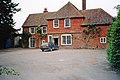
 Bentley Hall - geograph.org.uk - 1886092.jpg 2 560 × 1 920; 1,77 MB
-
 Bentley Milestone - geograph.org.uk - 1890263.jpg 1 920 × 2 560; 1,71 MB
-
 Bentley Mill on Gravel Hill Road (1) - geograph.org.uk - 2285805.jpg 800 × 600; 105 KB
-
 Bentley Mill on Gravel Hill Road (2) - geograph.org.uk - 2285817.jpg 800 × 600; 141 KB
-
 Bentley Primary School - geograph.org.uk - 1890242.jpg 2 560 × 1 920; 1,91 MB
-
 Bentley sign-1.jpg 320 × 240; 36 KB
-
 Bentley Thanks Careful Drivers - geograph.org.uk - 1890337.jpg 2 560 × 1 920; 1,73 MB
-
 Bentley Village Church - geograph.org.uk - 5560592.jpg 4 608 × 3 456; 3,17 MB
-
 Bentley Village Pond - geograph.org.uk - 1890306.jpg 1 920 × 2 560; 1,81 MB
-
 Bentley, Hampshire - geograph.org.uk - 13381.jpg 640 × 480; 94 KB
-
 Blossom at Pax Hill Care Home - geograph.org.uk - 2313685.jpg 800 × 672; 190 KB
-
 BritishCassiniGridMilitaryMap.jpg 4 150 × 2 443; 4,65 MB
-

-
 Bury Court Farm, Bentley Hampshire - geograph.org.uk - 3426058.jpg 800 × 533; 138 KB
-
 Cautionary Sign - geograph.org.uk - 1890367.jpg 1 920 × 2 560; 1,69 MB
-
 Cereal Crop by Bentley - geograph.org.uk - 1890040.jpg 2 560 × 1 920; 1,77 MB
-
 Cheek by Jowl - geograph.org.uk - 1890358.jpg 2 560 × 1 920; 1,94 MB
-
 Cheeks Farm - geograph.org.uk - 4900741.jpg 3 264 × 1 840; 2,11 MB
-
 Cheeks Farm near Bentley - geograph.org.uk - 4959913.jpg 2 000 × 1 333; 2,74 MB
-
 Church Cottage, Bentley - geograph.org.uk - 1890190.jpg 2 560 × 1 920; 1,78 MB
-
 Church Lane, Bentley - geograph.org.uk - 1890224.jpg 2 560 × 1 920; 1,93 MB
-
 Churchyard, Bentley - geograph.org.uk - 4180457.jpg 640 × 480; 352 KB
-
 Coldfrey Farm - geograph.org.uk - 3479265.jpg 640 × 427; 95 KB
-
 Coldrey Farm - geograph.org.uk - 3479269.jpg 640 × 427; 91 KB
-
 Coldrey Lodge - geograph.org.uk - 1890013.jpg 2 560 × 1 920; 1,83 MB
-
 Converted House - Hole Lane - geograph.org.uk - 4900712.jpg 3 264 × 1 840; 1,98 MB
-
 Cottage at the corner of Church Lane, Bentley - geograph.org.uk - 4085332.jpg 4 320 × 3 240; 4,11 MB
-
 Cottages near bus stop in Bentley - geograph.org.uk - 2312043.jpg 600 × 800; 84 KB
-

-
 Country lane by Bury Court - geograph.org.uk - 2714051.jpg 640 × 420; 41 KB
-
 Country lane south of Glade Farm - geograph.org.uk - 2714054.jpg 800 × 507; 57 KB
-
 Country lane south of Glade Farm - geograph.org.uk - 2714055.jpg 640 × 480; 76 KB
-
 Countryside near Dippenhall - geograph.org.uk - 4961721.jpg 2 000 × 1 333; 2,19 MB
-
 Countryside near Dippenhall - geograph.org.uk - 4962328.jpg 2 000 × 1 333; 2,66 MB
-
 Crock's Farm Sheep Field - geograph.org.uk - 4900707.jpg 3 264 × 1 840; 2,19 MB
-
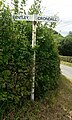
 Crondall Road meets the A31 - geograph.org.uk - 2714078.jpg 640 × 441; 59 KB
-
 Crondall Road, Bentley - geograph.org.uk - 4959872.jpg 2 000 × 1 333; 3,11 MB
-
 Crondall Road, Bentley - geograph.org.uk - 4960038.jpg 2 000 × 1 333; 3 MB
-
 Crondall Road, Bentley - geograph.org.uk - 4960060.jpg 2 000 × 1 333; 2,85 MB
-
 Crossroads and pylons near Glade Farm - geograph.org.uk - 4084278.jpg 3 767 × 2 850; 3,7 MB
-
 Crossroads in Bentley - geograph.org.uk - 2312061.jpg 800 × 600; 79 KB
-
 Crossroads with bus shelter in the rain - geograph.org.uk - 2285866.jpg 800 × 652; 146 KB
-
 Dilapidated wooden shed - geograph.org.uk - 630447.jpg 640 × 477; 117 KB
-
-
 Direction Sign at Alice Holt Forest - geograph.org.uk - 1431916.jpg 640 × 480; 120 KB
-
 Disused pit north of Pax Hill Care Home - geograph.org.uk - 2313713.jpg 800 × 600; 136 KB
-
 Don't Go There^ - geograph.org.uk - 1890232.jpg 2 560 × 1 920; 1,98 MB
-
 Eastward view along Main Road, Bentley, Hampshire (May 2021).JPG 3 600 × 2 600; 1,83 MB
-
 Entering Bentley from the east - geograph.org.uk - 1890347.jpg 2 560 × 1 920; 2,02 MB
-
 Entering Redcap Copse - geograph.org.uk - 621921.jpg 640 × 477; 134 KB
-

-
 Entrance, Alice Holt Research Station - geograph.org.uk - 383269.jpg 640 × 428; 190 KB
-
 Fallen oak - geograph.org.uk - 2316849.jpg 2 272 × 1 704; 2,99 MB
-
 Farm track near Glade Farm - geograph.org.uk - 2312078.jpg 800 × 600; 77 KB
-
 Farmland near Bury Court - geograph.org.uk - 4084291.jpg 4 320 × 3 240; 4,89 MB
-
 Farmland, Bentley - geograph.org.uk - 2123846.jpg 640 × 480; 125 KB
-
 Farmland, Bentley - geograph.org.uk - 2123944.jpg 640 × 480; 153 KB
-
 Farmland, Bentley - geograph.org.uk - 282170.jpg 640 × 480; 150 KB
-
 Farmyard at Bury Court, Bentley - geograph.org.uk - 3425993.jpg 800 × 533; 107 KB
-
 Field beside Lawn's Copse - geograph.org.uk - 4961200.jpg 2 000 × 1 333; 3,68 MB
-
 Field beside the A31 near Bentley - geograph.org.uk - 5350052.jpg 640 × 427; 93 KB
-
 Field by Hole Lane - geograph.org.uk - 3479241.jpg 640 × 427; 63 KB
-
 Field by the A31, Bentley - geograph.org.uk - 4959868.jpg 2 000 × 1 333; 2,86 MB
-
 Field by Wallfield Copse - geograph.org.uk - 2313580.jpg 800 × 600; 180 KB
-
 Field near Pax Hill - geograph.org.uk - 3468406.jpg 640 × 427; 83 KB
-
 Field near Pax Hill Care Home - geograph.org.uk - 3479273.jpg 640 × 427; 64 KB
-
 Field of all trades in Bentley - geograph.org.uk - 2312058.jpg 800 × 600; 99 KB
-
 Field of wheat - geograph.org.uk - 4572546.jpg 640 × 480; 107 KB
-
 Field off the Crondall Road - geograph.org.uk - 4962311.jpg 2 000 × 1 333; 3,05 MB
-
 Fields near Cheeks Farm - geograph.org.uk - 4959908.jpg 2 000 × 1 333; 2,16 MB
-
 Fields near Hill Farm - geograph.org.uk - 4900738.jpg 3 264 × 1 840; 2,25 MB
-
 Foot bridge over road, Bentley - geograph.org.uk - 4084304.jpg 4 320 × 3 240; 4,51 MB
-
 Footbridge over A31 at Bentley - geograph.org.uk - 2312051.jpg 800 × 600; 115 KB
-
 Footbridge over the A31 - geograph.org.uk - 630467.jpg 640 × 467; 79 KB
-
 Footbridge over the A31, Bentley - geograph.org.uk - 5022265.jpg 2 188 × 1 637; 1,03 MB
-
 Footpath junction on St Swithun's Way - geograph.org.uk - 2313674.jpg 800 × 600; 195 KB
-
 Footpath near Bentley - geograph.org.uk - 4900714.jpg 3 264 × 1 840; 2,46 MB
-
 Footpath near Coldrey Farm - geograph.org.uk - 3479296.jpg 640 × 427; 171 KB
-
 Footpath near Isington Mill - geograph.org.uk - 1886333.jpg 2 560 × 1 920; 1,93 MB
-
 Footpath near Jenkyn Place - geograph.org.uk - 4900710.jpg 3 264 × 1 840; 2,4 MB
-
 Footpath near The Hanger - geograph.org.uk - 2313711.jpg 600 × 800; 121 KB
-
 Footpath reaches road south of Crondall - geograph.org.uk - 2292911.jpg 800 × 600; 145 KB
-
 Footpath south to Bury Court - geograph.org.uk - 2312068.jpg 800 × 600; 111 KB
-
 Footpath to Bentley station - geograph.org.uk - 621911.jpg 640 × 477; 145 KB
-
 Footpath towards Blackacre Cottage - geograph.org.uk - 3479278.jpg 640 × 427; 85 KB
-
 Footpath unaffected by new Solar Farm - geograph.org.uk - 4900801.jpg 3 264 × 1 840; 3,23 MB
-

-
 Glade Farm north of Bentley - geograph.org.uk - 2312072.jpg 800 × 504; 95 KB
-
 Grover's Farm, Dippenhall - geograph.org.uk - 4961727.jpg 2 000 × 1 333; 2,68 MB
-
 Hedgerow near Cheeks Farm - geograph.org.uk - 4956710.jpg 2 000 × 1 333; 2,73 MB
-
 Hidden lake - geograph.org.uk - 2316838.jpg 2 272 × 1 704; 3,74 MB
-
 Hill Farm Lane junction - geograph.org.uk - 4956114.jpg 2 000 × 1 333; 2,87 MB
-
 Hill Farm Lane, Bentley - geograph.org.uk - 4962304.jpg 2 000 × 1 333; 2,74 MB
-
 Hilltop Tree by Bentley - geograph.org.uk - 1890111.jpg 2 560 × 1 920; 1,69 MB
-
 Historic Coldrey Farm - geograph.org.uk - 4900695.jpg 3 264 × 1 840; 3,68 MB
-
 Hole Lane - geograph.org.uk - 1978438.jpg 640 × 429; 40 KB
-
 Hole Lane near Bentley - geograph.org.uk - 5032960.jpg 2 048 × 1 536; 987 KB
-
 Hole Lane, Bentley - geograph.org.uk - 1890211.jpg 2 560 × 1 920; 1,69 MB
-
 Hole Lane, Bentley, Hampshire.jpg 320 × 228; 29 KB
-
 Horses in a field off the St Swithun’s Way - geograph.org.uk - 5560597.jpg 4 608 × 3 456; 5,8 MB
-
 House at Kimbers Farm - geograph.org.uk - 2292909.jpg 800 × 600; 129 KB
-
 House near Bury Court - geograph.org.uk - 2312065.jpg 600 × 800; 87 KB
-
 House on corner - Bury Court - geograph.org.uk - 2714049.jpg 640 × 439; 48 KB
-
 Houses on Hole Lane - geograph.org.uk - 4180543.jpg 640 × 480; 346 KB
-
 Houses, East Green - geograph.org.uk - 4572394.jpg 640 × 480; 120 KB
-
 How Now Brown Cow - geograph.org.uk - 1890383.jpg 2 560 × 1 920; 1,8 MB
-
 Jenkyn Place - geograph.org.uk - 1890202.jpg 2 560 × 1 920; 1,9 MB
-
 Jenkyn Place Cottages - geograph.org.uk - 1890196.jpg 2 560 × 1 920; 1,86 MB
-
 Jenkyn Place Footbridge over Hole Lane, Bentley, Hampshire (May 2021) (1).JPG 2 600 × 3 200; 1,58 MB
-
 Jenkyn Place Footbridge over Hole Lane, Bentley, Hampshire (May 2021) (2).JPG 2 600 × 3 200; 1,56 MB
-
 Jenkyn Place, Bentley.jpg 4 032 × 3 024; 4,04 MB
-
 Junction of lanes near Dippenhall - geograph.org.uk - 4081769.jpg 4 320 × 2 738; 5,05 MB
-
 Junction on the A31, Bentley - geograph.org.uk - 5022266.jpg 2 087 × 1 564; 929 KB
-
 Lane between Bury Court ^ Glade Farm - geograph.org.uk - 2714052.jpg 640 × 451; 45 KB
-
 Large Fields - geograph.org.uk - 4900739.jpg 3 264 × 1 840; 2,04 MB
-
 Lay-by beside the A31 near Bentley - geograph.org.uk - 5350054.jpg 640 × 427; 88 KB
-
 Lay-by on the A31 - geograph.org.uk - 4961188.jpg 2 000 × 1 333; 3,11 MB
-
 Lodge Pond, Alice Holt Forest - geograph.org.uk - 15121.jpg 640 × 426; 82 KB
-
 Looking east across lake to The Hanger - geograph.org.uk - 2313709.jpg 800 × 600; 233 KB
-
 Looking west across field to The Hanger - geograph.org.uk - 2313694.jpg 800 × 600; 153 KB
-
 Marsh House Hill, Bentley - geograph.org.uk - 4956685.jpg 2 000 × 1 333; 3,41 MB
-

-
 North section of boundary wall east of Jenkyn Place, Bentley.jpg 3 024 × 4 032; 5 MB
-
 Northbrook Park Coach House - geograph.org.uk - 3323383.jpg 5 025 × 1 925; 1,65 MB
-
 Northbrook Park House - geograph.org.uk - 3323377.jpg 2 796 × 2 062; 625 KB
-
 Northbrook Park House - geograph.org.uk - 3323381.jpg 2 820 × 2 096; 1,33 MB
-
 Northbrook Park Mews - geograph.org.uk - 3323391.jpg 2 848 × 2 134; 1,29 MB
-
 Northbrook Park Nun's Garden - geograph.org.uk - 3323390.jpg 640 × 480; 108 KB
-
 Northbrook Park Walled Garden - geograph.org.uk - 3323385.jpg 5 673 × 1 850; 2,71 MB
-
 Northbrook Park Walled Garden - geograph.org.uk - 3323389.jpg 5 690 × 2 280; 3,15 MB
-
 Oilseed rape near Bentley - geograph.org.uk - 1332403.jpg 640 × 427; 73 KB
-
 Old Cottage in Bentley - geograph.org.uk - 1890239.jpg 2 560 × 1 920; 1,79 MB
-
 Old Cottage in Bentley - geograph.org.uk - 1890321.jpg 2 560 × 1 920; 1,93 MB
-
 Old Cottages - East Green - geograph.org.uk - 4900717.jpg 3 264 × 1 840; 3,09 MB
-

-
 Old Farnham Lane - geograph.org.uk - 4961743.jpg 2 000 × 1 333; 3,62 MB
-
 Old Farnham Lane, Bentley - geograph.org.uk - 4959879.jpg 2 000 × 1 333; 2,92 MB
-
 Old Oasts at Bentley - geograph.org.uk - 1890183.jpg 2 560 × 1 920; 1,84 MB
-
 Old yews leading to St Mary's Church - geograph.org.uk - 2318026.jpg 2 272 × 1 704; 2,7 MB
-
 On the Moove - geograph.org.uk - 1890374.jpg 2 560 × 1 920; 1,92 MB
-
 Paddock by Pax Hill - geograph.org.uk - 1890130.jpg 2 560 × 1 920; 1,96 MB
-
 Paddocks East of Pax Hill - geograph.org.uk - 1890143.jpg 2 560 × 1 920; 1,73 MB
-
 Pasture North of Isington - geograph.org.uk - 1890006.jpg 2 560 × 1 920; 1,89 MB
-
 Path into Wallfield Copse - geograph.org.uk - 4900722.jpg 3 264 × 1 840; 4,23 MB
-
 Path near Broad Flood, Bentley - geograph.org.uk - 3238638.jpg 640 × 427; 120 KB
-
 Path through Field - geograph.org.uk - 4900701.jpg 3 264 × 1 840; 2,41 MB
-
 Path through the solar farm - geograph.org.uk - 4956693.jpg 2 000 × 1 333; 3,26 MB
-
 Pax Hill - geograph.org.uk - 1890122.jpg 2 560 × 1 920; 1,71 MB
-
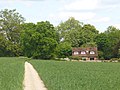
 Pax Hill Care Home - geograph.org.uk - 3479272.jpg 640 × 480; 118 KB
-
 Pax Hill Nursing Home - geograph.org.uk - 4900705.jpg 3 264 × 1 840; 3,08 MB
-
 Paxhill new building and bicycle - geograph.org.uk - 2316839.jpg 2 272 × 1 704; 3,22 MB
-
 Plank bridge near Wallfield Copse - geograph.org.uk - 5560602.jpg 4 608 × 3 456; 5,79 MB
-
 Pond by tree and building at Hill Farm - geograph.org.uk - 2292895.jpg 800 × 600; 177 KB
-
 Pond near Broadhatch House - geograph.org.uk - 2316847.jpg 2 272 × 1 704; 2,12 MB
-
 Postbox by Bentley Church - geograph.org.uk - 2569922.jpg 640 × 480; 121 KB
-
 Pussy willow buds against the sky - geograph.org.uk - 2313701.jpg 600 × 800; 146 KB
-
 Railway Course, by Bentley - geograph.org.uk - 1886131.jpg 2 560 × 1 920; 1,78 MB
-
 Rectory Lane in Bentley - geograph.org.uk - 2312048.jpg 600 × 800; 183 KB
-
 Red Lion House, Bentley - geograph.org.uk - 1890271.jpg 2 560 × 1 920; 2 MB
-
 Renewable Power Farm - Solar Panals - geograph.org.uk - 4900746.jpg 3 264 × 1 840; 2,81 MB
-
 Road junction at Barley Pound - geograph.org.uk - 2292917.jpg 800 × 600; 106 KB
-
 Road junction south of Crondall - geograph.org.uk - 2292905.jpg 800 × 600; 95 KB
-
 Road to Pax Hill - geograph.org.uk - 4900703.jpg 3 264 × 1 840; 2,57 MB
-
 Rural Road to Bentley - geograph.org.uk - 4900720.jpg 3 264 × 1 840; 3,21 MB
-
 Saint Swithun's Way - Near Bentley - geograph.org.uk - 4900708.jpg 3 264 × 1 840; 2,17 MB
-
 Saint Swithun's Way - Near Bentley - geograph.org.uk - 4900716.jpg 3 264 × 1 840; 2,21 MB
-
-
 Sharp bend in Crondall Road - geograph.org.uk - 4961205.jpg 2 000 × 1 333; 2,71 MB
-
 Sign - Saint Swithun's Way - geograph.org.uk - 4900806.jpg 3 264 × 1 840; 2,87 MB
-
 Sign for Pax Hill Nursing Home - geograph.org.uk - 5560580.jpg 4 608 × 3 456; 5,26 MB
-
 Signpost on Crondall Road - geograph.org.uk - 2292898.jpg 800 × 600; 134 KB
-
 Small Tributary of the River Wey - geograph.org.uk - 4900699.jpg 3 264 × 1 840; 3,18 MB
-
 Small wood on hill north of Bentley - geograph.org.uk - 4574869.jpg 640 × 480; 141 KB
-
 Solar farm near Bentley - geograph.org.uk - 4956691.jpg 2 000 × 1 333; 2,22 MB
-
 Solar Farm near Gully Copse - geograph.org.uk - 4956689.jpg 2 000 × 1 333; 3,05 MB
-
 Solar Farm near Gully Copse - geograph.org.uk - 4959925.jpg 2 000 × 1 333; 2,25 MB
-
 South section of boundary wall east of Jenkyn Place, Bentley.jpg 4 032 × 3 024; 5,4 MB
-
 Spring in Bentley - geograph.org.uk - 1890253.jpg 2 560 × 1 920; 1,78 MB
-
 St Mary the Virgin, Bentley - geograph.org.uk - 4085347.jpg 4 320 × 3 240; 4,62 MB
-
 St Swithun's Way in Wallfield Copse (1) - geograph.org.uk - 2313577.jpg 800 × 600; 209 KB
-
 St Swithun's Way in Wallfield Copse (2) - geograph.org.uk - 2313594.jpg 800 × 600; 241 KB
-
 St Swithun's Way in Wallfield Copse (3) - geograph.org.uk - 2313599.jpg 600 × 800; 244 KB
-
 St Swithun's Way near Bentley - geograph.org.uk - 4960069.jpg 2 000 × 1 330; 3,44 MB
-
 St Swithun's Way near Bentley - geograph.org.uk - 4960075.jpg 2 000 × 1 333; 2,97 MB
-
 St Swithun's Way, Signpost - geograph.org.uk - 3323392.jpg 2 752 × 2 002; 1,39 MB
-
 Stile near Pax Hill Care Home - geograph.org.uk - 2313689.jpg 800 × 600; 169 KB
-
 Straw stacks - geograph.org.uk - 4180496.jpg 640 × 480; 384 KB
-
 The A31 - geograph.org.uk - 282172.jpg 640 × 480; 128 KB
-
 The A31 at the Hampshire-Surrey border - geograph.org.uk - 2285948.jpg 800 × 579; 103 KB
-
 The A31 Bentley bypass - geograph.org.uk - 2285782.jpg 800 × 600; 74 KB
-
 The A31 east of Bentley - geograph.org.uk - 5022269.jpg 2 242 × 1 642; 1,08 MB
-

-
 The A31, Lower Froyle - geograph.org.uk - 5022275.jpg 2 304 × 1 728; 941 KB
-
 The A31, Lower Froyle - geograph.org.uk - 5023423.jpg 2 304 × 1 728; 941 KB


_-_geograph.org.uk_-_2285805.jpg)
_-_geograph.org.uk_-_2285817.jpg)


.JPG)


_(1).JPG)
_(2).JPG)


_(May_2021).JPG)


_-_geograph.org.uk_-_2313577.jpg)
_-_geograph.org.uk_-_2313594.jpg)
_-_geograph.org.uk_-_2313599.jpg)


