Category:Beorgs of Housetter
Zur Navigation springen
Zur Suche springen
| Objektposition | | Karte mit allen Koordinaten: OpenStreetMap |
|---|
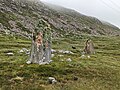
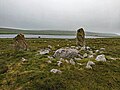
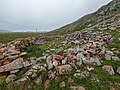
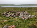
English: Beorgs of Housetter, a mountain in the Northmavine area in the northern part of Mainland, Shetlands.
Deutsch: Beorgs of Housetter, ein Berg im Gebiet von Northmavine im Norden von Mainland, Shetland
147m hill in the north of Mainland, Shetland Islands, Scotland, UK .jpg) | |||||
| Medium hochladen | |||||
| Ist ein(e) | |||||
|---|---|---|---|---|---|
| Ort | Shetlandinseln, Schottland | ||||
 | |||||
Medien in der Kategorie „Beorgs of Housetter“
Folgende 14 Dateien sind in dieser Kategorie, von 14 insgesamt.
-
 Beorgs of Housetter 01.jpg 4.080 × 3.072; 5,7 MB
-
 Beorgs of Housetter 02.jpg 4.080 × 3.072; 5,24 MB
-
 Beorgs of Housetter 03.jpg 4.080 × 3.072; 5,23 MB
-
 Beorgs of Housetter 04.jpg 4.080 × 3.072; 5,41 MB
-
 Beorgs of Housetter 05.jpg 4.080 × 3.072; 6,2 MB
-
 Beorgs of Housetter 06.jpg 4.080 × 3.072; 5,91 MB
-
 Housetter and the Beorgs of Housetter (geograph 1926064).jpg 800 × 533; 119 KB
-
 Laurence Loch - geograph.org.uk - 632432.jpg 640 × 449; 111 KB
-
 Loch of Housetter, Northmavine (geograph 3348918).jpg 1.024 × 683; 198 KB
-
 Lochend, Housetter, Northmavine (geograph 3348888).jpg 1.024 × 682; 196 KB
-
 MV Altaire at Collafirth pier, from Queyfirth (geograph 4867497).jpg 1.024 × 682; 136 KB
-
 Sheep fold, Giants Garden (geograph 1973441).jpg 2.816 × 2.112; 948 KB
-
 Skelberry - geograph.org.uk - 182013.jpg 640 × 366; 158 KB
-
 Western Slopes of Beorgs of Housetter (geograph 1973431).jpg 2.816 × 2.112; 779 KB


.jpg)
.jpg)
.jpg)
.jpg)

.jpg)