Category:Besselsleigh
Aller à la navigation
Aller à la recherche
localité britannique du comté anglais d'Oxfordshire  | |||||
| Téléverser des médias | |||||
| Nature de l’élément | |||||
|---|---|---|---|---|---|
| Lieu | Vale of White Horse, Oxfordshire, Angleterre du Sud-Est, Angleterre | ||||
| Superficie |
| ||||
 | |||||
English: Besselsleigh or Bessels Leigh is a small village and civil parish in the Vale of White Horse district of the English county of Oxfordshire. It is west of Cumnor. According to the 2001 census, it had a population of 87. In 1974 it was transferred from Berkshire.
Sous-catégories
Cette catégorie comprend 5 sous-catégories, dont les 5 ci-dessous.
B
- The Greyhound, Besselsleigh (5 F)
P
- Parsonage Moor (4 F)
Média dans la catégorie « Besselsleigh »
Cette catégorie comprend 35 fichiers, dont les 35 ci-dessous.
-

-
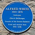 AlfredWhitePlaque.jpg 1 896 × 1 896 ; 525 kio
-
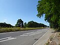
 B4017 (Cumnor Road) at Henwood - geograph.org.uk - 3360483.jpg 1 024 × 683 ; 149 kio
-
 B4017 Cumnor Road in Henwood - geograph.org.uk - 4534225.jpg 1 024 × 738 ; 307 kio
-
 Benchmark on buttress of St Lawrence's Church - geograph.org.uk - 4759665.jpg 683 × 1 024 ; 328 kio
-
 Benchmark on culvert beside A420 - geograph.org.uk - 4709586.jpg 683 × 1 024 ; 226 kio
-
 Benchmark on The Greyhound ph - geograph.org.uk - 4709561.jpg 645 × 1 024 ; 211 kio
-
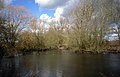
 Besselsleigh Fishponds - geograph.org.uk - 1120914.jpg 640 × 428 ; 112 kio
-
 Cothill Fen National Nature Reserve - geograph.org.uk - 2214215.jpg 2 560 × 1 920 ; 1,26 Mio
-
 Cottages, Bessels Leigh - geograph.org.uk - 6204550.jpg 4 000 × 3 000 ; 4,92 Mio
-
 Culverted ditch beside the A420 at Bessels Leigh - geograph.org.uk - 4709599.jpg 1 024 × 683 ; 305 kio
-
 Cumnor Road, Henwood - geograph.org.uk - 6205354.jpg 4 000 × 3 000 ; 4,76 Mio
-
 Dual carriageway near Bessels Leigh School - geograph.org.uk - 6214312.jpg 4 000 × 3 000 ; 4,99 Mio
-
 Entrance to Rye House, Besselsleigh Park from A420 - geograph.org.uk - 4762981.jpg 1 024 × 683 ; 211 kio
-
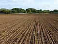
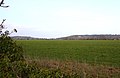
 Farmland, Besselsleigh - geograph.org.uk - 4380645.jpg 640 × 480 ; 243 kio
-
 Farmland, Cumnor - geograph.org.uk - 4380744.jpg 640 × 480 ; 239 kio
-
 Fishpond at Great Park Farm - geograph.org.uk - 2880181.jpg 3 456 × 2 232 ; 1,89 Mio
-
 Footpath to Appleton - geograph.org.uk - 3577219.jpg 1 500 × 999 ; 214 kio
-
 Little Bradley Farmhouse - geograph.org.uk - 6204792.jpg 4 000 × 3 000 ; 4,95 Mio
-
 Looking over a field near Rockley - geograph.org.uk - 2313014.jpg 1 500 × 980 ; 130 kio
-
 Looking over a field towards Rockley Copse - geograph.org.uk - 3577229.jpg 1 500 × 999 ; 365 kio
-
 One of the Besselsleigh Fishponds - geograph.org.uk - 1120898.jpg 640 × 428 ; 118 kio
-
 Osse Stream near Besselsleigh.jpg 683 × 1 024 ; 340 kio
-
 Path heading towards Appleton - geograph.org.uk - 5651336.jpg 640 × 480 ; 93 kio
-
 Public footpath to Rockley Heath - geograph.org.uk - 6204570.jpg 4 000 × 3 000 ; 4,65 Mio
-
 St Lawrence's Church - geograph.org.uk - 4759711.jpg 1 024 × 683 ; 224 kio
-
 The belfry of St Lawrence's Church - geograph.org.uk - 4759642.jpg 683 × 1 024 ; 179 kio
-
 The Greyhound pub, Bessels Leigh - geograph.org.uk - 6234724.jpg 1 860 × 1 184 ; 1,4 Mio
-
 The Greyhound, Bessels Leigh - geograph.org.uk - 4709571.jpg 1 024 × 683 ; 246 kio
-
 The road from Wootton joins the A420 - geograph.org.uk - 2311766.jpg 1 500 × 1 000 ; 306 kio
-
 The road into Bessels Leigh - geograph.org.uk - 3577223.jpg 1 500 × 999 ; 264 kio
-
 The road to Cumnor - geograph.org.uk - 3577226.jpg 1 500 × 999 ; 210 kio
-
 View across former parkland at Besselsleigh - geograph.org.uk - 1120874.jpg 640 × 428 ; 101 kio
-

-
 ^7 Rockley Cottages, Faringdon Road - geograph.org.uk - 4722424.jpg 1 024 × 683 ; 143 kio
,_dating_to_AD.1620-1621._(FindID_1002380).jpg)

_at_Henwood_-_geograph.org.uk_-_3360483.jpg)


