Category:Bierton
Aller à la navigation
Aller à la recherche
village britannique _-_geograph.org.uk_-_1442978.jpg) | |||||
| Téléverser des médias | |||||
| Nature de l’élément |
| ||||
|---|---|---|---|---|---|
| Lieu |
| ||||
 | |||||
English: Bierton is a village in Buckinghamshire, England, about a half mile northeast of of Aylesbury. The parish church is dedicated to St James.

Sous-catégories
Cette catégorie comprend 6 sous-catégories, dont les 6 ci-dessous.
B
- The Bell, Bierton (2 F)
- Bierton Clay Pit (5 F)
- Burcott, Bierton (1 F)
J
O
- St Osyth's Well, Bierton (4 F)
R
- The Red Lion, Bierton (2 F)
Média dans la catégorie « Bierton »
Cette catégorie comprend 48 fichiers, dont les 48 ci-dessous.
-
 A418 Aylesbury Road - geograph.org.uk - 6340908.jpg 1 024 × 684 ; 232 kio
-
 A418 Aylesbury Road, Bierton - geograph.org.uk - 6340910.jpg 1 024 × 684 ; 218 kio
-
 A418 Aylesbury Road, Bierton - geograph.org.uk - 6340912.jpg 1 024 × 512 ; 180 kio
-
 Ash tree just in leaf, Bierton - geograph.org.uk - 428350.jpg 480 × 640 ; 299 kio
-
 Ash, hawthorn and cow parsley - geograph.org.uk - 429663.jpg 640 × 480 ; 324 kio
-
 Aylesbury Road at the junction of Oldhams Meadow - geograph.org.uk - 5677192.jpg 2 304 × 1 728 ; 875 kio
-
 Aylesbury Road, Bierton - geograph.org.uk - 5677217.jpg 2 304 × 1 728 ; 807 kio
-
 Baldrick's Farm - geograph.org.uk - 1734579.jpg 2 592 × 1 944 ; 2,21 Mio
-
 Bean field, Grendon Hill Farm - geograph.org.uk - 429693.jpg 640 × 479 ; 183 kio
-
 Bear Brook - geograph.org.uk - 1145163.jpg 640 × 480 ; 109 kio
-
 Bierton Bierton Chapel.jpg 360 × 270 ; 51 kio
-
 Bierton Crematorium (1) - geograph.org.uk - 6135353.jpg 2 592 × 1 944 ; 1,39 Mio
-
 Bierton Crematorium (2) - geograph.org.uk - 6135357.jpg 2 592 × 1 944 ; 1,37 Mio
-
 Bierton Crematorium (3) - geograph.org.uk - 6135360.jpg 2 592 × 1 944 ; 1,37 Mio
-
 Bierton front 11.jpg 360 × 270 ; 58 kio
-
 Bierton houses - geograph.org.uk - 197660.jpg 640 × 480 ; 88 kio
-
 Bierton village and fieldscape - geograph.org.uk - 3558997.jpg 3 264 × 2 448 ; 2,9 Mio
-
 Bierton, A418 Aylesbury Road - geograph.org.uk - 889917.jpg 640 × 480 ; 72 kio
-
 Bierton, A418 Aylesbury Road - geograph.org.uk - 889951.jpg 640 × 480 ; 73 kio
-
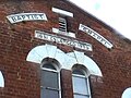
 Bierton, Baptist Chapel - geograph.org.uk - 889935.jpg 640 × 480 ; 82 kio
-
 Bierton, Former Wesleyan Chapel - geograph.org.uk - 889908.jpg 640 × 480 ; 73 kio
-
 Bungalow on Gib Lane, Bierton - geograph.org.uk - 5677215.jpg 2 304 × 1 728 ; 820 kio
-
 Entrance to the Bierton Crematorium - geograph.org.uk - 6133926.jpg 2 592 × 1 944 ; 1,37 Mio
-
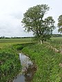
 Footbridge over River Thame - geograph.org.uk - 429700.jpg 640 × 480 ; 266 kio
-
 Footpath to Dunsham Farm - geograph.org.uk - 1734782.jpg 2 592 × 1 944 ; 2,58 Mio
-
 Footpath to St Osyth's well and beyond - geograph.org.uk - 3102360.jpg 1 600 × 1 067 ; 648 kio
-
 Footpath towards Broughton Crossing - geograph.org.uk - 3102361.jpg 1 600 × 1 066 ; 611 kio
-
 Gib Lane, Bierton - geograph.org.uk - 5677213.jpg 1 468 × 2 134 ; 969 kio
-
 Great Lane - geograph.org.uk - 3240978.jpg 640 × 480 ; 63 kio
-
 Grendon Hill Farm - geograph.org.uk - 429688.jpg 640 × 480 ; 78 kio
-
 Horse chestnut in flower - geograph.org.uk - 429673.jpg 640 × 480 ; 101 kio
-
 Houses on Aylesbury Road, Bierton - geograph.org.uk - 5677286.jpg 2 304 × 1 728 ; 811 kio
-
 I am Watching You - geograph.org.uk - 1283056.jpg 640 × 480 ; 249 kio
-
 New housing estate by Weedon Hill roundabout, aerial - geograph.org.uk - 3478289.jpg 1 024 × 683 ; 188 kio
-
 Old Milepost by the A418, west of Hulcott - geograph.org.uk - 6049233.jpg 640 × 440 ; 96 kio
-
 Path along the A418 Aylesbury Road in Bierton - geograph.org.uk - 4991786.jpg 800 × 611 ; 173 kio
-
 Path towards Baldrick's Farm - geograph.org.uk - 3102369.jpg 1 200 × 1 600 ; 733 kio
-
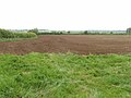 Ploughed field ready for planting - geograph.org.uk - 429677.jpg 640 × 480 ; 195 kio
-
 River Thame north of Aylesbury - geograph.org.uk - 428378.jpg 480 × 640 ; 185 kio
-
 Stile and Tree, Burcott - geograph.org.uk - 197686.jpg 480 × 640 ; 144 kio
-
 Stile ant path to Grove Farm - geograph.org.uk - 3102368.jpg 1 600 × 1 071 ; 659 kio
-
 The Red Lion on Aylesbury Road, Bierton - geograph.org.uk - 4991792.jpg 800 × 536 ; 103 kio
-
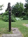 The Village Pump - geograph.org.uk - 197665.jpg 480 × 640 ; 121 kio
-
 Traffic heading north along the A418 - geograph.org.uk - 4991825.jpg 800 × 609 ; 115 kio
-
 Wesleyan chapel now business premises - geograph.org.uk - 3102364.jpg 1 200 × 1 600 ; 428 kio
-
 Wheat field - geograph.org.uk - 429667.jpg 640 × 480 ; 204 kio
-
 Oak tree, view to Weedon - geograph.org.uk - 428388.jpg 640 × 540 ; 156 kio
-
 Wheat field, view to Weedon - geograph.org.uk - 429709.jpg 640 × 480 ; 171 kio


_-_geograph.org.uk_-_6135353.jpg)
_-_geograph.org.uk_-_6135357.jpg)
_-_geograph.org.uk_-_6135360.jpg)


