Category:Bight of Biafra
Vai alla navigazione
Vai alla ricerca
golfo africano  | |||||
| Carica un file multimediale | |||||
| Istanza di | |||||
|---|---|---|---|---|---|
| Parte di | |||||
| Luogo |
| ||||
| Consiste di | |||||
| Immissario | |||||
 | |||||
English: Also Bight of Bonny
Sottocategorie
Questa categoria contiene un'unica sottocategoria, indicata di seguito.
B
File nella categoria "Bight of Biafra"
Questa categoria contiene 15 file, indicati di seguito, su un totale di 15.
-
 1729 West Africa map (Cameroon & Nigeria).jpg 466 × 355; 266 KB
-

-
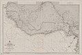 Admiralty Chart No 594 Africa west coast River Gambia to Cape Lopez and Anno Bom, Published 1885.jpg 12 439 × 8 287; 14,14 MB
-
 Bakassi.jpg 1 280 × 956; 92 KB
-
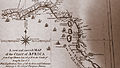
 Bight of Biafra 1841.jpg 1 128 × 716; 226 KB
-
 Bonny Chiefs with Naval Commandant of the Coast Biafra and Bight of Benin 1896.jpg 1 700 × 1 294; 1,53 MB
-
 Cameroons that Saker laboured.jpg 869 × 1 360; 526 KB
-

-

-
 Ju-ju house.png 1 599 × 1 442; 1,61 MB
-
 Jujuh-house, or place of worship ILN-1850-0622-0004.jpg 976 × 1 006; 560 KB
-
 Map Cameroon Coast 1846 B002.png 1 860 × 2 998; 1,03 MB
-
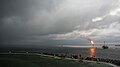 Offshore thunderstorm.JPG 4 592 × 2 576; 2,33 MB
-
 Partial Ivory & Gold Coasts of Africa including Angola.jpg 3 968 × 2 232; 4,04 MB
-
 Rigobert-Bonne-Atlas-de-toutes-les-parties-connues-du-globe-terrestre MG 9990.tif 5 073 × 3 439; 49,95 MB
.jpg)


_(14596429539).jpg)


